Ballifeary

Settlement in Inverness-shire

Scotland

Ballifeary

Inverness Castle Although not very old - it was built in 1835 - the castle occupies the site of an earlier fortress, dominating the River Ness
Inverness Castle Credit: Anne Burgess

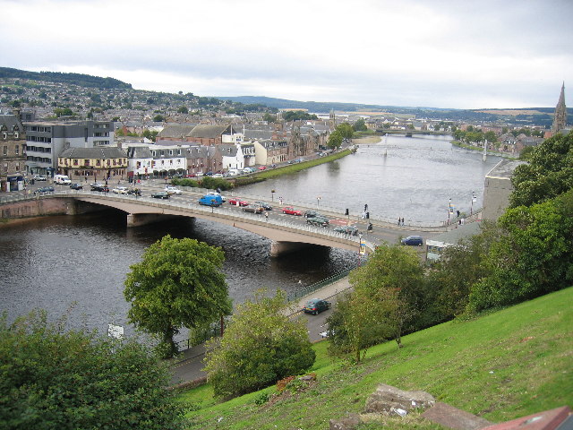
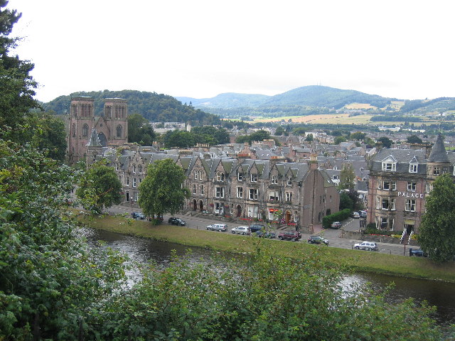
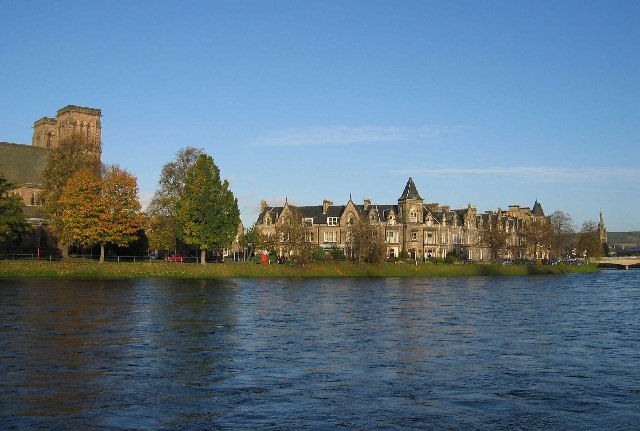
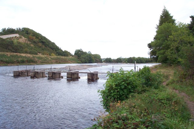
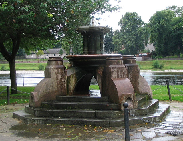
Ballifeary is a small village located in the region of Inverness-shire, in the Scottish Highlands. Situated just a few miles northwest of the city of Inverness, Ballifeary is known for its picturesque surroundings and tranquil atmosphere. The village is nestled amidst rolling hills, lush green fields, and stunning views of the nearby River Ness.

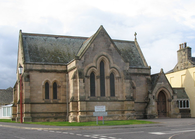
The architecture in Ballifeary is a mix of traditional Scottish styles and modern designs. Many of the houses in the village are made from local stone, giving them a charming and rustic appearance. The village also boasts a beautiful church, which is a prominent landmark in the area.

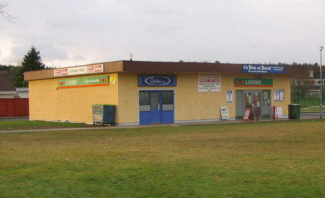
Despite its small size, Ballifeary offers some amenities to its residents and visitors. There is a local pub where locals and tourists can gather for a drink and socialize. Additionally, there are a few small shops and businesses that cater to the needs of the community.

Nature enthusiasts will find plenty to explore in and around Ballifeary. The village is surrounded by stunning natural landscapes, including forests, rivers, and lochs. Outdoor activities such as hiking, fishing, and wildlife spotting are popular among locals and visitors alike.

Ballifeary's close proximity to Inverness provides residents with access to a wider range of amenities, including shopping centers, restaurants, and cultural attractions. The city also offers excellent transport links, making it easy to travel to and from Ballifeary.

Overall, Ballifeary is a charming village that offers a peaceful and idyllic setting for those seeking a rural retreat in the Scottish Highlands.

If you have any feedback on the listing, please let us know in the comments section below.
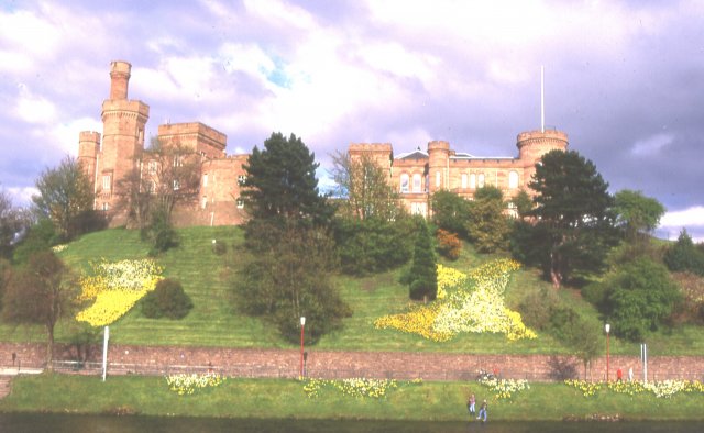
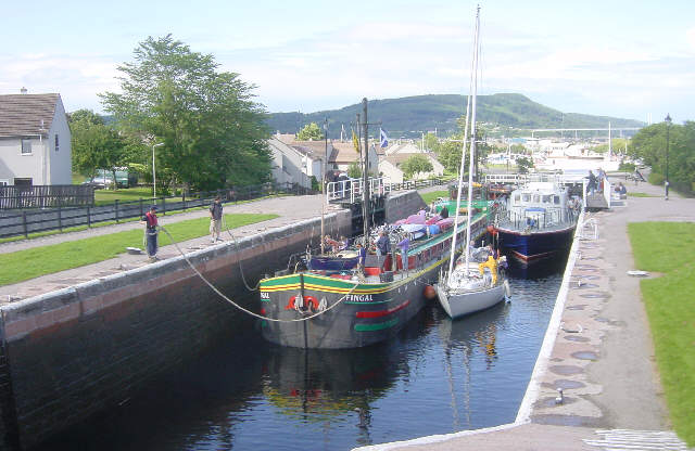
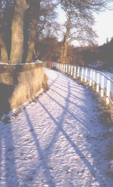
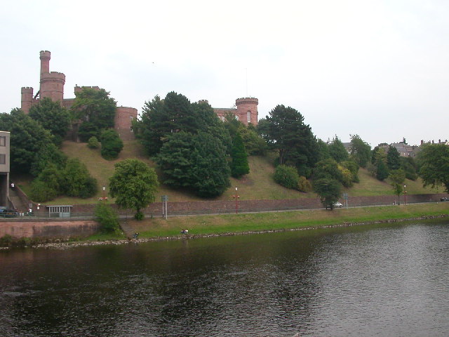
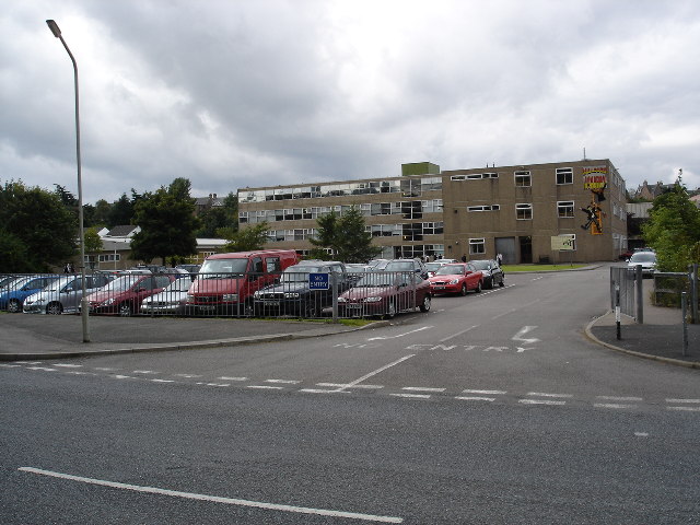
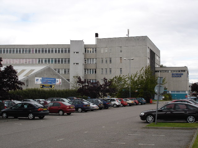
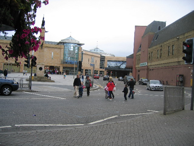
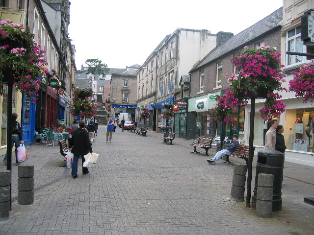
Ballifeary Images

Images are sourced within 2km of 57.470156/-4.229867 or Grid Reference NH6644. Thanks to Geograph Open Source API. All images are credited.

Inverness Castle Although not very old - it was built in 1835 - the castle occupies the site of an earlier fortress, dominating the River Ness
Inverness Castle
Although not very old - it was built in 1835 - the castle occupies the site of an earlier fortress, dominating the River Ness
Muirtown Locks Muirtown Locks on the Caledonian Canal at Inverness.
Muirtown Locks
Muirtown Locks on the Caledonian Canal at Inverness.
Footpath along River Ness Inverness benefits from a good network of paths along both banks of the river and on to the islands. This is near the sports centre, looking downstream.
Footpath along River Ness
Inverness benefits from a good network of paths along both banks of the river and on to the islands. This is near the sports centre, looking downstream.
Inverness Castle The view of the castle from the bridge on the River Ness.
Inverness Castle
The view of the castle from the bridge on the River Ness.
View over Millburn to Inverness golf course  clubhouse The burn had a number of mills in the past, now seems mostly to have shopping trolleys and other junk.  The building in the background is the clubhouse which is marked on the 1:50000, as is the course.
View over Millburn to Inverness golf course clubhouse
The burn had a number of mills in the past, now seems mostly to have shopping trolleys and other junk. The building in the background is the clubhouse which is marked on the 1:50000, as is the course.
Millburn Academy Inverness First day of term I believe.  The eponymous burn is directly behind where the photograph was taken.
Millburn Academy Inverness
First day of term I believe. The eponymous burn is directly behind where the photograph was taken.
Inverness College Part of the University of the Highlands and Islands.    A prominent building when driving into the centre of Inverness.  Strictly speaking taken from just outside the square.
Inverness College
Part of the University of the Highlands and Islands. A prominent building when driving into the centre of Inverness. Strictly speaking taken from just outside the square.
Eastgate Shopping Centre, Inverness
Inglis Street, Inverness
The Bridge, from the Castle, Inverness
Inverness Cathedral and the River Ness from the Castle with Dunain Hill top right
The Falcon's Return, Eastgate Shopping Centre, Inverness ‘The Falcon’s Return’ a larger than life-size statue cast in bronze by local artist, Leonie Gibbs. Surrounding the statue, you’ll find The Baked Potato, Café Centro, Lorimers, Pizza Hut Express and KFC.
The Falcon's Return, Eastgate Shopping Centre, Inverness
‘The Falcon’s Return’ a larger than life-size statue cast in bronze by local artist, Leonie Gibbs. Surrounding the statue, you’ll find The Baked Potato, Café Centro, Lorimers, Pizza Hut Express and KFC.
Lock flight at Muirtown
River Ness
River Ness
Chapel of Royal Northern Infirmary This chapel was built next to the RNI around 1896. It was dedicated to the memory of the first Lord Tweedmouth. The main nave was designed for Presbyterian worship but the transepts were used for Episcopalian and Roman Catholic worship. Old photographs show a slender turret but I believe this was removed in 1966.
Chapel of Royal Northern Infirmary
This chapel was built next to the RNI around 1896. It was dedicated to the memory of the first Lord Tweedmouth. The main nave was designed for Presbyterian worship but the transepts were used for Episcopalian and Roman Catholic worship. Old photographs show a slender turret but I believe this was removed in 1966.
River Ness near Ness-side The picture shows a sluice (foreground) and a weir. In the middle left of the picture the straight edge a few metres above river level is the bank of the Caledonian Canal (not itself visible) which then veers away to the left. The distant trees just to right of centre show where the river divides around Whin Island.
River Ness near Ness-side
The picture shows a sluice (foreground) and a weir. In the middle left of the picture the straight edge a few metres above river level is the bank of the Caledonian Canal (not itself visible) which then veers away to the left. The distant trees just to right of centre show where the river divides around Whin Island.
Lochardil Stores Local convenience store in Lochardil area of Inverness on the right of the building. There is a ladies hairdresser (blue frontage) on the left. Lies at one end of an open grassed area.
Lochardil Stores
Local convenience store in Lochardil area of Inverness on the right of the building. There is a ladies hairdresser (blue frontage) on the left. Lies at one end of an open grassed area.
Forbes Fountain An old fountain of Inverness which I think used to have a canopy. It has also been moved from its original, more central, position. River Ness can be seen in the background. The fountain lies between "The Islands" and "Ladies Walk" on the east bank.
Forbes Fountain
An old fountain of Inverness which I think used to have a canopy. It has also been moved from its original, more central, position. River Ness can be seen in the background. The fountain lies between "The Islands" and "Ladies Walk" on the east bank.
Show me another place!

Ballifeary is located at Grid Ref: NH6644 (Lat: 57.470156, Lng: -4.229867)

Unitary Authority: Highland

Police Authority: Highlands and Islands

What 3 Words

///chops.pouch.soda. Near Inverness, Highland

Related Wikis

Royal Northern Infirmary

The Royal Northern Infirmary was a health facility in Ness Walk, Inverness, Scotland. The site remains the home of a small facility, known as the RNI Community...

Eden Court Theatre

Eden Court Theatre (Scottish Gaelic: Cùirt an Easbaig) is a large theatre, cinema and arts venue situated in Inverness, Scotland close to the banks of...

Politics of the Highland council area

The politics of the Highland council area in Scotland are evident in the deliberations and decisions of the Highland Council, in elections to the council...

Inverness Cathedral

Inverness Cathedral (Scottish Gaelic: Cathair-Eaglais Inbhir Nis), also known as the Cathedral Church of Saint Andrew (1866–69), is a cathedral of the...

Nearby Amenities

Located within 500m of 57.470156,-4.229867
Mini Roundabout
Direction: clockwise
Lat/Long: 57.4722892/-4.2339549
Crossing
Crossing: unmarked
Kerb: lowered
Tactile Paving: no
Lat/Long: 57.468732/-4.2296604
Crossing
Crossing: traffic_signals
Crossing Island: no
Source: survey
Tactile Paving: yes
Lat/Long: 57.4704327/-4.2272373
Mini Roundabout
Direction: clockwise
Lat/Long: 57.4700769/-4.2299128
Traffic Signals
Lat/Long: 57.4732943/-4.2242658
Post Box
Brand: Royal Mail
Brand Wikidata: Q638098
Brand Wikipedia: en:Royal Mail
Check Date Collection Times: 2022-03-14
Collection Times: Mo-Fr 09:00; Sa 07:00
Operator: Royal Mail
Operator Wikidata: Q638098
Post Box Type: wall
Postal Code: IV2
Ref: IV2 8D
Royal Cypher: scottish_crown
Source: survey
Lat/Long: 57.4709359/-4.2223173
Post Box
Brand: Royal Mail
Brand Wikidata: Q638098
Brand Wikipedia: en:Royal Mail
Check Date: 2021-10-05
Collection Times: Mo-Fr 09:00; Sa 07:00
Operator: Royal Mail
Operator Wikidata: Q638098
Post Box Type: pillar
Postal Code: IV2
Ref: IV2 25D
Royal Cypher: GR
Royal Cypher Wikidata: Q33102273
Source: survey
Lat/Long: 57.4733499/-4.2273172
Post Box
Brand: Royal Mail
Brand Wikidata: Q638098
Brand Wikipedia: en:Royal Mail
Collection Times: Mo-Fr 09:00; Sa 07:00
Operator: Royal Mail
Operator Wikidata: Q638098
Post Box Type: wall
Postal Code: IV2
Ref: IV2 14D
Royal Cypher: VR
Royal Cypher Wikidata: Q33102356
Source: survey
Lat/Long: 57.4714691/-4.227025
Post Box
Collection Times: Mo-Fr 17:30; Sa 12:30
Operator: Royal Mail
Postal Code: IV3
Ref: IV3 1
Source: survey
Lat/Long: 57.46964/-4.2361843
Turning Circle
Lat/Long: 57.4689846/-4.2236743
Barrier: cycle_barrier
Lat/Long: 57.4722378/-4.2243973
Barrier: cycle_barrier
Lat/Long: 57.4713298/-4.2247992
Barrier: cycle_barrier
Cycle Barrier: double
Lat/Long: 57.4687295/-4.229769
Crossing
Crossing: marked
Lat/Long: 57.4733757/-4.2315348
Barrier: lift_gate
Lat/Long: 57.4729018/-4.2318118
Barrier: lift_gate
Lat/Long: 57.4735874/-4.2310752
Barrier: bollard
Lat/Long: 57.4714645/-4.2282186
Recycling
Lat/Long: 57.4727195/-4.2328643
Ness Walk Inverness
Description: 11kV/414V Substation
Operator: SSE Power Distribution
Power: substation
Lat/Long: 57.4680809/-4.2298177
Turning Circle
Lat/Long: 57.4695196/-4.2221591
Bus Stop
Haugh Road
Naptan AtcoCode: 670000064
Naptan Bearing: S
Naptan CommonName: Haugh Road
Naptan Indicator: at Haugh Court
Naptan Landmark: Haugh Court
Naptan NaptanCode: 45327439
Naptan PlusbusZoneRef: IVRNESS
Naptan Street: Haugh Road
Naptan Verified: no
Source: naptan_import
Lat/Long: 57.472661/-4.2263035
Bus Stop
Bellfield Park
Naptan AtcoCode: 670000065
Naptan Bearing: S
Naptan CommonName: Bellfield Park
Naptan Indicator: at Bellfield Park
Naptan Landmark: Bellfield Park
Naptan NaptanCode: 45327452
Naptan PlusbusZoneRef: IVRNESS
Naptan Street: Island Bank Rd
Naptan Verified: no
Source: naptan_import
Lat/Long: 57.4701926/-4.2271706
Bus Stop
Bellfield Park
Naptan AtcoCode: 670000066
Naptan Bearing: N
Naptan CommonName: Bellfield Park
Naptan Indicator: opp Bellfield Park
Naptan Landmark: Bellfield Park
Naptan NaptanCode: 45327453
Naptan PlusbusZoneRef: IVRNESS
Naptan Street: Island Bank Rd
Naptan Verified: no
Source: naptan_import
Lat/Long: 57.4699827/-4.227358
Bus Stop
Island Bank Rd
Naptan AtcoCode: 670000067
Naptan Bearing: S
Naptan CommonName: Island Bank Rd
Naptan Indicator: o/s No 11
Naptan Landmark: Aquaduct
Naptan NaptanCode: 45327454
Naptan PlusbusZoneRef: IVRNESS
Naptan Street: Island Bank Rd
Naptan Verified: no
Source: naptan_import
Lat/Long: 57.4671167/-4.2273337
Bus Stop
Island Bank Rd
Naptan AtcoCode: 670000068
Naptan Bearing: N
Naptan CommonName: Island Bank Rd
Naptan Indicator: opp No 11
Naptan Landmark: Aquaduct
Naptan NaptanCode: 45327456
Naptan PlusbusZoneRef: IVRNESS
Naptan Street: Island Bank Rd
Naptan Verified: no
Source: naptan_import
Lat/Long: 57.4671224/-4.2275174
Bus Stop
Ballifeary Lane
Local Ref: AT
Naptan AtcoCode: 670030030
Naptan Bearing: SW
Naptan CommonName: Ballifeary Lane
Naptan Indicator: at
Naptan Landmark: Ballifeary Lane
Naptan NaptanCode: 45326475
Naptan PlusbusZoneRef: IVRNESS
Naptan Street: Glenurquhart Road
Naptan Verified: no
Source: naptan_import
Lat/Long: 57.4701912/-4.2368936
Bus Stop
Balifearry Lane
Naptan AtcoCode: 670040051A
Naptan Bearing: SW
Naptan CommonName: Balifearry Lane
Naptan Indicator: opp Bruce Avenue
Naptan Landmark: Bruce Avenue
Naptan NaptanCode: 45325438
Naptan PlusbusZoneRef: IVRNESS
Naptan Street: Glenurquhart Road
Naptan Verified: no
Source: naptan_import
Lat/Long: 57.4689354/-4.2377841
Bus Stop
Glenurquhart Road
Direction: N
Naptan AtcoCode: 670040052B
Naptan Bearing: NE
Naptan CommonName: Glenurquhart Road
Naptan Indicator: o/s No 58
Naptan Landmark: Smith Street
Naptan NaptanCode: 45325436
Naptan PlusbusZoneRef: IVRNESS
Naptan Street: Glenurquhart Road
Naptan Verified: no
Source: naptan_import
Lat/Long: 57.4707872/-4.2367299
Bus Stop
Glenurquhart Road
Naptan AtcoCode: 670040053
Naptan Bearing: SW
Naptan CommonName: Glenurquhart Road
Naptan Indicator: o/s Mace Shop
Naptan Landmark: Smith Street
Naptan NaptanCode: 45325435
Naptan PlusbusZoneRef: IVRNESS
Naptan Street: Glenurquhart Road
Naptan Verified: no
Source: naptan_import
Lat/Long: 57.4719528/-4.2353501
Bus Stop
Council Buildings
Direction: N
Naptan AtcoCode: 670040053A
Naptan Bearing: NE
Naptan CommonName: Council Buildings
Naptan Indicator: opp Council Buildings
Naptan Landmark: Council Buildings
Naptan NaptanCode: 45325434
Naptan PlusbusZoneRef: IVRNESS
Naptan Street: Glenurquhart Road
Naptan Verified: no
Source: naptan_import
Lat/Long: 57.4736149/-4.2343037
Bus Stop
Council Buildings
Bench: yes
Naptan AtcoCode: 670040053B
Naptan Bearing: SW
Naptan CommonName: Council Buildings
Naptan Indicator: o/s Council Buildings
Naptan Landmark: Council Buildings
Naptan NaptanCode: 45325432
Naptan PlusbusZoneRef: IVRNESS
Naptan Street: Glenurquhart Road
Naptan Verified: no
Shelter: yes
Source: naptan_import
Lat/Long: 57.4735255/-4.2341425
Bus Stop
Culduthel Road
Bench: no
Bin: yes
Departures Board: no
Naptan AtcoCode: 6700600045
Naptan Bearing: S
Naptan CommonName: Culduthel Road
Naptan Indicator: o/s Ardlarich Medical Centre
Naptan Landmark: Ardlarich Medical Centre
Naptan NaptanCode: 45325457
Naptan PlusbusZoneRef: IVRNESS
Naptan Street: Culduthel Road
Naptan Verified: no
Shelter: yes
Source: naptan_import
Lat/Long: 57.4716725/-4.2232579
Bus Stop
Culduthel Road
Bench: no
Bin: no
Bus: yes
Naptan AtcoCode: 6700600085
Naptan Bearing: N
Naptan CommonName: Culduthel Road
Naptan Indicator: opp Southside Road
Naptan Landmark: Southside Road
Naptan NaptanCode: 45325636
Naptan PlusbusZoneRef: IVRNESS
Naptan Street: Culduthel Road
Naptan Verified: no
Public Transport: platform
Shelter: no
Source: naptan_import
Lat/Long: 57.4709307/-4.2230294
Bishops Court
Operator: SSE
Operator Wikidata: Q493854
Power: substation
Voltage: 11000;400
Lat/Long: 57.4709953/-4.2327585
R.N.I. S/S
Operator: Scottish and Southern Electricity Networks
Operator Wikidata: Q43080530
Power: substation
Lat/Long: 57.4714377/-4.2330231
Barrier: bollard
Foot: yes
Lat/Long: 57.4714021/-4.2313196
Barrier: bollard
Foot: yes
Lat/Long: 57.4713826/-4.2310469
Post Box
Brand: Royal Mail
Brand Wikidata: Q638098
Brand Wikipedia: en:Royal Mail
Collection Times: Mo-Fr 09:00; Sa 07:00
Operator: Royal Mail
Operator Wikidata: Q638098
Post Box Type: lamp
Ref: IV3 358D
Royal Cypher: scottish_crown
Source: survey
Lat/Long: 57.4713956/-4.2307671
Barrier: bollard
Bollard: removable
Foot: yes
Lat/Long: 57.4712758/-4.2298931
Restaurant
Contrast Brasserie
Addr Street: Ness Bank
Diet Vegetarian: yes
Lat/Long: 57.4728277/-4.2272203
Restaurant
The Waterside
Addr Street: Ness Bank
Diet Vegetarian: yes
Indoor Seating: yes
Outdoor Seating: yes
Lat/Long: 57.4731261/-4.2272592
Bar
The Waterside
Addr Street: Ness Bank
Indoor Seating: yes
Outdoor Seating: yes
Lat/Long: 57.473123/-4.2271289
Restaurant
Nicky Tam's
Old Name: Nico's Bistro
Lat/Long: 57.4739449/-4.2265064
Noexit: yes
Lat/Long: 57.4683139/-4.2332479
Haugh
Name En: Haugh
Name Gd: An Talchan
Place: suburb
Lat/Long: 57.4735905/-4.2253215
Ballifeary
Name Gd: Baile na Faire
Place: suburb
Wikidata: Q4851676
Wikipedia: en:Ballifeary
Lat/Long: 57.4700981/-4.2344581
Crossing
Crossing: marked
Tactile Paving: no
Lat/Long: 57.473602/-4.2307032
Crossing
Crossing: marked
Tactile Paving: no
Lat/Long: 57.4735291/-4.2306831
Entrance: main
Lat/Long: 57.4730027/-4.227164
Fountain
Source: Bing
Lat/Long: 57.4690509/-4.2276494
Island Bank Road
Description: 11kV/414V Substation
Operator: Scottish and Southern Electricity Networks
Operator Wikidata: Q43080530
Power: substation
Lat/Long: 57.4691536/-4.2276998
Description: surf wave
Waterway: rapids
Lat/Long: 57.4709634/-4.2294921
Rapids: 2
Waterway: rapids
Lat/Long: 57.4660062/-4.2294594
Inverness War Memorial
Historic: memorial
Memorial: war_memorial
Source: survey
Lat/Long: 57.4711001/-4.2279426
Chalky's
Addr City: Inverness
Addr Housenumber: 65
Addr Postcode: IV2 4SD
Addr Street: Haugh Road
Fhrs Id: 360478
Shop: convenience
Source Addr: FHRS Open Data
Lat/Long: 57.4722511/-4.226454
Entrance: yes
Lat/Long: 57.4730989/-4.2269049
Toilets
Lat/Long: 57.4696217/-4.2260652
Ticket To Ride - Bike Hire
Addr City: Inverness
Addr Country: GB
Addr Housename: The Pavilion
Addr Postcode: IV2 4SZ
Addr Street: Bellfield Park
Email: info@tickettoridehighlands.co.uk
Phone: +44 1463 419160
Service Bicycle Rental: yes
Service Bicycle Second Hand: yes
Shop: bicycle
Website: https://www.tickettoridehighlands.co.uk/
Lat/Long: 57.4695507/-4.2260644
Barrier: bollard
Bollard: fixed
Lat/Long: 57.470718/-4.2300255
Scotmid
Addr City: Inverness
Addr Postcode: IV3 5NZ
Addr Street: Glenurquhart Road
Brand: Scotmid
Brand Wikidata: Q7435719
Brand Wikipedia: en:Scotmid
Fhrs Id: 453810
Shop: convenience
Lat/Long: 57.4716475/-4.2353271
Fast Food
1st Pizza Direct
Addr City: Inverness
Addr Housenumber: 3
Addr Postcode: IV3 5NZ
Addr Street: Glenurquhart Road
Cuisine: pizza
Fhrs Id: 453863
Lat/Long: 57.4715177/-4.2354505
Fast Food
1st Plaice Fish Bar
Cuisine: fish_and_chips
Lat/Long: 57.471509/-4.235649
Barrier: bollard
Bicycle: yes
Foot: yes
Lat/Long: 57.4727602/-4.2318235
Barrier: bollard
Bicycle: yes
Bollard: removable
Foot: yes
Lat/Long: 57.4734033/-4.2304669
Pharmacy
Lloyds Pharmacy
Addr City: Inverness
Addr Housename: Riverside Medical Practice
Addr Postcode: IV3 5PW
Addr Street: Ballifeary Lane
Brand: Lloyds Pharmacy
Brand Wikidata: Q6662870
Brand Wikipedia: en:LloydsPharmacy
Fhrs Id: 454047
Healthcare: pharmacy
Lat/Long: 57.4700805/-4.2313327
Charging Station
Brand: EVolt
Capacity: 2
Operator: ChargePlace Scotland
Operator Wikidata: Q105359316
Ref: 51065
Lat/Long: 57.4738541/-4.2291574
Addr City: Inverness
Addr Housename: Felstead House
Addr Housenumber: 18
Addr Postcode: IV2 4SF
Addr Street: Ness Bank
Lat/Long: 57.4733359/-4.2270211
Doctors
Cairn Medical Practice
Addr City: Inverness
Addr Housenumber: 15
Addr Street: Culduthel Road
Healthcare: doctor
Lat/Long: 57.4718194/-4.2230927
Atm
Lat/Long: 57.471566/-4.2353995
Bosta B&B
Tourism: guest_house
Lat/Long: 57.4713259/-4.2359009
Bench
Memorial Bench
Description: memorial bench
Lat/Long: 57.4699552/-4.2269941
Bench
Memorial Bench
Description: Memorial Bench
Lat/Long: 57.4697191/-4.2270177
Waste Basket
Lat/Long: 57.4716617/-4.2232445
Waste Basket
Lat/Long: 57.4722203/-4.2244242
Life Ring
Check Date: 2023-04-17
Emergency: life_ring
Lat/Long: 57.4717862/-4.2296706
Life Ring
Check Date: 2023-04-17
Emergency: life_ring
Lat/Long: 57.471616/-4.2282074
Life Ring
Check Date: 2023-04-17
Emergency: life_ring
Lat/Long: 57.4729073/-4.2277907
Life Ring
Check Date: 2023-04-17
Emergency: life_ring
Lat/Long: 57.4692686/-4.2295391
Generator Method: photovoltaic
Generator Output Electricity: yes
Generator Source: solar
Generator Type: solar_photovoltaic_panel
Location: roof
Power: generator
Lat/Long: 57.4683952/-4.2362595
Generator Method: photovoltaic
Generator Output Electricity: yes
Generator Source: solar
Generator Type: solar_photovoltaic_panel
Location: roof
Power: generator
Lat/Long: 57.4688604/-4.236639
Generator Method: photovoltaic
Generator Output Electricity: yes
Generator Source: solar
Generator Type: solar_photovoltaic_panel
Location: roof
Power: generator
Lat/Long: 57.4688661/-4.2367865
Generator Method: photovoltaic
Generator Output Electricity: yes
Generator Source: solar
Generator Type: solar_photovoltaic_panel
Location: roof
Power: generator
Lat/Long: 57.4723551/-4.2300354
Generator Method: photovoltaic
Generator Output Electricity: yes
Generator Source: solar
Generator Type: solar_photovoltaic_panel
Location: roof
Power: generator
Lat/Long: 57.4724157/-4.2300032
Generator Method: photovoltaic
Generator Output Electricity: yes
Generator Source: solar
Generator Type: solar_photovoltaic_panel
Location: roof
Power: generator
Lat/Long: 57.4711919/-4.2264265
Generator Method: photovoltaic
Generator Output Electricity: yes
Generator Source: solar
Generator Type: solar_photovoltaic_panel
Location: roof
Power: generator
Lat/Long: 57.4719484/-4.2271453
Inverness Legal Services
Office: lawyer
Phone: +441463229981
Website: https://www.inverness-legal.co.uk/
Lat/Long: 57.4688337/-4.2259763
Artwork Type: statue
Tourism: artwork
Lat/Long: 57.4692295/-4.2271031
Bicycle Parking
Bicycle Parking: stands
Covered: yes
Fee: no
Lat/Long: 57.4719827/-4.2230737
Give Way
Direction: forward
Lat/Long: 57.4690588/-4.227268
Tourism: viewpoint
Lat/Long: 57.4670919/-4.2289242
Bench
Backrest: yes
Lat/Long: 57.474337/-4.2284403
The Kiosk on Ness Walk
Opening Hours: PH,Mo-Su 10:00-16:00
Shop: kiosk
Lat/Long: 57.4738196/-4.2288237
Charging Station
Capacity: 2
Notes: Appears to be recently installed not yet operational
Operator: electric a9
Lat/Long: 57.4739116/-4.2291359
Waste Basket
Lat/Long: 57.4657703/-4.2284629
Bench
Backrest: yes
Lat/Long: 57.4680072/-4.2277997
Bench
Backrest: yes
Lat/Long: 57.4669636/-4.2278555
Bench
Backrest: yes
Lat/Long: 57.4664033/-4.2277329
Waste Basket
Lat/Long: 57.4673089/-4.2293992
Bench
Backrest: no
Lat/Long: 57.4675322/-4.2292061
Bench
Backrest: no
Lat/Long: 57.4673321/-4.2292067
Bench
Backrest: yes
Lat/Long: 57.4672947/-4.2291938
Cafe
Café Ness
Dog: yes
Opening Hours: Mo-Su 09:00-16:00
Lat/Long: 57.4742437/-4.2296652
Uile-bheist Distillery
Craft: distillery
Lat/Long: 57.4739453/-4.2263431
Bench
Backrest: yes
Direction: E
Inscription: In fond memory of Bill & Barbara Archer from all your boys, Erik, Hamish, Robin Laurence & Ronnie and Families
Material: wood
Lat/Long: 57.4688071/-4.2295516
Bench
Backrest: yes
Direction: E
Inscription: IN LOVING MEMORY OF RAMON NICHOL WHO LOVED INVERNESS AND THE HIGHLANDS 31.10.1966 -- 07.12.2018 FROM ALL THE FAMILY
Material: wood
Lat/Long: 57.4684151/-4.2294726
Leisure: picnic_table
Lat/Long: 57.4744472/-4.2288671
Leisure: picnic_table
Lat/Long: 57.4744353/-4.2288743
Entrance: yes
Lat/Long: 57.474231/-4.2295985
Entrance: yes
Lat/Long: 57.4691384/-4.2375673
Heathcote B&B
Addr City: Inverness
Addr Country: GB
Addr Street: Glenurquhart Road
Tourism: guest_house
Lat/Long: 57.4691265/-4.2375308
Defibrillator
Emergency: defibrillator
Indoor: yes
Level: 0
Lat/Long: 57.473043/-4.2304552
Bench
Backrest: yes
Lat/Long: 57.4685647/-4.2279017
Bench
Backrest: yes
Lat/Long: 57.4683195/-4.2278977
Bench
Backrest: yes
Colour: brown
Direction: 270
Lat/Long: 57.4677515/-4.2278085
Waste Basket
Lat/Long: 57.4674014/-4.2277944
Bench
Backrest: yes
Colour: brown
Direction: 260
Lat/Long: 57.4673754/-4.2277864
Bench
Backrest: yes
Lat/Long: 57.465938/-4.2285079
Bench
Lat/Long: 57.4738898/-4.2268562
Waste Basket
Lat/Long: 57.4732684/-4.2274007
Bicycle Parking
Bicycle Parking: stands
Capacity: 12
Covered: yes
Lat/Long: 57.472589/-4.2299035
Bench
Lat/Long: 57.4732911/-4.2290642
Waste Basket
Lat/Long: 57.4733359/-4.2290417
Bench
Lat/Long: 57.4734387/-4.2290057
Bench
Lat/Long: 57.4735807/-4.2289324
Waste Basket
Lat/Long: 57.473624/-4.2288985
Waste Basket
Lat/Long: 57.4738056/-4.2287902
Bench
Lat/Long: 57.4738424/-4.228772
Bench
Lat/Long: 57.4739094/-4.2287321
Waste Basket
Lat/Long: 57.4741078/-4.2286314
Waste Basket
Lat/Long: 57.4741221/-4.228612
Waste Basket
Lat/Long: 57.474221/-4.2285674
Waste Basket
Lat/Long: 57.4742463/-4.2285565
Bench
Lat/Long: 57.4732498/-4.2274161
Bench
Lat/Long: 57.4726225/-4.2278929
Bench
Lat/Long: 57.4719985/-4.2281164
Generator Method: photovoltaic
Generator Output Electricity: yes
Generator Source: solar
Generator Type: solar_photovoltaic_panel
Power: generator
Lat/Long: 57.4729335/-4.2335175
Barrier: cycle_barrier
Lat/Long: 57.4685957/-4.2305236
The data included in this document is from www.openstreetmap.org. The data is made available under ODbL.

Have you been to Ballifeary?

Leave your review of Ballifeary below (or comments, questions and feedback).