Cnoc na Tri-dail

Hill, Mountain in Argyllshire

Scotland

Cnoc na Tri-dail

Avenvogie Farm Spelt Avonvogie on the 1:50 000 OS, the farm is Avenvogie on the 
1:25 000 series, so I have used that spelling.
Avenvogie Farm Credit: Becky Williamson

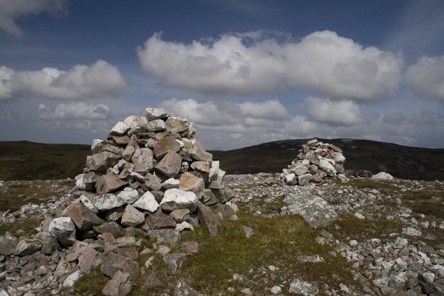
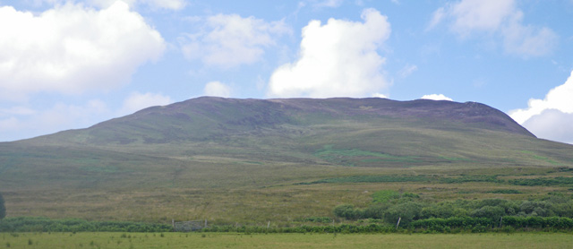
Cnoc na Tri-dail is a prominent hill located in Argyllshire, Scotland. It stands at an elevation of approximately 610 meters (2001 feet) above sea level, making it a popular destination for hikers and outdoor enthusiasts seeking panoramic views of the surrounding landscape.

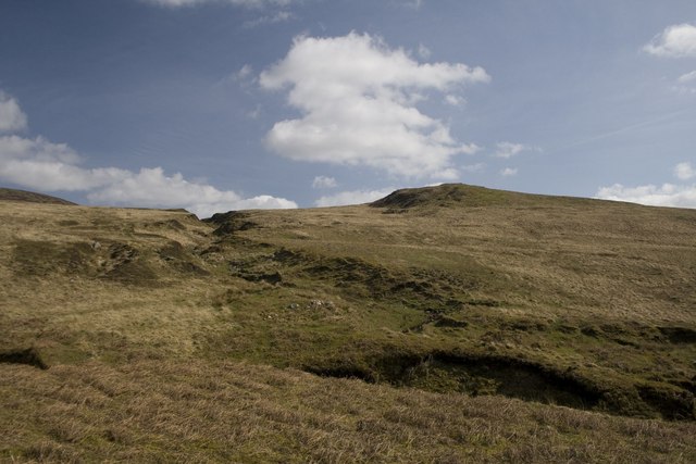
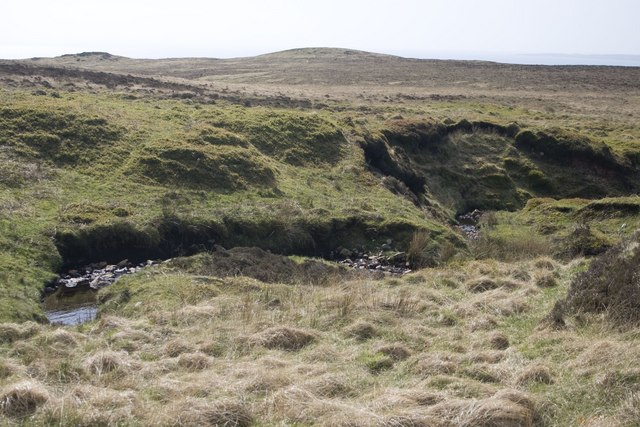
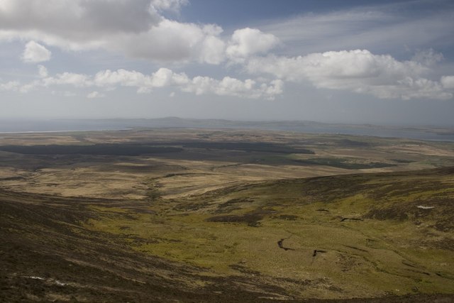
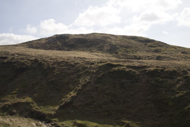
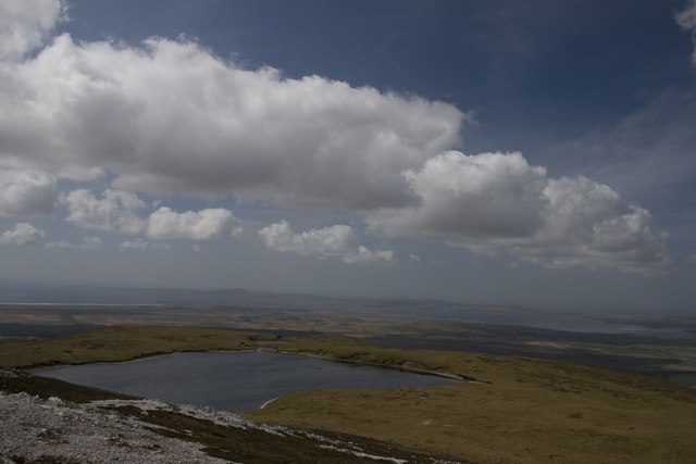
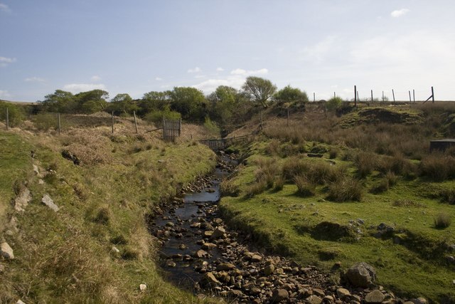
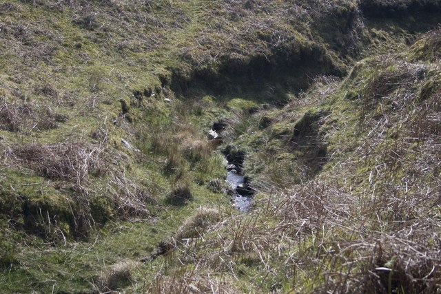
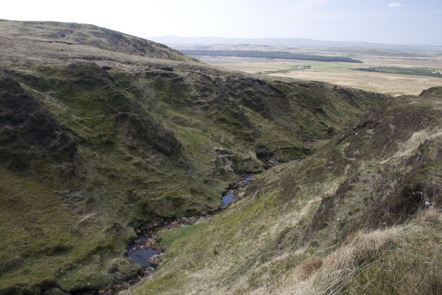
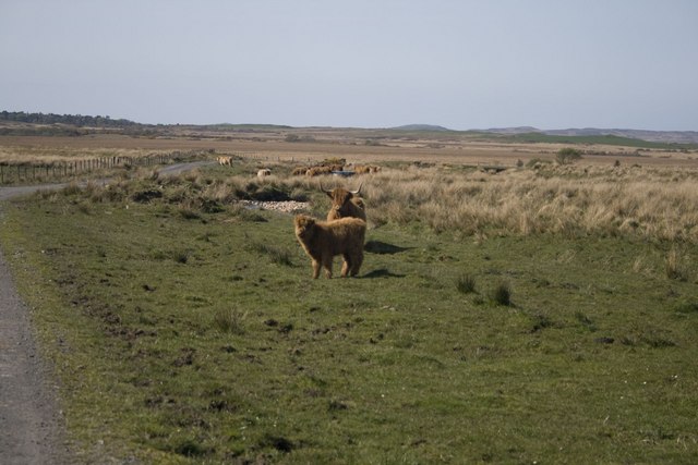
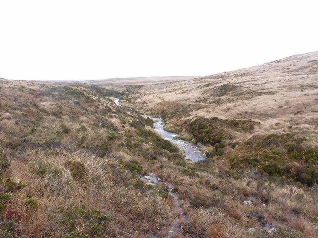
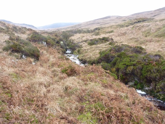
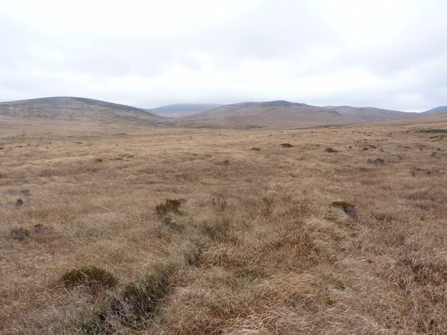
The hill is known for its rugged terrain, characterized by steep slopes and rocky outcrops. It is situated within a remote and wild area, offering visitors a sense of seclusion and tranquility. The summit of Cnoc na Tri-dail provides stunning views of the surrounding countryside, including the nearby Loch Awe and the surrounding mountain ranges.

The hill is accessible via a network of walking trails, although the ascent can be challenging for inexperienced hikers due to the steep gradients and uneven terrain. Despite this, Cnoc na Tri-dail is a popular destination for those looking to escape the hustle and bustle of everyday life and immerse themselves in the natural beauty of the Scottish Highlands.

Overall, Cnoc na Tri-dail offers a rewarding hiking experience for those willing to make the journey to its summit, with breathtaking views and a sense of accomplishment awaiting those who reach the top.

If you have any feedback on the listing, please let us know in the comments section below.

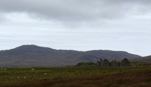
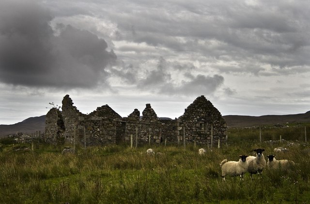
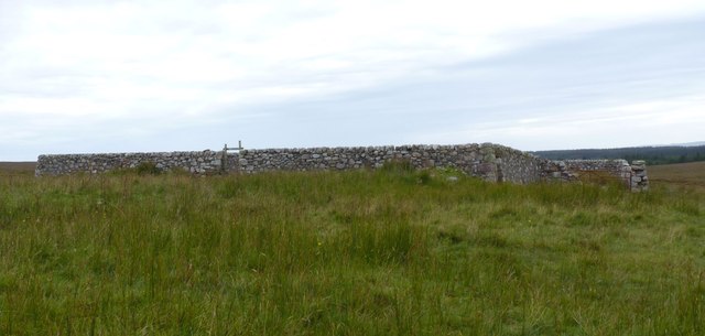
Cnoc na Tri-dail Images

Images are sourced within 2km of 55.723545/-6.1840701 or Grid Reference NR3755. Thanks to Geograph Open Source API. All images are credited.

Avenvogie Farm Spelt Avonvogie on the 1:50 000 OS, the farm is Avenvogie on the 
1:25 000 series, so I have used that spelling.
Avenvogie Farm
Spelt Avonvogie on the 1:50 000 OS, the farm is Avenvogie on the 1:25 000 series, so I have used that spelling.
Looking back to Cnoc na Tri-dail Hillock of the Three Dales (I counted more than three dales so not sure which ones it's referring to!) A modest eminence at the western foot of Beinn Bhàn (Fair mountain).
Looking back to Cnoc na Tri-dail
Hillock of the Three Dales (I counted more than three dales so not sure which ones it's referring to!) A modest eminence at the western foot of Beinn Bhàn (Fair mountain).
Meanders in Allt na Tri-dail, Islay A mountain burn which flows from a lochan at the summit of Beinn Bhàn (Fair/Pale mountain). Its name translates as 'Burn of the Three Dales'.
Meanders in Allt na Tri-dail, Islay
A mountain burn which flows from a lochan at the summit of Beinn Bhàn (Fair/Pale mountain). Its name translates as 'Burn of the Three Dales'.
Allt na Tri-dail, Islay This beautiful valley is located on Beinn Bhàn's (Fair/Pale mountain) western slopes. 'Allt na Tri-dail' translates as 'Burn of the Three Dales'.
Allt na Tri-dail, Islay
This beautiful valley is located on Beinn Bhàn's (Fair/Pale mountain) western slopes. 'Allt na Tri-dail' translates as 'Burn of the Three Dales'.
Cnoc na Tri-dail, Islay Hillock of the Three Dales. At least three rivulets merge at some point down the slopes of Beinn Bhàn (Fair/Pale Mountain), Islay's second highest mountain, to form Allt na Tri-dail. This modest eminence is located south of the burn.
Cnoc na Tri-dail, Islay
Hillock of the Three Dales. At least three rivulets merge at some point down the slopes of Beinn Bhàn (Fair/Pale Mountain), Islay's second highest mountain, to form Allt na Tri-dail. This modest eminence is located south of the burn.
Avenvogie Farm from the rear, Islay There are various spellings for this farm.
Avenvogie Farm from the rear, Islay
There are various spellings for this farm.
Unnamed loch at summit of Beinn Bhàn, Islay This loch has a beautiful location at the summit of Islay's second highest mountain, Beinn Bhàn (Fair/Pale Mountain) - but it does not appear to have a name. The photo is taken looking west towards Loch Indaal.
Unnamed loch at summit of Beinn Bhàn, Islay
This loch has a beautiful location at the summit of Islay's second highest mountain, Beinn Bhàn (Fair/Pale Mountain) - but it does not appear to have a name. The photo is taken looking west towards Loch Indaal.
Allt na Tri-dail, Islay Burn of the Three Dales, near Avenvogie Farm. The burn consists of at least three rivulets (hence the name) which have merged on their way down the western slopes of Beinn Bhàn (Fair/Pale Mountain), Islay's second highest mountain (472 metres).
Allt na Tri-dail, Islay
Burn of the Three Dales, near Avenvogie Farm. The burn consists of at least three rivulets (hence the name) which have merged on their way down the western slopes of Beinn Bhàn (Fair/Pale Mountain), Islay's second highest mountain (472 metres).
Allt na Tri-dail, Islay One of the several rivulets which merge to form the 'Burn of the Three Dales' at the western foot of Beinn Bhàn (Fair/Pale Mountain), Islay.
Allt na Tri-dail, Islay
One of the several rivulets which merge to form the 'Burn of the Three Dales' at the western foot of Beinn Bhàn (Fair/Pale Mountain), Islay.
Steep-sided ravine, Allt na Tri-dail, Islay This burn consists of at least three rivulets which merge to form the Allt na Tri-dail (Burn of the Three Dales). At this point down the mountain (Beinn Bhàn - Fair/Pale Mountain) it cuts through quite a steep-sided ravine. Avenvogie Farm can just be seen in the distance. This was our destination after walking from Kynagarry (<a href="https://www.geograph.org.uk/gridref/NR+378+589">NR 378 589</a>) and up Beinn Bhàn.
Steep-sided ravine, Allt na Tri-dail, Islay
This burn consists of at least three rivulets which merge to form the Allt na Tri-dail (Burn of the Three Dales). At this point down the mountain (Beinn Bhàn - Fair/Pale Mountain) it cuts through quite a steep-sided ravine. Avenvogie Farm can just be seen in the distance. This was our destination after walking from Kynagarry (NR 378 589) and up Beinn Bhàn.
Highland Cattle at  Avenvogie, Islay There are various spellings of Avenvogie, but this is the correct spelling according to the 1:25 000 O.S. map.
Highland Cattle at Avenvogie, Islay
There are various spellings of Avenvogie, but this is the correct spelling according to the 1:25 000 O.S. map.
Twin cairns on Beinn Bhàn's westernmost summit, Islay Beinn Bhàn (Fair/Pale Mountain) is Islay's second highest mountain (equal with Glas Bheinn, Grey Mountain NR 431 592). There are several cairns along its mile long ridge and in fact I only managed to fit two of the three cairns at this summit!
Twin cairns on Beinn Bhàn's westernmost summit, Islay
Beinn Bhàn (Fair/Pale Mountain) is Islay's second highest mountain (equal with Glas Bheinn, Grey Mountain NR 431 592). There are several cairns along its mile long ridge and in fact I only managed to fit two of the three cairns at this summit!
Kilennan, Islay There is much evidence of erstwhile habitation here by the Kilennan River and the lower slopes of Beinn Bhan. The photo shows the most substantial building with Beinn Bhan in the background.
Kilennan, Islay
There is much evidence of erstwhile habitation here by the Kilennan River and the lower slopes of Beinn Bhan. The photo shows the most substantial building with Beinn Bhan in the background.
Kilennan, Islay This is the most substantial of a group of buildings that once existed here. Remnants of walls can be traced throughout the area and a sheep enclosure now replaces what was once thought to be a chapel. See <a href="https://www.geograph.org.uk/photo/2586319">NR3757 : Sheepfold, Kilennan, Islay</a>
Kilennan, Islay
This is the most substantial of a group of buildings that once existed here. Remnants of walls can be traced throughout the area and a sheep enclosure now replaces what was once thought to be a chapel. See NR3757 : Sheepfold, Kilennan, Islay
Sheepfold, Kilennan, Islay Part of this structure is considered to be the remaining wall of an ancient chapel. Other evidence of this building, and other buildings, is scattered round the area. For more information see: <span class="nowrap"><a title="http://www.scotlandsplaces.gov.uk/search_item/index.php?service=RCAHMS&id=37644&refer=L3NlYXJjaC9pbmRleC5waHA%2FYWN0aW9uPWRvX3NlYXJjaCZwX3R5cGU9Y29vcmRpbmF0ZXMmcF9uYW1lPU5hdGlvbmFsK0dyaWQrTlIrMzc1KzU3NSZwX25ncl94PTEzNzUwMCZwX25ncl95PTY1NzUwMCZwX2V4dGVudHZhbHVlPTEyNTAmaWRbXT05Mzg%3D" rel="nofollow ugc noopener" href="http://www.scotlandsplaces.gov.uk/search_item/index.php?service=RCAHMS&id=37644&refer=L3NlYXJjaC9pbmRleC5waHA%2FYWN0aW9uPWRvX3NlYXJjaCZwX3R5cGU9Y29vcmRpbmF0ZXMmcF9uYW1lPU5hdGlvbmFsK0dyaWQrTlIrMzc1KzU3NSZwX25ncl94PTEzNzUwMCZwX25ncl95PTY1NzUwMCZwX2V4dGVudHZhbHVlPTEyNTAmaWRbXT05Mzg%3D">Link</a><img style="margin-left:2px;" alt="External link" title="External link - shift click to open in new window" src="https://s1.geograph.org.uk/img/external.png" width="10" height="10"/></span>
Sheepfold, Kilennan, Islay
Part of this structure is considered to be the remaining wall of an ancient chapel. Other evidence of this building, and other buildings, is scattered round the area. For more information see: LinkExternal link
Allt Gleann Creag a' Chait, Islay A tributary of the Torra River. Looking westwards downstream.
Allt Gleann Creag a' Chait, Islay
A tributary of the Torra River. Looking westwards downstream.
Allt Gleann Creag a' Chait, Islay A tributary of the Torra River. Looking eastwards upstream along Gleann Creag a' Chait.
Allt Gleann Creag a' Chait, Islay
A tributary of the Torra River. Looking eastwards upstream along Gleann Creag a' Chait.
Moorland east of Torra, Islay Very boggy moorland and difficult to cross. The photo is taken looking towards Gleann Creag a' Chait.
Moorland east of Torra, Islay
Very boggy moorland and difficult to cross. The photo is taken looking towards Gleann Creag a' Chait.
Show me another place!

Cnoc na Tri-dail is located at Grid Ref: NR3755 (Lat: 55.723545, Lng: -6.1840701)

Unitary Authority: Argyll and Bute

Police Authority: Argyll and West Dunbartonshire

What 3 Words

///struggle.bloodshot.dabbling. Near Bowmore, Argyll & Bute

Nearby Locations

Cnoc na Tri-dail

Related Wikis

Mulindry House

Mulindry House, also known as Caisteal Mhic Dhomhnuill or Mullintrae House, was a fortified house north of Mulindry Farm, Islay, Scotland. == History... ==

Dun Nosebridge

Dun Nosebridge is an Iron Age fort southeast of Bridgend, Islay, Scotland. The fort is on the right bank of the River Laggan.The name's origin is probably...

Eilean na Muice Duibhe

Eilean na Muice Duibhe, also known as Duich Moss, is an area of low-level blanket mire on the island of Islay, off the west coast of Scotland. Located...

Beinn Bheigeir

Beinn Bheigeir (occasionally anglicised as "Ben Vicar") is a hill on the island of Islay in Scotland, UK. At 491 m, it is the highest of the seven 'Marilyn...

Have you been to Cnoc na Tri-dail?

Leave your review of Cnoc na Tri-dail below (or comments, questions and feedback).