Hersham

Settlement in Cornwall

England

Hersham

Wind Turbine near Stratton Newly installed by the look of it, and rotating at a good speed!
Wind Turbine near Stratton Credit: Julian P Guffogg

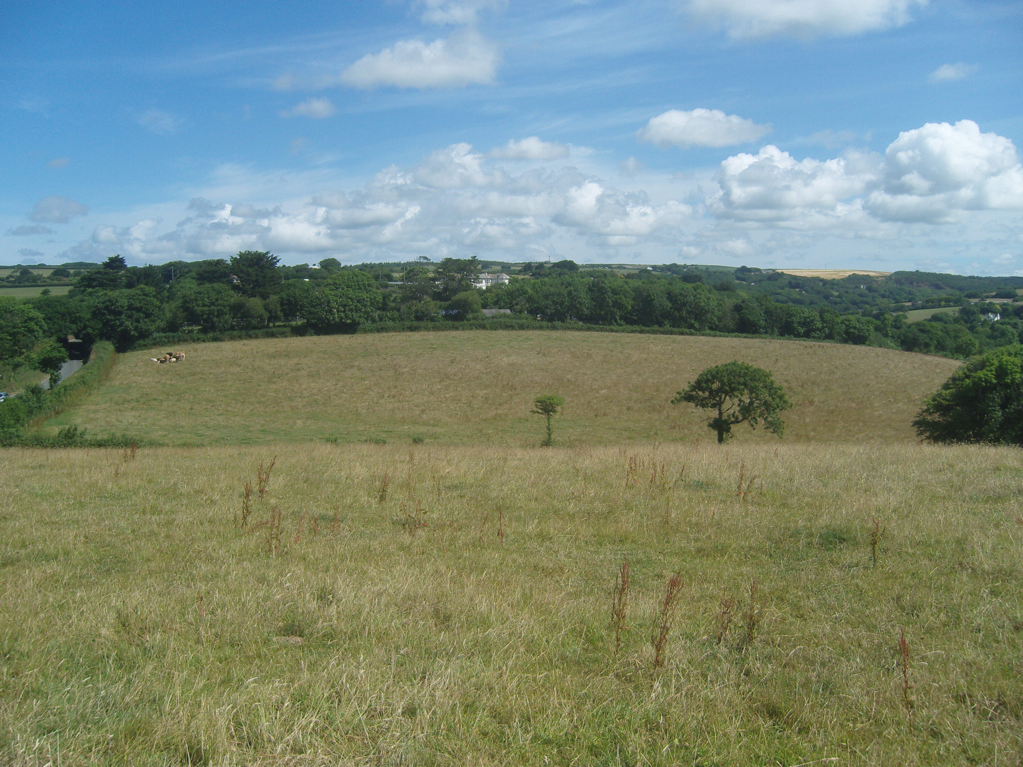
Hersham is a small village located in the county of Cornwall, England. Situated near the North Cornwall coast, it is nestled within a picturesque rural landscape, surrounded by rolling green hills and farmland. The village is known for its tranquil and idyllic setting, making it a popular destination for those seeking a peaceful retreat.

Hersham is home to a close-knit community of residents who take pride in their village. The village center features a quaint local pub, The Hersham Arms, which serves as a gathering place for both locals and visitors. The pub offers a range of traditional Cornish dishes and ales, providing a taste of local cuisine.

Although small in size, Hersham boasts a rich history. The village is dotted with well-preserved historic buildings, including a charming 15th-century church, St. Mary's, which stands as a testament to the village's heritage. The church features beautiful stained glass windows and an impressive tower, attracting history enthusiasts and architecture admirers alike.

Nature lovers will appreciate the natural beauty that surrounds Hersham. The village is located just a short distance from the stunning North Cornwall coast, allowing residents and visitors to enjoy walks along the sandy beaches and breathtaking cliffs. The nearby countryside also offers ample opportunities for hiking and exploring, with scenic trails leading through fields and woodlands.

Overall, Hersham offers a peaceful and picturesque escape from the hustle and bustle of modern life. Its charming village center, rich history, and proximity to beautiful natural landscapes make it an appealing destination for both locals and tourists alike.

If you have any feedback on the listing, please let us know in the comments section below.

Hersham Images

Images are sourced within 2km of 50.84276/-4.475016 or Grid Reference SS2507. Thanks to Geograph Open Source API. All images are credited.

Wind Turbine near Stratton Newly installed by the look of it, and rotating at a good speed!
Wind Turbine near Stratton
Newly installed by the look of it, and rotating at a good speed!
Lane towards Stratton
Houses near Hersham This lane runs to Stratton.
Houses near Hersham
This lane runs to Stratton.
Sheep near Hersham
Sheep near Hersham
Hersham Cross At junction with B3254. Many of the lanes here don't seem to have a name.
Hersham Cross
At junction with B3254. Many of the lanes here don't seem to have a name.
Guyed Mast in Field A transmitter or maybe wind speed monitor?
Near Prustacott Farm.
Guyed Mast in Field
A transmitter or maybe wind speed monitor? Near Prustacott Farm.
Lane Junction to Launcells Church A narrow lane leads to St Swithin's church
Lane Junction to Launcells Church
A narrow lane leads to St Swithin's church
Farmland off Cross Lanes
A gate beside the B3254 at Launcells Cross Looking across the fields towards Grimscott.
A gate beside the B3254 at Launcells Cross
Looking across the fields towards Grimscott.
Entering Grimscott from the north-northwest Along Chapel Street (B3254).
Entering Grimscott from the north-northwest
Along Chapel Street (B3254).
Crossroads at Rhude Cross Looking along the B3254 in the direction of Kilkhampton. The road to the left ends at Bush on the A39 in <a href="https://www.geograph.org.uk/gridref/SS2307">SS2307</a> while that to the right ends at a junction with the A388 in <a href="https://www.geograph.org.uk/gridref/SS3610">SS3610</a> north of Holsworthy Beacon. The tree to the right of the house shows which way the prevailing wind blows from!
Crossroads at Rhude Cross
Looking along the B3254 in the direction of Kilkhampton. The road to the left ends at Bush on the A39 in SS2307 while that to the right ends at a junction with the A388 in SS3610 north of Holsworthy Beacon. The tree to the right of the house shows which way the prevailing wind blows from!
Unnamed lane through the  woods The edge of Norton Wood on the right.
Unnamed lane through the woods
The edge of Norton Wood on the right.
Field with cows Near Norton Barton.
Field with cows
Near Norton Barton.
House by junction at Moreton Pound
Grimscott : Grimscott Estate Looking along a small residential lane off of Chapel Street.
Grimscott : Grimscott Estate
Looking along a small residential lane off of Chapel Street.
Milestone - Kilkhampton 3 East side of road. There is a damaged Ordnance Survey Bench Mark on the top. It marked a point 141.457m above mean sea level.
Milestone - Kilkhampton 3
East side of road. There is a damaged Ordnance Survey Bench Mark on the top. It marked a point 141.457m above mean sea level.
Ordnance Survey Cut Mark This OS cut mark can be found on the SE angle of Launcells Methodist Chapel. It marks a point 121.832m above mean sea level. <a title="https://www.geograph.org.uk/photo/4450491" href="https://www.geograph.org.uk/photo/4450491">Link</a>
Ordnance Survey Cut Mark
This OS cut mark can be found on the SE angle of Launcells Methodist Chapel. It marks a point 121.832m above mean sea level. Link
Launcells, Methodist Chapel There is an OS cut mark on the SE angle of the chapel. <a title="https://www.geograph.org.uk/photo/4450483" href="https://www.geograph.org.uk/photo/4450483">Link</a>
Launcells, Methodist Chapel
There is an OS cut mark on the SE angle of the chapel. Link
Show me another place!

Hersham is located at Grid Ref: SS2507 (Lat: 50.84276, Lng: -4.475016)

Unitary Authority: Cornwall

Police Authority: Devon and Cornwall

What 3 Words

///youngest.tubes.inflating. Near Bude, Cornwall

Related Wikis

Hersham, Cornwall

Hersham is a hamlet south of Kilkhampton in Cornwall, England. Hersham is near Grimscott. It is in the civil parish of Launcells. == References ==
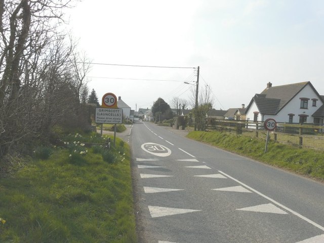
Grimscott

Grimscott is a village in north Cornwall, England, UK. It is situated in the civil parish of Launcells, 3 miles (4.8 km) east of the town of Bude.Half...

Launcells Cross

Launcells Cross is a hamlet in the parish of Launcells in Cornwall, England. It is on the B3254 road between Grimscott and Red Post. == References ==

Launcells

Launcells (Cornish: Lannseles) is a hamlet and civil parish in north-east Cornwall, England, United Kingdom. It is located 3 miles (4.8 km) east of Bude...

Bush, Cornwall

Bush is a hamlet in the parish of Bude-Stratton, Cornwall, England, UK (where the 2011 census population is included). == References ==

Red Post

Red Post is a crossroads near Launcells in Cornwall, England. It is on the A3072 Holsworthy to Stratton road where it is crossed by the B3254 road. �...

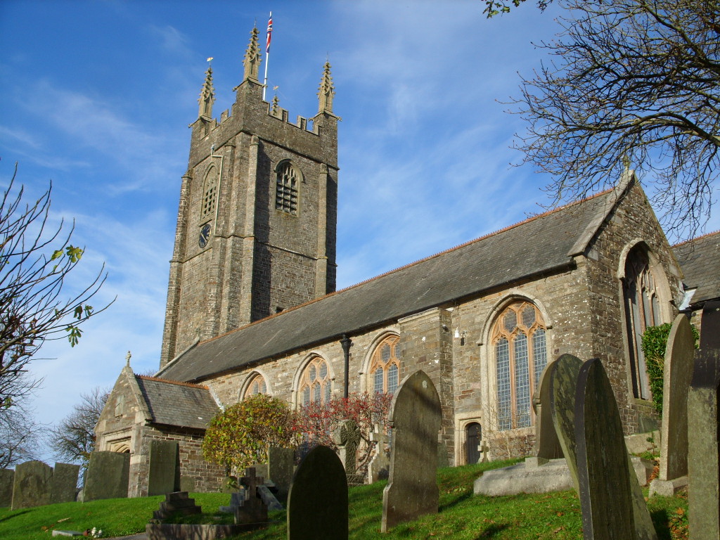
St Andrew's Church, Stratton

St Andrew's Church is a Grade I listed church in Stratton, Bude, Cornwall. It is located along the main road in Stratton. The font is dated to the 12th...

Battle of Stratton

The Battle of Stratton, also known as the Battle of Stamford Hill, took place on 16 May 1643, at Stratton in Cornwall, during the First English Civil War...

Nearby Amenities

Located within 500m of 50.84276,-4.475016
Hersham
Is In: Cornwall, England, UK
Place: hamlet
Wikidata: Q5744427
Lat/Long: 50.8421783/-4.475127
Bus Stop
Venn Farm
Naptan AtcoCode: 0800COC56565
Naptan Bearing: S
Naptan CommonName: Venn Farm
Naptan NaptanCode: corgawmt
Naptan Street: B3254
Naptan Verified: no
Source: naptan_import
Lat/Long: 50.84673/-4.4727469
Bus Stop
Opp Venn Farm
Naptan AtcoCode: 0800COC56566
Naptan Bearing: N
Naptan CommonName: Opp Venn Farm
Naptan NaptanCode: corgawmw
Naptan Street: B3254
Naptan Verified: no
Source: naptan_import
Lat/Long: 50.846635/-4.4729834
Bus Stop
Hersham Cross
Naptan AtcoCode: 0800COD40830
Naptan Bearing: SE
Naptan CommonName: Hersham Cross
Naptan NaptanCode: cordtgpm
Naptan Street: B3254
Naptan Verified: no
Source: naptan_import
Lat/Long: 50.8431226/-4.4706525
Bus Stop
Hersham Cross
Naptan AtcoCode: 0800COD40831
Naptan Bearing: E
Naptan CommonName: Hersham Cross
Naptan NaptanCode: cordtgpd
Naptan Street: B3254
Naptan Verified: no
Source: naptan_import
Lat/Long: 50.8431088/-4.4708791
Power: pole
Lat/Long: 50.8401531/-4.4750056
Power: pole
Lat/Long: 50.8413692/-4.4731066
Power: pole
Lat/Long: 50.8420128/-4.4720605
Power: pole
Lat/Long: 50.8427936/-4.4706041
Power: pole
Lat/Long: 50.8435321/-4.4692093
Man Made: mast
Tower Type: communication
Lat/Long: 50.8431393/-4.477046
Direction: E
Generator Method: photovoltaic
Generator Output Electricity: yes
Generator Solar Modules: 8
Generator Source: solar
Generator Type: solar_photovoltaic_panel
Location: roof
Power: generator
Lat/Long: 50.8401711/-4.4697092
Direction: W
Generator Method: photovoltaic
Generator Output Electricity: yes
Generator Solar Modules: 4
Generator Source: solar
Generator Type: solar_photovoltaic_panel
Location: roof
Power: generator
Lat/Long: 50.8401518/-4.4697461
Direction: W
Generator Method: photovoltaic
Generator Output Electricity: yes
Generator Solar Modules: 4
Generator Source: solar
Generator Type: solar_photovoltaic_panel
Location: roof
Power: generator
Lat/Long: 50.8401772/-4.4697468
The data included in this document is from www.openstreetmap.org. The data is made available under ODbL.

Have you been to Hersham?

Leave your review of Hersham below (or comments, questions and feedback).