Cnoc Gormadail

Hill, Mountain in Argyllshire

Scotland

Cnoc Gormadail

At Cill an Ailein Burial Ground The edge of the old burial ground is shown on the right-hand side of this shot.
At Cill an Ailein Burial Ground Credit: Mary and Angus Hogg

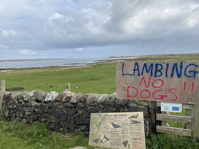
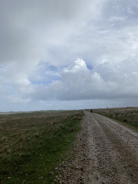
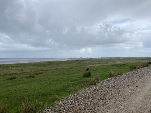
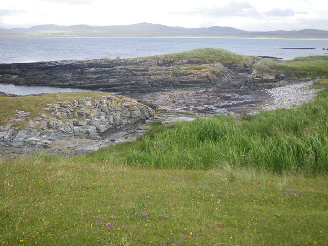
Cnoc Gormadail is a prominent hill located in Argyllshire, Scotland. It is part of the rugged and picturesque landscape of the Scottish Highlands. Situated in the western region of the country, Cnoc Gormadail offers breathtaking panoramic views and is a favorite destination for hikers and nature enthusiasts.

With an elevation of approximately 505 meters (1,657 feet), Cnoc Gormadail stands tall amidst the surrounding mountains and offers a challenging yet rewarding climb. The hill is characterized by its rocky terrain, heather-covered slopes, and scattered patches of woodland. Its name translates to "blue hill" in Gaelic, reflecting the atmospheric beauty of the area.

The ascent to the summit of Cnoc Gormadail provides an opportunity to witness the diverse flora and fauna of the region. Hikers may spot a variety of bird species, including golden eagles, peregrine falcons, and ptarmigans. The hill is also home to red deer, wild goats, and other wildlife.

At the summit, visitors are rewarded with breathtaking vistas of the surrounding landscape, including the nearby Loch Scammadale and the distant Isle of Mull. On a clear day, it is possible to see the Inner Hebrides archipelago in the distance.

Cnoc Gormadail is a place of natural beauty and tranquility, allowing visitors to immerse themselves in the Scottish Highlands' rugged wilderness. It serves as a reminder of the untamed nature that Scotland has to offer and attracts outdoor enthusiasts seeking adventure and a connection with nature.

If you have any feedback on the listing, please let us know in the comments section below.

Cnoc Gormadail Images

Images are sourced within 2km of 55.860138/-6.3073352 or Grid Reference NR3071. Thanks to Geograph Open Source API. All images are credited.

At Cill an Ailein Burial Ground The edge of the old burial ground is shown on the right-hand side of this shot.
At Cill an Ailein Burial Ground
The edge of the old burial ground is shown on the right-hand side of this shot.
Cill an Ailein Burial Ground The Canmore website describes Cill an Ailein as a featureless site between a crag and a burn. It was somewhat challenging to find and wan't easy for someone inexperienced to identify.
Cill an Ailein Burial Ground
The Canmore website describes Cill an Ailein as a featureless site between a crag and a burn. It was somewhat challenging to find and wan't easy for someone inexperienced to identify.
Cill an Ailein Burial Ground Site The Gaelic name of this ancient burial ground means “Church of the Plains” but no evidence of any building or burials can be found now. It’s a featureless site between a crag and a burn, not easy for someone inexperienced to identify. The Gaelic name has been Anglicised as Killinallan.
Cill an Ailein Burial Ground Site
The Gaelic name of this ancient burial ground means “Church of the Plains” but no evidence of any building or burials can be found now. It’s a featureless site between a crag and a burn, not easy for someone inexperienced to identify. The Gaelic name has been Anglicised as Killinallan.
Raised Beach Near Killinallan Looking over the post-glacial raised beach towards the former rocky shoreline near Killinallan. The small mound on the skyline just to the right of centre is the Cill an Ailein medieval burial ground.
Raised Beach Near Killinallan
Looking over the post-glacial raised beach towards the former rocky shoreline near Killinallan. The small mound on the skyline just to the right of centre is the Cill an Ailein medieval burial ground.
Towards Ton nam Fang The old dry-stone dyke and the modern fence mark the edge of the dune system and the grazing land on the raised beach. The rocks of Ton nam Fang are shown in the background.
Towards Ton nam Fang
The old dry-stone dyke and the modern fence mark the edge of the dune system and the grazing land on the raised beach. The rocks of Ton nam Fang are shown in the background.
Old Cliffs And Stacks Near Killinallan Cliffs, rocks and stacks of the former coastline at Killinallan. The raised beach and the dune system now keep the sea considerably further to the north.
Old Cliffs And Stacks Near Killinallan
Cliffs, rocks and stacks of the former coastline at Killinallan. The raised beach and the dune system now keep the sea considerably further to the north.
Ruin Near Killinallan The remains of a building on the raised beach with the former sea cliffs in the background.
Ruin Near Killinallan
The remains of a building on the raised beach with the former sea cliffs in the background.
Cave Near Killinallan This old sea cave is shown on the Explorer Map. It now lies high and dry above the post-glacial raised beach on Islay.
Cave Near Killinallan
This old sea cave is shown on the Explorer Map. It now lies high and dry above the post-glacial raised beach on Islay.
End of the public road at Cnuic na Croise Glad the dogs are left at home
End of the public road at Cnuic na Croise
Glad the dogs are left at home
Track near Killinallan
Views to the coast
Views to the coast
Stormy skies approaching Killnallan
Allt an t-Seanna Chlaiginn
Nearly back at the car
Killinallan View across Loch Gruinart towards the farmstead of Killinallan
Killinallan
View across Loch Gruinart towards the farmstead of Killinallan
Killinallan Taking cover from the rain in farm building, looking towards Loch Gruinart.
Killinallan
Taking cover from the rain in farm building, looking towards Loch Gruinart.
Oyster farming on Loch Gruinart Pacific oysters growing in baskets on a remote Islay beach.
Oyster farming on Loch Gruinart
Pacific oysters growing in baskets on a remote Islay beach.
Show me another place!

Cnoc Gormadail is located at Grid Ref: NR3071 (Lat: 55.860138, Lng: -6.3073352)

Unitary Authority: Argyll and Bute

Police Authority: Argyll and West Dunbartonshire

What 3 Words

///recliner.notes.piano. Near Bridgend, Argyll & Bute

Nearby Locations

Cnoc Gormadail

Related Wikis

Loch Gruinart

Loch Gruinart (Scottish Gaelic: Loch Gruinneard from the Old Norse, meaning "shallow fjord") is a sea loch on the northern coast of isle of Islay in Scotland...

Ardnave Point

Ardnave Point (Scottish Gaelic, Àird an Naoimh) is a coastal promontory on the northwest of Islay, a Scottish island. This landform has a rocky northern...

Nave Island

Nave Island lies to the north of Islay in the Inner Hebrides near the mouth of Loch Gruinart. It is uninhabited. == Geography == The island is all but...

Gruinart Flats

The Gruinart Flats is a low-lying landform on the western part of the isle of Islay in Scotland. The locale is an important conservation area, having been...

Battle of Traigh Ghruinneart

The Battle of Traigh Ghruinneart or in Scottish Gaelic Blàr Tràigh Ghruineart or sometimes called the Battle of Gruinart Strand was a Scottish clan battle...

Finlaggan

Finlaggan (NR 388 680, Scottish Gaelic: Port an Eilein) is a historic site on Eilean Mòr in Loch Finlaggan. The Loch, the island, and Finlaggan Castle...

Islay House

Islay House is a Category A listed country house near Bridgend, Islay in the county of Argyll, in western Scotland on the shores of Loch Indaal. ��2�...

Loch Gorm Castle

Loch Gorm Castle is a ruined castle located on Eilean Mòr (big island) on Loch Gorm, Islay, Scotland. It was once a stronghold of Clan Macdonald. The castle...

Nearby Amenities

Located within 500m of 55.860138,-6.3073352
Source: PGS
Lat/Long: 55.8645115/-6.3065614
Source: PGS
Lat/Long: 55.8600801/-6.3092589
Source: PGS
Lat/Long: 55.8597581/-6.3100571
The data included in this document is from www.openstreetmap.org. The data is made available under ODbL.

Have you been to Cnoc Gormadail?

Leave your review of Cnoc Gormadail below (or comments, questions and feedback).