Cnoc Glas

Hill, Mountain in Ross-shire

Scotland

Cnoc Glas

Pentland Road near Carloway Small road that runs across the moorland from Stornoway to Carloway.
Pentland Road near Carloway Credit: Stuart Wilding

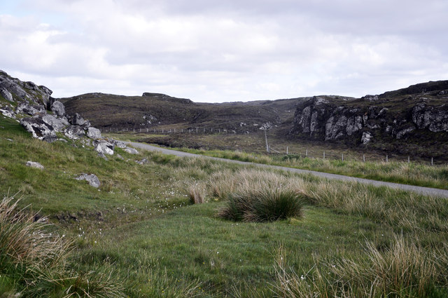
Cnoc Glas is a prominent hill located in Ross-shire, Scotland. Situated near the village of Contin, it forms part of the stunning Scottish Highlands landscape. Rising to a height of approximately 1,182 feet (360 meters), it offers breathtaking panoramic views of the surrounding area.

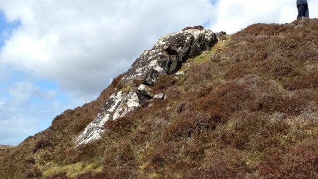
The hill is characterized by its rugged terrain, with steep slopes covered in heather and grasses. It is a popular destination for hikers and outdoor enthusiasts, as it provides a challenging yet rewarding climb. The ascent to the summit can be steep at times, but the effort is well worth it for the breathtaking vistas that await.

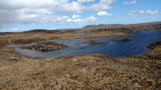
From the top of Cnoc Glas, visitors can enjoy stunning views of the surrounding Ross-shire countryside, including the picturesque Black Isle, the Cromarty Firth, and the towering peaks of the nearby mountains. On clear days, it is even possible to catch a glimpse of the distant snow-capped peaks of the Cairngorms National Park.

The hill is also home to a variety of wildlife, including red deer, mountain hares, and various bird species. Nature enthusiasts can often spot these animals as they explore the hill's diverse ecosystem.

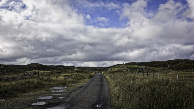
Cnoc Glas is easily accessible for hikers, with several well-marked trails leading to the summit. Its close proximity to Contin village also makes it a convenient destination for those looking to explore the beauty of the Scottish Highlands.

Overall, Cnoc Glas offers a memorable outdoor experience, combining challenging hiking trails with breathtaking views of the Ross-shire countryside.

If you have any feedback on the listing, please let us know in the comments section below.
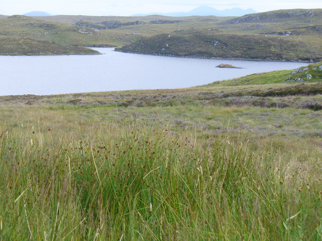
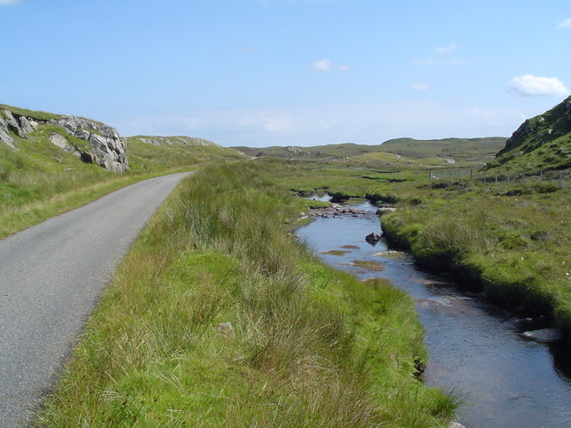
Cnoc Glas Images

Images are sourced within 2km of 58.254255/-6.7382434 or Grid Reference NB2239. Thanks to Geograph Open Source API. All images are credited.

Pentland Road near Carloway Small road that runs across the moorland from Stornoway to Carloway.
Pentland Road near Carloway
Small road that runs across the moorland from Stornoway to Carloway.
Pentland road and Cattle Grid
Abhainn Chàrlabhaigh By the Pentland Road.
Abhainn Chàrlabhaigh
By the Pentland Road.
Tiny Loch N.E. of Loch Earraid, Carloway, Isle of Lewis This part of the world has a close affinity to the water table.  Myriad lochs and lochans beyond every looming peat hag.  I often wonder about the level at which they stopped giving them names.  Loch Earraid nearby large enough to warrant titling, this one, barely four inches deep clearly not.
Just ten yards of walking this terrain and you see why I am the first geographer to visit.
Tiny Loch N.E. of Loch Earraid, Carloway, Isle of Lewis
This part of the world has a close affinity to the water table. Myriad lochs and lochans beyond every looming peat hag. I often wonder about the level at which they stopped giving them names. Loch Earraid nearby large enough to warrant titling, this one, barely four inches deep clearly not. Just ten yards of walking this terrain and you see why I am the first geographer to visit.
Bog and hills by  Rathad a' Phentland (The Pentland Road)
Bog and hills by Rathad a' Phentland (The Pentland Road)
Rathad a' Phentland Loch Earraid on the right.
Rathad a' Phentland
Loch Earraid on the right.
Loch Lacsabhat Iarach By the Pentland Road.
Loch Lacsabhat Iarach
By the Pentland Road.
Bog beside the Pentland Road Looking towards Beinn Braghair (261 metres).
Bog beside the Pentland Road
Looking towards Beinn Braghair (261 metres).
Loch Fionnacleit Lovely, remote Loch Fionnacleit.  This loch and the grid square had never been visited by Geographers with a camera until now.  This hard-to-reach tranquillity in the mid north western wilderness of the Isle of Lewis.  Other than a far-running fence there was no sign of humanity anywhere.
Loch Fionnacleit
Lovely, remote Loch Fionnacleit. This loch and the grid square had never been visited by Geographers with a camera until now. This hard-to-reach tranquillity in the mid north western wilderness of the Isle of Lewis. Other than a far-running fence there was no sign of humanity anywhere.
Loch na Faing Small loch on the way to the day's bigger prize of Loch Fionnacleit.  Hill and heather stomping in remote N. W. Lewis.
Loch na Faing
Small loch on the way to the day's bigger prize of Loch Fionnacleit. Hill and heather stomping in remote N. W. Lewis.
Loch Earraid from the north Just off the Pentland Road out of Carloway (Càrlabhagh) Loch Earraid.
Loch Earraid from the north
Just off the Pentland Road out of Carloway (Càrlabhagh) Loch Earraid.
Rocky knoll at 72m spot height south of Pentland Rd, Carloway, Lewis Tramp out across the bog to the tiny hump that is this 72 metre spot height amidst the wilderness of Lewis.  Then drop down the S.E. side and this is what you'll see.  Can't guarantee my wife's legs will be there when you go to check.
Rocky knoll at 72m spot height south of Pentland Rd, Carloway, Lewis
Tramp out across the bog to the tiny hump that is this 72 metre spot height amidst the wilderness of Lewis. Then drop down the S.E. side and this is what you'll see. Can't guarantee my wife's legs will be there when you go to check.
Roadside memorial to Murdo Macleod On the lonely bog-traversing Pentland Road twixt Carloway and Stornoway lies this memorial to a man who dropped dead at this spot on 1st June 1902 aged just 40.  If anyone ever contacts me to tell me the cause, I will be delighted to update this page.  Murdo was clearly loved by his descendants.
Roadside memorial to Murdo Macleod
On the lonely bog-traversing Pentland Road twixt Carloway and Stornoway lies this memorial to a man who dropped dead at this spot on 1st June 1902 aged just 40. If anyone ever contacts me to tell me the cause, I will be delighted to update this page. Murdo was clearly loved by his descendants.
View from the knoll at 72m spot height My previous image from this spot shows what's underfoot, this one shows the view roughly south.  Bog, some bog, then a boggy patch.  Two lochans which I think are called Loch Mòr and Loch Gheòidh can be seen mid distant.
Off Pentland Rd, Carloway, Isle of Lewis.
View from the knoll at 72m spot height
My previous image from this spot shows what's underfoot, this one shows the view roughly south. Bog, some bog, then a boggy patch. Two lochans which I think are called Loch Mòr and Loch Gheòidh can be seen mid distant. Off Pentland Rd, Carloway, Isle of Lewis.
Lewisian Nice View from the Pentland Road / Rathad Phentland across moorland and Loch Lacsabhat Iarach towards distant Harris hills.
Lewisian Nice
View from the Pentland Road / Rathad Phentland across moorland and Loch Lacsabhat Iarach towards distant Harris hills.
Cattle Grid on Pentland Road This cattle grid keeps sheep out of the village of Carloway. There are many sheep on the moor along the pentland road.
Cattle Grid on Pentland Road
This cattle grid keeps sheep out of the village of Carloway. There are many sheep on the moor along the pentland road.
Carloway River The Pentland Road and Carloway River run side by side for much of their length, although they are generally further apart than they are in this section.
Carloway River
The Pentland Road and Carloway River run side by side for much of their length, although they are generally further apart than they are in this section.
Abhainn Charlabhaigh This stream drains a large number of lochs on the high ground and flows into the sea Loch Charlabhaigh
Abhainn Charlabhaigh
This stream drains a large number of lochs on the high ground and flows into the sea Loch Charlabhaigh
Show me another place!

Cnoc Glas is located at Grid Ref: NB2239 (Lat: 58.254255, Lng: -6.7382434)

Unitary Authority: Na h-Eileanan an Iar

Police Authority: Highlands and Islands

What 3 Words

///coins.backpacks.remember. Near Carloway, Na h-Eileanan Siar

Related Wikis

Tolsta Chaolais

Tolsta Chaolais (also Tolastadh Chaolais, Tolstadh a' Chaolais) is a village on the Isle of Lewis, Scotland. It consists of about forty houses, clustered...

Carloway

Carloway (Scottish Gaelic: Càrlabhagh [ˈkʰaːɾɫ̪ə.ɤː]) is a crofting township and a district on the west coast of the Isle of Lewis, in the Outer Hebrides...

Dun Carloway

Dun Carloway (Scottish Gaelic: Dùn Chàrlabhaigh) is a broch situated in the district of Carloway, on the west coast of the Isle of Lewis, Scotland (grid...

Breasclete

Breasclete (Scottish Gaelic: Brèascleit) is a village and community on the west side of the Isle of Lewis, in the Outer Hebrides, Scotland. Breasclete...

Have you been to Cnoc Glas?

Leave your review of Cnoc Glas below (or comments, questions and feedback).