Cnoc a' Bhonnaich Mòr

Hill, Mountain in Inverness-shire

Scotland

Cnoc a' Bhonnaich Mòr

The pass above Cealabost—Cnoc an t-Sìthean and the Monument to the Glendale Land Leaguers
The pass above Cealabost—Cnoc an t-Sìthean and the Monument to the Glendale Land Leaguers Credit: Mick Garratt

Cnoc a' Bhonnaich Mòr is a prominent hill located in the Inverness-shire region of Scotland. Rising to an elevation of approximately 644 meters (2,113 feet), it is situated in the remote and picturesque landscape of the Scottish Highlands. The hill is part of the Monadhliath Mountains, a range known for its rugged beauty and outstanding natural features.

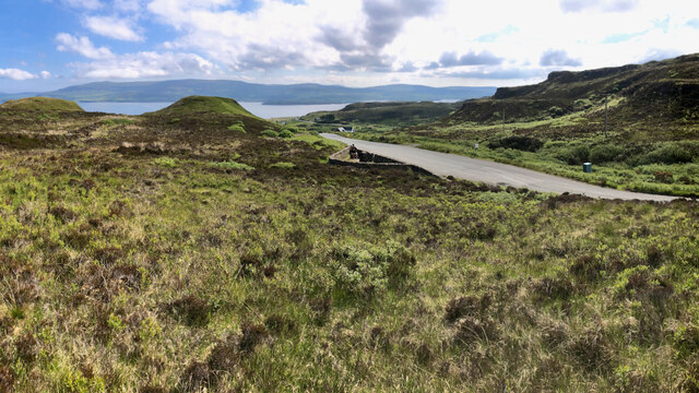
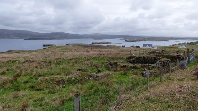
Cnoc a' Bhonnaich Mòr offers breathtaking panoramic views of the surrounding countryside, including the nearby Loch Ness. Its remote location and untouched terrain make it an ideal destination for outdoor enthusiasts and hikers who seek to explore the wilderness of the Scottish Highlands. The hill boasts a variety of trails and paths, catering to both experienced climbers and casual walkers.

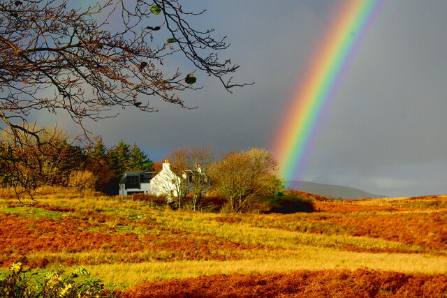
The hill is adorned with heather and grassy slopes, creating a vibrant landscape that changes with the seasons. During the summer months, the hillside comes alive with an array of colorful wildflowers, providing a picturesque backdrop for visitors. The area is also home to a diverse range of wildlife, including deer, eagles, and numerous bird species.

Cnoc a' Bhonnaich Mòr is easily accessible from nearby towns and villages, making it a popular destination for locals and tourists alike. Its remote location and untouched natural beauty make it a must-visit for anyone seeking to immerse themselves in the stunning landscapes of the Scottish Highlands. Whether visitors are looking for a challenging climb or a peaceful nature walk, Cnoc a' Bhonnaich Mòr offers an unforgettable experience in the heart of Scotland's wilderness.

If you have any feedback on the listing, please let us know in the comments section below.

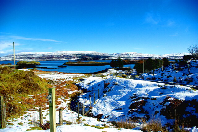
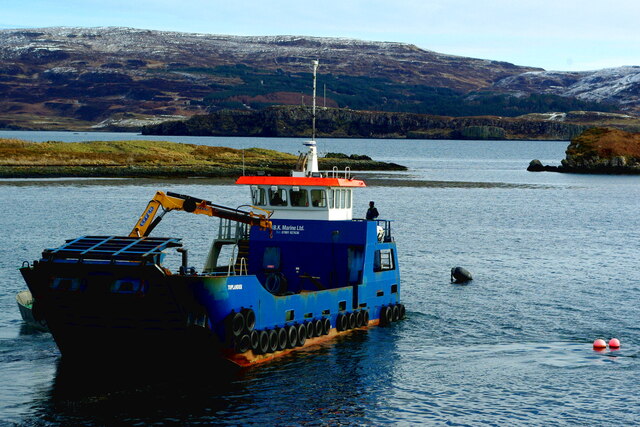
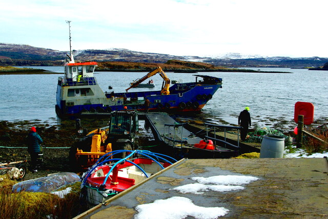
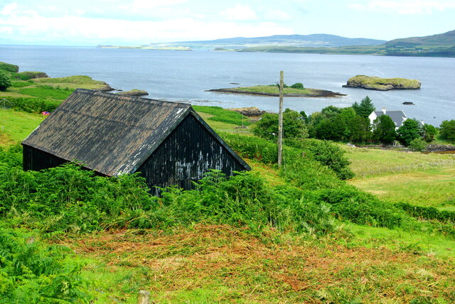
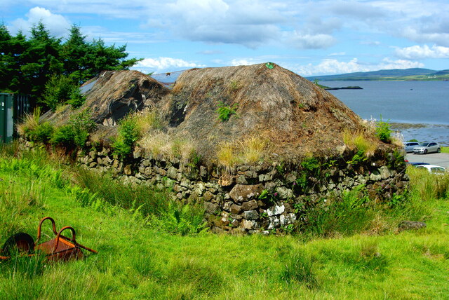
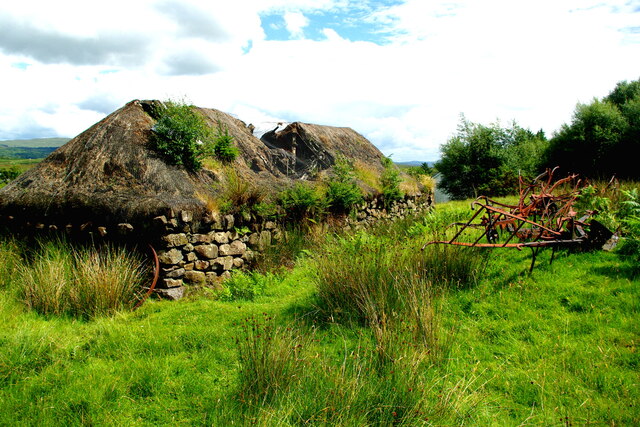
Cnoc a' Bhonnaich Mòr Images

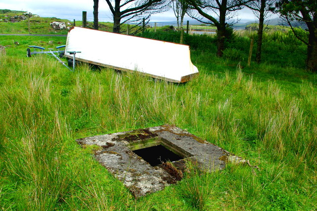
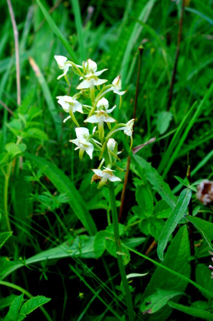
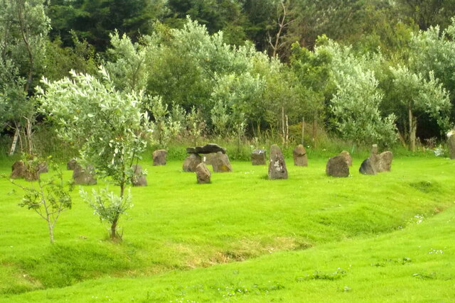
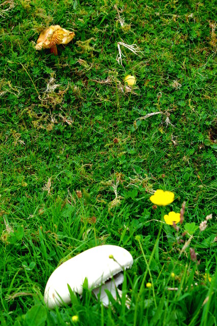
Images are sourced within 2km of 57.44153/-6.6432771 or Grid Reference NG2148. Thanks to Geograph Open Source API. All images are credited.

The pass above Cealabost—Cnoc an t-Sìthean and the Monument to the Glendale Land Leaguers
New postbox at Colbost <a href="https://www.geograph.org.uk/photo/4698963">NG2049 : Colbost postbox IV55 42</a> has recently been replaced by a new pressed steel model which can accept larger letters and small packets. The daily collection is still made at 8.15am.
New postbox at Colbost
NG2049 : Colbost postbox IV55 42 has recently been replaced by a new pressed steel model which can accept larger letters and small packets. The daily collection is still made at 8.15am.
Blackhouse Museum, Colbost The croft museum in the township of Colbost, on the west shore of Loch Dunvegan, was established in 1969 by local man Peter MacAskill as the first of several heritage projects in the area. Its centrepiece was a restored island blackhouse (Taigh Dubh), constructed of rough unmortared stone and replicating typical living conditions in 19th-century rural Skye. There were two doors, one for the crofter's family who occupied two thirds of the building and the other for the animals housed in the byre which took up the remaining space. There were no windows or chimneys; daylight entered through the doorways and smoke from the central peat fire, continuously burning in its hearth on the floor of the living room, escaped though a raised opening in the thatched roof. The interior was thus dark and smoky and the floor was of beaten earth. Kettles and cooking pots were hung on a slabhraidh (chain) suspended from the rafters over the fire, and crockery and utensils was kept in a dresser and presses (cupboards) against the walls. A replica of an illicit whisky still could be seen to the rear of the museum.

The adjoining Three Chimneys restaurant was also opened by Peter, initially to provide refreshments for visitors to the museum, and takes its name from the Kent hamlet near Sevenoaks where Peter had formerly lived.

Sadly the museum was not able to reopen following its closure just before the Covid pandemic of 2020, and by 2023 it stood derelict with the neglected roof thatch disintegrating.
Blackhouse Museum, Colbost
The croft museum in the township of Colbost, on the west shore of Loch Dunvegan, was established in 1969 by local man Peter MacAskill as the first of several heritage projects in the area. Its centrepiece was a restored island blackhouse (Taigh Dubh), constructed of rough unmortared stone and replicating typical living conditions in 19th-century rural Skye. There were two doors, one for the crofter's family who occupied two thirds of the building and the other for the animals housed in the byre which took up the remaining space. There were no windows or chimneys; daylight entered through the doorways and smoke from the central peat fire, continuously burning in its hearth on the floor of the living room, escaped though a raised opening in the thatched roof. The interior was thus dark and smoky and the floor was of beaten earth. Kettles and cooking pots were hung on a slabhraidh (chain) suspended from the rafters over the fire, and crockery and utensils was kept in a dresser and presses (cupboards) against the walls. A replica of an illicit whisky still could be seen to the rear of the museum. The adjoining Three Chimneys restaurant was also opened by Peter, initially to provide refreshments for visitors to the museum, and takes its name from the Kent hamlet near Sevenoaks where Peter had formerly lived. Sadly the museum was not able to reopen following its closure just before the Covid pandemic of 2020, and by 2023 it stood derelict with the neglected roof thatch disintegrating.
Loch Dunvegan A view across the sea loch from Colbost on a June evening. Dunvegan Castle in <a href="https://www.geograph.org.uk/gridref/NG2449">NG2449</a> is prominent on the eastern shore.
Loch Dunvegan
A view across the sea loch from Colbost on a June evening. Dunvegan Castle in NG2449 is prominent on the eastern shore.
Tobar Eòin (John's Well) Marked by the Ordnance Survey as a spring, this well gives clear fresh water though within a few metres of high water. Eòin is the old form of the name John, used in the Gaelic Bible for both John the Baptist and John the Evangelist in the New Testament, almost completely replaced in modern Scottish Gaelic by Iain, and in Ireland by Seán. One local tradition associates this spring with a John Mackay, but others take it to be a holy well dedicated to one of the biblical saints. There are several such wells in Ireland commemorating the Baptist, including this <a href="https://www.geograph.org.uk/photo/7142493">S5661 : Holy Well</a> at Johnswell (Tobar Eoin) in Co. Kilkenny which was the scene of a midsummer festival on St John's Eve, 23rd June.

The present concrete surround is modern. The well also gives its name to the nearby house <a href="https://www.geograph.org.uk/photo/2923125">NG2149 : Tobar Eòin</a>.
Tobar Eòin (John's Well)
Marked by the Ordnance Survey as a spring, this well gives clear fresh water though within a few metres of high water. Eòin is the old form of the name John, used in the Gaelic Bible for both John the Baptist and John the Evangelist in the New Testament, almost completely replaced in modern Scottish Gaelic by Iain, and in Ireland by Seán. One local tradition associates this spring with a John Mackay, but others take it to be a holy well dedicated to one of the biblical saints. There are several such wells in Ireland commemorating the Baptist, including this S5661 : Holy Well at Johnswell (Tobar Eoin) in Co. Kilkenny which was the scene of a midsummer festival on St John's Eve, 23rd June. The present concrete surround is modern. The well also gives its name to the nearby house NG2149 : Tobar Eòin.
Lesser butterfly orchid (Platanthera bifolia) This plant is widely though patchily distributed throughout Britain and Ireland, being rare in central England and the south of Scotland. Its particular strongholds include the Hebrides (though it is rare in Lewis) and the counties of Ceredigion in Wales and Clare in Ireland. Since 1930 the population has declined greatly, as modern farming and grazing practices have resulted in the loss of unimproved grassland, a preferred habitat.  

Here the plant is growing in grassland on the western shore of Loch Dunvegan. Nearby the <a href="https://www.geograph.org.uk/photo/6898767">NG2149 : Spotted orchid</a> is in bloom as it was in mid-July the previous year.
Lesser butterfly orchid (Platanthera bifolia)
This plant is widely though patchily distributed throughout Britain and Ireland, being rare in central England and the south of Scotland. Its particular strongholds include the Hebrides (though it is rare in Lewis) and the counties of Ceredigion in Wales and Clare in Ireland. Since 1930 the population has declined greatly, as modern farming and grazing practices have resulted in the loss of unimproved grassland, a preferred habitat. Here the plant is growing in grassland on the western shore of Loch Dunvegan. Nearby the NG2149 : Spotted orchid is in bloom as it was in mid-July the previous year.
Stone circle, Upper Colbost In the garden of a house called Middle Earth. It may not be very ancient.
Stone circle, Upper Colbost
In the garden of a house called Middle Earth. It may not be very ancient.
Fungi, Colbost Beside the lane leading to the jetty. Mycologists are invited to identify these two species.
Fungi, Colbost
Beside the lane leading to the jetty. Mycologists are invited to identify these two species.
Ruined Blackhouse at Colbost
Ruined Blackhouse Settlement
Autumn fungi Battered remnants of fruiting bodies beside the road to the jetty. Mycologists are welcome to guess at the species.
Autumn fungi
Battered remnants of fruiting bodies beside the road to the jetty. Mycologists are welcome to guess at the species.
Colbost House with rainbow The former factor's house for Glendale was the first in the township to be roofed with slate in the 1840s and received a modern extension early in the 21st century.
Colbost House with rainbow
The former factor's house for Glendale was the first in the township to be roofed with slate in the 1840s and received a modern extension early in the 21st century.
Colbost Burn The "Beast from the North" has brought an unexpected wintry spell to many parts of the UK in early March. An uneven dusting of snow surrounds the final reach of the burn as it discharges into Loch Dunvegan. The three small islands in the loch, exposed to the sun and salt spray, show almost no covering but the final stretch of the jetty road, in the shadow of a belt of trees, is deeply and treacherously iced.
Colbost Burn
The "Beast from the North" has brought an unexpected wintry spell to many parts of the UK in early March. An uneven dusting of snow surrounds the final reach of the burn as it discharges into Loch Dunvegan. The three small islands in the loch, exposed to the sun and salt spray, show almost no covering but the final stretch of the jetty road, in the shadow of a belt of trees, is deeply and treacherously iced.
Landing craft Toplander in Loch Dunvegan Seen here off Colbost where she was delivering a pontoon, Toplander is a 22-metre multi-role vessel built in 2019 by Meercat Boats of Hythe near Southampton for civil engineering firm Topbond, and leased to BK Marine of Tingwall, Shetland.

RINA <span class="nowrap"><a title="https://www.rina.org.uk/MRV22.html" rel="nofollow ugc noopener" href="https://www.rina.org.uk/MRV22.html">Link</a><img style="margin-left:2px;" alt="External link" title="External link - shift click to open in new window" src="https://s1.geograph.org.uk/img/external.png" width="10" height="10"/></span>
Landing craft Toplander in Loch Dunvegan
Seen here off Colbost where she was delivering a pontoon, Toplander is a 22-metre multi-role vessel built in 2019 by Meercat Boats of Hythe near Southampton for civil engineering firm Topbond, and leased to BK Marine of Tingwall, Shetland. RINA LinkExternal link
Laying a pontoon at Colbost Jetty The landing craft Toplander <a title="www.geograph.org.uk/photo/7429356" href="https://www.geograph.org.uk/photo/7429356">Link</a> has brought the structure across the loch from Dunvegan. It will provide a facility for fish farm support craft.
Laying a pontoon at Colbost Jetty
The landing craft Toplander Link has brought the structure across the loch from Dunvegan. It will provide a facility for fish farm support craft.
Willie Alec's shed A corrugated building stands in the angle between the Upper Colbost road and the B884. In the background are the Colbost islands in Loch Dunvegan and in the misty distance the peninsula of Waternish on the far side of the loch.
Willie Alec's shed
A corrugated building stands in the angle between the Upper Colbost road and the B884. In the background are the Colbost islands in Loch Dunvegan and in the misty distance the peninsula of Waternish on the far side of the loch.
Folk Museum in decline Three years on from the closure enforced by Covid, the restored black house at the centre of the Colbost Croft Museum is showing sad signs of severe neglect.  The central section of the thatched roof has given way, leaving only the retaining wire netting, while rank weeds have invaded the remaining parts of the thatch. An upturned wheelbarrow is quietly rusting away in the foreground.
Folk Museum in decline
Three years on from the closure enforced by Covid, the restored black house at the centre of the Colbost Croft Museum is showing sad signs of severe neglect. The central section of the thatched roof has given way, leaving only the retaining wire netting, while rank weeds have invaded the remaining parts of the thatch. An upturned wheelbarrow is quietly rusting away in the foreground.
Decline of the Colbost Folk Museum Three years on from the closure enforced by Covid, the restored black house is showing sad signs of severe neglect.  The central section of the thatched roof has given way, leaving only the retaining wire netting, while rank weeds have invaded the remaining parts of the thatch. Agricultural machinery and an old wheel lie among the long grass.
Decline of the Colbost Folk Museum
Three years on from the closure enforced by Covid, the restored black house is showing sad signs of severe neglect. The central section of the thatched roof has given way, leaving only the retaining wire netting, while rank weeds have invaded the remaining parts of the thatch. Agricultural machinery and an old wheel lie among the long grass.
Show me another place!

Cnoc a' Bhonnaich Mòr is located at Grid Ref: NG2148 (Lat: 57.44153, Lng: -6.6432771)

Unitary Authority: Highland

Police Authority: Highlands and Islands

What 3 Words

///defended.reds.lakeside. Near Glendale, Highland

Related Wikis

The Three Chimneys

The Three Chimneys is a restaurant in Colbost, Isle of Skye, Scotland. While in operation beforehand, the restaurant came to prominence after being taken...

Colbost

Colbost (Scottish Gaelic: Cealabost) is a scattered hamlet on the B884 road, in the Glendale estate, overlooking Loch Dunvegan on the Scottish island of...

Duirinish, Skye

Duirinish (Scottish Gaelic: Diùirinis) is a peninsula and civil parish on the island of Skye in Scotland. It is situated in the north west between Loch...

Eilean Mòr, Loch Dunvegan

Eilean Mòr is an uninhabited island in Loch Dunvegan in north west Skye, Scotland. At low water the island is connected to Eilean Dubh. == Footnotes ==

Nearby Amenities

Located within 500m of 57.44153,-6.6432771
Access Cattle: no
Barrier: cattle_grid
Lat/Long: 57.4419133/-6.6396155
Bus Stop
Museum
Naptan AtcoCode: 6700712516
Naptan Bearing: SE
Naptan CommonName: Museum
Naptan Indicator: o/s
Naptan Landmark: Museum
Naptan NaptanCode: 45327879
Naptan Street: B884
Naptan Verified: no
Source: naptan_import
Lat/Long: 57.4432949/-6.6415797
Access: private
Barrier: swing_gate
Lat/Long: 57.4449398/-6.6482611
Power: pole
Lat/Long: 57.4376386/-6.6406593
Power: pole
Lat/Long: 57.4382702/-6.6415269
Power: pole
Lat/Long: 57.4384934/-6.6420664
Power: pole
Lat/Long: 57.4387523/-6.6426944
Power: pole
Lat/Long: 57.4392225/-6.6433909
Power: pole
Lat/Long: 57.4397685/-6.6442001
Power: pole
Lat/Long: 57.4401/-6.6446833
Power: pole
Lat/Long: 57.4403557/-6.6456072
Power: pole
Lat/Long: 57.4406438/-6.6466238
Power: pole
Lat/Long: 57.4410566/-6.6471572
Power: pole
Lat/Long: 57.4415842/-6.6478215
Power: pole
Lat/Long: 57.4420987/-6.6484717
Power: pole
Lat/Long: 57.4426079/-6.64914
Power: pole
Lat/Long: 57.4431343/-6.6497902
Power: pole
Lat/Long: 57.4435947/-6.6502451
Power: pole
Lat/Long: 57.4432654/-6.649456
Power: pole
Lat/Long: 57.4436575/-6.6483871
Power: pole
Lat/Long: 57.4440096/-6.6473786
The data included in this document is from www.openstreetmap.org. The data is made available under ODbL.

Have you been to Cnoc a' Bhonnaich Mòr?

Leave your review of Cnoc a' Bhonnaich Mòr below (or comments, questions and feedback).