Cnoc a' Charnain

Hill, Mountain in Ross-shire

Scotland

Cnoc a' Charnain

Abhainn Ghriomarstaidh (Grimersta River) Dramatic lighting as storm clouds gather to the south-west. This river is possibly the best salmon fishing river in the Western Isles, and drains a large tract of southern Lewis. There was a lot of water today following a week of unsettled weather with frequent rain showers.
Abhainn Ghriomarstaidh (Grimersta River) Credit: Anne Burgess

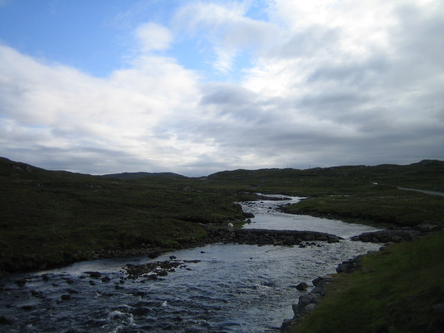
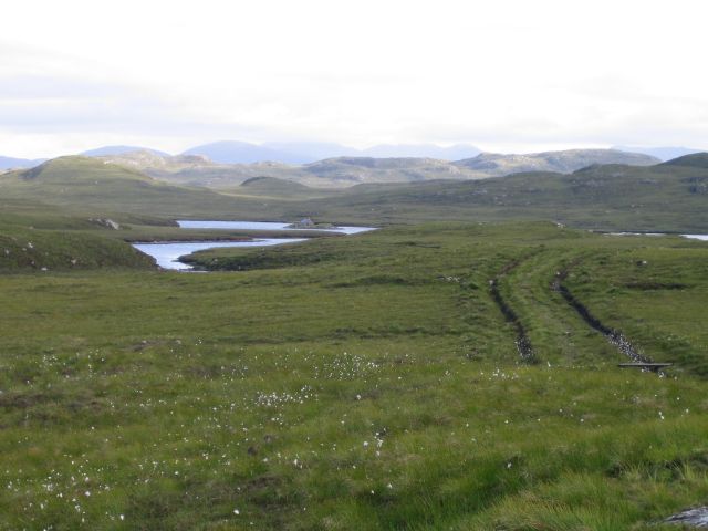
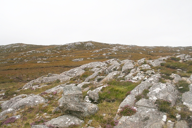
Cnoc a' Charnain, located in Ross-shire, Scotland, is a prominent hill/mountain rising to a height of approximately 330 meters (1,080 feet) above sea level. Situated in the picturesque region of the Highlands, it offers breathtaking views of the surrounding landscape. The hill is located near the small village of Achnasheen, making it easily accessible for outdoor enthusiasts and hikers.

Cnoc a' Charnain boasts a distinctive shape with its gently sloping sides covered in vibrant heather and grasslands. Its summit offers a panoramic view of the surrounding mountains, including the nearby Beinn Eighe and Liathach. On clear days, it is possible to spot the sparkling waters of Loch Maree in the distance.

The hill/mountain is a popular destination for walkers and hikers of varying abilities, with several trails and paths leading to the summit. The ascent is considered moderate, providing a satisfying challenge without being overly strenuous. Along the way, visitors can enjoy the diverse flora and fauna of the Scottish Highlands, with sightings of red deer, mountain hares, and various bird species being common.

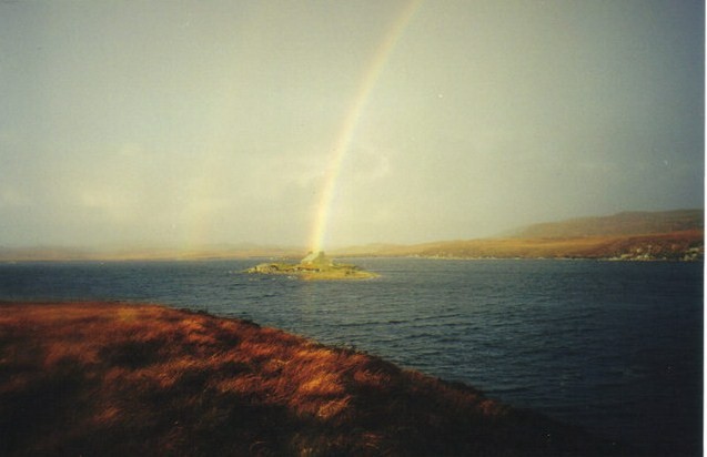
Cnoc a' Charnain is an excellent location for nature lovers and photographers, offering opportunities to capture the stunning landscape in all its glory. The ever-changing weather conditions in the region also add to the charm and allure of the hill/mountain.

Overall, Cnoc a' Charnain in Ross-shire is a captivating natural landmark that showcases the beauty and ruggedness of the Scottish Highlands, making it a must-visit destination for outdoor enthusiasts and those seeking a tranquil escape in nature.

If you have any feedback on the listing, please let us know in the comments section below.

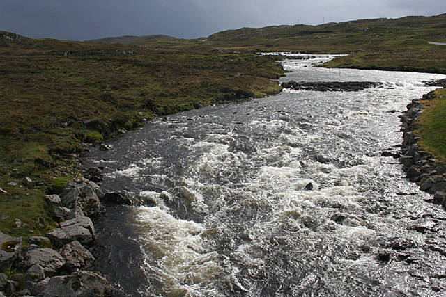
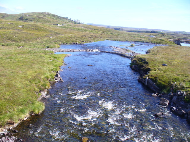
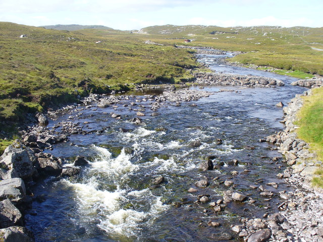
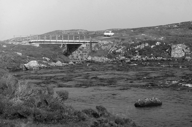
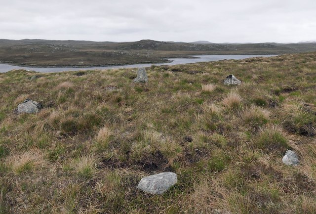
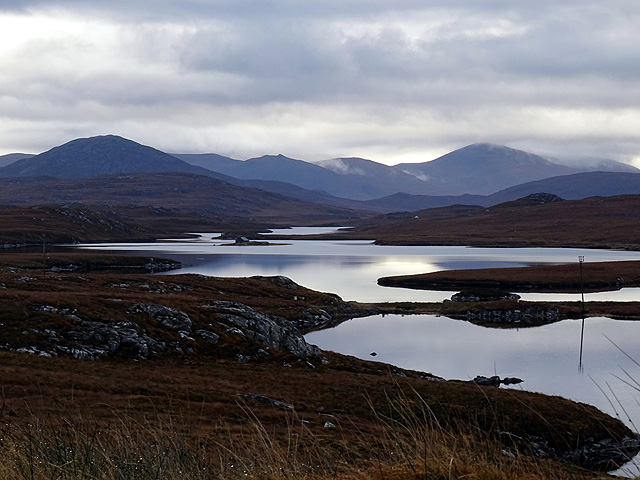
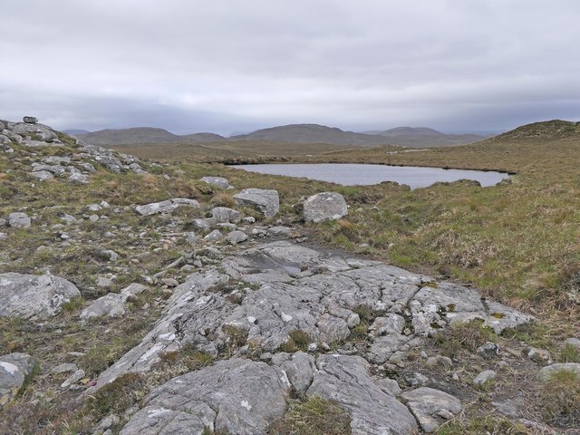
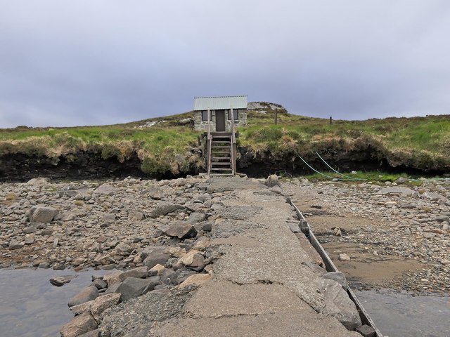
Cnoc a' Charnain Images

Images are sourced within 2km of 58.149797/-6.7420354 or Grid Reference NB2127. Thanks to Geograph Open Source API. All images are credited.

Abhainn Ghriomarstaidh (Grimersta River) Dramatic lighting as storm clouds gather to the south-west. This river is possibly the best salmon fishing river in the Western Isles, and drains a large tract of southern Lewis. There was a lot of water today following a week of unsettled weather with frequent rain showers.
Abhainn Ghriomarstaidh (Grimersta River)
Dramatic lighting as storm clouds gather to the south-west. This river is possibly the best salmon fishing river in the Western Isles, and drains a large tract of southern Lewis. There was a lot of water today following a week of unsettled weather with frequent rain showers.
Grimersta River Abhainn Ghriomarstaidh tumbling down to the sea at Loch Ceann Hulabhig. The old road and bridge are visible in mid distance.
Grimersta River
Abhainn Ghriomarstaidh tumbling down to the sea at Loch Ceann Hulabhig. The old road and bridge are visible in mid distance.
Grimersta River from the Bridge View upstream of a tumbling, Highland river (Abhainn Ghriomarstaidh) from the new B8011 road bridge.
Grimersta River from the Bridge
View upstream of a tumbling, Highland river (Abhainn Ghriomarstaidh) from the new B8011 road bridge.
Lewis style bus shelter (i)
Old road bridge over the Abhainn Ghriomarstaidh/Grimersta River When this photo was taken in 1975, the bridge seen carried the B road to west Lewis over the river. Since then, a replacement has been constructed a short distance downstream. Fairly recent imagery seen online suggests that the bridge is still standing, although it no longer lies on a public road.
Old road bridge over the Abhainn Ghriomarstaidh/Grimersta River
When this photo was taken in 1975, the bridge seen carried the B road to west Lewis over the river. Since then, a replacement has been constructed a short distance downstream. Fairly recent imagery seen online suggests that the bridge is still standing, although it no longer lies on a public road.
Loch Faoghail am Tuim Looking south towards the hills of West Lewis. The little house highlighted by a ray of sunshine is a boathouse, in the next square. The nearest hill on the left is Ciorabhal, and on the right is Geure Dubh Mhòr. On the distant skyline is Roineabhal.
Loch Faoghail am Tuim
Looking south towards the hills of West Lewis. The little house highlighted by a ray of sunshine is a boathouse, in the next square. The nearest hill on the left is Ciorabhal, and on the right is Geure Dubh Mhòr. On the distant skyline is Roineabhal.
Cycling the B8059 The hills of Harris on the skyline
Cycling the B8059
The hills of Harris on the skyline
Looking south east from the old Ardroil road A short spur which has been bypassed by new road construction forms a convenient parking place to admire the view.
Looking south east from the old Ardroil road
A short spur which has been bypassed by new road construction forms a convenient parking place to admire the view.
Stone setting, Druim Cam, Isle of Lewis Looking towards Loch Faoghail Charrasan, most of which lies within the grid square.

From Discovery and Excavation in Scotland, 1991: "Possible kerb cairn or hut circle.  There is a sub-circular setting of 7 stones on edge set firmly into the ground, now under 20cm to 40cm of peat. The largest stone is 0.5m high. The internal dimensions are approximately 5.5m by 4.0m.  It is located on near-level ground on a gently sloping rock and heather ridge overlooking land on the shore of the loch."
Stone setting, Druim Cam, Isle of Lewis
Looking towards Loch Faoghail Charrasan, most of which lies within the grid square. From Discovery and Excavation in Scotland, 1991: "Possible kerb cairn or hut circle. There is a sub-circular setting of 7 stones on edge set firmly into the ground, now under 20cm to 40cm of peat. The largest stone is 0.5m high. The internal dimensions are approximately 5.5m by 4.0m. It is located on near-level ground on a gently sloping rock and heather ridge overlooking land on the shore of the loch."
Causeway and fishing bothy, Loch Faoghail an Tuim, Isle of Lewis Loch Faoghail an Tuim is part of the Grimersta salmon system (<span class="nowrap"><a title="https://www.grimersta.com/guide.htm" rel="nofollow ugc noopener" href="https://www.grimersta.com/guide.htm">Link</a><img style="margin-left:2px;" alt="External link" title="External link - shift click to open in new window" src="https://s1.geograph.org.uk/img/external.png" width="10" height="10"/></span> ).
Causeway and fishing bothy, Loch Faoghail an Tuim, Isle of Lewis
Loch Faoghail an Tuim is part of the Grimersta salmon system (LinkExternal link ).
Lewis bus shelter
Lewis bus shelter
Loch Sgàire Viewed from the B8059 road from Great Bernera.
Loch Sgàire
Viewed from the B8059 road from Great Bernera.
Rock slab, Cnoc na Clais, Isle of Lewis The OS Name Book of 1848-1852 describes Cnoc na Clais as, "a small, round, rocky, heathy hill" and says that its name means Furrows Hill.
Rock slab, Cnoc na Clais, Isle of Lewis
The OS Name Book of 1848-1852 describes Cnoc na Clais as, "a small, round, rocky, heathy hill" and says that its name means Furrows Hill.
Jetty and fishing bothy, Loch Faoghail an Tuim, Isle of Lewis Loch Faoghail an Tuim is part of the Grimersta salmon system (<span class="nowrap"><a title="https://www.grimersta.com/guide.htm" rel="nofollow ugc noopener" href="https://www.grimersta.com/guide.htm">Link</a><img style="margin-left:2px;" alt="External link" title="External link - shift click to open in new window" src="https://s1.geograph.org.uk/img/external.png" width="10" height="10"/></span> ).
Jetty and fishing bothy, Loch Faoghail an Tuim, Isle of Lewis
Loch Faoghail an Tuim is part of the Grimersta salmon system (LinkExternal link ).
Grimersta River The most famous and productive salmon river in the Scottish islands. Also the most expensive! and booked up years in advance anyway.
Grimersta River
The most famous and productive salmon river in the Scottish islands. Also the most expensive! and booked up years in advance anyway.
Moorland Moorland and a track out to the loch at the head of the Grimersta river.
Moorland
Moorland and a track out to the loch at the head of the Grimersta river.
Aird na Faoghalach Rocky landscape interspersed with peat bog.
Aird na Faoghalach
Rocky landscape interspersed with peat bog.
Loch Faoghail an Tuim The rainbow strikes through the bothy on an islet in the Loch which is linked to the shore by stepping stones.
Loch Faoghail an Tuim
The rainbow strikes through the bothy on an islet in the Loch which is linked to the shore by stepping stones.
Show me another place!

Cnoc a' Charnain is located at Grid Ref: NB2127 (Lat: 58.149797, Lng: -6.7420354)

Unitary Authority: Na h-Eileanan an Iar

Police Authority: Highlands and Islands

What 3 Words

///against.wired.silent. Near Carloway, Na h-Eileanan Siar

Related Wikis

Callanish IV

The Callanish IV stone circle (Scottish Gaelic: Ceann Hulavig) is one of many megalithic structures around the better-known (and larger) Calanais I on...

Garynahine

Garynahine (Scottish Gaelic: Gearraidh na h-aibhne) is a settlement on Lewis, in the Outer Hebrides, Scotland. Garynahine is situated at a T-junction where...

Garynahine Estate

Garynahine Estate (Scottish Gaelic: Gearraidh na h-aibhne) in Garynahine, a village on the Isle of Lewis, Outer Hebrides was owned by Sir James Matheson...

Callanish II

The Callanish II stone circle (Scottish Gaelic: Cnoc Ceann a' Gharaidh) is one of many megalithic structures around the better-known (and larger) Calanais...

Callanish III

The Callanish III stone circle (Scottish Gaelic: Cnoc Fillibhir Bheag) is one of many megalithic structures around the better-known (and larger) Calanais...

Callanish Stones

The Callanish Stones (or "Callanish I": Scottish Gaelic: Clachan Chalanais or Tursachan Chalanais) are an arrangement of standing stones placed in a cruciform...

Eilean Mòr, Loch Langavat

Eilean Mòr is an island in Loch Langavat on the Isle of Lewis in the Outer Hebrides of Scotland. == Footnotes ==

Callanish

Callanish (Scottish Gaelic: Calanais) is a village (township) on the west side of the Isle of Lewis, in the Outer Hebrides (Western Isles), Scotland. Callanish...

Have you been to Cnoc a' Charnain?

Leave your review of Cnoc a' Charnain below (or comments, questions and feedback).