Cleite Tiorsdam

Hill, Mountain in Ross-shire

Scotland

Cleite Tiorsdam

Mast on a hill Telecoms mast close to woodland above Loch an Rathaid.
Mast on a hill Credit: James Allan

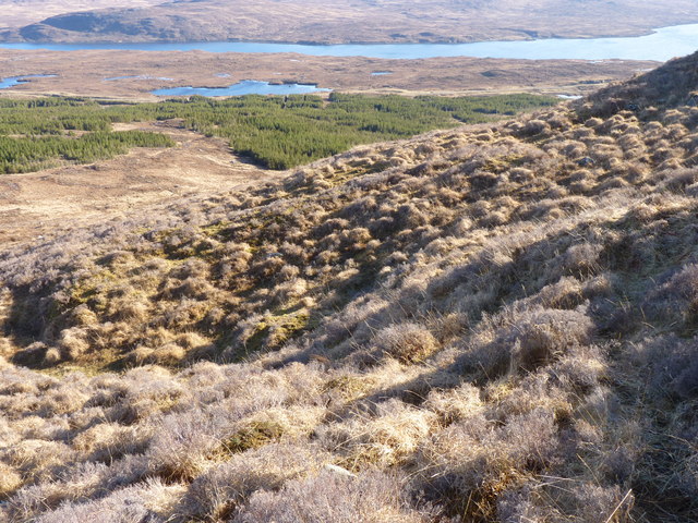
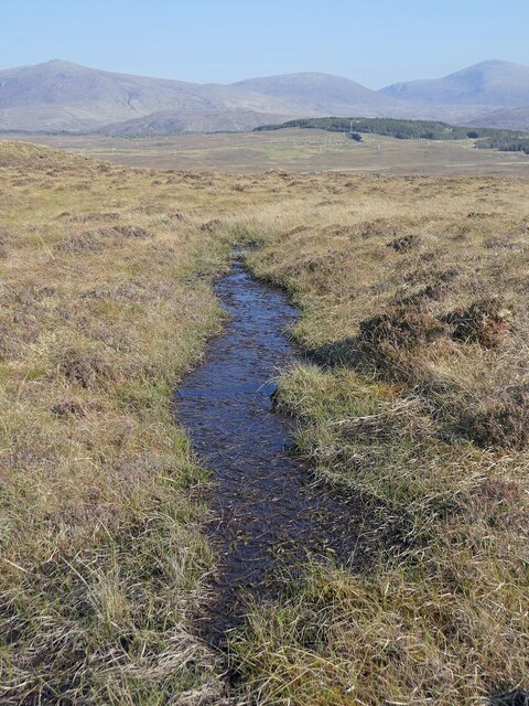
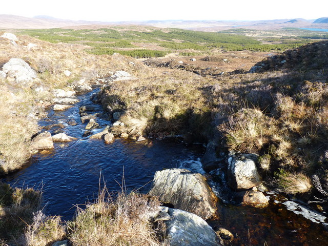
Cleite Tiorsdam is a prominent hill located in Ross-shire, Scotland. It is part of the expansive mountain range known as the Highlands, which is renowned for its rugged beauty and stunning landscapes. Standing at an impressive height of approximately 786 meters (2,579 feet), Cleite Tiorsdam offers breathtaking panoramic views of the surrounding area.

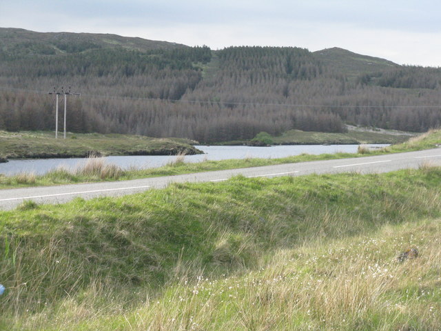
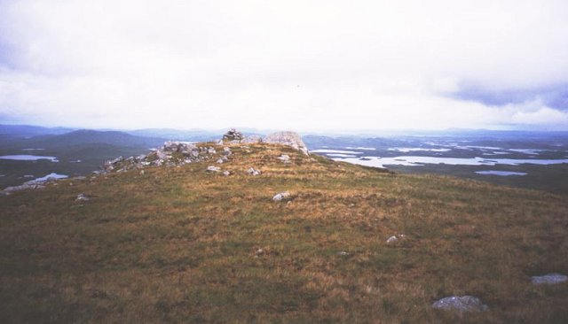
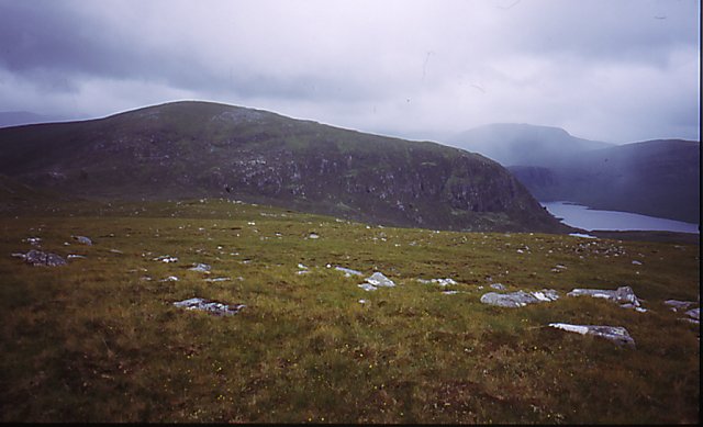
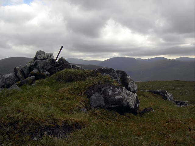
The hill is characterized by its steep slopes and rocky terrain, making it a challenging yet rewarding destination for outdoor enthusiasts and hikers. Its location within the Highlands provides ample opportunities for exploration and adventure, with numerous trails and paths leading up to its summit. As climbers ascend Cleite Tiorsdam, they are treated to ever-expanding vistas of rolling hills, vast moorlands, and sparkling lochs that dot the region.

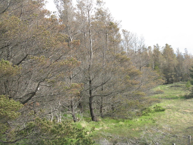
The hill is also home to a diverse range of flora and fauna, adding to its natural appeal. Various species of birds, including golden eagles and ptarmigans, can often be spotted soaring above, while deer and other mammals roam the lower slopes. The hillside is adorned with heather and wildflowers during the summer months, creating a vibrant and picturesque scene.

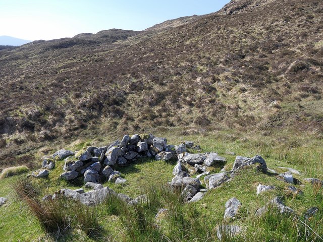
Cleite Tiorsdam is not only a popular destination for hikers and nature enthusiasts, but it also holds historical significance. The surrounding area is scattered with ancient ruins and remnants of past settlements, providing a glimpse into the rich cultural heritage of the Highlands.

Overall, Cleite Tiorsdam is a majestic mountain in Ross-shire that offers both natural beauty and historical intrigue, attracting visitors from near and far who seek to immerse themselves in the wonders of the Scottish Highlands.

If you have any feedback on the listing, please let us know in the comments section below.

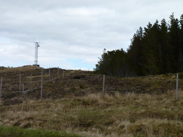
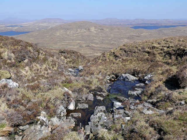
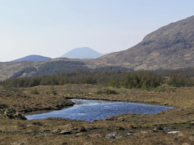
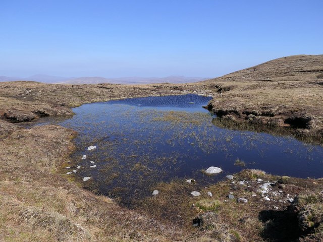
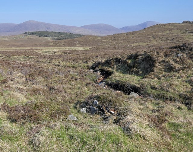
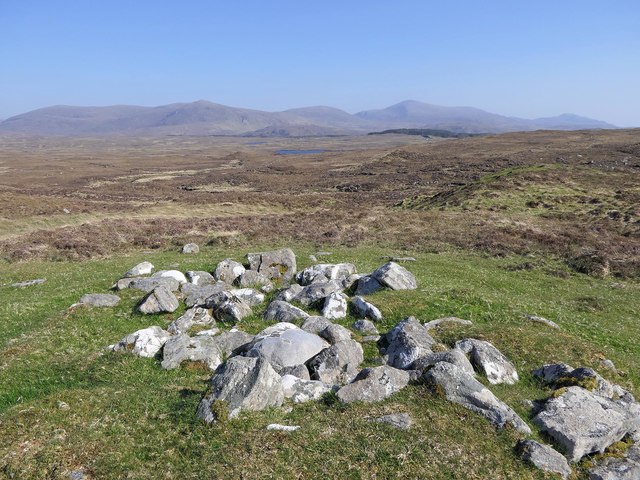
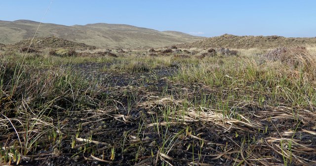
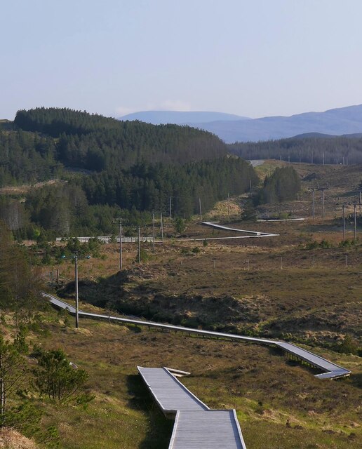
Cleite Tiorsdam Images

Images are sourced within 2km of 58.041322/-6.7386891 or Grid Reference NB2015. Thanks to Geograph Open Source API. All images are credited.

Mast on a hill Telecoms mast close to woodland above Loch an Rathaid.
Mast on a hill
Telecoms mast close to woodland above Loch an Rathaid.
The Allt Brinigamol, Isle of Lewis Looking towards Cleit Faoph and Loch Langabhat.
The Allt Brinigamol, Isle of Lewis
Looking towards Cleit Faoph and Loch Langabhat.
Lochan in Aline Community Woodland, Isle of Lewis Looking towards Tòdun (centre).
Lochan in Aline Community Woodland, Isle of Lewis
Looking towards Tòdun (centre).
Lochan below Maol Brinìgeamul, Isle of Lewis The shape of the lochan appears to have simplified since it was surveyed in the early 1850s for the 1st edition OS map on which it appears to have the shape of a three-toed foot: <span class="nowrap"><a title="http://maps.nls.uk/geo/explore/#zoom=19&lat=58.0484&lon=-6.7620&layers=5&b=1" rel="nofollow ugc noopener" href="http://maps.nls.uk/geo/explore/#zoom=19&lat=58.0484&lon=-6.7620&layers=5&b=1">Link</a><img style="margin-left:2px;" alt="External link" title="External link - shift click to open in new window" src="https://s1.geograph.org.uk/img/external.png" width="10" height="10"/></span> .
Lochan below Maol Brinìgeamul, Isle of Lewis
The shape of the lochan appears to have simplified since it was surveyed in the early 1850s for the 1st edition OS map on which it appears to have the shape of a three-toed foot: LinkExternal link .
Moorland on the side of Beinn a' Mhuil with Loch Seaforth in the distance
Kearnaval [Cearnabhal] After Liuthaid with Jim Bloomer and Jonathan de Ferranti.


Name: Kearnaval [Cearnabhal]
Hill number: 1571
Height: 378m / 1240ft
Area: 24A: Lewis and Nearby Islands
Class: Ma
Grid ref: NB 18642 15741
Summit feature: rock outcrop 5m SE of cairn
Drop: 160m
Col: 218m  NB181141
Kearnaval [Cearnabhal]
After Liuthaid with Jim Bloomer and Jonathan de Ferranti. Name: Kearnaval [Cearnabhal] Hill number: 1571 Height: 378m / 1240ft Area: 24A: Lewis and Nearby Islands Class: Ma Grid ref: NB 18642 15741 Summit feature: rock outcrop 5m SE of cairn Drop: 160m Col: 218m NB181141
Dying forest in the Isle of Lewis Many conifers in plantations on the island were showing signs of distress - discolouration and defoliation. Not sure of the cause, but there are some new forest pathogens becoming more widespread. These were on the A859 Stornoway- Tarbert road.
Dying forest in the Isle of Lewis
Many conifers in plantations on the island were showing signs of distress - discolouration and defoliation. Not sure of the cause, but there are some new forest pathogens becoming more widespread. These were on the A859 Stornoway- Tarbert road.
Loch Cleit na Stiuire With a large patch of dying conifers beyond. The road is the A859 Stornoway/ Tarbert road.
Loch Cleit na Stiuire
With a large patch of dying conifers beyond. The road is the A859 Stornoway/ Tarbert road.
Shieling hut, Airigh na h-Uamha, Isle of Lewis Shielings were moorland summer grazings for cattle.  Shieling huts (often also referred to as shielings) were dwellings located within the shieling.  They were usually occupied from May until the “flitting” in September.  In early May the men of a village would go onto the moor to check and repair the shieling huts.  They would be joined by the women and children for one night before the men returned to the village to tend to crops or to travel away for summer work such as fishing.  The women and children would spend the summer at the shielings tending the cattle and making cheese and butter, some of which was for immediate use but most was salted to preserve it for the winter.  Peat cutting for fuel would also be done.  Evenings would be spent making music and story telling.  Visits were made between the shielings of different villages.

The shieling huts were made from materials available in the immediate vicinity.  They usually had walls made of stone or turf, turf roofs and compacted earth or clay floors.  In coastal areas and on the islands rafters would be made from locally collected driftwood.  Usually there would be a single doorway, facing away from the prevailing wind (although some shieling huts have two doors opposite each other), and often no windows.  Furniture built into shieling huts included stone or turf beds covered with heather, turf seats and cupboards and niches built into the stone wall, often one above the door.  Other furniture would be carried out onto the moor for the season.  In places where the practice of using shielings continued into the 20th century, shieling huts can be found which are constructed making more extensive use of timber than in the traditional type, along with other materials such as tin and bitumen.  There are also examples of buses and caravans used as shieling huts.

The Clearances and ongoing changes in agricultural methods meant that the shieling tradition had generally ended by the close of the nineteenth century.  In places it continued for longer and, particularly on Lewis, some shieling huts are still used today during the peat cutting season and as summer retreats.

The remains of shieling huts can be seen as

changes in vegetation: <a href="https://www.geograph.org.uk/photo/1962348">ND1340 : Shieling site by the Allt a' Cheracher</a> ;
shieling mounds where successive shieling huts have been built on the same site: <a href="https://www.geograph.org.uk/photo/5238987">NB5059 : Shieling mounds by the Abhainn Dhail, Isle of Lewis</a> ;
footings: <a href="https://www.geograph.org.uk/photo/5027765">NB5357 : Shieling footings beside the Feadan Mòr, Isle of Lewis</a> ; and
more substantial remains: <a href="https://www.geograph.org.uk/photo/5238993">NB3040 : Shieling above Gleann Leitir, Isle of Lewis</a> .

Examples of modern shielings are shown at:

<a href="https://www.geograph.org.uk/photo/5238999">NB5458 : Shieling, Airigh A' Bhealaich, Isle of Lewis</a> and <a href="https://www.geograph.org.uk/photo/5048077">NB5458 : Disused shieling, Airigh A' Bhealaich, Isle of Lewis</a> .
Shieling hut, Airigh na h-Uamha, Isle of Lewis
Shielings were moorland summer grazings for cattle. Shieling huts (often also referred to as shielings) were dwellings located within the shieling. They were usually occupied from May until the “flitting” in September. In early May the men of a village would go onto the moor to check and repair the shieling huts. They would be joined by the women and children for one night before the men returned to the village to tend to crops or to travel away for summer work such as fishing. The women and children would spend the summer at the shielings tending the cattle and making cheese and butter, some of which was for immediate use but most was salted to preserve it for the winter. Peat cutting for fuel would also be done. Evenings would be spent making music and story telling. Visits were made between the shielings of different villages. The shieling huts were made from materials available in the immediate vicinity. They usually had walls made of stone or turf, turf roofs and compacted earth or clay floors. In coastal areas and on the islands rafters would be made from locally collected driftwood. Usually there would be a single doorway, facing away from the prevailing wind (although some shieling huts have two doors opposite each other), and often no windows. Furniture built into shieling huts included stone or turf beds covered with heather, turf seats and cupboards and niches built into the stone wall, often one above the door. Other furniture would be carried out onto the moor for the season. In places where the practice of using shielings continued into the 20th century, shieling huts can be found which are constructed making more extensive use of timber than in the traditional type, along with other materials such as tin and bitumen. There are also examples of buses and caravans used as shieling huts. The Clearances and ongoing changes in agricultural methods meant that the shieling tradition had generally ended by the close of the nineteenth century. In places it continued for longer and, particularly on Lewis, some shieling huts are still used today during the peat cutting season and as summer retreats. The remains of shieling huts can be seen as changes in vegetation: ND1340 : Shieling site by the Allt a' Cheracher ; shieling mounds where successive shieling huts have been built on the same site: NB5059 : Shieling mounds by the Abhainn Dhail, Isle of Lewis ; footings: NB5357 : Shieling footings beside the Feadan Mòr, Isle of Lewis ; and more substantial remains: NB3040 : Shieling above Gleann Leitir, Isle of Lewis . Examples of modern shielings are shown at: NB5458 : Shieling, Airigh A' Bhealaich, Isle of Lewis and NB5458 : Disused shieling, Airigh A' Bhealaich, Isle of Lewis .
Shieling hut footings by the Allt Airigh na h-Uamha, Isle of Lewis Shielings were moorland summer grazings for cattle.  Shieling huts (often also referred to as shielings) were dwellings located within the shieling.  They were usually occupied from May until the “flitting” in September.  In early May the men of a village would go onto the moor to check and repair the shieling huts.  They would be joined by the women and children for one night before the men returned to the village to tend to crops or to travel away for summer work such as fishing.  The women and children would spend the summer at the shielings tending the cattle and making cheese and butter, some of which was for immediate use but most was salted to preserve it for the winter.  Peat cutting for fuel would also be done.  Evenings would be spent making music and story telling.  Visits were made between the shielings of different villages.

The shieling huts were made from materials available in the immediate vicinity.  They usually had walls made of stone or turf, turf roofs and compacted earth or clay floors.  In coastal areas and on the islands rafters would be made from locally collected driftwood.  Usually there would be a single doorway, facing away from the prevailing wind (although some shieling huts have two doors opposite each other), and often no windows.  Furniture built into shieling huts included stone or turf beds covered with heather, turf seats and cupboards and niches built into the stone wall, often one above the door.  Other furniture would be carried out onto the moor for the season.  In places where the practice of using shielings continued into the 20th century, shieling huts can be found which are constructed making more extensive use of timber than in the traditional type, along with other materials such as tin and bitumen.  There are also examples of buses and caravans used as shieling huts.

The Clearances and ongoing changes in agricultural methods meant that the shieling tradition had generally ended by the close of the nineteenth century.  In places it continued for longer and, particularly on Lewis, some shieling huts are still used today during the peat cutting season and as summer retreats.

The remains of shieling huts can be seen as

changes in vegetation: <a href="https://www.geograph.org.uk/photo/1962348">ND1340 : Shieling site by the Allt a' Cheracher</a> ;
shieling mounds where successive shieling huts have been built on the same site: <a href="https://www.geograph.org.uk/photo/5238987">NB5059 : Shieling mounds by the Abhainn Dhail, Isle of Lewis</a> ;
footings: <a href="https://www.geograph.org.uk/photo/5027765">NB5357 : Shieling footings beside the Feadan Mòr, Isle of Lewis</a> ; and
more substantial remains: <a href="https://www.geograph.org.uk/photo/5238993">NB3040 : Shieling above Gleann Leitir, Isle of Lewis</a> .

Examples of modern shielings are shown at:

<a href="https://www.geograph.org.uk/photo/5238999">NB5458 : Shieling, Airigh A' Bhealaich, Isle of Lewis</a> and <a href="https://www.geograph.org.uk/photo/5048077">NB5458 : Disused shieling, Airigh A' Bhealaich, Isle of Lewis</a> .
Shieling hut footings by the Allt Airigh na h-Uamha, Isle of Lewis
Shielings were moorland summer grazings for cattle. Shieling huts (often also referred to as shielings) were dwellings located within the shieling. They were usually occupied from May until the “flitting” in September. In early May the men of a village would go onto the moor to check and repair the shieling huts. They would be joined by the women and children for one night before the men returned to the village to tend to crops or to travel away for summer work such as fishing. The women and children would spend the summer at the shielings tending the cattle and making cheese and butter, some of which was for immediate use but most was salted to preserve it for the winter. Peat cutting for fuel would also be done. Evenings would be spent making music and story telling. Visits were made between the shielings of different villages. The shieling huts were made from materials available in the immediate vicinity. They usually had walls made of stone or turf, turf roofs and compacted earth or clay floors. In coastal areas and on the islands rafters would be made from locally collected driftwood. Usually there would be a single doorway, facing away from the prevailing wind (although some shieling huts have two doors opposite each other), and often no windows. Furniture built into shieling huts included stone or turf beds covered with heather, turf seats and cupboards and niches built into the stone wall, often one above the door. Other furniture would be carried out onto the moor for the season. In places where the practice of using shielings continued into the 20th century, shieling huts can be found which are constructed making more extensive use of timber than in the traditional type, along with other materials such as tin and bitumen. There are also examples of buses and caravans used as shieling huts. The Clearances and ongoing changes in agricultural methods meant that the shieling tradition had generally ended by the close of the nineteenth century. In places it continued for longer and, particularly on Lewis, some shieling huts are still used today during the peat cutting season and as summer retreats. The remains of shieling huts can be seen as changes in vegetation: ND1340 : Shieling site by the Allt a' Cheracher ; shieling mounds where successive shieling huts have been built on the same site: NB5059 : Shieling mounds by the Abhainn Dhail, Isle of Lewis ; footings: NB5357 : Shieling footings beside the Feadan Mòr, Isle of Lewis ; and more substantial remains: NB3040 : Shieling above Gleann Leitir, Isle of Lewis . Examples of modern shielings are shown at: NB5458 : Shieling, Airigh A' Bhealaich, Isle of Lewis and NB5458 : Disused shieling, Airigh A' Bhealaich, Isle of Lewis .
Shieling hut, Airighean a' Mheoig, Isle of Lewis According to the OS Name Book of 1848-1852, Airighean a' Mheoig means Whey Shealings (sic).
Shieling hut, Airighean a' Mheoig, Isle of Lewis
According to the OS Name Book of 1848-1852, Airighean a' Mheoig means Whey Shealings (sic).
Bog on moorland below Maol Brinìgeamul, Isle of Lewis Taken during a spell of low rainfall.  According to the map this would usually be a pool.
Bog on moorland below Maol Brinìgeamul, Isle of Lewis
Taken during a spell of low rainfall. According to the map this would usually be a pool.
Boardwalk, Aline Community Woodland, Isle of Lewis Aline Community Woodland comprises 636ha land lying either side of the A859.  It was bought from the Forestry Commission by the Erisort Trust in 2007.
Boardwalk, Aline Community Woodland, Isle of Lewis
Aline Community Woodland comprises 636ha land lying either side of the A859. It was bought from the Forestry Commission by the Erisort Trust in 2007.
Bog, Cleit nan Clach, Isle of Lewis Looking towards the hills of Park/Pàirc.
Bog, Cleit nan Clach, Isle of Lewis
Looking towards the hills of Park/Pàirc.
Cearnabhal Summit of Cearnabhal overlooking the complex of the Langabhat loch system.
Cearnabhal
Summit of Cearnabhal overlooking the complex of the Langabhat loch system.
On Cearnabhal Getting to the hill involves crossing some wet and slippery ground, but the higher parts of the hill are easier drier ground. View across the summit plateau towards
Liuthaid and the hilly end of Loch Langavat.
On Cearnabhal
Getting to the hill involves crossing some wet and slippery ground, but the higher parts of the hill are easier drier ground. View across the summit plateau towards Liuthaid and the hilly end of Loch Langavat.
Kearnaval summit The small cairn on top of Kearnaval.
Kearnaval summit
The small cairn on top of Kearnaval.
Abhainn Cuil Beinn a' Mhuil
Show me another place!

Cleite Tiorsdam is located at Grid Ref: NB2015 (Lat: 58.041322, Lng: -6.7386891)

Unitary Authority: Na h-Eileanan an Iar

Police Authority: Highlands and Islands

What 3 Words

///hologram.icicles.options. Near Tarbert, Na h-Eileanan Siar

Related Wikis

Airidh a' Bhruaich

Airidh a' Bhruaich (Arivruaich - anglicised) is a scattered crofting township in the South Lochs district of the Isle of Lewis in the Outer Hebrides of...

Seaforth Island

There is also a Seaforth Island in the Whitsunday Islands of Queensland, AustraliaSeaforth Island (Scottish Gaelic: Eilean Shìphoirt/Shìophoirt or Mulag...

Ardvourlie Castle

Ardvourlie Castle is a 19th-century country house on Harris, one of the Western Isles off the north-west coast of Scotland. The house was built beside...

Eilean Mòr, Loch Langavat

Eilean Mòr is an island in Loch Langavat on the Isle of Lewis in the Outer Hebrides of Scotland. == Footnotes ==

Balallan

Balallan (Scottish Gaelic: Baile Ailein, Bail' Ailein), meaning "Allan's Town", is a crofting township on the Isle of Lewis, in the Outer Hebrides, Scotland...

Loch Seaforth

Loch Seaforth (Scottish Gaelic: Loch Shiphoirt or Shìophoirt) is a sea loch in the Outer Hebrides of Scotland. It consists of three distinct sections;...

Nearby Amenities

Located within 500m of 58.041322,-6.7386891
Airigh na h-Uamha
Place: locality
Lat/Long: 58.0442175/-6.7353162
The data included in this document is from www.openstreetmap.org. The data is made available under ODbL.

Have you been to Cleite Tiorsdam?

Leave your review of Cleite Tiorsdam below (or comments, questions and feedback).