Cnoc Feoal

Hill, Mountain in Ross-shire

Scotland

Cnoc Feoal

View towards Tolsta Chaolais
View towards Tolsta Chaolais Credit: David Dixon

Cnoc Feoal is a prominent hill located in Ross-shire, a county in the Highlands of Scotland. With an elevation of approximately 622 meters (2,041 feet), it is considered a Corbett, which is a term used to describe a Scottish mountain between 2,500 and 3,000 feet in height.

Situated in the northwest part of Ross-shire, Cnoc Feoal offers breathtaking panoramic views of the surrounding landscape. From the summit, visitors can observe the rugged terrain of the Highlands, with its rolling hills, deep valleys, and sparkling lochs. On clear days, it is even possible to see the nearby mountains of Ben Wyvis and An Teallach.

The ascent to the top of Cnoc Feoal is a popular hiking route, attracting both experienced climbers and casual walkers. The path is well-defined and relatively easy to follow, although some parts can be steep and require a moderate level of fitness. The hill is composed mainly of rocky terrain, heather, and grassy slopes, adding to its natural beauty.

The hill's name, Cnoc Feoal, is derived from Scottish Gaelic, where "cnoc" means hill and "feoal" is the name of a nearby loch. This linguistic connection reflects the close relationship between the land and the local culture.

Overall, Cnoc Feoal is a stunning natural landmark that offers outdoor enthusiasts an opportunity to immerse themselves in the awe-inspiring Scottish Highlands, while also providing a glimpse into the rich history and heritage of Ross-shire.

If you have any feedback on the listing, please let us know in the comments section below.
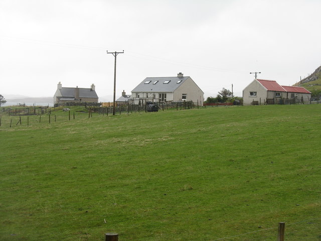
Cnoc Feoal Images

Images are sourced within 2km of 58.236709/-6.7781635 or Grid Reference NB1937. Thanks to Geograph Open Source API. All images are credited.

View towards Tolsta Chaolais
West Point
West Point
The Road to Tolsta Chaolais
Fish Farm Cages, Loch na Muilne
Loch na Muilne
Loch na Muilne
Croft near Breasclete
House on a hill near Breasclete
Port a' Chaoil Stream flowing from Loch a' Bhaile enters Loch Rog an Ear, a sea loch, at Aird na Moine.
Port a' Chaoil
Stream flowing from Loch a' Bhaile enters Loch Rog an Ear, a sea loch, at Aird na Moine.
Loch a' Bhaile The narrow loch, hemmed in by steep hillsides, flows out into Loch Rog an Ear, a sea loch, via a short river.
Loch a' Bhaile
The narrow loch, hemmed in by steep hillsides, flows out into Loch Rog an Ear, a sea loch, via a short river.
Loch a' Bhaile Loch a' Bhaile & Tolastadh a' Chaolais beyond.
Loch a' Bhaile
Loch a' Bhaile & Tolastadh a' Chaolais beyond.
Tolstachaolais: the post office While many post offices have a buzzer which sounds as the door opens, the postmistress here is alerted to the arrival of customers by the loud bark of the dog tethered to the outside wall.
Tolstachaolais: the post office
While many post offices have a buzzer which sounds as the door opens, the postmistress here is alerted to the arrival of customers by the loud bark of the dog tethered to the outside wall.
Tolstachaolais: along the shore of Loch a' Bhaile Looking across the loch, which runs alongside the road through the village. However, this is the far side that we are looking along.
Tolstachaolais: along the shore of Loch a' Bhaile
Looking across the loch, which runs alongside the road through the village. However, this is the far side that we are looking along.
Tolstachaolais: postbox № HS2 62 This postbox stands more or less in the centre of the village, in front of a house that is set particularly well back from the road. The larger-scale map still marks that house as a post office, although it has actually (as reflected in the 1:50,000 and 1:25,000 map) relocated just over a kilometre to the north - see <a href="https://www.geograph.org.uk/photo/3086624">NB1939 : Tolstachaolais: the post office</a>.
Tolstachaolais: postbox № HS2 62
This postbox stands more or less in the centre of the village, in front of a house that is set particularly well back from the road. The larger-scale map still marks that house as a post office, although it has actually (as reflected in the 1:50,000 and 1:25,000 map) relocated just over a kilometre to the north - see NB1939 : Tolstachaolais: the post office.
Tolstachaolais: Loch a’ Bhaile Looking down this loch from its northern end, with the main part of the village visible far right.
Tolstachaolais: Loch a’ Bhaile
Looking down this loch from its northern end, with the main part of the village visible far right.
Tolstachaolais: hillside cows and Bernera view Looking across the sound separating the eastern side of Bernera from the Lewis mainland, beyond three cows grazing on the slopes to the south of Tolstachaolais village.
Tolstachaolais: hillside cows and Bernera view
Looking across the sound separating the eastern side of Bernera from the Lewis mainland, beyond three cows grazing on the slopes to the south of Tolstachaolais village.
Outlet from Loch a' Bhaile into Port a' Chaoil At the crofting community of Tolastadh a' Chaolais.
Outlet from Loch a' Bhaile into Port a' Chaoil
At the crofting community of Tolastadh a' Chaolais.
Loch a' Bhaile In the crofting community of Tolastadh a' Chaolais.
Loch a' Bhaile
In the crofting community of Tolastadh a' Chaolais.
Cnoc Feoal Part of the crofting community of Tolastadh a' Chaolais on the shores of Loch Ròg an Ear.
Cnoc Feoal
Part of the crofting community of Tolastadh a' Chaolais on the shores of Loch Ròg an Ear.
Show me another place!

Cnoc Feoal is located at Grid Ref: NB1937 (Lat: 58.236709, Lng: -6.7781635)

Unitary Authority: Na h-Eileanan an Iar

Police Authority: Highlands and Islands

What 3 Words

///spicy.chromatic.wardrobe. Near Carloway, Na h-Eileanan Siar

Related Wikis

Tolsta Chaolais

Tolsta Chaolais (also Tolastadh Chaolais, Tolstadh a' Chaolais) is a village on the Isle of Lewis, Scotland. It consists of about forty houses, clustered...

Ceabhaigh

Ceabhaigh is a small island in an arm of Loch Ròg on the west coast of Lewis in the Outer Hebrides of Scotland. It is about 25 hectares (62 acres) in extent...

Breasclete

Breasclete (Scottish Gaelic: Brèascleit) is a village and community on the west side of the Isle of Lewis, in the Outer Hebrides, Scotland. Breasclete...

Breaclete

Breacleit (or Roulanish; Scottish Gaelic: Breacleit; Old Norse: Breiðiklettr) is the central village on Great Bernera in the Outer Hebrides, Scotland....

Dun Carloway

Dun Carloway (Scottish Gaelic: Dùn Chàrlabhaigh) is a broch situated in the district of Carloway, on the west coast of the Isle of Lewis, Scotland (grid...

Eilean Chearstaidh

Eilean Kearstay (Scottish Gaelic: Eilean Chearstaigh) is an uninhabited island in Loch Roag in the Outer Hebrides of Scotland. It lies south east of Great...

Great Bernera

Great Bernera (; Scottish Gaelic: Beàrnaraigh Mòr), often known just as Bernera (Scottish Gaelic: Beàrnaraigh), is an island and community in the Outer...

Callanish

Callanish (Scottish Gaelic: Calanais) is a village (township) on the west side of the Isle of Lewis, in the Outer Hebrides (Western Isles), Scotland. Callanish...

Nearby Amenities

Located within 500m of 58.236709,-6.7781635
Passing Place
Lat/Long: 58.2371642/-6.7707768
Passing Place
Lat/Long: 58.2385126/-6.7754012
Passing Place
Lat/Long: 58.2382636/-6.776396
Tolastadh a' Chaolais
Addr City: Càrlabhagh
Name En: Tolsta Chaolais
Name Gd: Tolastadh a' Chaolais
Place: village
Lat/Long: 58.2405351/-6.7815586
Passing Place
Lat/Long: 58.2379551/-6.7786383
Passing Place
Lat/Long: 58.2390521/-6.7804188
Tolsta Chaolais War Memorial
Historic: memorial
Memorial: war_memorial
Lat/Long: 58.2393515/-6.7809194
Barrier: cattle_grid
Lat/Long: 58.2376886/-6.7775489
Power: pole
Lat/Long: 58.2375492/-6.7705507
Power: pole
Lat/Long: 58.2375764/-6.7717706
Power: pole
Lat/Long: 58.2376128/-6.7731679
Power: pole
Lat/Long: 58.2376283/-6.7738554
Power: pole
Lat/Long: 58.238011/-6.774474
Power: pole
Lat/Long: 58.2382852/-6.7749375
Power: pole
Lat/Long: 58.2383435/-6.7753722
Power: pole
Lat/Long: 58.2385611/-6.7770099
Power: pole
Lat/Long: 58.2386617/-6.7779732
Power: pole
Lat/Long: 58.2392875/-6.7786659
Power: pole
Lat/Long: 58.2398479/-6.7792722
Power: pole
Lat/Long: 58.2405068/-6.7799943
Power: pole
Lat/Long: 58.240918/-6.7802382
Passing Place
Lat/Long: 58.2372449/-6.7699926
Power: pole
Lat/Long: 58.2391614/-6.7735581
Power: pole
Lat/Long: 58.2392427/-6.7726602
Power: pole
Lat/Long: 58.2387447/-6.7748743
Power: pole
Lat/Long: 58.2390394/-6.7723141
Power: pole
Lat/Long: 58.2388843/-6.7737495
Barrier: cattle_grid
Lat/Long: 58.2398436/-6.7815214
Turning Circle
Lat/Long: 58.2368346/-6.7794366
Barrier: cattle_grid
Lat/Long: 58.2403131/-6.781919
Sgeir na Muice Blianais
Place: locality
Lat/Long: 58.2362511/-6.785654
Barrier: cattle_grid
Lat/Long: 58.23797/-6.7792535
Cnoc na Caillich
Place: locality
Lat/Long: 58.2404146/-6.7791644
Cnoc Feoal
Place: locality
Lat/Long: 58.2366985/-6.7780272
Rubha nan Lìon
Place: locality
Lat/Long: 58.2371955/-6.7739073
Sgeir nan Sgarbh
Place: locality
Lat/Long: 58.2328352/-6.778349
Àird na Mòine
Natural: cape
Lat/Long: 58.2334678/-6.7796579
Port Àird na Mòine
Natural: cape
Lat/Long: 58.2343941/-6.7777697
Port a' Chaoil
Natural: cape
Lat/Long: 58.236258/-6.7744223
The data included in this document is from www.openstreetmap.org. The data is made available under ODbL.

Have you been to Cnoc Feoal?

Leave your review of Cnoc Feoal below (or comments, questions and feedback).