Àird na Mòine
Coastal Feature, Headland, Point in Ross-shire
Scotland
Àird na Mòine

Àird na Mòine is a prominent coastal feature located in Ross-shire, Scotland. It is a headland or point that extends into the North Atlantic Ocean, offering breathtaking views of the surrounding landscape. The name Àird na Mòine translates to "Headland of the Moor" in English.
This coastal feature is characterized by its rugged and rocky terrain, with steep cliffs that drop down to the sea below. The cliffs are composed of various rock types, including sandstone and granite, which have been shaped by the relentless power of the ocean over thousands of years.
The headland is a popular destination for nature enthusiasts and hikers due to its outstanding natural beauty. It offers a diverse range of flora and fauna, including seabirds such as gannets, puffins, and kittiwakes, which nest on the cliffs. Visitors can also spot seals and dolphins swimming in the waters surrounding Àird na Mòine.
The headland provides ample opportunities for outdoor activities such as coastal walks, birdwatching, and photography. It is a haven for photographers, who are drawn to the dramatic cliffs, crashing waves, and stunning sunsets that can be captured from this vantage point.
Àird na Mòine is easily accessible by road, and there are nearby parking facilities available for visitors. Local amenities, including cafes and accommodation options, can be found in the nearby town of Gairloch, making it a convenient base for exploring this beautiful coastal feature.
In conclusion, Àird na Mòine is a captivating headland in Ross-shire, Scotland, known for its rugged cliffs, diverse wildlife, and breathtaking views. It is a must-visit destination for nature lovers and outdoor enthusiasts seeking to immerse themselves in the natural beauty of the Scottish coastline.
If you have any feedback on the listing, please let us know in the comments section below.
Àird na Mòine Images
Images are sourced within 2km of 58.233743/-6.7797763 or Grid Reference NB1937. Thanks to Geograph Open Source API. All images are credited.


Àird na Mòine is located at Grid Ref: NB1937 (Lat: 58.233743, Lng: -6.7797763)
Unitary Authority: Na h-Eileanan an Iar
Police Authority: Highlands and Islands
What 3 Words
///tactical.users.confirms. Near Carloway, Na h-Eileanan Siar
Related Wikis

Tolsta Chaolais
Tolsta Chaolais (also Tolastadh Chaolais, Tolstadh a' Chaolais) is a village on the Isle of Lewis, Scotland. It consists of about forty houses, clustered...

Ceabhaigh
Ceabhaigh is a small island in an arm of Loch Ròg on the west coast of Lewis in the Outer Hebrides of Scotland. It is about 25 hectares (62 acres) in extent...

Breasclete
Breasclete (Scottish Gaelic: Brèascleit) is a village and community on the west side of the Isle of Lewis, in the Outer Hebrides, Scotland. Breasclete...

Breaclete
Breacleit (or Roulanish; Scottish Gaelic: Breacleit; Old Norse: Breiðiklettr) is the central village on Great Bernera in the Outer Hebrides, Scotland....
Related Videos

Lovely calm flight above Breasclete tonight ,just a wee taster of my week in Isle of Lewis
A flight above Breasclete in my phantom 4 on the Isle of Lewis Please like and subscribe Copyright Airborne Media.

Hebridean Sunset Isle of Lewis #shorts
Another stunning sunset on the Hebridean Isle of Lewis Flight was with my DJI Mini 2 Please like and Subscribe Copyright ...

Sunrise Sunset Isle of Lewis
This sunrise was taken just before leaving Breasclete to catch the ferry at Tarbet in Harris Ignore the wobble in the video I'm trying ...
Sunset over Breasclete Isle of Lewis
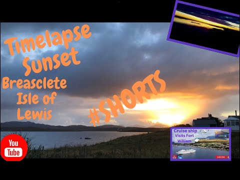
Welcome This is a #shorts video of a Timelapse made in Breasclete Isle of Lewis Please check out the full version here ...
Nearby Amenities
Located within 500m of 58.233743,-6.7797763Have you been to Àird na Mòine?
Leave your review of Àird na Mòine below (or comments, questions and feedback).