Henstead

Settlement in Suffolk East Suffolk

England

Henstead

Barn Conversion at The Elms <span class="nowrap"><a title="https://historicengland.org.uk/listing/the-list/list-entry/1284275?section=official-list-entry" rel="nofollow ugc noopener" href="https://historicengland.org.uk/listing/the-list/list-entry/1284275?section=official-list-entry">Link</a><img style="margin-left:2px;" alt="External link" title="External link - shift click to open in new window" src="https://s1.geograph.org.uk/img/external.png" width="10" height="10"/></span>
Barn Conversion at The Elms Credit: Sandy Gerrard

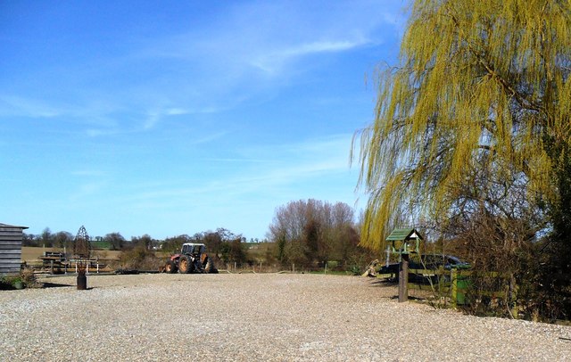
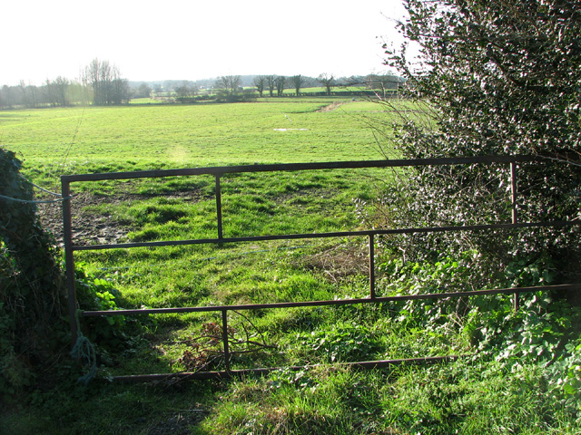
Henstead is a small village located in the county of Suffolk, England. Situated approximately 10 miles south of the town of Norwich, it falls within the district of South Norfolk. The village is nestled in a rural setting, surrounded by picturesque countryside and farmland.

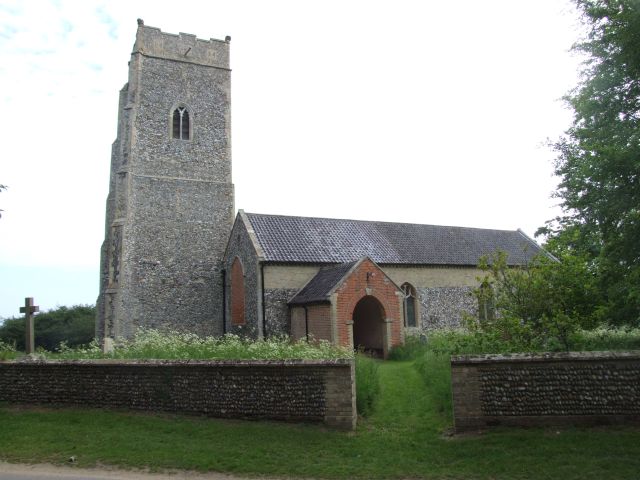
Henstead boasts a rich history dating back to the Anglo-Saxon period, evidenced by the presence of a Grade I listed church, St. Mary's, which dates back to the 13th century. The church's stunning architecture and intricate stained glass windows attract visitors from near and far.

Despite its small size, Henstead offers a range of amenities to its residents. These include a primary school, providing education for children aged 4-11, and a village hall that serves as a central hub for community activities and events. The village also has a local pub, The Angel Inn, which offers a warm and friendly atmosphere along with a selection of food and beverages.

The surrounding countryside provides ample opportunities for outdoor enthusiasts to explore the natural beauty of the area. The village is located close to the Broads National Park, a network of rivers, lakes, and marshes that are perfect for boating, fishing, and wildlife spotting.

In summary, Henstead is a charming village in Suffolk that offers a peaceful and idyllic setting, rich history, and close proximity to beautiful natural surroundings.

If you have any feedback on the listing, please let us know in the comments section below.

Henstead Images

Images are sourced within 2km of 52.414911/1.6668182 or Grid Reference TM4985. Thanks to Geograph Open Source API. All images are credited.

Barn Conversion at The Elms <span class="nowrap"><a title="https://historicengland.org.uk/listing/the-list/list-entry/1284275?section=official-list-entry" rel="nofollow ugc noopener" href="https://historicengland.org.uk/listing/the-list/list-entry/1284275?section=official-list-entry">Link</a><img style="margin-left:2px;" alt="External link" title="External link - shift click to open in new window" src="https://s1.geograph.org.uk/img/external.png" width="10" height="10"/></span>
Barn Conversion at The Elms
Primrose Lane
Primrose Lane
Car park, Henstead Art and Craft workshops
Layby on the A12 Looking towards Henstead at the junction with Dam Lane
Layby on the A12
Looking towards Henstead at the junction with Dam Lane
Heaps of muck by The Elms
Black Street past The Elms
Bungalow under construction in Black Street
View along Blower's Lane
Fields by Blower's Lane
Cottage by Blower's Lane junction
Bends in Black Street
Marsh pastures by Latymere Dam
Fields by The Rookery The wind turbines seen in the background are located at the "Africa Alive" wildlife park in Kessingland (in adjacent grid square). 

Between 2007 and 2009 protesters tried to halt the installation of the two  126m high turbines, said to generate electricity equivalent to the needs of 3,000 homes, but finally lost their fight in April 2009.  Kessingland Wind Farm was completed in June 2011. More than 200 complaints were then  lodged concerning the noise generated by one of the turbines, apparently caused by light winds blowing in the direction of nearby homes. Measures to change the angle of the blades have since been undertaken.
Fields by The Rookery
The wind turbines seen in the background are located at the "Africa Alive" wildlife park in Kessingland (in adjacent grid square). Between 2007 and 2009 protesters tried to halt the installation of the two 126m high turbines, said to generate electricity equivalent to the needs of 3,000 homes, but finally lost their fight in April 2009. Kessingland Wind Farm was completed in June 2011. More than 200 complaints were then lodged concerning the noise generated by one of the turbines, apparently caused by light winds blowing in the direction of nearby homes. Measures to change the angle of the blades have since been undertaken.
Sheds at The Rookery
Farm sheds at The Rookery
House at Rookery Farm
The hamlet of Black Street The road running through it is also called Black Street.
The hamlet of Black Street
The road running through it is also called Black Street.
Through the hamlet of Black Street
Show me another place!

Henstead is located at Grid Ref: TM4985 (Lat: 52.414911, Lng: 1.6668182)

Administrative County: Suffolk

District: East Suffolk

Police Authority: Suffolk

What 3 Words

///legroom.equity.jacket. Near Kessingland, Suffolk

Related Wikis

Henstead

Henstead is a village near Kessingland and the A12 in the civil parish of Henstead with Hulver Street, in the county of Suffolk, England. It has a church...

Henstead with Hulver Street

Henstead with Hulver Street is a civil parish in the East Suffolk district of the English county of Suffolk. It is around 5 miles (8.0 km) south-west of...

Rushmere, north Suffolk

Rushmere is a village and civil parish in the East Suffolk district of the English county of Suffolk. The village is around 5 miles (8.0 km) south-west...

Benacre, Suffolk

Benacre is a village and civil parish in the East Suffolk district of the English county of Suffolk. The village is located about 5+3⁄4 miles (9 km) south...

Nearby Amenities

Located within 500m of 52.414911,1.6668182
Henstead
Created By: Potlatch 0.10b
Place: village
Source: NPE
Wikidata: Q2154009
Lat/Long: 52.4142766/1.6663769
Bus Stop
Crossroads
Bus: yes
Naptan AtcoCode: 390070897
Naptan Bearing: W
Naptan BusStopType: CUS
Naptan CommonName: Crossroads
Naptan Indicator: W-bound
Naptan Landmark: Crossroads
Naptan NaptanCode: sufjmjwt
Naptan Street: Church Road
Naptan Verified: no
Public Transport: platform
Source: naptan_import
Lat/Long: 52.4156583/1.6598936
The data included in this document is from www.openstreetmap.org. The data is made available under ODbL.

Have you been to Henstead?

Leave your review of Henstead below (or comments, questions and feedback).