Ben Skriaig

Hill, Mountain in Inverness-shire

Scotland

Ben Skriaig

Clifftop above Scorgruim Looking towards Dunvegan Head from a little below the high point at Biod an Athair. The cliff edge here still has a drop from it of over 250m.
Clifftop above Scorgruim Credit: John Allan

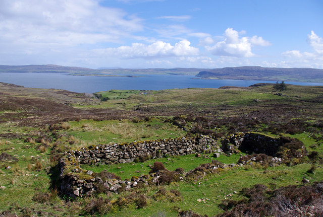
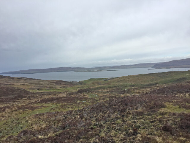
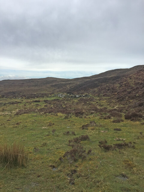
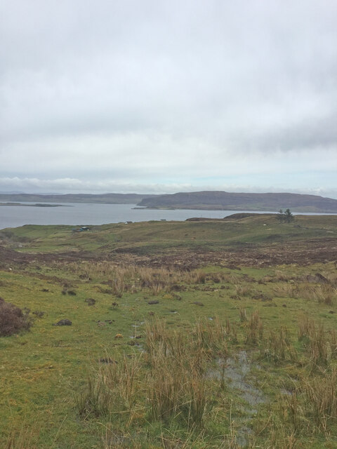
Ben Skriaig is a prominent hill located in the county of Inverness-shire, Scotland. It is situated in the western part of the county, specifically on the Isle of Skye, which is known for its rugged landscapes and stunning natural beauty. Standing at an elevation of approximately 489 meters (1,604 feet), Ben Skriaig offers breathtaking panoramic views of the surrounding area.

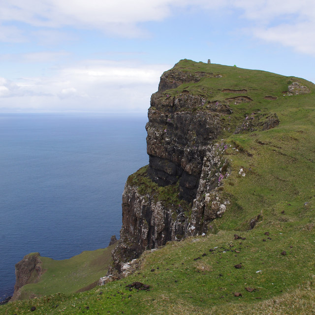
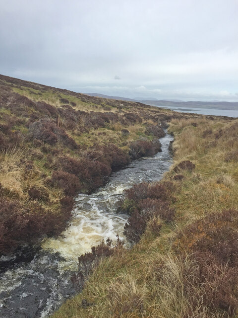
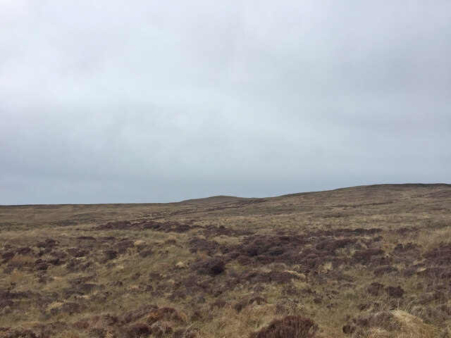
The hill is characterized by its distinctive shape, featuring a steep and rocky terrain that challenges even the most experienced hikers and climbers. Its slopes are adorned with heather and grass, providing a picturesque landscape that changes color with the seasons. Ben Skriaig is a haven for nature enthusiasts, offering opportunities for outdoor activities such as hillwalking, trekking, and wildlife spotting.

The summit of Ben Skriaig boasts a magnificent vista of the Isle of Skye, with its dramatic cliffs, sparkling lochs, and rolling hills. On clear days, the views extend to the neighboring islands of Rum, Eigg, and Canna, adding to the allure of this natural wonder.

Accessible from the village of Elgol, Ben Skriaig is a popular destination for both locals and tourists seeking an adventurous and scenic experience. It is recommended to come prepared with suitable hiking gear and a map, as the hill can be challenging to navigate due to its rugged nature.

Overall, Ben Skriaig in Inverness-shire is a must-visit destination for outdoor enthusiasts and nature lovers, offering a thrilling and unforgettable experience amidst the stunning Scottish highlands.

If you have any feedback on the listing, please let us know in the comments section below.
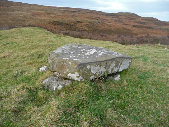
Ben Skriaig Images

Images are sourced within 2km of 57.483114/-6.7326386 or Grid Reference NG1653. Thanks to Geograph Open Source API. All images are credited.

Clifftop above Scorgruim Looking towards Dunvegan Head from a little below the high point at Biod an Athair. The cliff edge here still has a drop from it of over 250m.
Clifftop above Scorgruim
Looking towards Dunvegan Head from a little below the high point at Biod an Athair. The cliff edge here still has a drop from it of over 250m.
Geodha na Gliongraich Pinnacle at the southern bound of Geodha na Gliongraich, a geo or gully 400m south of the summit of Biod an Athair.
Geodha na Gliongraich
Pinnacle at the southern bound of Geodha na Gliongraich, a geo or gully 400m south of the summit of Biod an Athair.
Ruin above Galtrigill This is clearly the same ruined croft or blackhouse as shown in <a href="https://www.geograph.org.uk/photo/3955062">NG1754 : Ruined croft above Galtrigill</a>.
Ruin above Galtrigill
This is clearly the same ruined croft or blackhouse as shown in NG1754 : Ruined croft above Galtrigill.
Ruin below Biod an Athair I presume these are remains of an old settlement, which are in an area of lazy beds.
Ruin below Biod an Athair
I presume these are remains of an old settlement, which are in an area of lazy beds.
Biod an Athair It was too windy to dwell near the edge, or try to work out how the sheep get to and from that shelf below (Scorgruim).
Biod an Athair
It was too windy to dwell near the edge, or try to work out how the sheep get to and from that shelf below (Scorgruim).
Flush bracket S9357 On the trig point on Biod an Athair (313m). See <a href="https://www.geograph.org.uk/photo/1048165">NG1554 : Biod an Athair trig point</a>.
Flush bracket S9357
On the trig point on Biod an Athair (313m). See NG1554 : Biod an Athair trig point.
Scorgruim Looking down from the cliff top (Biod an Athair) to the shelf below. It can be difficult to distinguish the sheep from the fallen rocks.
Scorgruim
Looking down from the cliff top (Biod an Athair) to the shelf below. It can be difficult to distinguish the sheep from the fallen rocks.
Ruined crofthouse at Galtrigill <a href="https://www.geograph.org.uk/photo/3360898">NG1854 : Ruin at Galtrigill</a> viewed from a different angle.
Ruined crofthouse at Galtrigill
NG1854 : Ruin at Galtrigill viewed from a different angle.
Geodha na Gliongraich A deep geodha in the high cliff-line south of Biod an Athair, with a big open view across the Minch to North Uist.

Forbes' Place Names of Skye (1923) gives a translation of "creek of the jingling or tinkling noise or sound".
Geodha na Gliongraich
A deep geodha in the high cliff-line south of Biod an Athair, with a big open view across the Minch to North Uist. Forbes' Place Names of Skye (1923) gives a translation of "creek of the jingling or tinkling noise or sound".
Biod an Athair from the south Looking towards the trig on the 313m summit of Biod an Athair -  the highest point on any of Skye's many sea cliffs.
Biod an Athair from the south
Looking towards the trig on the 313m summit of Biod an Athair - the highest point on any of Skye's many sea cliffs.
View to Loch Dunvegan on the way to Dunvegan Head Trig Point
Shieling on the way to Dunvegan Head Trig Point A shieling (Scottish Gaelic: àirigh), also spelt sheiling, shealing and sheeling, is a hut, or collection of huts, once common in wild or lonely places in the hills and mountains of Scotland and northern England.

<span class="nowrap"><a title="https://en.wikipedia.org/wiki/Shieling" rel="nofollow ugc noopener" href="https://en.wikipedia.org/wiki/Shieling">Link</a><img style="margin-left:2px;" alt="External link" title="External link - shift click to open in new window" src="https://s1.geograph.org.uk/img/external.png" width="10" height="10"/></span>
Shieling on the way to Dunvegan Head Trig Point
A shieling (Scottish Gaelic: àirigh), also spelt sheiling, shealing and sheeling, is a hut, or collection of huts, once common in wild or lonely places in the hills and mountains of Scotland and northern England. LinkExternal link
View to Loch Dunvegan on the way to Dunvegan Head Trig Point
Galtrigill Burn on the way to Dunvegan Head Trig Point
View towards Dunvegan Head Trig Point Still some distance to go across pathless rough, tough moorland
View towards Dunvegan Head Trig Point
Still some distance to go across pathless rough, tough moorland
View to Loch Dunvegan on the way to Dunvegan Head Trig Point
Dunvegan Head Trig Point Flush Bracket S9357
Biod an Athair Cliffs
Show me another place!

Ben Skriaig is located at Grid Ref: NG1653 (Lat: 57.483114, Lng: -6.7326386)

Unitary Authority: Highland

Police Authority: Highlands and Islands

What 3 Words

///mint.curiosity.flattery. Near Glendale, Highland

Nearby Locations

Ben Skriaig

Related Wikis

Galtrigill

Galtrigill (Scottish Gaelic: Galtraigil) is a largely abandoned crofting township on the far north end of the east side of the Duirinish peninsula on the...

Borreraig

Borreraig (Scottish Gaelic: Boraraig) is a crofting settlement in Duirinish, north-west of Dunvegan on the Isle of Skye. The ancient and famous MacCrimmon...

Uig, Duirinish

Uig is a hamlet 14 miles (23 km) south west of Uig in Snizort, on the eastern shore of Loch Dunvegan, in the civil parish of Duirinish, on the Isle of...

Milovaig

Milovaig (Scottish Gaelic: Mìolabhaig), comprises two small scattered, mixed crofting and residential townships, consisting of Lower Milovaig to the North...

Feriniquarrie

Feriniquarrie (Scottish Gaelic: Fearann MhicGuaire) is a remote scattered crofting township, situated close to Glendale, on the Duirinish peninsula, in...

Glendale, Skye

Glendale (Scottish Gaelic: Gleann Dail) is a community-owned estate on the north-western coastline of the Duirinish peninsula on the island of Skye and...

Loch Dunvegan

Loch Dunvegan (Scottish Gaelic: Loch Dhùn Bheagain), is a sea loch on the west coast of the island of Skye in the Inner Hebrides of Scotland. Dunvegan...

Totaig

Totaig (from Old Norse Topt-vík) is a small crofting settlement on the west coast of Loch Dunvegan on the Isle of Skye. The village of Dunvegan is 5 miles...

Related Videos

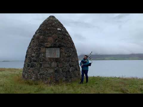
Fhuair Mi Pog at the MacCrimmon Cairn at Borreraig

During a holiday to Skye, I visited the MacCrimmon Cairn at Borreraig and played a slow air version of the piobaireachd 'I Got A ...

Nearby Amenities

Located within 500m of 57.483114,-6.7326386
Ben Skriaig
Corbett: no
Ele: 307
Graham: no
Munro: no
Natural: peak
Lat/Long: 57.4849955/-6.7277073
The data included in this document is from www.openstreetmap.org. The data is made available under ODbL.

Have you been to Ben Skriaig?

Leave your review of Ben Skriaig below (or comments, questions and feedback).