Beinn na Teanga

Hill, Mountain in Inverness-shire

Scotland

Beinn na Teanga

Gleann Lacasdail
Gleann Lacasdail Credit: Alan Reid

Beinn na Teanga, located in Inverness-shire, Scotland, is a prominent hill/mountain that stands at a height of 917 meters (3,009 feet). It is part of the Grampian Mountains range and is situated within the Lochaber region. The name "Beinn na Teanga" translates to "hill of the tongue" in English.

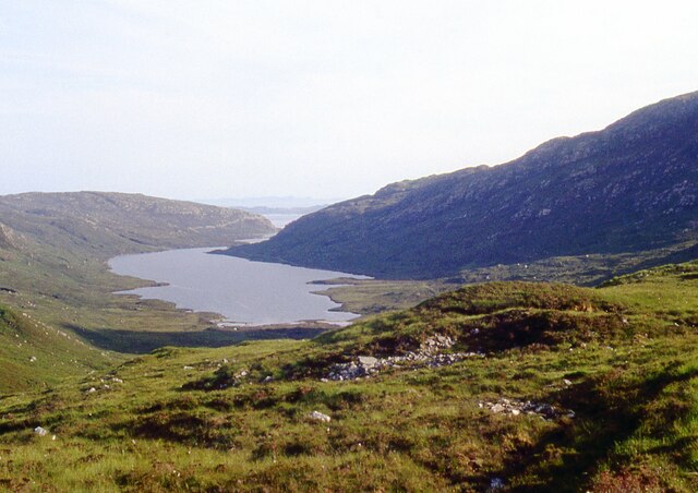
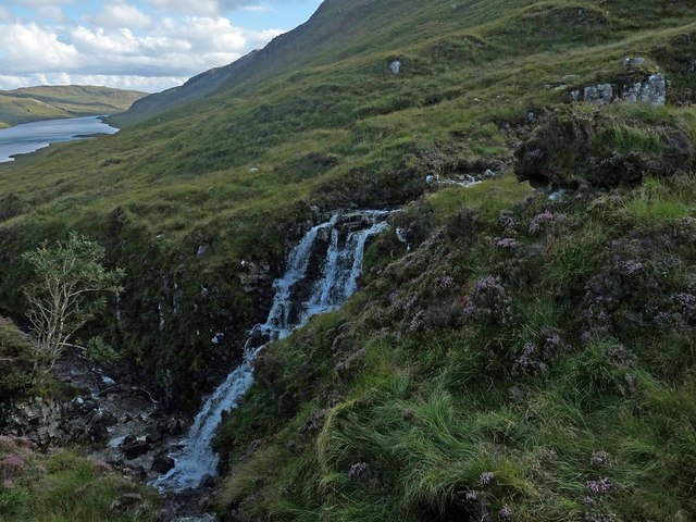
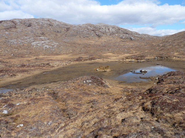
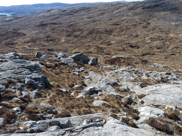
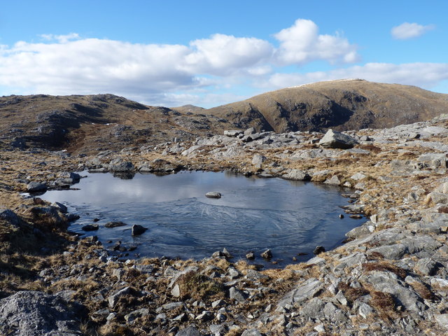
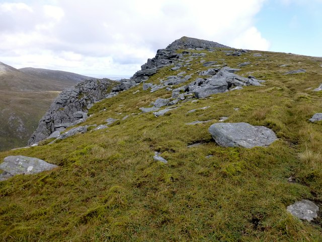
This mountain is known for its distinctive shape, featuring a long and narrow ridge that stretches from southwest to northeast. It is often described as a whaleback due to its rounded profile, offering a unique and eye-catching sight for visitors.

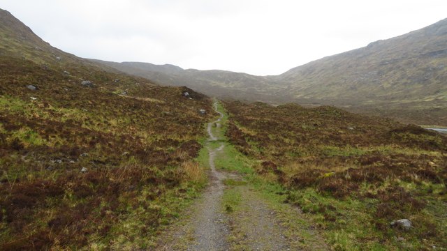
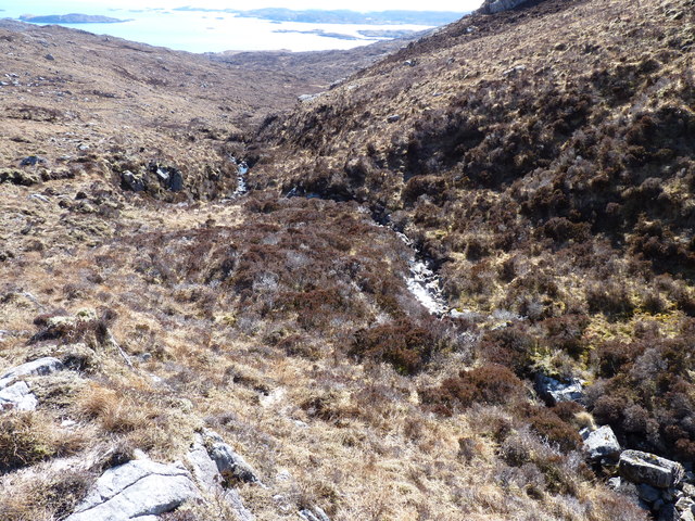
The ascent of Beinn na Teanga is relatively straightforward, making it a popular destination for hillwalkers and hikers. There are various routes that can be taken, with the most common starting from the village of Fersit, located to the west. The climb offers breathtaking views of the surrounding landscapes, including Loch Treig and the Grey Corries.

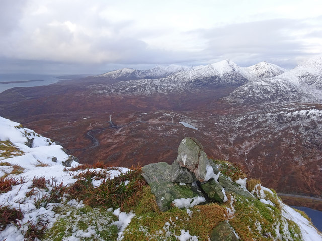
The summit of Beinn na Teanga provides panoramic views of the surrounding mountains, including the nearby peak of Sron a' Choire Ghairbh. On a clear day, one can even catch a glimpse of the Ben Nevis range to the northwest.

Given its location in the Scottish Highlands, weather conditions on Beinn na Teanga can change rapidly, with strong winds and fog being common occurrences. It is essential for climbers to be properly equipped and to exercise caution when ascending the mountain.

Overall, Beinn na Teanga offers a rewarding and picturesque experience for outdoor enthusiasts, showcasing the natural beauty of the Scottish Highlands.

If you have any feedback on the listing, please let us know in the comments section below.

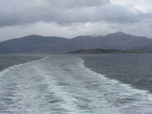
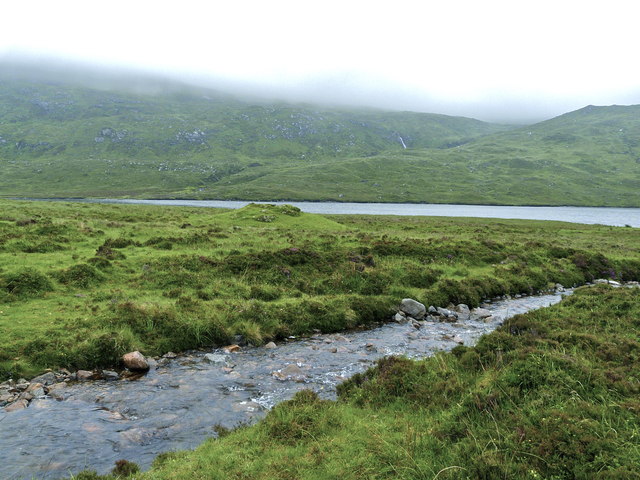
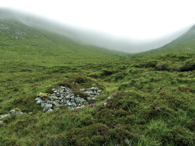
Beinn na Teanga Images

Images are sourced within 2km of 57.925285/-6.7908035 or Grid Reference NB1602. Thanks to Geograph Open Source API. All images are credited.
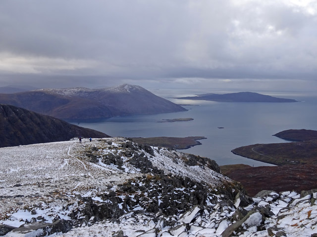
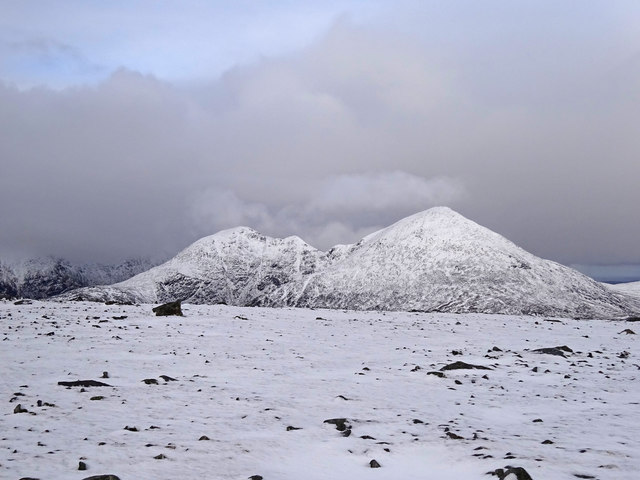
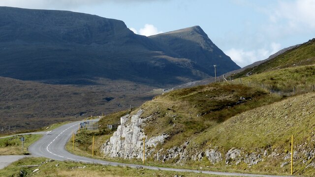
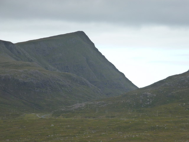
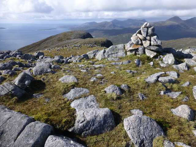
Gleann Lacasdail
Gleann Lacasdail
A wet afternoon on the Hebridean Way ascending N towards Braigh an Ruisg
Waterfall on the Abhainn Scrien, Gleann Lacasdail, Harris Looking towards Lochannan Lacasdail and the eastern slopes of Sròn an Toistear.
Waterfall on the Abhainn Scrien, Gleann Lacasdail, Harris
Looking towards Lochannan Lacasdail and the eastern slopes of Sròn an Toistear.
The Low Wing The small summit cairn on Sgaoth Iosal - The Low Wing is the translation from the Gaelic. The snowy West Harris Hills can be seen as well as the 3 turbines of the North Harris Trust at Monan. These are unique two-bladed machines that can deal with the turbulent wind conditions found amongst the North Harris hills and were manufactured in New Zealand. They were installed in late 2014/early 2015.
The Low Wing
The small summit cairn on Sgaoth Iosal - The Low Wing is the translation from the Gaelic. The snowy West Harris Hills can be seen as well as the 3 turbines of the North Harris Trust at Monan. These are unique two-bladed machines that can deal with the turbulent wind conditions found amongst the North Harris hills and were manufactured in New Zealand. They were installed in late 2014/early 2015.
Winging It Descending from the lovely hill of Sgaoth Iosal on New Year's day with views of the island of Taransay and the hills above Losgaintir. A lovely way to start the year.
Winging It
Descending from the lovely hill of Sgaoth Iosal on New Year's day with views of the island of Taransay and the hills above Losgaintir. A lovely way to start the year.
View to Clisham From the summit plateau of Sgoath Aird - High Wing - looking towards the snow covered An Cliseam and Mulla bho Dheas - fine hills both.
View to Clisham
From the summit plateau of Sgoath Aird - High Wing - looking towards the snow covered An Cliseam and Mulla bho Dheas - fine hills both.
Sgaoth Iosal
Sgaoth Iosal
Sgaoth Iosal: view from the northeast This distinctive, almost angular summit is viewed from a layby on the A859 a couple of miles to the northeast. The road can be seen at the bottom of the picture, swinging round to the right and passing the foot of the mountain.
Sgaoth Iosal: view from the northeast
This distinctive, almost angular summit is viewed from a layby on the A859 a couple of miles to the northeast. The road can be seen at the bottom of the picture, swinging round to the right and passing the foot of the mountain.
Loch Torsacleit
Loch Torsacleit
Looking down Abhainn in Gleann Lingeadail
Looking across Gleann Lingeadail
A small lochan on Goromul Sgaoth Aird in the background.
A small lochan on Goromul
Sgaoth Aird in the background.
Leaving Harris/Na Hearadh Looking back to the hills of South Harris, north of Tarbert, 10km out on the way to Uig, Isle of Skye.
Leaving Harris/Na Hearadh
Looking back to the hills of South Harris, north of Tarbert, 10km out on the way to Uig, Isle of Skye.
Sheiling remains beside Lochannan Lacasdail If you try to walk from the track to the loch, you can see why the owners would have built their property on a mound - it's very wet ground. The Abhainn Dhiobadail isn't particularly high here. In spite of the mist on the hill,there had been very little rain for weeks. In spate conditions it would easily flood the land around the knoll.
Sheiling remains beside Lochannan Lacasdail
If you try to walk from the track to the loch, you can see why the owners would have built their property on a mound - it's very wet ground. The Abhainn Dhiobadail isn't particularly high here. In spite of the mist on the hill,there had been very little rain for weeks. In spate conditions it would easily flood the land around the knoll.
Farming relics in Gleann Lacasdail Within a hundred metres or so of <a href="https://www.geograph.org.uk/photo/3566263">NB1802 : Sheiling remains beside Lochannan Lacasdail</a>, this appears to have been more of a stone-built enclosure rather than habitation.
Farming relics in Gleann Lacasdail
Within a hundred metres or so of NB1802 : Sheiling remains beside Lochannan Lacasdail, this appears to have been more of a stone-built enclosure rather than habitation.
Giolabhal Glas Giolabhal Glas summit cairn with a view towards Giolabhal Dubh and the coast.  This hill is a HuMP with a height of 475 metres and a prominence of 122 metres.
Giolabhal Glas
Giolabhal Glas summit cairn with a view towards Giolabhal Dubh and the coast. This hill is a HuMP with a height of 475 metres and a prominence of 122 metres.
Sgaoth Iosal First of 5 TuMPs in a clockwise direction with Martin Richardson on a sunny afternoon.
Name: Sgaoth Iosal
Hill number: 7107
Height: 531m / 1742ft
Area: 24B: Harris and Nearby Islands
Class: 5H
Grid ref: NB 15462 04358
Summit feature: pile of stones on rock
Drop: 83m
Col: 448m  NB158042
Sgaoth Iosal
First of 5 TuMPs in a clockwise direction with Martin Richardson on a sunny afternoon. Name: Sgaoth Iosal Hill number: 7107 Height: 531m / 1742ft Area: 24B: Harris and Nearby Islands Class: 5H Grid ref: NB 15462 04358 Summit feature: pile of stones on rock Drop: 83m Col: 448m NB158042
View Towards Clisham [An Cliseam] Climbing up Sgaoth Iosal when I managed to snap Clisham [An Cliseam] over the cliff edge.
View Towards Clisham [An Cliseam]
Climbing up Sgaoth Iosal when I managed to snap Clisham [An Cliseam] over the cliff edge.
Show me another place!

Beinn na Teanga is located at Grid Ref: NB1602 (Lat: 57.925285, Lng: -6.7908035)

Unitary Authority: Na h-Eileanan an Iar

Police Authority: Highlands and Islands

What 3 Words

///charities.gobbles.expanded. Near Tarbert, Na h-Eileanan Siar

Nearby Locations

Beinn na Teanga

Related Wikis

Harris, Outer Hebrides

Harris (Scottish Gaelic: Na Hearadh, pronounced [nə ˈhɛɾəɣ] ) is the southern and more mountainous part of Lewis and Harris, the largest island in the...

Tarbert, Harris

Tarbert (Scottish Gaelic: An Tairbeart [ən̪ˠ ˈt̪ɛrʲɛbərˠʃt̪]) is the main community on Harris in the Western Isles of Scotland. The name means "isthmus...

Harris distillery

Harris distillery is a Scotch whisky and Gin distillery in Tarbert on the Isle of Harris, Scotland. The distillery was the first legal distillery ever...

Ardhasaig

Ardhasaig (Scottish Gaelic: Àird Àsaig) is a settlement on the western coast of north Harris, in the Outer Hebrides, Scotland. Ardhasaig is also within...

Nearby Amenities

Located within 500m of 57.925285,-6.7908035
Created By: dmgroom_coastlines
Lat/Long: 57.92701/-6.79324
Created By: dmgroom_coastlines
Lat/Long: 57.92711/-6.79356
Created By: dmgroom_coastlines
Lat/Long: 57.92728/-6.79371
Created By: dmgroom_coastlines
Lat/Long: 57.92727/-6.79323
Beinn na Teanga
Ele: 438
Natural: peak
Source: OS7
Lat/Long: 57.9252895/-6.7890324
The data included in this document is from www.openstreetmap.org. The data is made available under ODbL.

Have you been to Beinn na Teanga?

Leave your review of Beinn na Teanga below (or comments, questions and feedback).