Cnoc Dubh
Hill, Mountain in Ross-shire
Scotland
Cnoc Dubh
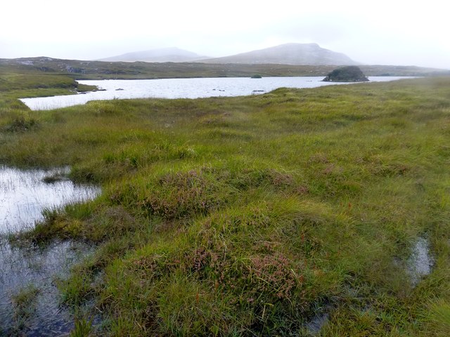
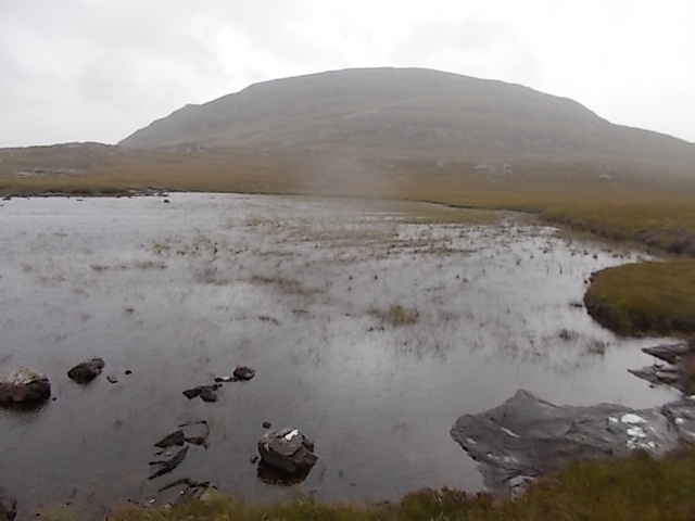
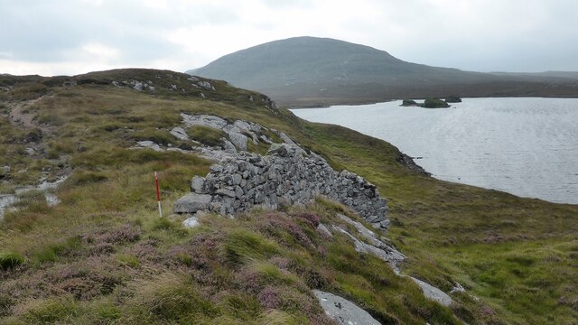
![View Towards Loch Ruadh Meadhanach A view towards Loch Ruadh Meadhanach from the lower slopes of Caultrashal Mor [Coltraiseal Mòr].](https://s3.geograph.org.uk/geophotos/03/69/37/3693795_acc940a3.jpg)
Cnoc Dubh is a prominent hill located in the county of Ross-shire, in the Highland region of Scotland. Standing at an elevation of approximately 799 meters (2,621 feet), it is often referred to as a mountain due to its impressive height and rugged terrain. The hill is situated within the wider Northwest Highlands, an area known for its breathtaking landscapes and outdoor recreational opportunities.
Cnoc Dubh offers stunning panoramic views of the surrounding countryside, including the nearby Loch Luichart and the towering peaks of the Torridon Mountains to the west. The hill is covered in a mixture of heather, grass, and scattered rocky outcrops, creating a diverse and picturesque landscape.
Hiking and hillwalking enthusiasts are drawn to Cnoc Dubh for its challenging ascent and rewarding vistas. There are a variety of routes to reach the summit, ranging from more gentle paths to more strenuous and demanding climbs. The hill is known for its steep slopes and rocky sections, which require proper navigation skills and appropriate footwear.
The area surrounding Cnoc Dubh is rich in natural beauty and wildlife. Visitors may encounter native species such as red deer, golden eagles, and mountain hares during their exploration of the hill. It is recommended to bring appropriate outdoor gear, including warm clothing and waterproofs, as the weather conditions can change rapidly in this exposed environment.
Cnoc Dubh is a popular destination for those seeking an outdoor adventure in the Scottish Highlands, offering a challenging climb and breathtaking views that showcase the natural splendor of Ross-shire.
If you have any feedback on the listing, please let us know in the comments section below.
Cnoc Dubh Images
Images are sourced within 2km of 58.085806/-6.8436498 or Grid Reference NB1421. Thanks to Geograph Open Source API. All images are credited.


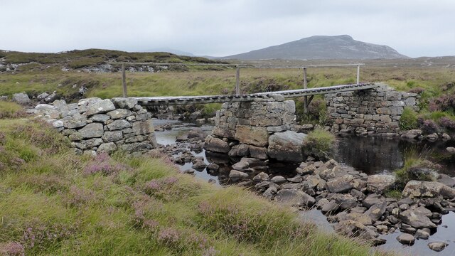
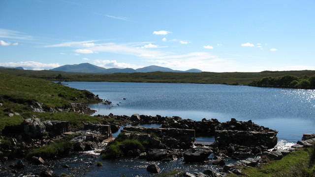
![Scalaval [Scalabhal] [Sgalabhal] Fourth HuMP of four today with Michael Earnshaw, Jim Bloomer and Martin Richardson in mixed weather.
Name: Scalaval [Scalabhal] [Sgalabhal]
Hill number: 4938
Height: 260m / 853ft
Area: 24A: Lewis and Nearby Islands
Class: Hu,2
Grid ref: NB 14257 19826
Summit feature: trig point: OS measurement
Drop: 122m
Col: 138m NB132175](https://s1.geograph.org.uk/geophotos/03/69/38/3693801_2cb73434.jpg)


Cnoc Dubh is located at Grid Ref: NB1421 (Lat: 58.085806, Lng: -6.8436498)
Unitary Authority: Na h-Eileanan an Iar
Police Authority: Highlands and Islands
What 3 Words
///travel.bounded.glows. Near Tarbert, Na h-Eileanan Siar
Nearby Locations
Related Wikis

Gisla Hydro-Electric Scheme
Gisla Hydro-Electric Scheme was a small scheme promoted by the North of Scotland Hydro-Electric Board on the Isle of Lewis, Outer Hebrides, Scotland. It...

Eilean Mòr, Loch Langavat
Eilean Mòr is an island in Loch Langavat on the Isle of Lewis in the Outer Hebrides of Scotland. == Footnotes ==
Have you been to Cnoc Dubh?
Leave your review of Cnoc Dubh below (or comments, questions and feedback).