Gillaval Dubh

Hill, Mountain in Inverness-shire

Scotland

Gillaval Dubh

Long abandoned whaling station at Bunavoneader Viewed from across the water, with the bulk of Mònan rising beyond.

Whaling Station, 1904 Gaunt remains of a long-defunct industry, with a lone, tapering red brick chimney rising from the foundations of the boiling house/desiccator. Little else but the carcass ramp survives. Founded by Norwegian Karl Herlofsen, the factory was acquired by Lever Bros in 1922 when the market was declining, but was abandoned by them in 1929, a financial failure. Leverhulme never pursued his bizarre notion of turning whale meat into tinned sausages for Africans. The whaling station finally closed in 1951.

Taken from "Western Seaboard: An Illustrated Architectural Guide", by Mary Miers, 2008. Published by the Rutland Press.
Long abandoned whaling station at Bunavoneader Credit: Richard Dorrell

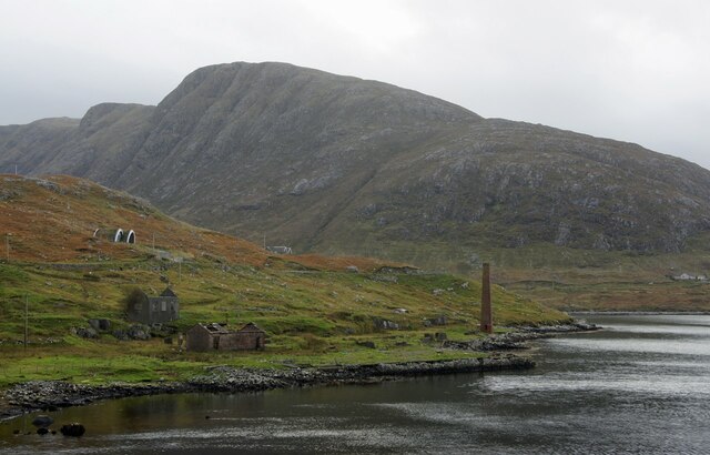
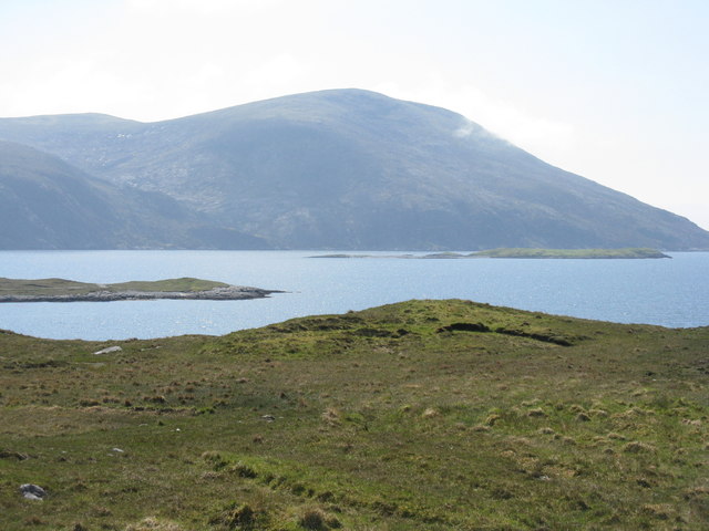
Gillaval Dubh, located in Inverness-shire, Scotland, is a prominent hill or mountain that attracts outdoor enthusiasts and nature lovers from all over the world. Standing at an elevation of approximately 1,024 meters (3,360 feet), it offers breathtaking panoramic views of the surrounding countryside.

The hill is situated in the western part of Inverness-shire, close to the village of Tomich. It is part of the Glen Affric National Nature Reserve, renowned for its stunning landscapes and diverse wildlife. The area surrounding Gillaval Dubh is characterized by rolling hills, tranquil lochs, and dense forests, creating a picturesque and serene atmosphere.

Gillaval Dubh is a popular destination for hikers and mountaineers, offering a variety of routes and trails suitable for different skill levels. The ascent to the summit can be challenging, with steep and rugged terrain in certain sections. However, the rewards are well worth the effort, as climbers are treated to breathtaking vistas of the nearby mountains, including the famous Ben Nevis.

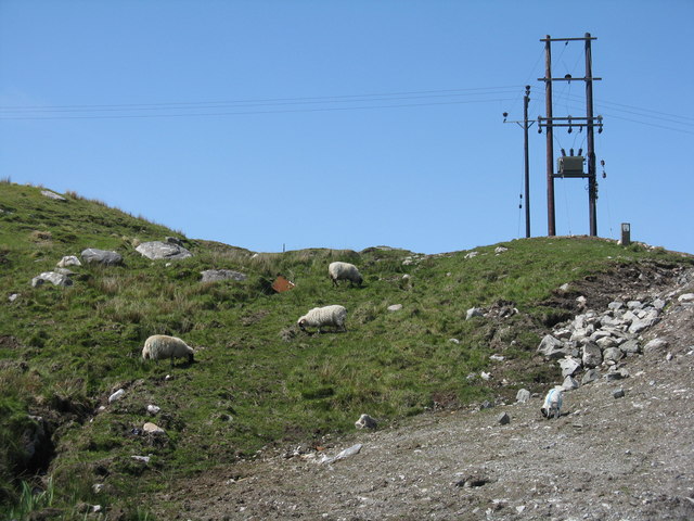
The hill is home to a rich variety of flora and fauna, with heather, ferns, and mosses covering the slopes. Wildlife enthusiasts may spot red deer, golden eagles, and ptarmigans during their visit. The area is also known for its archaeological significance, with ancient settlements and standing stones scattered throughout the landscape.

Overall, Gillaval Dubh is a remarkable hill in Inverness-shire that offers a memorable and rewarding experience for outdoor enthusiasts, combining stunning natural beauty, challenging hiking trails, and a rich cultural and historical heritage.

If you have any feedback on the listing, please let us know in the comments section below.

Gillaval Dubh Images

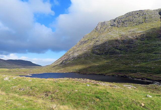
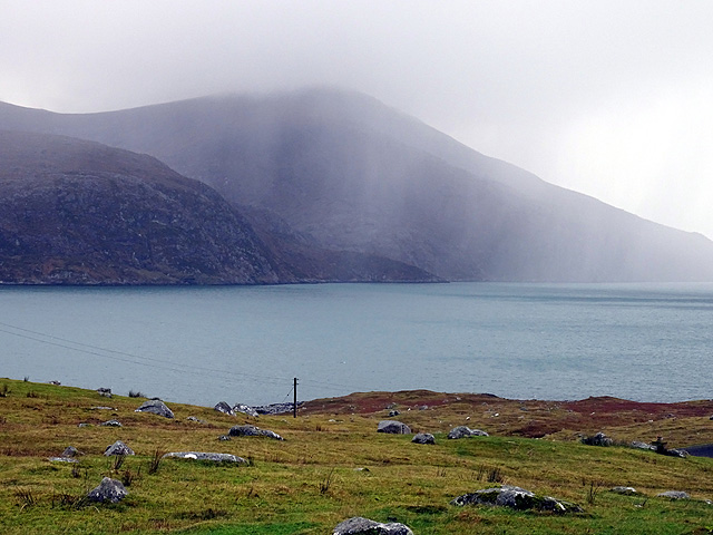
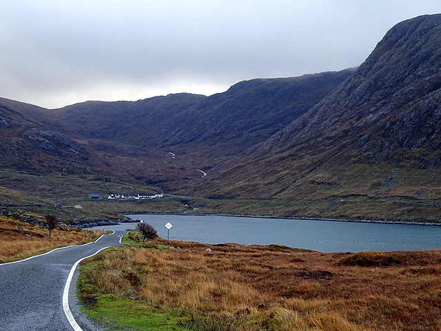
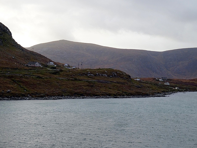
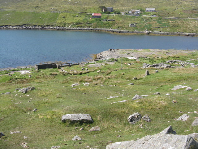
Images are sourced within 2km of 57.921881/-6.8311787 or Grid Reference NB1402. Thanks to Geograph Open Source API. All images are credited.
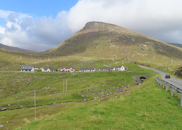
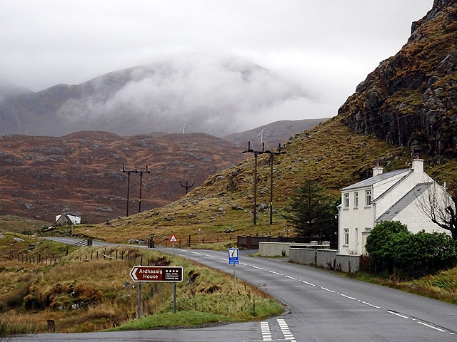
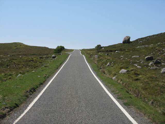
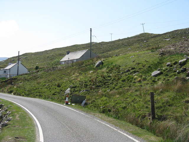
Long abandoned whaling station at Bunavoneader Viewed from across the water, with the bulk of Mònan rising beyond.

Whaling Station, 1904 Gaunt remains of a long-defunct industry, with a lone, tapering red brick chimney rising from the foundations of the boiling house/desiccator. Little else but the carcass ramp survives. Founded by Norwegian Karl Herlofsen, the factory was acquired by Lever Bros in 1922 when the market was declining, but was abandoned by them in 1929, a financial failure. Leverhulme never pursued his bizarre notion of turning whale meat into tinned sausages for Africans. The whaling station finally closed in 1951.

Taken from "Western Seaboard: An Illustrated Architectural Guide", by Mary Miers, 2008. Published by the Rutland Press.
Long abandoned whaling station at Bunavoneader
Viewed from across the water, with the bulk of Mònan rising beyond. Whaling Station, 1904 Gaunt remains of a long-defunct industry, with a lone, tapering red brick chimney rising from the foundations of the boiling house/desiccator. Little else but the carcass ramp survives. Founded by Norwegian Karl Herlofsen, the factory was acquired by Lever Bros in 1922 when the market was declining, but was abandoned by them in 1929, a financial failure. Leverhulme never pursued his bizarre notion of turning whale meat into tinned sausages for Africans. The whaling station finally closed in 1951. Taken from "Western Seaboard: An Illustrated Architectural Guide", by Mary Miers, 2008. Published by the Rutland Press.
Hydro-electric Power Station at Bun Abhainn Eadarra The nearby whaling station is visible in the background.
Hydro-electric Power Station at Bun Abhainn Eadarra
The nearby whaling station is visible in the background.
Abhainn Eadarra after heavy rain
Ceann an Ora A row of modern houses dwarfed by Sròn a' Sgaoth rising above.
Ceann an Ora
A row of modern houses dwarfed by Sròn a' Sgaoth rising above.
Loch na Sgeireagain Mòr The shoulder of Sgaoth Iosal rises steeply above the lochan.
Loch na Sgeireagain Mòr
The shoulder of Sgaoth Iosal rises steeply above the lochan.
By Ãird Asaig Looking towards Beinn Dhubh which is swathed in a rainstorm.
By Ãird Asaig
Looking towards Beinn Dhubh which is swathed in a rainstorm.
Skirting Ãird Bun Abhainn Eadarra Beside Loch Bun Abhainn Eadarra.
Skirting Ãird Bun Abhainn Eadarra
Beside Loch Bun Abhainn Eadarra.
Road junction at Ãird Asaig/Ardhasaig The appropriately named 'Roadside Cottage' on the right, with Mulla bho Dheas partially obscured by cloud.
Road junction at Ãird Asaig/Ardhasaig
The appropriately named 'Roadside Cottage' on the right, with Mulla bho Dheas partially obscured by cloud.
A view towards Ãird Asaig/Ardhasaig Looking across Loch Bun Abhainn Eadarra.
A view towards Ãird Asaig/Ardhasaig
Looking across Loch Bun Abhainn Eadarra.
Glacial erratic by the B887 The road to Hushinish from Tarbert.
Glacial erratic by the B887
The road to Hushinish from Tarbert.
Looking east from Ãird Bun Abhainn Eadarra With Sgaoth Iosal beyond and Loch Bun Abhainn Eadarra below to the right.
Looking east from Ãird Bun Abhainn Eadarra
With Sgaoth Iosal beyond and Loch Bun Abhainn Eadarra below to the right.
The A859 on Harris Looking north to the bridges [old and new] over Abhainn Ceann an Ora and, on the left, the entrance to a quarry.
The A859 on Harris
Looking north to the bridges [old and new] over Abhainn Ceann an Ora and, on the left, the entrance to a quarry.
The cliffs of Geodhan Dubh The northern aspect of Gillaval Dubh, seen from the A859 looking south.
The cliffs of Geodhan Dubh
The northern aspect of Gillaval Dubh, seen from the A859 looking south.
Loch Bun Abhainn Eadarra Looking southwest from above Gob an Sgurr to Beinn Dubh.
Loch Bun Abhainn Eadarra
Looking southwest from above Gob an Sgurr to Beinn Dubh.
Rough grazing at Bun Abhainn Eadarra With electricity transmission poles; these seem to be replacements for those seen in Google Earth imagery of 2009.
Rough grazing at Bun Abhainn Eadarra
With electricity transmission poles; these seem to be replacements for those seen in Google Earth imagery of 2009.
Houses at Bun Abhainn Eadarra On a rough hillside. The road is the B887, ending at Huisinis.
Houses at Bun Abhainn Eadarra
On a rough hillside. The road is the B887, ending at Huisinis.
Remains of whaling station at Bun Abhainn Eadarra Apart from the chimney, not much now remains of the whaling station on Loch Bun Abhainn Eadarra, near Ardhasaig.
Remains of whaling station at Bun Abhainn Eadarra
Apart from the chimney, not much now remains of the whaling station on Loch Bun Abhainn Eadarra, near Ardhasaig.
Old whaling station remains At Bun Abhainn Eadarra; little remains apart from the chimney <a href="https://www.geograph.org.uk/photo/5007689">NB1303 : Remains of whaling station at Bun Abhainn Eadarra</a> and concrete bases of buildings.
Old whaling station remains
At Bun Abhainn Eadarra; little remains apart from the chimney NB1303 : Remains of whaling station at Bun Abhainn Eadarra and concrete bases of buildings.
Show me another place!

Gillaval Dubh is located at Grid Ref: NB1402 (Lat: 57.921881, Lng: -6.8311787)

Unitary Authority: Na h-Eileanan an Iar

Police Authority: Highlands and Islands

What 3 Words

///richly.glaze.movements. Near Tarbert, Na h-Eileanan Siar

Related Wikis

Ardhasaig

Ardhasaig (Scottish Gaelic: Àird Àsaig) is a settlement on the western coast of north Harris, in the Outer Hebrides, Scotland. Ardhasaig is also within...

Harris, Outer Hebrides

Harris (Scottish Gaelic: Na Hearadh, pronounced [nə ˈhɛɾəɣ] ) is the southern and more mountainous part of Lewis and Harris, the largest island in the...
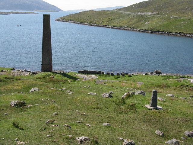
Bun Abhainn Eadarra

Bun Abhainn Eadarra or Bunavoneadar is a hamlet adjacent to the Loch Bun Abhainn Eadarra, on the south shore of North Harris, in the Outer Hebrides, Scotland...

Tarbert, Harris

Tarbert (Scottish Gaelic: An Tairbeart [ən̪ˠ ˈt̪ɛrʲɛbərˠʃt̪]) is the main community on Harris in the Western Isles of Scotland. The name means "isthmus...

Have you been to Gillaval Dubh?

Leave your review of Gillaval Dubh below (or comments, questions and feedback).