Tèileasbhal

Hill, Mountain in Inverness-shire

Scotland

Tèileasbhal

Cairn an Duine (The Cairn of the man) On the pass leading down to Loch Langabhat, just visible in the distance. Oral tradition is that a man was murdered and buried nearby in times gone by. I'm surprised the cairn does not feature on the map of the area.
Cairn an Duine (The Cairn of the man) Credit: JJM

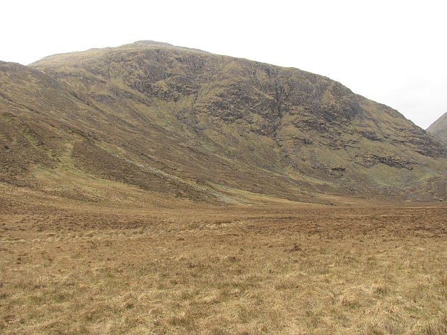
Tèileasbhal is a prominent hill located in Inverness-shire, a county in the Scottish Highlands. With an elevation of approximately 1,764 feet (537 meters), it stands as an impressive landmark in the region. The hill is situated near the village of Ullapool, offering breathtaking panoramic views of the surrounding landscape.

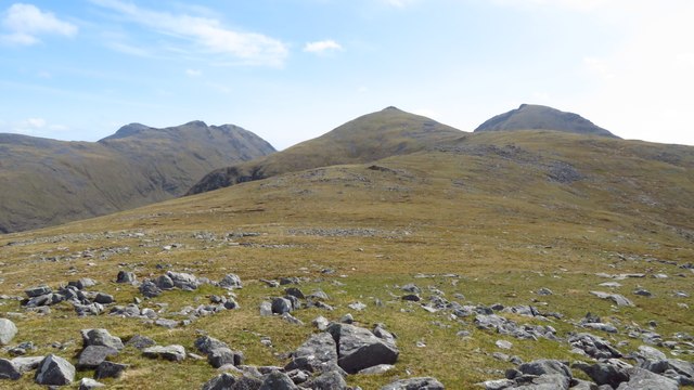
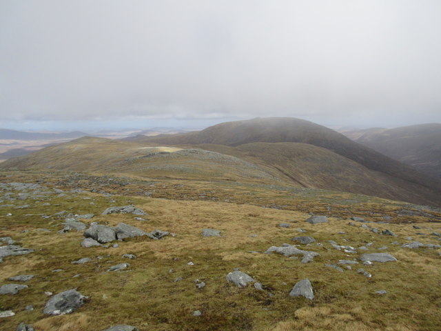
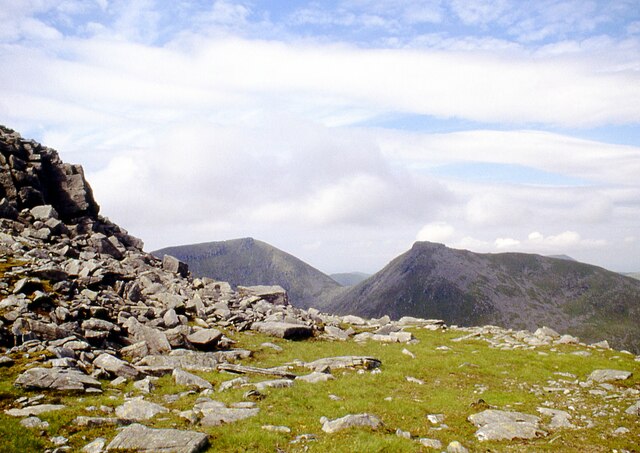
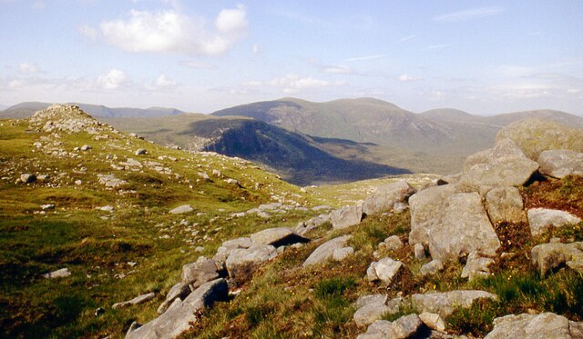
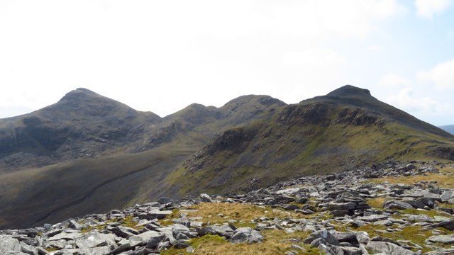
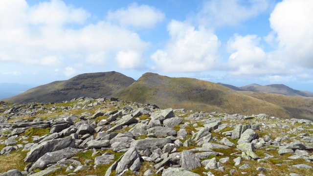
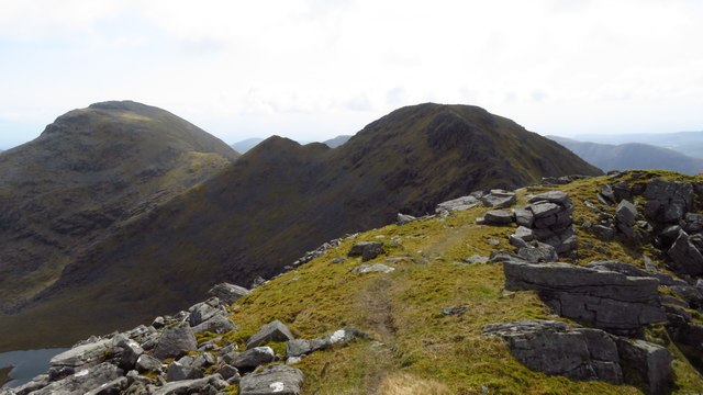
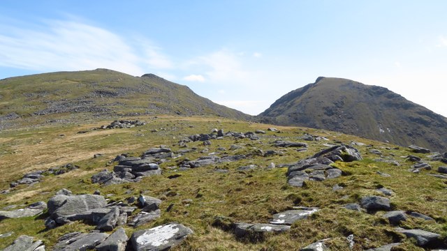
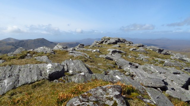
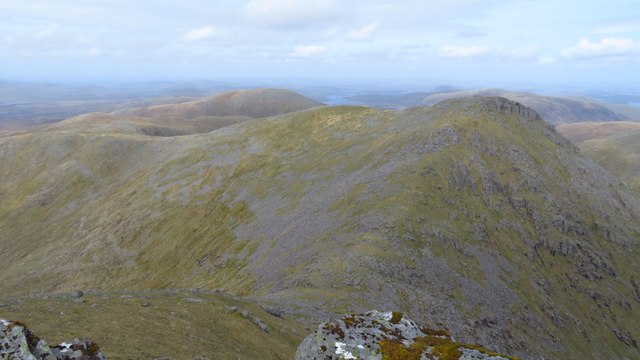
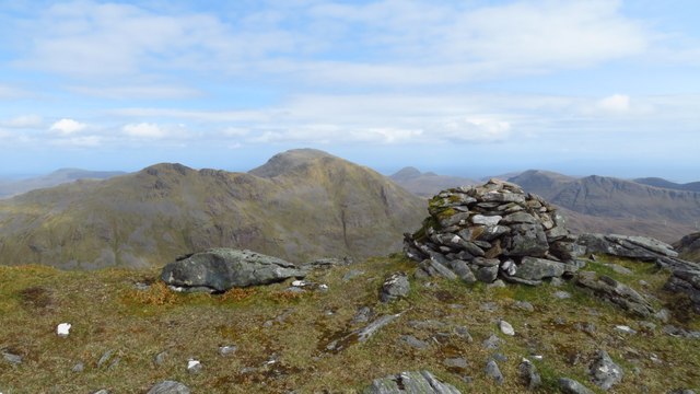
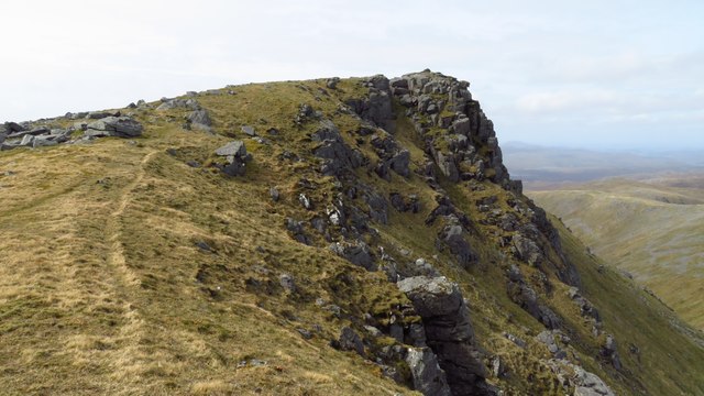
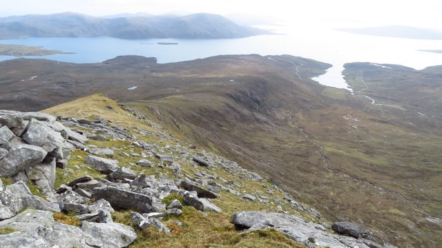
Tèileasbhal is known for its rugged and steep terrain, covered in heather and grasses, which adds to its natural beauty. The hill is a popular destination for hikers and outdoor enthusiasts, who are attracted by its challenging trails and picturesque scenery. As climbers ascend Tèileasbhal, they are treated to stunning views of Loch Broom and the nearby mountains, including the iconic Suilven.

The hill also holds historical significance, as it is believed to have been an important landmark for ancient Celtic tribes. The name "Tèileasbhal" is derived from Gaelic and translates to "flat-topped hill." This name accurately describes the distinct flattened peak of the mountain, which can be seen from miles away.

Wildlife is abundant on Tèileasbhal, with various species of birds, such as golden eagles and peregrine falcons, soaring through the skies. Red deer can also be spotted roaming the lower slopes of the hill.

Overall, Tèileasbhal stands as a captivating mountain in Inverness-shire, offering a challenging yet rewarding experience for adventurers and nature enthusiasts alike. Its stunning views, rich history, and diverse wildlife make it a must-visit destination in the Scottish Highlands.

If you have any feedback on the listing, please let us know in the comments section below.
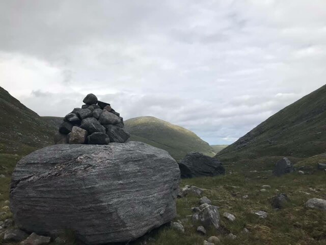
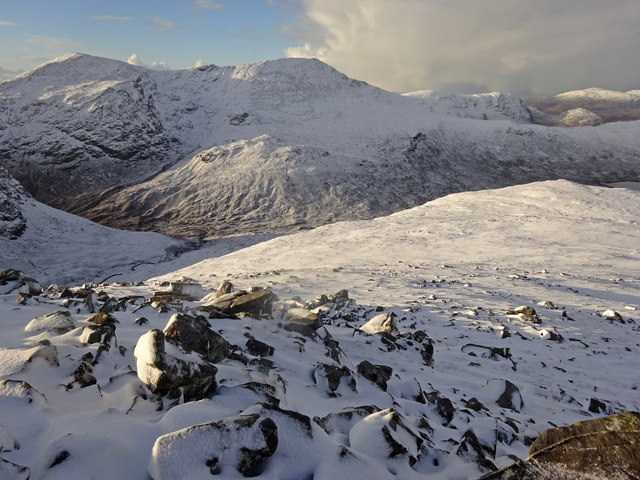
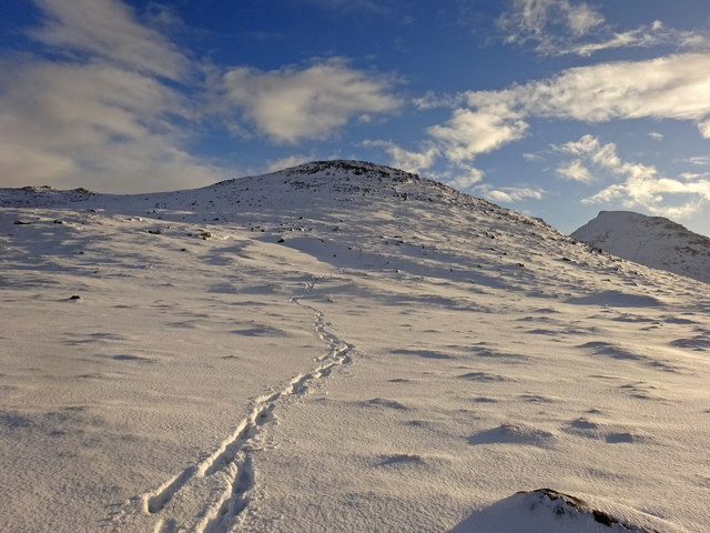
Tèileasbhal Images

Images are sourced within 2km of 57.977839/-6.8633463 or Grid Reference NB1209. Thanks to Geograph Open Source API. All images are credited.

Cairn an Duine (The Cairn of the man) On the pass leading down to Loch Langabhat, just visible in the distance. Oral tradition is that a man was murdered and buried nearby in times gone by. I'm surprised the cairn does not feature on the map of the area.
Cairn an Duine (The Cairn of the man)
On the pass leading down to Loch Langabhat, just visible in the distance. Oral tradition is that a man was murdered and buried nearby in times gone by. I'm surprised the cairn does not feature on the map of the area.
Broad ridge leading south from Creag Stulabhal towards Teileasbhal
Above Gleann Mhiabhaig Descending the peak of Teileasbhal on a fine winters day looking across Gleann Mhiabhaig to the peaks of Oireabhal and Ulabhal.
Above Gleann Mhiabhaig
Descending the peak of Teileasbhal on a fine winters day looking across Gleann Mhiabhaig to the peaks of Oireabhal and Ulabhal.
Teileasbhal Looking back up our descent route from the fine peak of Teileasbhal. The Graham of Uisgneabhal Mor can be seen at the right.
Teileasbhal
Looking back up our descent route from the fine peak of Teileasbhal. The Graham of Uisgneabhal Mor can be seen at the right.
North ridge of Teileasbhal The ridge opens out into a plateau with nice walking conditions. Rare for Harris!
North ridge of Teileasbhal
The ridge opens out into a plateau with nice walking conditions. Rare for Harris!
Mulla bho Thuath Looking towards Teileasbhal.
Mulla bho Thuath
Looking towards Teileasbhal.
Mulla bho Thuath
Mulla bho Thuath
On Mullach an Langa with view towards Mulla bho Thuath
On Mullach an Langa - view towards Uisgneabhal Mor & Teileasbhal
On Mulla bho Thuath - view towards Mulla bho Dheas
Ridge running southeast towards Teileasbhal with Uisgneabhal Mor beyond
Summit area of Teileasbhal
On Uisgneabhal Mor - view to Teileasbhal
On Uisgneabhal Mor - summit cairn
On Uisgneabhal Mor - summit
On Uisgneabhal Mor - ridge leading south towards Creag na Speireig The southern ridge from Uisgneabhal Mor provides a fine walk. Only the bottom few hundred feet does the ground become far more difficult with tussocky grass before reaching the road.
On Uisgneabhal Mor - ridge leading south towards Creag na Speireig
The southern ridge from Uisgneabhal Mor provides a fine walk. Only the bottom few hundred feet does the ground become far more difficult with tussocky grass before reaching the road.
Crag, Mullach an Langa Large vegetated crag above Gleann Langadail.
Crag, Mullach an Langa
Large vegetated crag above Gleann Langadail.
Bealach a' Sgàil The Bealach a' Sgàil is a pass at the head of Gleann Langadail and between Tèileasbhal and Mulla-Fo-Thuath. View across the head of Gleann Langadail.
Bealach a' Sgàil
The Bealach a' Sgàil is a pass at the head of Gleann Langadail and between Tèileasbhal and Mulla-Fo-Thuath. View across the head of Gleann Langadail.
Show me another place!

Tèileasbhal is located at Grid Ref: NB1209 (Lat: 57.977839, Lng: -6.8633463)

Unitary Authority: Na h-Eileanan an Iar

Police Authority: Highlands and Islands

What 3 Words

///engine.shelter.suspended. Near Tarbert, Na h-Eileanan Siar

Nearby Locations

Tèileasbhal

Related Wikis

Uisgneabhal Mor

Uisgnabhal Mor (729 m) is a mountain in Harris, in the Outer Hebrides of Scotland. A complex mountain of several ridges and summits, it lies in the centre...

Oireabhal

Oireabhal (662 m) is a mountain in Harris, in the Outer Hebrides of Scotland. The peak is the highest point on a complex ridge that runs from north to...

Bun Abhainn Eadarra

Bun Abhainn Eadarra or Bunavoneadar is a hamlet adjacent to the Loch Bun Abhainn Eadarra, on the south shore of North Harris, in the Outer Hebrides, Scotland...

Uladail

Uladail is a location near Amhuinnsuidhe, on Harris in the Outer Hebrides, Scotland. Sron Ulladail is a sheer cliff which at 370 metres (1,210 ft) is one...

Nearby Amenities

Located within 500m of 57.977839,-6.8633463
Teileasbhal
Ele: 697
Name En: Teilesval
Name Gd: Teileasbhal
Natural: peak
Source: OS7
Lat/Long: 57.9777094/-6.8631
The data included in this document is from www.openstreetmap.org. The data is made available under ODbL.

Have you been to Tèileasbhal?

Leave your review of Tèileasbhal below (or comments, questions and feedback).