Stromacleit

Hill, Mountain in Ross-shire

Scotland

Stromacleit

B8011 at Leathad Mòr
B8011 at Leathad Mòr Credit: Sandy Gerrard

Stromacleit is a hill located in the county of Ross-shire, in the Highland region of Scotland. It stands at an elevation of approximately 441 meters (1,447 feet) above sea level. The hill is situated in a rural area, surrounded by picturesque landscapes and rolling hills.

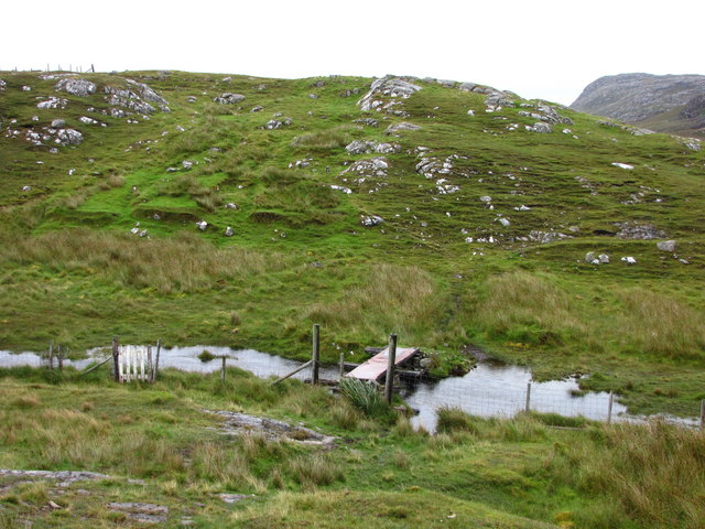
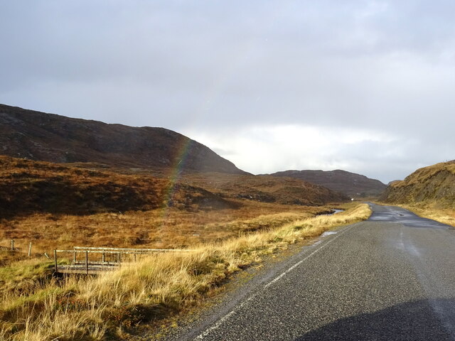
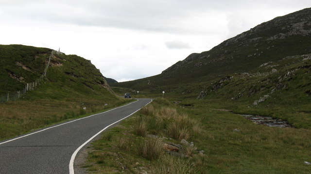
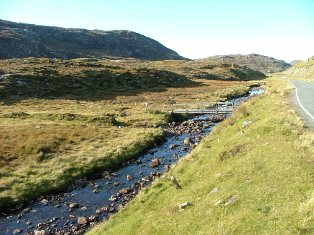
Stromacleit is known for its scenic views and is a popular destination for nature enthusiasts and hikers. The hill offers a moderate hiking trail, making it accessible to both experienced trekkers and beginners. The path takes hikers through open moorland, heathland, and occasionally dense vegetation, providing a diverse and immersive experience.

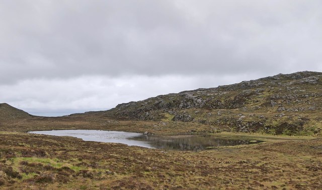
At the summit of Stromacleit, visitors can enjoy panoramic views of the surrounding countryside, including the nearby Loch Bad an Sgalaig and the distant mountain ranges. On clear days, it is even possible to spot some of the neighboring hills and peaks, such as Ben Wyvis and Ben Wyvis Forest.

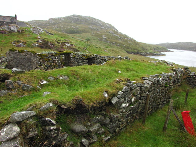
The hill is home to a variety of flora and fauna, including heather, grasses, and wildflowers. It is not uncommon to encounter wildlife such as deer, rabbits, and various bird species during a hike. The area is also rich in cultural history, with ancient ruins and archaeological sites scattered throughout the region.

Overall, Stromacleit is a beautiful and tranquil hill, offering a memorable outdoor experience for those seeking to explore the Scottish Highlands. Whether it is for hiking, photography, or simply enjoying the serenity of nature, Stromacleit has something to offer for everyone.

If you have any feedback on the listing, please let us know in the comments section below.

Stromacleit Images

Images are sourced within 2km of 58.176606/-6.8948108 or Grid Reference NB1231. Thanks to Geograph Open Source API. All images are credited.

B8011 at Leathad Mòr
Ruined blackhouse, Ungaisidar
Cairn, Druim Sandavig, Isle of Lewis This is one of several similarly shaped cairns in the area.  See also <a href="https://www.geograph.org.uk/photo/6205869">NB1229 : Cairn, Druim Sandavig, Isle of Lewis</a>.
Cairn, Druim Sandavig, Isle of Lewis
This is one of several similarly shaped cairns in the area. See also NB1229 : Cairn, Druim Sandavig, Isle of Lewis.
Cairn, Druim Sandavig, Isle of Lewis This is one of several similarly shaped cairns in the area.  See also <a href="https://www.geograph.org.uk/photo/6205867">NB1129 : Cairn, Druim Sandavig, Isle of Lewis</a>.
Cairn, Druim Sandavig, Isle of Lewis
This is one of several similarly shaped cairns in the area. See also NB1129 : Cairn, Druim Sandavig, Isle of Lewis.
Crofthouse at Ungisiadar Overlooking Loch Ròg Beag.
Crofthouse at Ungisiadar
Overlooking Loch Ròg Beag.
Disused Croft Buildings Ungisiadar.
Disused Croft Buildings
Ungisiadar.
Gate and Mailbox to No1 Ungaisidar The un-metalled track beyond the gate leads down to Ungaisidar. You soon reach the limit of vehicular access and the rest of the journey to No1 is definitely upon foot.
Gate and Mailbox to No1 Ungaisidar
The un-metalled track beyond the gate leads down to Ungaisidar. You soon reach the limit of vehicular access and the rest of the journey to No1 is definitely upon foot.
Footbridge to Ungaisidar In 1992 this bridge was precarious; now in 2009, and clearly showing no signs of renovation, it was with some trepidation that we crossed it again in the pouring rain. The metal plate has rusted through in several places giving a view of the mud below.
Footbridge to Ungaisidar
In 1992 this bridge was precarious; now in 2009, and clearly showing no signs of renovation, it was with some trepidation that we crossed it again in the pouring rain. The metal plate has rusted through in several places giving a view of the mud below.
No 1 Ungaisidar A one-time croft and subsequent holiday cottage this property now appears to be inhabited. However, the access by track seems no better with the final few hundred metres being by foot only.
No 1 Ungaisidar
A one-time croft and subsequent holiday cottage this property now appears to be inhabited. However, the access by track seems no better with the final few hundred metres being by foot only.
Mill Ruins at Ungaisidar Where the stream runs down from west to east and into Little Loch Roag evidence of a water powered mill is present. I understand, from locals, that this was where local cereals were ground. No 1 Ungaisidar and the narrows on Little Loch Roag can be seen in the background.
Mill Ruins at Ungaisidar
Where the stream runs down from west to east and into Little Loch Roag evidence of a water powered mill is present. I understand, from locals, that this was where local cereals were ground. No 1 Ungaisidar and the narrows on Little Loch Roag can be seen in the background.
Café in old school An excellently positioned little café in a former school building, provided us with welcome sustenance as we were beginning to wonder where we'd find to get a bite to eat. Once inside, it is obvious that this used to be a school, but I don't know how long ago it ceased to be one.
The hill rising up behind is Seabhal.
Café in old school
An excellently positioned little café in a former school building, provided us with welcome sustenance as we were beginning to wonder where we'd find to get a bite to eat. Once inside, it is obvious that this used to be a school, but I don't know how long ago it ceased to be one. The hill rising up behind is Seabhal.
Geisiadar On Croft Number 8 - The Crofting Commission are looking to evict the tenant of this croft and destroy the woods.
Geisiadar
On Croft Number 8 - The Crofting Commission are looking to evict the tenant of this croft and destroy the woods.
Dam on Loch Mòr na Muilne, Isle of Lewis The name of the loch means large loch of the mill.  The outflow controlled by the dam flows into Loch Beag na Muilne (small loch of the mill).  This lower loch supplied water to the mill shown at <a href="https://www.geograph.org.uk/photo/1522799">NB1229 : Mill Ruins at Ungaisidar</a>.
Dam on Loch Mòr na Muilne, Isle of Lewis
The name of the loch means large loch of the mill. The outflow controlled by the dam flows into Loch Beag na Muilne (small loch of the mill). This lower loch supplied water to the mill shown at NB1229 : Mill Ruins at Ungaisidar.
Loch Mòr na Muilne, Isle of Lewis Loch Mòr na Muilne means large loch of the mill. The outflow from the loch flows into Loch Beag na Muilne (small loch of the mill). This lower loch supplied water to the mill shown at <a href="https://www.geograph.org.uk/photo/1522799">NB1229 : Mill Ruins at Ungaisidar</a>.
Loch Mòr na Muilne, Isle of Lewis
Loch Mòr na Muilne means large loch of the mill. The outflow from the loch flows into Loch Beag na Muilne (small loch of the mill). This lower loch supplied water to the mill shown at NB1229 : Mill Ruins at Ungaisidar.
A hint of a rainbow by Abhainn Mhòr a Ghlinne Ruaidh Just cross the footbridge and you are at the end of the rainbow (now where's my shovel!).
A hint of a rainbow by Abhainn Mhòr a Ghlinne Ruaidh
Just cross the footbridge and you are at the end of the rainbow (now where's my shovel!).
The B8011 in West Lewis For much of its length, the B8011 has been rebuilt and regraded, though this section is still single track with passing places.
The B8011 in West Lewis
For much of its length, the B8011 has been rebuilt and regraded, though this section is still single track with passing places.
Former school, West Lewis. Centrally situated between the crofting communities of Cairisaidar, Geisiadar and Einacleite, this building once served as the local school. Teas and refreshments are now served here, but not on Sundays.
Former school, West Lewis.
Centrally situated between the crofting communities of Cairisaidar, Geisiadar and Einacleite, this building once served as the local school. Teas and refreshments are now served here, but not on Sundays.
Bridge on the Abhainn Mhor à  Ghlinne Ruaidh Looking north.
Bridge on the Abhainn Mhor à Ghlinne Ruaidh
Looking north.
Show me another place!

Stromacleit is located at Grid Ref: NB1231 (Lat: 58.176606, Lng: -6.8948108)

Unitary Authority: Na h-Eileanan an Iar

Police Authority: Highlands and Islands

What 3 Words

///swarm.survived.bound. Near Carloway, Na h-Eileanan Siar

Related Wikis

Fuaigh Beag

Fuaigh Beag or Vuia Be(a)g is an island in the Outer Hebrides. It is off the west coast of Lewis near Great Bernera in Loch Roag. Its name means "little...

Flodaigh, Lewis

Flodaigh is a small island in Loch Roag on the west coast of Lewis in the Outer Hebrides of Scotland. It is about 33 hectares (82 acres) in extent and...

Loch Ròg

Loch Ròg or Loch Roag is a large sea loch on the west coast of Lewis, Outer Hebrides. It is broadly divided into East Loch Roag and West Loch Roag with...

Fuaigh Mòr

Fuaigh Mòr (sometimes anglicised as Vuia Mor) is an island in the Outer Hebrides of Scotland. It is off the west coast of Lewis near Great Bernera in...

Have you been to Stromacleit?

Leave your review of Stromacleit below (or comments, questions and feedback).