Cnoc Breac

Hill, Mountain in Ross-shire

Scotland

Cnoc Breac

B8011 at Leathad Mòr
B8011 at Leathad Mòr Credit: Sandy Gerrard

Cnoc Breac is a prominent hill located in the region of Ross-shire, Scotland. It stands at an elevation of approximately 586 meters (1,923 feet) above sea level, making it a notable landmark in the area. The hill is situated within the broader Highland region, known for its stunning natural beauty and rugged landscapes.

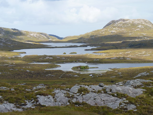
Cnoc Breac is characterized by its distinctive shape and rocky terrain. It offers breathtaking panoramic views of the surrounding countryside, including picturesque valleys, rolling hills, and nearby lochs. On a clear day, visitors can even catch a glimpse of the distant sea.

The hill is a popular destination for outdoor enthusiasts and hikers, who are drawn to its challenging yet rewarding trails. Its relatively moderate height makes it accessible to a wide range of fitness levels, providing opportunities for both seasoned climbers and beginners. The ascent to the summit can be steep in some sections, but the effort is well worth it for the breathtaking vistas that await.

Wildlife enthusiasts will also find Cnoc Breac to be a haven for various species. The area is home to a diverse range of flora and fauna, including birds of prey, mountain hares, and red deer. It is not uncommon to spot these animals during a hike or a quiet moment of contemplation on the hill.

Overall, Cnoc Breac offers visitors a chance to immerse themselves in the natural beauty of the Scottish Highlands. Its stunning vistas, challenging trails, and abundant wildlife make it a must-visit destination for nature lovers and outdoor adventurers alike.

If you have any feedback on the listing, please let us know in the comments section below.
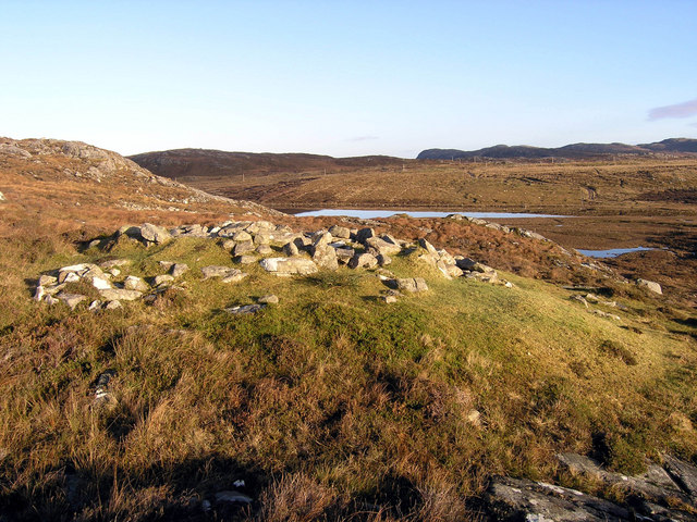
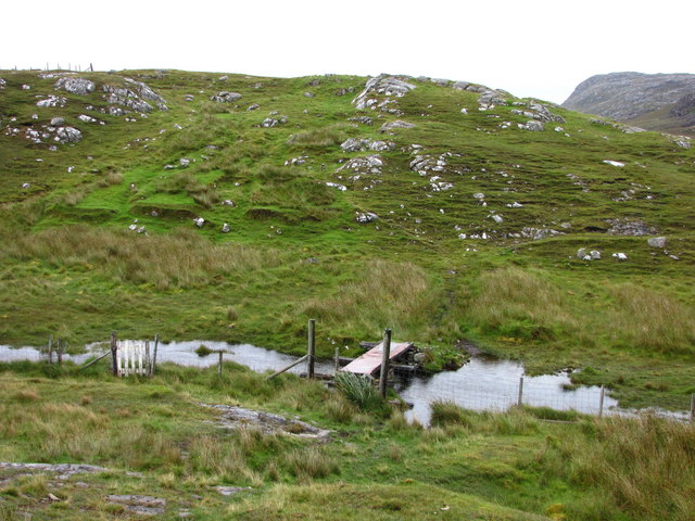
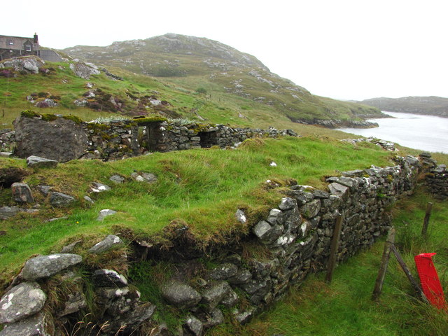
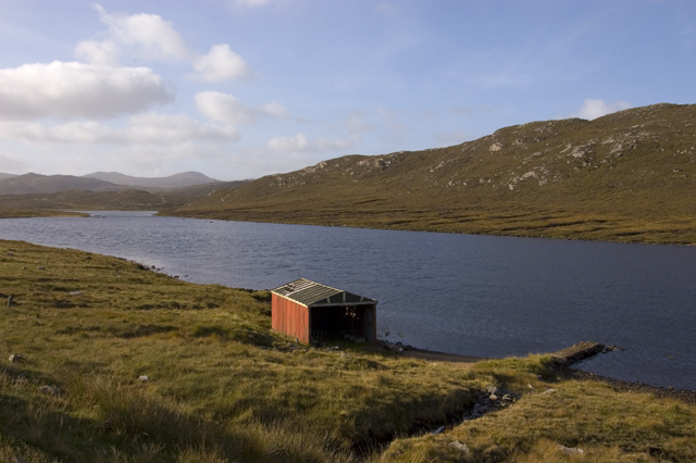
Cnoc Breac Images

Images are sourced within 2km of 58.172624/-6.9138605 or Grid Reference NB1130. Thanks to Geograph Open Source API. All images are credited.

B8011 at Leathad Mòr
Looking down Loch Croistean. Good brown trout fishing and a few finnock
Looking down Loch Croistean.
Good brown trout fishing and a few finnock
Ruined blackhouse, Ungaisidar
Looking towards Loch Croistean from the B8011
Cairn, Druim Sandavig, Isle of Lewis This is one of several similarly shaped cairns in the area.  See also <a href="https://www.geograph.org.uk/photo/6205869">NB1229 : Cairn, Druim Sandavig, Isle of Lewis</a>.
Cairn, Druim Sandavig, Isle of Lewis
This is one of several similarly shaped cairns in the area. See also NB1229 : Cairn, Druim Sandavig, Isle of Lewis.
Cairn, Druim Sandavig, Isle of Lewis This is one of several similarly shaped cairns in the area.  See also <a href="https://www.geograph.org.uk/photo/6205867">NB1129 : Cairn, Druim Sandavig, Isle of Lewis</a>.
Cairn, Druim Sandavig, Isle of Lewis
This is one of several similarly shaped cairns in the area. See also NB1129 : Cairn, Druim Sandavig, Isle of Lewis.
Loch Croistean, West Lewis. Loch with boathouse at the side of the B8011.
Loch Croistean, West Lewis.
Loch with boathouse at the side of the B8011.
Crofthouse at Ungisiadar Overlooking Loch Ròg Beag.
Crofthouse at Ungisiadar
Overlooking Loch Ròg Beag.
Disused Croft Buildings Ungisiadar.
Disused Croft Buildings
Ungisiadar.
Shieling on Ollashol Remains of a very old shieling on the slopes of Ollashol, above Loch Croistean in West Uig.
Shieling on Ollashol
Remains of a very old shieling on the slopes of Ollashol, above Loch Croistean in West Uig.
Gate and Mailbox to No1 Ungaisidar The un-metalled track beyond the gate leads down to Ungaisidar. You soon reach the limit of vehicular access and the rest of the journey to No1 is definitely upon foot.
Gate and Mailbox to No1 Ungaisidar
The un-metalled track beyond the gate leads down to Ungaisidar. You soon reach the limit of vehicular access and the rest of the journey to No1 is definitely upon foot.
Footbridge to Ungaisidar In 1992 this bridge was precarious; now in 2009, and clearly showing no signs of renovation, it was with some trepidation that we crossed it again in the pouring rain. The metal plate has rusted through in several places giving a view of the mud below.
Footbridge to Ungaisidar
In 1992 this bridge was precarious; now in 2009, and clearly showing no signs of renovation, it was with some trepidation that we crossed it again in the pouring rain. The metal plate has rusted through in several places giving a view of the mud below.
No 1 Ungaisidar A one-time croft and subsequent holiday cottage this property now appears to be inhabited. However, the access by track seems no better with the final few hundred metres being by foot only.
No 1 Ungaisidar
A one-time croft and subsequent holiday cottage this property now appears to be inhabited. However, the access by track seems no better with the final few hundred metres being by foot only.
Mill Ruins at Ungaisidar Where the stream runs down from west to east and into Little Loch Roag evidence of a water powered mill is present. I understand, from locals, that this was where local cereals were ground. No 1 Ungaisidar and the narrows on Little Loch Roag can be seen in the background.
Mill Ruins at Ungaisidar
Where the stream runs down from west to east and into Little Loch Roag evidence of a water powered mill is present. I understand, from locals, that this was where local cereals were ground. No 1 Ungaisidar and the narrows on Little Loch Roag can be seen in the background.
Loch Croistean and boathouse
Loch a' Phealair Beag and Loch a' Phealair Mor
Café in old school An excellently positioned little café in a former school building, provided us with welcome sustenance as we were beginning to wonder where we'd find to get a bite to eat. Once inside, it is obvious that this used to be a school, but I don't know how long ago it ceased to be one.
The hill rising up behind is Seabhal.
Café in old school
An excellently positioned little café in a former school building, provided us with welcome sustenance as we were beginning to wonder where we'd find to get a bite to eat. Once inside, it is obvious that this used to be a school, but I don't know how long ago it ceased to be one. The hill rising up behind is Seabhal.
Derelict house on slope of Beinn a' Ghlinne Ruaidh
Show me another place!

Cnoc Breac is located at Grid Ref: NB1130 (Lat: 58.172624, Lng: -6.9138605)

Unitary Authority: Na h-Eileanan an Iar

Police Authority: Highlands and Islands

What 3 Words

///pocketed.ranted.exactly. Near Carloway, Na h-Eileanan Siar

Nearby Locations

Cnoc Breac Sèabhal

Related Wikis

Flodaigh, Lewis

Flodaigh is a small island in Loch Roag on the west coast of Lewis in the Outer Hebrides of Scotland. It is about 33 hectares (82 acres) in extent and...

Fuaigh Beag

Fuaigh Beag or Vuia Be(a)g is an island in the Outer Hebrides. It is off the west coast of Lewis near Great Bernera in Loch Roag. Its name means "little...

Loch Ròg

Loch Ròg or Loch Roag is a large sea loch on the west coast of Lewis, Outer Hebrides. It is broadly divided into East Loch Roag and West Loch Roag with...

Loch na Berie

Loch Na Berie is a broch in the Outer Hebrides of Scotland, located approximately 400 yards from the shore, and is thought to have been located on an island...

Nearby Amenities

Located within 500m of 58.172624,-6.9138605
Passing Place
Lat/Long: 58.1695532/-6.9143156
Passing Place
Lat/Long: 58.1731449/-6.9206331
Passing Place
Lat/Long: 58.1719262/-6.9128043
Barrier: cattle_grid
Lat/Long: 58.1700708/-6.9143044
Passing Place
Lat/Long: 58.1705993/-6.9166072
Passing Place
Lat/Long: 58.1717303/-6.9132416
Passing Place
Lat/Long: 58.1735604/-6.9118959
Power: pole
Lat/Long: 58.168405/-6.9137543
Power: pole
Lat/Long: 58.1691217/-6.9142598
Power: pole
Lat/Long: 58.1697859/-6.914727
Power: pole
Lat/Long: 58.1703954/-6.9152025
Power: pole
Lat/Long: 58.1709822/-6.9160452
Power: pole
Lat/Long: 58.1715286/-6.9169322
Power: pole
Lat/Long: 58.1720988/-6.9178373
Power: pole
Lat/Long: 58.1726189/-6.9186679
Power: pole
Lat/Long: 58.17317/-6.9195233
Power: pole
Lat/Long: 58.173683/-6.9203336
Power: pole
Lat/Long: 58.1743876/-6.9210717
Power: pole
Lat/Long: 58.1708377/-6.9148138
Power: pole
Lat/Long: 58.1713275/-6.9143715
Power: pole
Lat/Long: 58.1718764/-6.9139132
Power: pole
Lat/Long: 58.1724039/-6.9134208
Power: pole
Lat/Long: 58.1730811/-6.9128953
Power: pole
Lat/Long: 58.1737505/-6.9123452
Power: pole
Lat/Long: 58.1743516/-6.9118842
Power: pole
Lat/Long: 58.1749887/-6.9113979
Power: pole
Lat/Long: 58.1755909/-6.9109171
Power: pole
Lat/Long: 58.1761464/-6.910469
Power: pole
Lat/Long: 58.1758885/-6.9104792
Passing Place
Lat/Long: 58.1745669/-6.9110975
Passing Place
Lat/Long: 58.1725764/-6.9124294
Passing Place
Lat/Long: 58.170178/-6.9154254
Passing Place
Lat/Long: 58.1710546/-6.9175587
Passing Place
Lat/Long: 58.1719414/-6.9189506
Passing Place
Lat/Long: 58.1751403/-6.9105071
The data included in this document is from www.openstreetmap.org. The data is made available under ODbL.

Have you been to Cnoc Breac?

Leave your review of Cnoc Breac below (or comments, questions and feedback).