Mullach na Reidheachd

Hill, Mountain in Inverness-shire

Scotland

Mullach na Reidheachd

Boat and fishing hut on Loch Uladail The boat and fishing hut on the famous Loch Uladail
Boat and fishing hut on Loch Uladail Credit: Philip

Mullach na Reidheachd is a prominent hill located in Inverness-shire, Scotland. It is situated about 12 miles northwest of the town of Newtonmore. The hill stands at an impressive height of 674 meters (2,211 feet), making it a popular destination for hikers and outdoor enthusiasts.

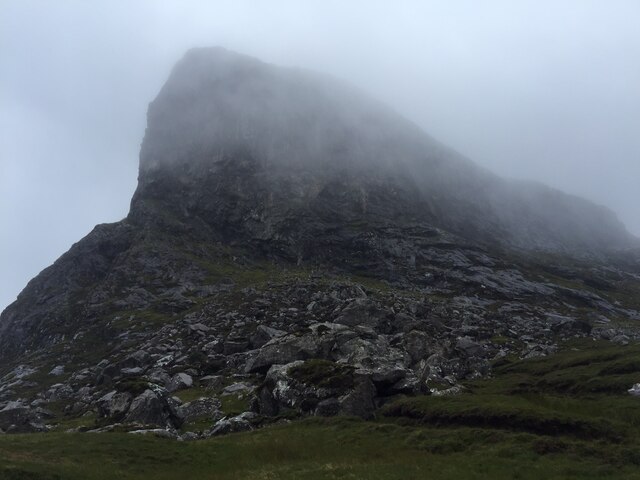
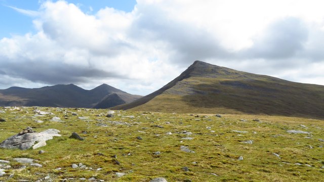
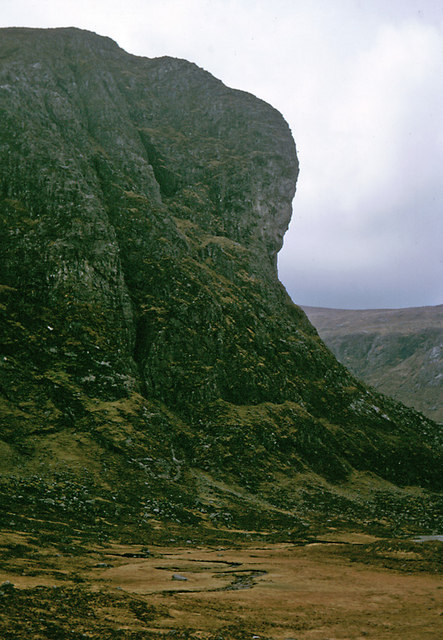
The name Mullach na Reidheachd translates to "summit of the boggy place" in Gaelic, which accurately reflects the terrain that can be found on the hill. Mullach na Reidheachd is a relatively steep and rugged hill, characterized by heather-covered slopes and rocky outcrops. The vegetation here is diverse, with a mix of grasses, mosses, and wildflowers adding to the scenic beauty of the area.

Reaching the summit of Mullach na Reidheachd requires a moderate level of fitness and adequate hiking gear. There are several well-marked trails leading to the top, offering stunning panoramic views of the surrounding countryside, including the Cairngorms National Park.

Wildlife enthusiasts will also appreciate the biodiversity found on and around the hill. Mullach na Reidheachd is home to various bird species, including golden eagles, buzzards, and ptarmigans. Other animals such as red deer and mountain hares can also be spotted in the area.

Overall, Mullach na Reidheachd offers a rewarding and challenging hiking experience, allowing visitors to immerse themselves in the natural beauty of the Scottish Highlands. Its scenic landscapes, diverse flora and fauna, and breathtaking views make it a must-visit destination for outdoor enthusiasts seeking a true Scottish adventure.

If you have any feedback on the listing, please let us know in the comments section below.

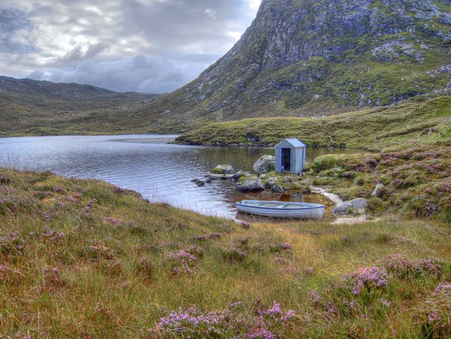
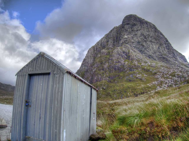
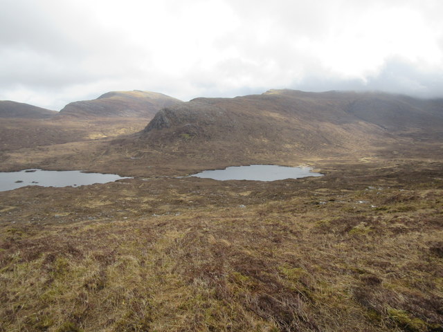
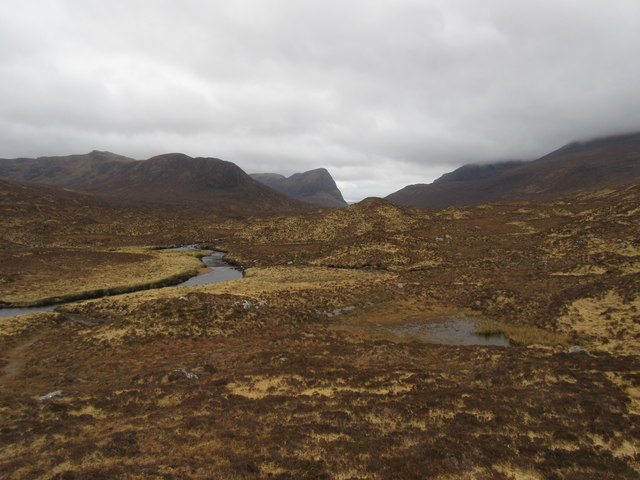
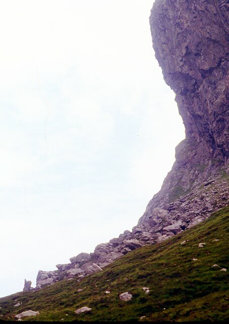
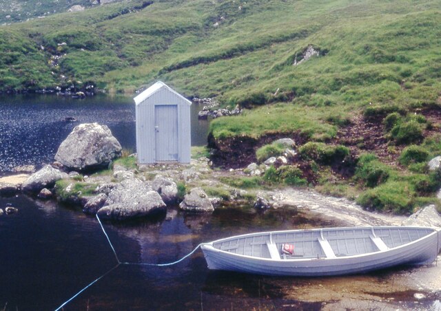
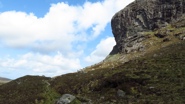
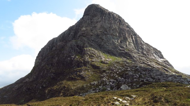
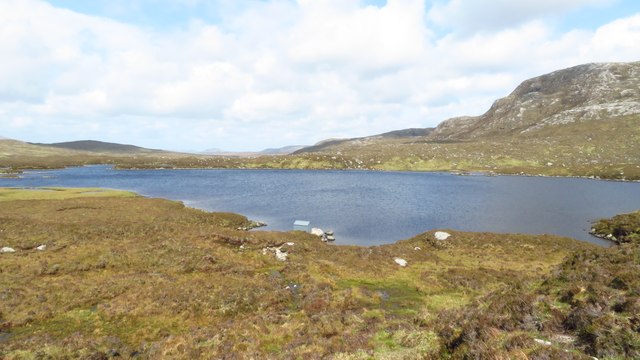
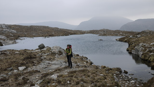
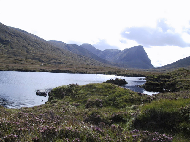
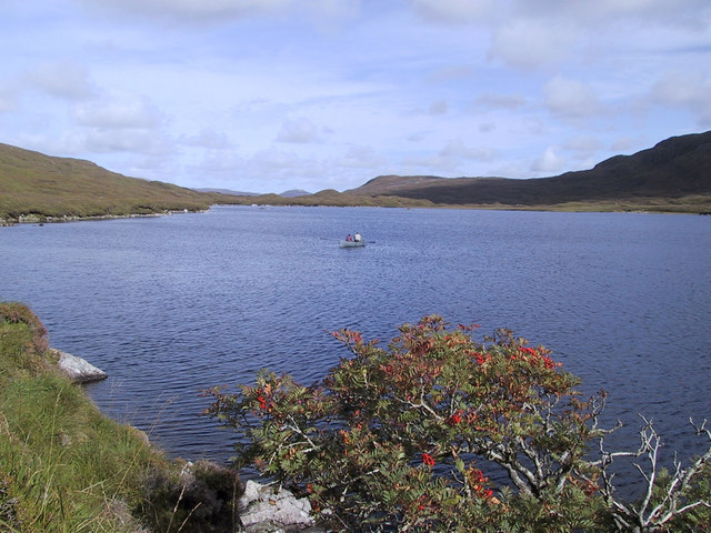
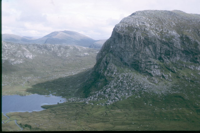
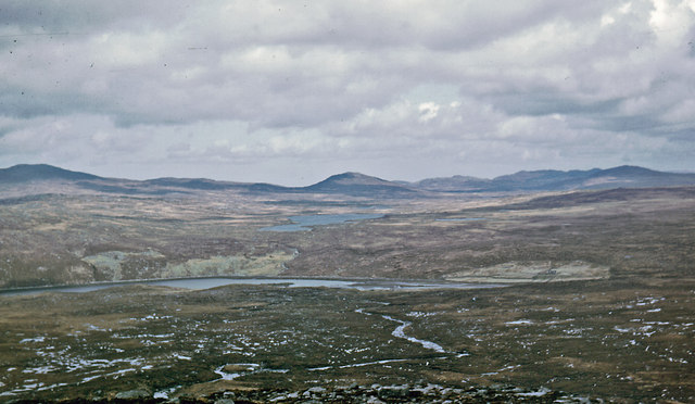
Mullach na Reidheachd Images

Images are sourced within 2km of 58.02129/-6.9293768 or Grid Reference NB0914. Thanks to Geograph Open Source API. All images are credited.

Boat and fishing hut on Loch Uladail The boat and fishing hut on the famous Loch Uladail
Boat and fishing hut on Loch Uladail
The boat and fishing hut on the famous Loch Uladail
Fishing hut on Loch Uladail The fishing hut and big overhang on Loch Uladail
Fishing hut on Loch Uladail
The fishing hut and big overhang on Loch Uladail
Upper Gleann Mhiabhaig Across the glen, the steep crags on Sron Ard rise above the lochs, Loch Bhoisimid and Lochan an Fheoir.
Upper Gleann Mhiabhaig
Across the glen, the steep crags on Sron Ard rise above the lochs, Loch Bhoisimid and Lochan an Fheoir.
Mullach na Reidheachd View from summit of Mullach na Reidheachd looking towards the moorland of Lewis.
Mullach na Reidheachd
View from summit of Mullach na Reidheachd looking towards the moorland of Lewis.
Abhainn Mhor Ceann Reasoirt In the distance can be seen the steep crag of Sron Scourst.
Abhainn Mhor Ceann Reasoirt
In the distance can be seen the steep crag of Sron Scourst.
Overhanging buttress on Sròn Uladail
Fishing bothy on Loch Uladail
Sron Uladail in mist The main buttress of Sron Uladail in atmospheric mist from the path to Loch Reasort.
Sron Uladail in mist
The main buttress of Sron Uladail in atmospheric mist from the path to Loch Reasort.
The plateau summit of Muladal with view towards Ulabhal
The Nose of Strone Ulladale This cliff face has the claim as having the biggest rock overhang in the British Isles.
The Nose of Strone Ulladale
This cliff face has the claim as having the biggest rock overhang in the British Isles.
The Nose of Strone Ulladale
Loch Uladail, Harris
Looking west from lochan east of Sron Uladal
Loch Voshimid with Sron Scourst behind
Loch Voshimid
Loch Voshimid
Sron Ulladail over Loch Uladail At 370m metres above the Loch over which it towers, Sron Ulladail is one of the highest sheer cliffs in Britain. It is also very hard to reach being 7km from an already remote road on the Outer Hebrides.
Sron Ulladail over Loch Uladail
At 370m metres above the Loch over which it towers, Sron Ulladail is one of the highest sheer cliffs in Britain. It is also very hard to reach being 7km from an already remote road on the Outer Hebrides.
North from the slope of Ruider The Ulladale river flows to Kinlochresort
North from the slope of Ruider
The Ulladale river flows to Kinlochresort
The Great Gully and overhang of Strone Ulladale The 1934 Scottish Mountaineering Club's Guide to the Islands of Scotland remarked "Strone Ulladale is worth the attention of cragsmen in search of something new".
The Great Gully and overhang of Strone Ulladale
The 1934 Scottish Mountaineering Club's Guide to the Islands of Scotland remarked "Strone Ulladale is worth the attention of cragsmen in search of something new".
Show me another place!

Mullach na Reidheachd is located at Grid Ref: NB0914 (Lat: 58.02129, Lng: -6.9293768)

Unitary Authority: Na h-Eileanan an Iar

Police Authority: Highlands and Islands

What 3 Words

///whiplash.penned.glare. Near Tarbert, Na h-Eileanan Siar

Nearby Locations

Mullach na Reidheachd

Related Wikis

Uladail

Uladail is a location near Amhuinnsuidhe, on Harris in the Outer Hebrides, Scotland. Sron Ulladail is a sheer cliff which at 370 metres (1,210 ft) is one...

Oireabhal

Oireabhal (662 m) is a mountain in Harris, in the Outer Hebrides of Scotland. The peak is the highest point on a complex ridge that runs from north to...

Tiorga Mor

Tiorga Mor (679 m) is a mountain in Harris, in the Outer Hebrides of Scotland. The most westerly peak of the high mountains of Harris, it is a very rugged...

Chliostair Hydro-Electric Scheme

Chliostair Hydro-Electric Scheme is a small scheme promoted by the North of Scotland Hydro-Electric Board on Harris, Outer Hebrides. It consists of a single...

Nearby Amenities

Located within 500m of 58.02129,-6.9293768
Mullach na Reidheachd
Ele: 295
Natural: peak
Source: OS7
Lat/Long: 58.0220061/-6.9252493
The data included in this document is from www.openstreetmap.org. The data is made available under ODbL.

Have you been to Mullach na Reidheachd?

Leave your review of Mullach na Reidheachd below (or comments, questions and feedback).