Beinn Mheadhanach
Hill, Mountain in Ross-shire
Scotland
Beinn Mheadhanach
Beinn Mheadhanach is a prominent hill located in Ross-shire, which is a county in the Scottish Highlands. It is part of the larger Monadhliath mountain range and stands at an impressive height of 901 meters (2,956 feet).
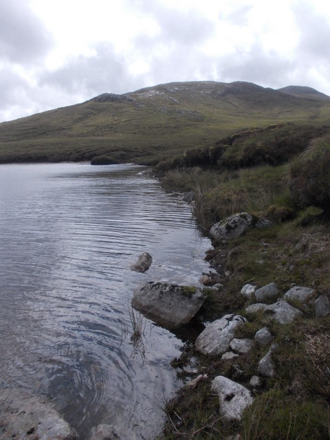
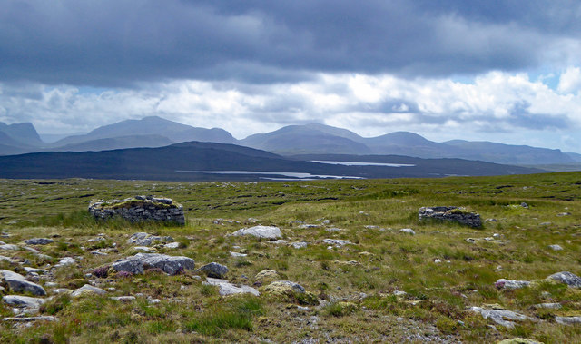
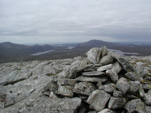
Situated approximately 30 kilometers southeast of Inverness, Beinn Mheadhanach offers stunning panoramic views of the surrounding landscape. Its location in the heart of the Scottish Highlands allows for breathtaking vistas of rolling hills, glens, and lochs. On a clear day, it is even possible to catch a glimpse of the famous Loch Ness in the distance.
The ascent up Beinn Mheadhanach is a popular choice for hikers and outdoor enthusiasts. The hill offers various routes, ranging from moderate to challenging, allowing visitors to choose the level of difficulty that suits them best. The most common starting point is the village of Moy, where a well-defined path leads up to the summit.
As climbers make their way up the hill, they are treated to diverse wildlife and plant species. Beinn Mheadhanach is home to a variety of birds, including golden eagles and ptarmigans, as well as several species of deer. The hillside is also adorned with heather and other wildflowers, creating a colorful tapestry during the summer months.
Beinn Mheadhanach is a remarkable natural landmark in Ross-shire, offering both physical challenges and visual rewards to those who venture to its summit. Its accessibility and stunning surroundings make it a popular destination for outdoor enthusiasts and nature lovers alike.
If you have any feedback on the listing, please let us know in the comments section below.
Beinn Mheadhanach Images
Images are sourced within 2km of 58.10545/-6.941014 or Grid Reference NB0923. Thanks to Geograph Open Source API. All images are credited.
Beinn Mheadhanach is located at Grid Ref: NB0923 (Lat: 58.10545, Lng: -6.941014)
Unitary Authority: Na h-Eileanan an Iar
Police Authority: Highlands and Islands
What 3 Words
///develops.refills.heaven. Near Carloway, Na h-Eileanan Siar
Nearby Locations
Related Wikis

Gisla Hydro-Electric Scheme
Gisla Hydro-Electric Scheme was a small scheme promoted by the North of Scotland Hydro-Electric Board on the Isle of Lewis, Outer Hebrides, Scotland. It...

Gasker
Gasker is a small uninhabited islet in the Outer Hebrides of Scotland, 8 kilometres (4+1⁄2 nautical miles) southwest of Scarp, off the west coast of Harris...

Abhainn Dearg distillery
Abhainn Dearg distillery ( AV-in JAIRG) or Red River distillery is a Scotch whisky distillery in Uig, on the west coast of the Isle of Lewis in the Outer...

Uig, Lewis
Uig (Scottish Gaelic: Ùig [uːkʲ]), also known as Sgìr' Ùig, is a civil parish and community in the west of the Isle of Lewis in the Outer Hebrides, Scotland...

Ardroil
Ardroil (Scottish Gaelic: Eadar Dhà Fhadhail) is a village on the Isle of Lewis in the Outer Hebrides, Scotland. Ardroil is within the parish of Uig....

Game pieces of the Lewis chessmen hoard
Game pieces of the Lewis chessmen hoard include the ninety-three game pieces of the Lewis chessmen hoard found on the Isle of Lewis in the Outer Hebrides...

Mealista
Mealista (Scottish Gaelic: Mealasta) was a township in the west of the Isle of Lewis. It is currently largely uninhabited due to the Highland Clearances...
Flodaigh, Lewis
Flodaigh is a small island in Loch Roag on the west coast of Lewis in the Outer Hebrides of Scotland. It is about 33 hectares (82 acres) in extent and...
Nearby Amenities
Located within 500m of 58.10545,-6.941014Have you been to Beinn Mheadhanach?
Leave your review of Beinn Mheadhanach below (or comments, questions and feedback).