Cnoc an Fhraoich

Hill, Mountain in Argyllshire

Scotland

Cnoc an Fhraoich

Port Chunn Nèill, Isle of Tiree
Port Chunn Nèill, Isle of Tiree Credit: Alpin Stewart

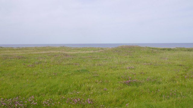
Cnoc an Fhraoich is a hill located in Argyllshire, Scotland. It has an elevation of 401 meters (1316 feet) above sea level and is situated near the village of Lochgair. The hill is known for its stunning views of the surrounding countryside, including Loch Fyne and the nearby hills and mountains.

Cnoc an Fhraoich is a popular destination for hikers and outdoor enthusiasts, with a well-marked trail leading to the summit. The trail is relatively moderate in difficulty, making it suitable for hikers of all skill levels. Along the way, hikers can enjoy the diverse flora and fauna that call the hill home, including heather, gorse, and a variety of bird species.

At the summit of Cnoc an Fhraoich, visitors are rewarded with panoramic views of the surrounding landscape, including the shimmering waters of Loch Fyne and the rolling hills of Argyllshire. On a clear day, it is possible to see as far as the Isle of Arran and the Kintyre Peninsula.

Overall, Cnoc an Fhraoich is a picturesque and enjoyable hill to hike, offering a glimpse into the natural beauty of the Scottish countryside.

If you have any feedback on the listing, please let us know in the comments section below.

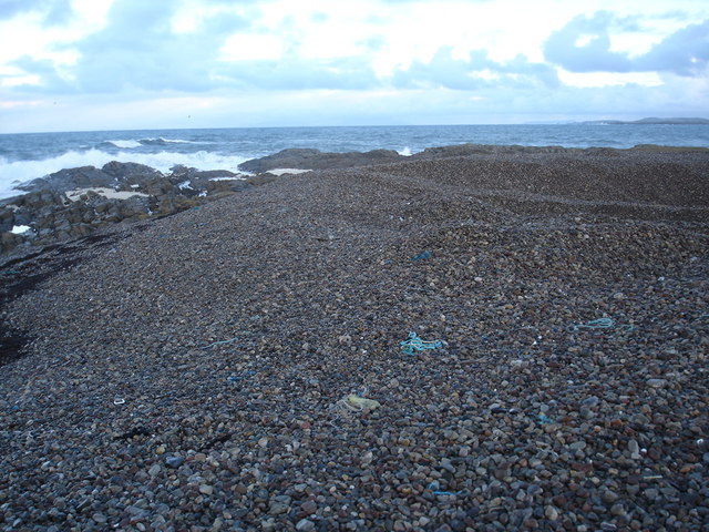
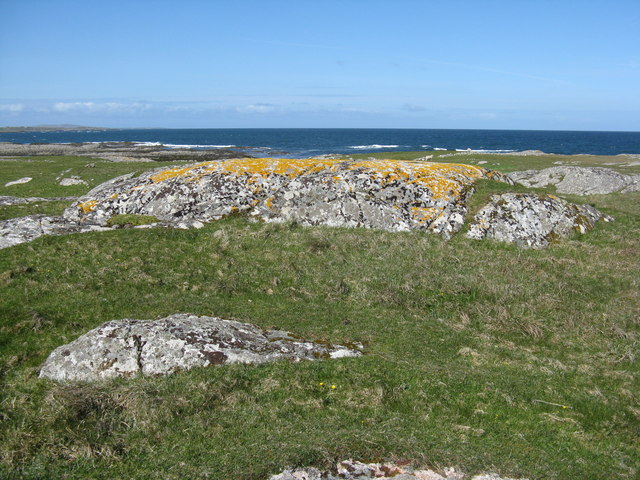
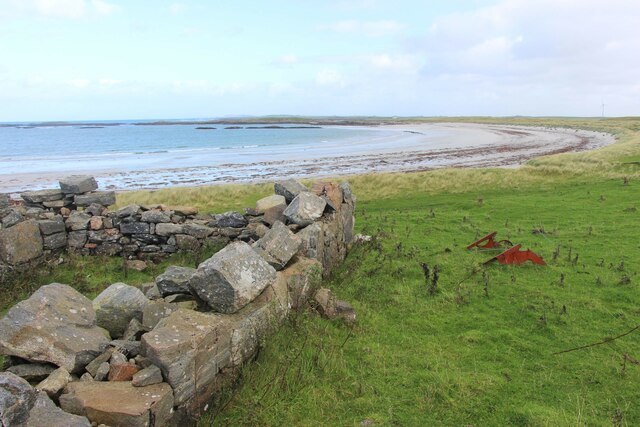
Cnoc an Fhraoich Images

Images are sourced within 2km of 56.537658/-6.766593 or Grid Reference NM0748. Thanks to Geograph Open Source API. All images are credited.

Port Chunn Nèill, Isle of Tiree
Machair, Urvaig The northeast tip of Tiree.
Machair, Urvaig
The northeast tip of Tiree.
Port Chunn Nèill An eider creche off Tiree.
Port Chunn Nèill
An eider creche off Tiree.
Port Chunn Nèill, Tiree
Coastal grassland at Urvaig
Port Chunn Nèill, northeast Tiree Gunna Sound leading into the Sea of the Hebrides.
Port Chunn Nèill, northeast Tiree
Gunna Sound leading into the Sea of the Hebrides.
Urvaig, Tiree Storm beach, looking north from Urvaig, Tiree
Urvaig, Tiree
Storm beach, looking north from Urvaig, Tiree
Pebble beach at Urvaig The dip in the pebbles at the right hand side is where some have been removed and probably crushed and used as aggregate.
Pebble beach at Urvaig
The dip in the pebbles at the right hand side is where some have been removed and probably crushed and used as aggregate.
Rocks and pebble bank at Urvaig
On Eilean Ghreusgain The view across the beach from this tiny low tide island towards the croft house at Miodar.
On Eilean Ghreusgain
The view across the beach from this tiny low tide island towards the croft house at Miodar.
Coast at Urvaig Looking out towards the island of Gunna which lies between Tiree and Coll.
Coast at Urvaig
Looking out towards the island of Gunna which lies between Tiree and Coll.
Looking out to sea from Urvaig Lichen-covered rocks and grassland.
Looking out to sea from Urvaig
Lichen-covered rocks and grassland.
Looking across Vaul bay A view southwest from Urvaig.
Looking across Vaul bay
A view southwest from Urvaig.
Looking north from Urvaig Over white sand and rock to the Sea of the Hebrides.
Looking north from Urvaig
Over white sand and rock to the Sea of the Hebrides.
House at Urvaig At the northeastern tip of Tiree.
House at Urvaig
At the northeastern tip of Tiree.
Tigh Dubh House on the machair, east side of Tiree.
Tigh Dubh
House on the machair, east side of Tiree.
Road, Caolas
Road, Caolas
Vaul Bay, Tiree
Vaul Bay, Tiree
Show me another place!

Cnoc an Fhraoich is located at Grid Ref: NM0748 (Lat: 56.537658, Lng: -6.766593)

Unitary Authority: Argyll and Bute

Police Authority: Argyll and West Dunbartonshire

What 3 Words

///grower.tinkle.rectangular. Near Scarinish, Argyll & Bute

Related Wikis

Dun Mor Vaul

Dun Mor Vaul (or simply Dun Mor; Scottish Gaelic: Dùn Mòr) is an iron-age broch located on the north coast of the island of Tiree, in Scotland. ��2�...

Tiree

Tiree (; Scottish Gaelic: Tiriodh, pronounced [ˈtʲʰiɾʲəɣ]) is the most westerly island in the Inner Hebrides of Scotland. The low-lying island, southwest...

Gunna, Scotland

Gunna (Gaelic: Gunnaigh) is an island in the Inner Hebrides of Scotland. == Geography and geology == Gunna lies between Coll and Tiree, closer to Coll...

Scarinish

Scarinish (Scottish Gaelic: Sgairinis [ˈs̪kaɾʲɪnɪʃ]) is the main village on the island of Tiree, in the Inner Hebrides of Scotland. It is located on the...

Nearby Amenities

Located within 500m of 56.537658,-6.766593
Passing Place
Lat/Long: 56.5355551/-6.7640313
Barrier: cattle_grid
Bicycle: yes
Foot: yes
Lat/Long: 56.5383362/-6.773634
Barrier: cattle_grid
Bicycle: yes
Foot: yes
Lat/Long: 56.5346144/-6.7714918
Salum
Name Gd: Sàlum
Place: hamlet
Lat/Long: 56.5373124/-6.7727026
Man Made: water_well
Lat/Long: 56.5358598/-6.7664305
Frequency: 50
Power: pole
Voltage: 11000
Lat/Long: 56.5359267/-6.7732236
Power: pole
Lat/Long: 56.5374101/-6.7719737
Power: pole
Lat/Long: 56.5368333/-6.7715391
Power: pole
Lat/Long: 56.536014/-6.7709008
Power: pole
Lat/Long: 56.5354172/-6.7704649
Power: pole
Lat/Long: 56.5351199/-6.771578
Power: pole
Lat/Long: 56.5348137/-6.7727502
Power: pole
Lat/Long: 56.5400954/-6.7608324
Frequency: 50
Power: pole
Voltage: 11000
Lat/Long: 56.5385869/-6.7655209
Frequency: 50
Power: pole
Voltage: 11000
Lat/Long: 56.538161/-6.7668217
Frequency: 50
Power: pole
Voltage: 11000
Lat/Long: 56.5378075/-6.7679644
Frequency: 50
Power: pole
Voltage: 11000
Lat/Long: 56.5371021/-6.7701665
Frequency: 50
Power: pole
Voltage: 11000
Lat/Long: 56.5367382/-6.7712769
Frequency: 50
Power: pole
Voltage: 11000
Lat/Long: 56.5363714/-6.7724302
Power: pole
Lat/Long: 56.5382808/-6.7600492
Power: pole
Lat/Long: 56.5376241/-6.7625651
Power: pole
Lat/Long: 56.5367663/-6.7657328
Power: pole
Lat/Long: 56.5358405/-6.7690346
Power: pole
Lat/Long: 56.53935/-6.763249
Power: pole
Lat/Long: 56.5403772/-6.7724892
Power: pole
Lat/Long: 56.5396809/-6.7728482
Power: pole
Lat/Long: 56.5389602/-6.7731184
Power: pole
Lat/Long: 56.5384188/-6.7732071
Power: pole
Lat/Long: 56.5344436/-6.7722611
Power: pole
Lat/Long: 56.5381353/-6.7725599
The data included in this document is from www.openstreetmap.org. The data is made available under ODbL.

Have you been to Cnoc an Fhraoich?

Leave your review of Cnoc an Fhraoich below (or comments, questions and feedback).