Feadan Dìrigil

Hill, Mountain in Inverness-shire

Scotland

Feadan Dìrigil

Boat and fishing hut on Loch Uladail The boat and fishing hut on the famous Loch Uladail
Boat and fishing hut on Loch Uladail Credit: Philip

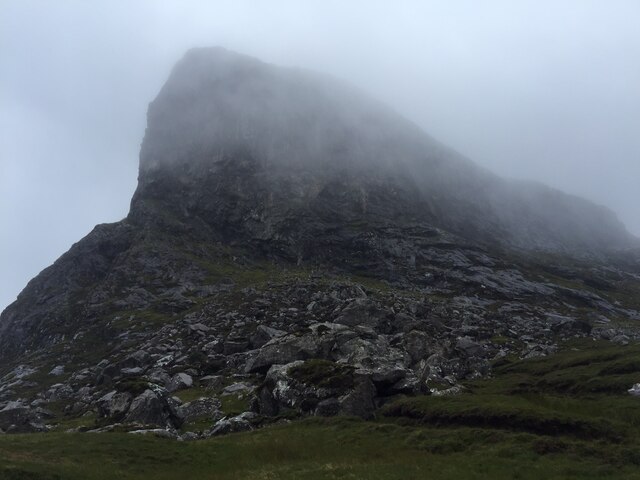
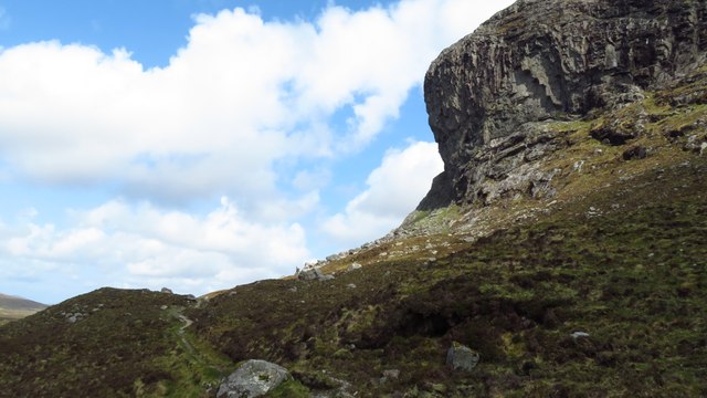
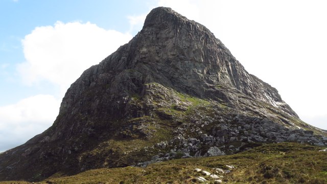
Feadan Dìrigil is a hill located in Inverness-shire, Scotland. It is part of the larger Scottish Highlands region and is known for its rugged and picturesque landscape. The hill stands at an elevation of 678 meters (2,224 feet) above sea level, making it a popular destination for hikers and outdoor enthusiasts.

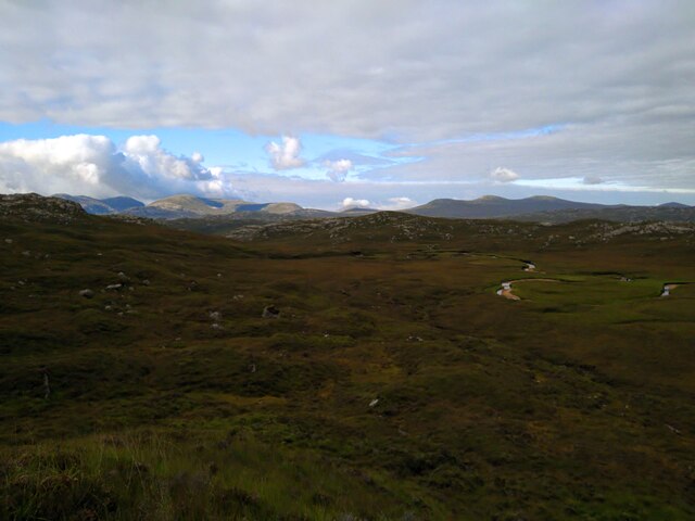
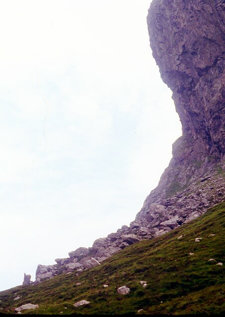
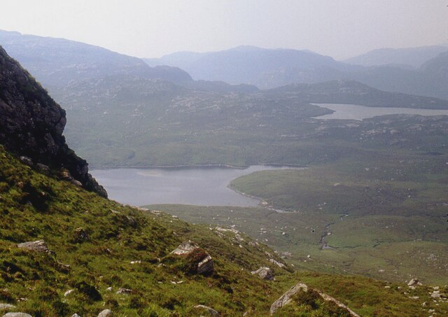
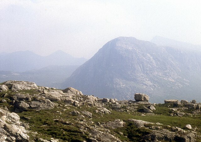
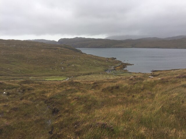
Feadan Dìrigil is characterized by its steep slopes and rocky terrain, offering a challenging yet rewarding hiking experience for those who venture to its summit. The hill is surrounded by stunning views of the surrounding countryside, including nearby lochs and forests.

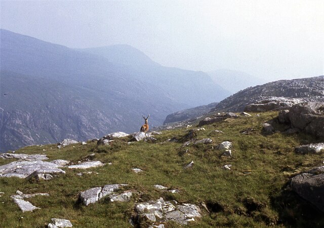
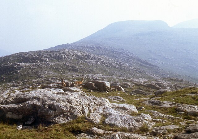
The name Feadan Dìrigil translates to "stream of the dyer," likely referring to a stream or water feature that flows near the hill. The area is rich in wildlife, with opportunities to spot various bird species, deer, and other native animals.

Overall, Feadan Dìrigil is a beautiful and rugged hill in the Scottish Highlands, offering visitors a chance to immerse themselves in the natural beauty of the region and enjoy a challenging outdoor adventure.

If you have any feedback on the listing, please let us know in the comments section below.

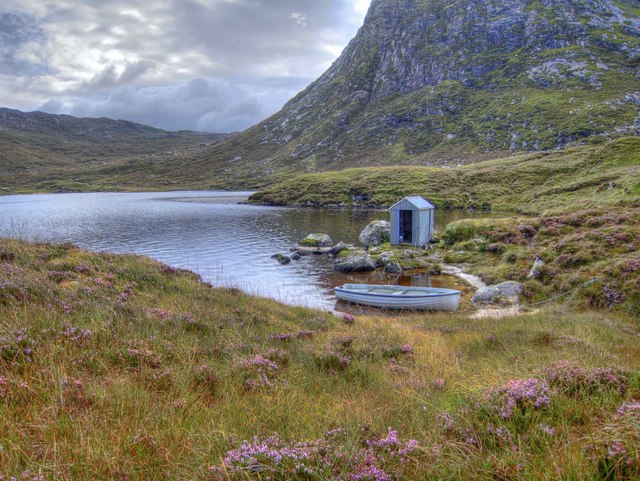
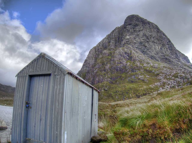
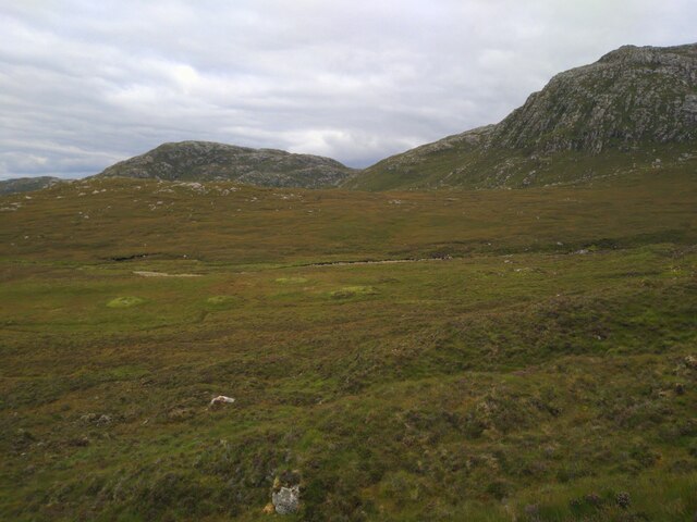
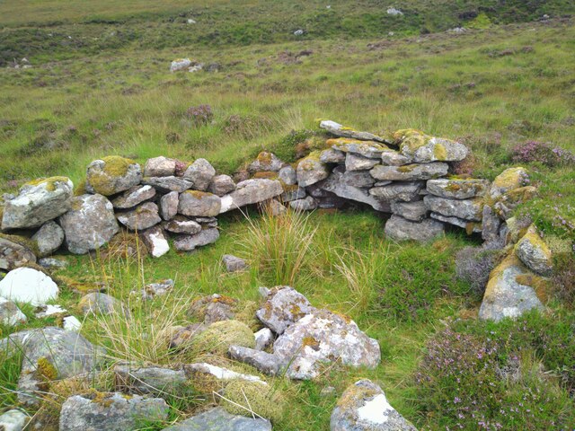
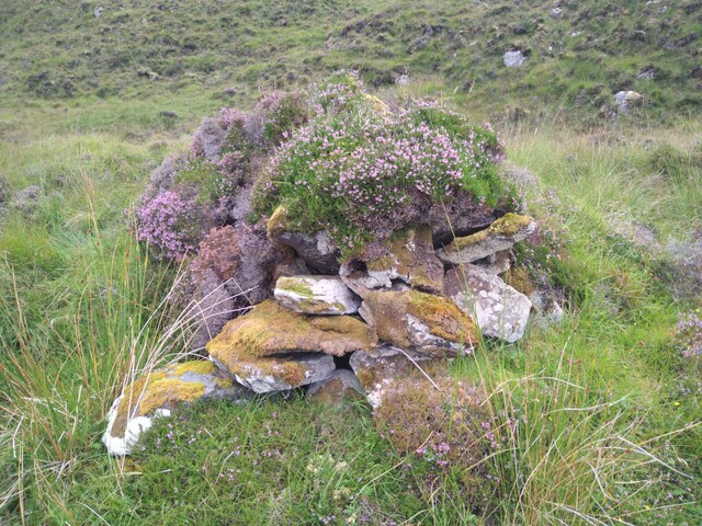
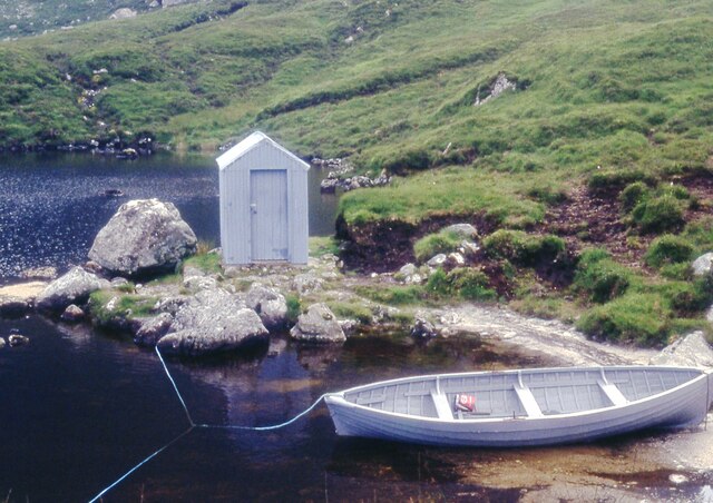
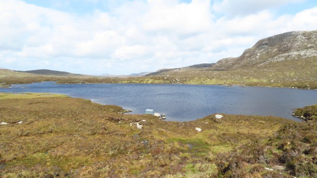
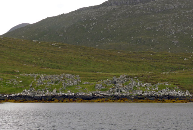
Feadan Dìrigil Images

Images are sourced within 2km of 58.030356/-6.9647668 or Grid Reference NB0715. Thanks to Geograph Open Source API. All images are credited.

Boat and fishing hut on Loch Uladail The boat and fishing hut on the famous Loch Uladail
Boat and fishing hut on Loch Uladail
The boat and fishing hut on the famous Loch Uladail
Fishing hut on Loch Uladail The fishing hut and big overhang on Loch Uladail
Fishing hut on Loch Uladail
The fishing hut and big overhang on Loch Uladail
Overview of Ruined Beehive Dwellings in Gleann Bhearraraigh Looking down on ruined beehive dwellings in Gleann Bhearraraigh, coming from Loch Uiseader.
Overview of Ruined Beehive Dwellings in Gleann Bhearraraigh
Looking down on ruined beehive dwellings in Gleann Bhearraraigh, coming from Loch Uiseader.
Ruined Beehive Dwelling in Gleann Bhearraraigh Ruined beehive dwelling, one of the best preserved in the area. Part of a group of eight or so (most others are heavily overgrown).
Ruined Beehive Dwelling in Gleann Bhearraraigh
Ruined beehive dwelling, one of the best preserved in the area. Part of a group of eight or so (most others are heavily overgrown).
Gleann Bhearraraigh Beehive Cell The most complete beehive cell in Gleann Bhearraraigh. Roof is partially collapsed and it is heavily overgrown.
Gleann Bhearraraigh Beehive Cell
The most complete beehive cell in Gleann Bhearraraigh. Roof is partially collapsed and it is heavily overgrown.
Looking North Over Gleann Bhearraraigh View North over Gleann Bhearraraigh to the Uig hills beyond.
Looking North Over Gleann Bhearraraigh
View North over Gleann Bhearraraigh to the Uig hills beyond.
Overhanging buttress on Sròn Uladail
Fishing bothy on Loch Uladail
Loch Brunabhal and Loch na Gillean
On Feadan Dìrigil Sròn Uladail beyond.
On Feadan Dìrigil
Sròn Uladail beyond.
Deer on Màs a' Chnoic Chuairtich
Deer on Creagan Leathan
Sron Uladail in mist The main buttress of Sron Uladail in atmospheric mist from the path to Loch Reasort.
Sron Uladail in mist
The main buttress of Sron Uladail in atmospheric mist from the path to Loch Reasort.
Old Shielings at Dirascal Abandoned shielings at Dirascal between Cravadale and Loch Reasort (water in background).
Old Shielings at Dirascal
Abandoned shielings at Dirascal between Cravadale and Loch Reasort (water in background).
The Nose of Strone Ulladale This cliff face has the claim as having the biggest rock overhang in the British Isles.
The Nose of Strone Ulladale
This cliff face has the claim as having the biggest rock overhang in the British Isles.
The Nose of Strone Ulladale
Loch Uladail, Harris
The derelict houses at Dirascal This would have been a very harsh environment to make a living.
The derelict houses at Dirascal
This would have been a very harsh environment to make a living.
Show me another place!

Feadan Dìrigil is located at Grid Ref: NB0715 (Lat: 58.030356, Lng: -6.9647668)

Unitary Authority: Na h-Eileanan an Iar

Police Authority: Highlands and Islands

What 3 Words

///rationed.march.slips. Near Tarbert, Na h-Eileanan Siar

Related Wikis

Uladail

Uladail is a location near Amhuinnsuidhe, on Harris in the Outer Hebrides, Scotland. Sron Ulladail is a sheer cliff which at 370 metres (1,210 ft) is one...

Tiorga Mor

Tiorga Mor (679 m) is a mountain in Harris, in the Outer Hebrides of Scotland. The most westerly peak of the high mountains of Harris, it is a very rugged...

Oireabhal

Oireabhal (662 m) is a mountain in Harris, in the Outer Hebrides of Scotland. The peak is the highest point on a complex ridge that runs from north to...

Chliostair Hydro-Electric Scheme

Chliostair Hydro-Electric Scheme is a small scheme promoted by the North of Scotland Hydro-Electric Board on Harris, Outer Hebrides. It consists of a single...

Nearby Amenities

Located within 500m of 58.030356,-6.9647668
Feadan Dìrigil
Ele: 240
Natural: peak
Source: OS7
Lat/Long: 58.0295529/-6.9622345
The data included in this document is from www.openstreetmap.org. The data is made available under ODbL.

Have you been to Feadan Dìrigil?

Leave your review of Feadan Dìrigil below (or comments, questions and feedback).