Cleit a' Ghobha

Hill, Mountain in Inverness-shire

Scotland

Cleit a' Ghobha

Tràigh Scarasta in 1981 The foreground is now a golf course.
Tràigh Scarasta in 1981 Credit: Sandy Gerrard

Cleit a' Ghobha, also known as Cleit Ghobhainn, is a hill located in Inverness-shire, Scotland. It is situated near the village of Roybridge, approximately 11 miles northeast of Fort William. With an elevation of 738 meters (2,421 feet), it is classified as a Corbett, which is a Scottish hill between 2,500 and 3,000 feet in height.

Cleit a' Ghobha offers breathtaking panoramic views of the surrounding landscape, including the Nevis Range and the Grey Corries. Its location within the Lochaber Geopark, a UNESCO Global Geopark, adds to its natural beauty and geological significance. The hill is part of the Lochaber National Scenic Area, attracting outdoor enthusiasts such as hikers, mountaineers, and nature lovers.

The ascent of Cleit a' Ghobha is relatively straightforward, with various routes available to suit different abilities and preferences. The most popular route begins from the east, starting at the Corriechoille Farm and following a path through a picturesque glen before ascending to the summit. The hill's slopes are mostly covered in heather and grass, offering a pleasant and enjoyable climb.

At the summit, visitors are rewarded with stunning views of the surrounding mountains, including the iconic Ben Nevis, the highest peak in the British Isles. On a clear day, one can also see the Great Glen, Loch Lochy, and Loch Laggan from this vantage point.

Overall, Cleit a' Ghobha is a scenic and accessible hill in Inverness-shire, providing visitors with a memorable outdoor experience and a chance to appreciate the natural beauty of the Scottish Highlands.

If you have any feedback on the listing, please let us know in the comments section below.

Cleit a' Ghobha Images

Images are sourced within 2km of 57.815842/-7.0470353 or Grid Reference NG0091. Thanks to Geograph Open Source API. All images are credited.
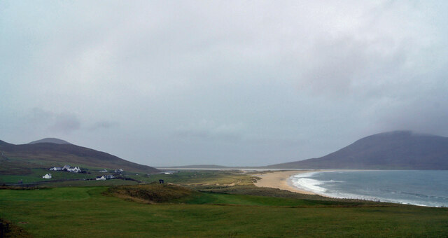
Tràigh Scarasta in 1981 The foreground is now a golf course.
Tràigh Scarasta in 1981
The foreground is now a golf course.
Coastal view of Harris
Lagoon near Northton A tidal lagoon with fine white sand. Ceapabhal is hiding its head in the low cloud.
Lagoon near Northton
A tidal lagoon with fine white sand. Ceapabhal is hiding its head in the low cloud.
Tràigh an Taoibh Thuath The name just means 'north side beach'. It is a tidal lagoon with fine white sand and fringed by saltmarsh.
Tràigh an Taoibh Thuath
The name just means 'north side beach'. It is a tidal lagoon with fine white sand and fringed by saltmarsh.
Isle of Harris Golf Club Looking south-west over the course with Scarista beach beyond.
Isle of Harris Golf Club
Looking south-west over the course with Scarista beach beyond.
The A859 in Harris, Outer Hebrides The main road up the island.
The A859 in Harris, Outer Hebrides
The main road up the island.
Spaniels on the ascent of Maodal Although it's only 823 feet high the approach to the summit is fairly steep. It was on this cloud enshrouded hill at around 1037hrs on the 30th of April 1990 that an AEW* Shackleton from 8 Sqn based at RAF Lossiemouth commenced a right hand turn and initiated a climb with disastrous consequences, striking the hill some 30 feet below the summit. All ten men on board were killed instantly on impact. I had personal friends on board that aircraft and the poignancy of the visit to the hill this day is almost palpable.   
*(Airborne Early Warning)
Spaniels on the ascent of Maodal
Although it's only 823 feet high the approach to the summit is fairly steep. It was on this cloud enshrouded hill at around 1037hrs on the 30th of April 1990 that an AEW* Shackleton from 8 Sqn based at RAF Lossiemouth commenced a right hand turn and initiated a climb with disastrous consequences, striking the hill some 30 feet below the summit. All ten men on board were killed instantly on impact. I had personal friends on board that aircraft and the poignancy of the visit to the hill this day is almost palpable. *(Airborne Early Warning)
In cloud again - Whisky Romeo 965 A former 8 Squadron aircrew member visits the crash site of AEW Shackleton WR965 which crashed here on 30th April 1990 claiming the lives of all 10 souls aboard. Atop the cairn you can see part of WR965's aerial system, a distinctive Shackleton feature. Situated on top of the fuselage amidst the four Rolls Royce Mk 58 Griffon engines, crews would tell an unsuspecting public that this was a giant spark plug which fed the engines! In reality it is a defunct ECM* aerial.

*(Electronic counter measures)
In cloud again - Whisky Romeo 965
A former 8 Squadron aircrew member visits the crash site of AEW Shackleton WR965 which crashed here on 30th April 1990 claiming the lives of all 10 souls aboard. Atop the cairn you can see part of WR965's aerial system, a distinctive Shackleton feature. Situated on top of the fuselage amidst the four Rolls Royce Mk 58 Griffon engines, crews would tell an unsuspecting public that this was a giant spark plug which fed the engines! In reality it is a defunct ECM* aerial. *(Electronic counter measures)
A memento of Whisky Romeo 965 on Maodal An ECM aerial (Electronic Counter Measures) stands on top of the cairn which is found at the site of the tragedy of 30th April 1990 when an AEW Shackleton of 8 Squadron impacted 30 feet below the surface of Maodal. Situated on top of the fuselage amidst the four Rolls Royce Mk 58 Griffon engines, crews would tell an unsuspecting public that this was a giant spark plug which fed the engines!
A memento of Whisky Romeo 965 on Maodal
An ECM aerial (Electronic Counter Measures) stands on top of the cairn which is found at the site of the tragedy of 30th April 1990 when an AEW Shackleton of 8 Squadron impacted 30 feet below the surface of Maodal. Situated on top of the fuselage amidst the four Rolls Royce Mk 58 Griffon engines, crews would tell an unsuspecting public that this was a giant spark plug which fed the engines!
Tràigh an Taoibh Thuath Looking northwest to the lower slopes of Ceapabhal across the sand from the A859, which is also NCN780. The clear vein across the lower part of the hill is Chaipaval [Ceapabhal] pegmatite, a Precambrian intrusion into these archaic rocks, that has been worked for feldspar.
Tràigh an Taoibh Thuath
Looking northwest to the lower slopes of Ceapabhal across the sand from the A859, which is also NCN780. The clear vein across the lower part of the hill is Chaipaval [Ceapabhal] pegmatite, a Precambrian intrusion into these archaic rocks, that has been worked for feldspar.
Tràigh an Taoibh Thuath Looking across the bay to Ceaoabhal, with its vein of pegmatite.
Tràigh an Taoibh Thuath
Looking across the bay to Ceaoabhal, with its vein of pegmatite.
Tràigh an Taoibh Thuath Looking north into the Sound of Taransay/Caolas Tharasaigh and hills of North Harris.
Tràigh an Taoibh Thuath
Looking north into the Sound of Taransay/Caolas Tharasaigh and hills of North Harris.
Roadside quarry on Maodal By the A859 north of Northton on Harris.
Roadside quarry on Maodal
By the A859 north of Northton on Harris.
Scarista beach seen through lifting cloud Cloud lifting as I approached the top of Ceapabhal ("KEEP-a-val").
Scarista beach seen through lifting cloud
Cloud lifting as I approached the top of Ceapabhal ("KEEP-a-val").
Scarista beach
Scarista beach
Grassy shore of tidal pond near Taobh Tuath
Tràigh an Taoibh Thuath, Isle of Harris
View from the A859 near Northton/Taobh Tuath
Show me another place!

Cleit a' Ghobha is located at Grid Ref: NG0091 (Lat: 57.815842, Lng: -7.0470353)

Unitary Authority: Na h-Eileanan an Iar

Police Authority: Highlands and Islands

What 3 Words

///bitters.sleeper.joys. Near Leverburgh, Na h-Eileanan Siar

Related Wikis

1990 Scotland RAF Shackleton crash

On 30 April 1990, a Royal Air Force Avro Shackleton AEW Mk II aircraft, of No. 8 Squadron RAF, based at RAF Lossiemouth, crashed into a hill on the Isle...

Borve, Harris

Borve (Scottish Gaelic: Na Buirgh) is a village in Harris in the Outer Hebrides, Scotland. Borve is also within the parish of Harris, and is on the A859...

Leverburgh

Leverburgh (Scottish Gaelic: An t-Òb [ən̪ˠ ˈt̪ɔːp]) is the second largest village, after Tarbert, in Harris in the Outer Hebrides of Scotland. Leverburgh...

Ensay (Outer Hebrides)

Ensay (Gaelic Easaigh) is a currently unpopulated and privately owned island in the Outer Hebrides of Scotland. The island lies in the Sound of Harris...

Nearby Amenities

Located within 500m of 57.815842,-7.0470353
Cleit a' Ghobha
Alt Name: Clett a' Ghobha
Ele: 128
Natural: peak
Lat/Long: 57.8158784/-7.0471307
Passing Place
Lat/Long: 57.8158387/-7.0552662
Passing Place
Lat/Long: 57.8169206/-7.054617
Material: wood
Power: pole
Lat/Long: 57.8189019/-7.0531597
Material: wood
Power: pole
Lat/Long: 57.8184262/-7.0535299
Material: wood
Power: pole
Lat/Long: 57.8178233/-7.0540046
Material: wood
Power: pole
Lat/Long: 57.8164804/-7.0545572
Material: wood
Power: pole
Lat/Long: 57.8158204/-7.0548415
Material: wood
Power: pole
Lat/Long: 57.8151575/-7.0551151
The data included in this document is from www.openstreetmap.org. The data is made available under ODbL.

Have you been to Cleit a' Ghobha?

Leave your review of Cleit a' Ghobha below (or comments, questions and feedback).