Ward Hill

Hill, Mountain in Cornwall

England

Ward Hill

Church Point
Church Point Credit: David Lally

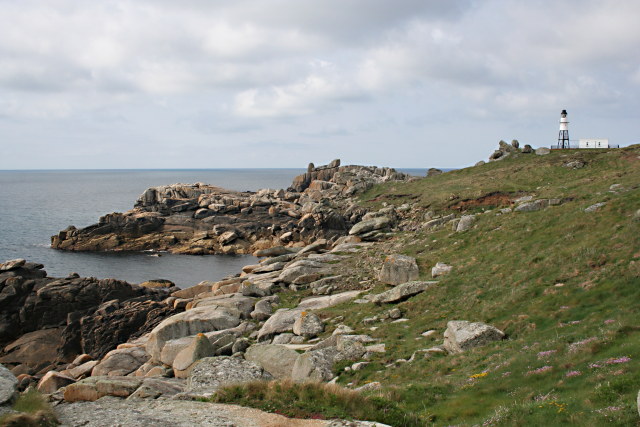
Ward Hill is an imposing hill located in the county of Cornwall, England. Standing at an elevation of 384 meters (1,260 feet), it is considered one of the prominent peaks in the region. Nestled within the Bodmin Moor, Ward Hill offers breathtaking panoramic views of the surrounding landscape.

The hill is characterized by its rugged and rocky terrain, covered in heather and gorse. Its distinctive appearance is the result of its formation during the Carboniferous period, when volcanic activity shaped the landscape. Ward Hill is also home to a rich variety of flora and fauna, including several species of birds, reptiles, and mammals that thrive in this unique habitat.

The hill holds historical significance as well, with evidence of Bronze Age settlements found in its vicinity. Archaeological remains, such as burial mounds and stone circles, provide insights into the ancient civilizations that once occupied this area. These historical remnants, coupled with its natural beauty, make Ward Hill a popular destination for hikers, nature enthusiasts, and history buffs alike.

Visitors can explore Ward Hill via various walking trails that wind through the moorland. These trails offer a chance to experience the tranquility of the countryside while taking in the breathtaking views from the hill's summit. Additionally, the hill serves as a starting point for longer treks, providing access to other notable landmarks and attractions in the region.

Ward Hill, with its rugged beauty, rich history, and scenic vistas, stands as an emblem of Cornwall's natural splendor and cultural heritage.

If you have any feedback on the listing, please let us know in the comments section below.
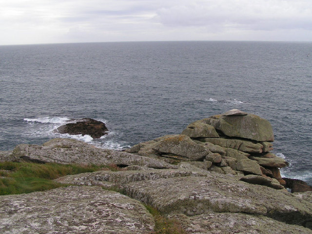
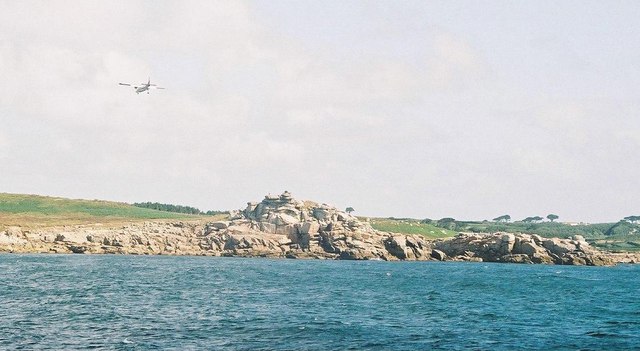
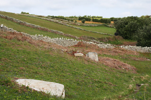
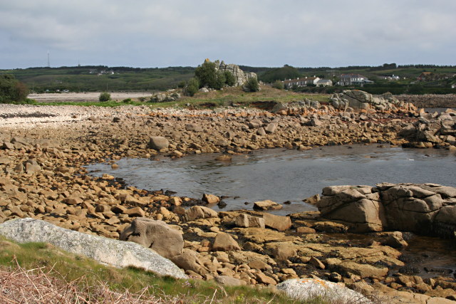
Ward Hill Images

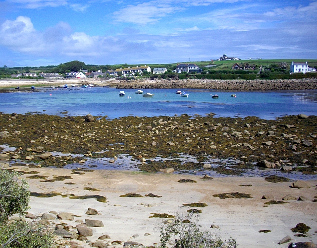
Images are sourced within 2km of 49.913459/-6.2932579 or Grid Reference SV9110. Thanks to Geograph Open Source API. All images are credited.

Church Point
Church Point
Pillbox entrance On Tolman Point.
Pillbox entrance
On Tolman Point.
Rock formations at Peninnis Head
Morning Point, the Garrison Looking SE to the offshore rocks Wras and (behind and smaller) Biggal; Inner Head <a href="https://www.geograph.org.uk/gridref/SV908093">SV908093</a> (part of Peninnis Head) is just visible to the far left, on the other side of Porth Cressa bay. Note the passing storm on the horizon...
Morning Point, the Garrison
Looking SE to the offshore rocks Wras and (behind and smaller) Biggal; Inner Head SV908093 (part of Peninnis Head) is just visible to the far left, on the other side of Porth Cressa bay. Note the passing storm on the horizon...
Peninnis Head Looking SSE to the lighthouse from approx. SV910097.
Peninnis Head
Looking SSE to the lighthouse from approx. SV910097.
Old Town Bay from Peninnis There is a former Battery on the island to the right of the pine tree.
Old Town Bay from Peninnis
There is a former Battery on the island to the right of the pine tree.
Tolman Point Viewed from the north on the very edge of the square; note the WW2 pillbox.
Tolman Point
Viewed from the north on the very edge of the square; note the WW2 pillbox.
Church Point The end of Church Point (just below the end of the main runway of St Mary's Airport) looking out to sea; this (and a rock off the end of Giant's Castle) is the only land in the square.
Church Point
The end of Church Point (just below the end of the main runway of St Mary's Airport) looking out to sea; this (and a rock off the end of Giant's Castle) is the only land in the square.
Lighthouse at Peninnis Head, St. Mary's The lighthouse guides shipping passing through St. Mary's Sound, between the islands of Agnes and St. Mary's.  The lattice-work construction reduces its wind resistance.
Lighthouse at Peninnis Head, St. Mary's
The lighthouse guides shipping passing through St. Mary's Sound, between the islands of Agnes and St. Mary's. The lattice-work construction reduces its wind resistance.
St. Mary’s: Peninnis Point Viewed from the ferry from Penzance shortly before arrival on the island.
St. Mary’s: Peninnis Point
Viewed from the ferry from Penzance shortly before arrival on the island.
St. Mary’s: plane over Church Point A plane approaches Scilly's airport, viewed from the ferry from Penzance.
St. Mary’s: plane over Church Point
A plane approaches Scilly's airport, viewed from the ferry from Penzance.
Photographing the Rock Labyrinth The area between the lighthouse and the Outer Head is appropriately known as the Rock Labyrinth. In younger (and slimmer) days we would explore this fantastic maze of huge granite rocks.
Photographing the Rock Labyrinth
The area between the lighthouse and the Outer Head is appropriately known as the Rock Labyrinth. In younger (and slimmer) days we would explore this fantastic maze of huge granite rocks.
Carn Leh, St. Mary's, Scilly Isles
Footpath on Peninnis Head, St. Mary's, Scilly Isles
Granite Stone Walls Granite is pretty much the only rock there is on the Scillies and there's plenty of it, so it makes sense to build your field walls out of it.
Granite Stone Walls
Granite is pretty much the only rock there is on the Scillies and there's plenty of it, so it makes sense to build your field walls out of it.
Fields on the eastern side of Peninnis The field at the bottom of the hill on the right is being used for bulb growing, the others look as though they have been left to grass.
Fields on the eastern side of Peninnis
The field at the bottom of the hill on the right is being used for bulb growing, the others look as though they have been left to grass.
Carn Leh Cove The headland of Carn Leh separates this small cove from the larger Old Town Bay.
Carn Leh Cove
The headland of Carn Leh separates this small cove from the larger Old Town Bay.
Peninnis Head Looking towards the Outer Head and the Lighthouse.
Peninnis Head
Looking towards the Outer Head and the Lighthouse.
Show me another place!

Ward Hill is located at Grid Ref: SV9110 (Lat: 49.913459, Lng: -6.2932579)

Division: Isles of Scilly

Unitary Authority: Isles of Scilly

Police Authority: Devon and Cornwall

What 3 Words

///audit.assorted.recording. Near St Mary's, Isles of Scilly

Related Wikis

St Mary's Airport, Isles of Scilly

St Mary's Airport or Isles of Scilly Airport (IATA: ISC, ICAO: EGHE) is an airport located 1 nautical mile (1.9 km; 1.2 mi) east of Hugh Town on St Mary...

Old Town, Isles of Scilly

Old Town (Cornish: Treveglos "church town") is a village on St Mary's in the Isles of Scilly located southeast of Hugh Town. It is thought to be the oldest...

Giant's Castle, Isles of Scilly

The Giant's Castle is a promontory fort of the Iron Age, on St Mary's, Isles of Scilly, England. It is a scheduled monument. == Description == The fort...

Porth Hellick

Porth Hellick (Cornish: Porth Helyk, meaning Willow Cove) is a tidal inlet on the south coast of St Mary’s, the largest island in the Isles of Scilly....

Nearby Amenities

Located within 500m of 49.913459,-6.2932579
Source: PGS
Lat/Long: 49.911774/-6.2959825
Source: PGS
Lat/Long: 49.9117838/-6.2969706
Source: PGS
Lat/Long: 49.9114692/-6.2975095
Old Town
Name Kw: Treveglos
Old Name: Porth Ennor
Place: village
Wikidata: Q601396
Wikipedia: en:Old Town, Isles of Scilly
Lat/Long: 49.9126007/-6.3000067
Restaurant
Tolman
Alt Name: Bayview
Contact Phone: +44 1720 423060
Lat/Long: 49.9114146/-6.2991029
Post Box
Ref: TR21 24
Lat/Long: 49.9142512/-6.2948692
Telephone
Phone: +44 1720 422383
Lat/Long: 49.9125077/-6.2998405
Post Box
Ref: TR21 9
Lat/Long: 49.9126707/-6.299869
Barrier: bollard
Bicycle: yes
Foot: yes
Lat/Long: 49.9132193/-6.2993232
Porth Minick
Natural: bay
Lat/Long: 49.9104668/-6.2952926
Salakee Down
Place: locality
Lat/Long: 49.9126221/-6.2870477
Ward Hill
Natural: peak
Lat/Long: 49.912515/-6.2889735
Mainmark Rock
Place: islet
Lat/Long: 49.9104734/-6.2935923
Shop: convenience
Lat/Long: 49.9138402/-6.2993531
Parking
Parking: surface
Lat/Long: 49.9141071/-6.2994599
Tolman Point
Place: locality
Lat/Long: 49.9106922/-6.2976232
Salakee
Place: isolated_dwelling
Lat/Long: 49.9162889/-6.290671
Cafe
Airport Cafe
Lat/Long: 49.9140647/-6.2948947
Tourism: zoo
Lat/Long: 49.9113406/-6.2991627
Turning Circle
Lat/Long: 49.9137011/-6.2912165
Aeroway: gate
Ref: 5
Lat/Long: 49.9144147/-6.2941699
Aeroway: gate
Ref: 4
Lat/Long: 49.9142325/-6.2943979
Aeroway: gate
Ref: 6
Lat/Long: 49.9138397/-6.2948869
Aeroway: gate
Ref: 3
Lat/Long: 49.9138383/-6.2945655
Aeroway: gate
Ref: 2
Lat/Long: 49.9138437/-6.2942381
Aeroway: gate
Ref: 1
Lat/Long: 49.9138422/-6.2938978
Power: pole
Transformer: distribution
Lat/Long: 49.9162711/-6.2922022
Power: pole
Lat/Long: 49.9166329/-6.2926286
Power: pole
Lat/Long: 49.9172227/-6.2932616
Power: pole
Lat/Long: 49.9177995/-6.2946001
Power: pole
Lat/Long: 49.9140379/-6.2998284
Power: pole
Transformer: distribution
Lat/Long: 49.9154118/-6.2994173
Generator Method: photovoltaic
Generator Output Electricity: yes
Generator Source: solar
Generator Type: solar_photovoltaic_panel
Power: generator
Lat/Long: 49.9130689/-6.2987347
Generator Method: photovoltaic
Generator Output Electricity: yes
Generator Source: solar
Generator Type: solar_photovoltaic_panel
Power: generator
Lat/Long: 49.9146726/-6.2958285
Generator Method: photovoltaic
Generator Output Electricity: yes
Generator Source: solar
Generator Type: solar_photovoltaic_panel
Power: generator
Lat/Long: 49.9147303/-6.2958776
Generator Method: photovoltaic
Generator Output Electricity: yes
Generator Source: solar
Generator Type: solar_photovoltaic_panel
Power: generator
Lat/Long: 49.9148004/-6.2959372
Aeroway: holding_position
Holding Position Type: runway
Lat/Long: 49.9144369/-6.2938792
Seamark Landmark Category: mast
Seamark Light Colour: red
Seamark Type: landmark
Lat/Long: 49.9121829/-6.2918749
Aeroway: holding_position
Holding Position Type: intermediate
Ref: H
Lat/Long: 49.9135622/-6.2946083
Parking Space
Lat/Long: 49.9144389/-6.2951275
Parking Space
Lat/Long: 49.9143927/-6.2951337
Parking Space
Lat/Long: 49.9143475/-6.2951398
Parking Space
Lat/Long: 49.9143033/-6.2951457
Parking Space
Lat/Long: 49.9142573/-6.2951518
Parking Space
Lat/Long: 49.9142115/-6.295158
Parking Space
Lat/Long: 49.914954/-6.2955346
Parking Space
Lat/Long: 49.9149355/-6.2955223
Parking Space
Lat/Long: 49.9149149/-6.2955086
Parking Space
Lat/Long: 49.9148932/-6.2954942
Parking Space
Lat/Long: 49.9148754/-6.2954823
Parking Space
Lat/Long: 49.9148561/-6.2954695
Parking Space
Lat/Long: 49.9148377/-6.2954573
Parking Space
Lat/Long: 49.9148156/-6.2954426
Parking Space
Lat/Long: 49.9147951/-6.2954289
Parking Space
Lat/Long: 49.9147763/-6.2954165
Parking Space
Lat/Long: 49.9147551/-6.2954023
Parking Space
Lat/Long: 49.914728/-6.2953843
Parking Space
Lat/Long: 49.9147022/-6.2953671
Parking Space
Lat/Long: 49.9149714/-6.2955462
Parking Space
Lat/Long: 49.9146761/-6.2953497
Parking Space
Parking Space: disabled
Lat/Long: 49.9144921/-6.2951204
The data included in this document is from www.openstreetmap.org. The data is made available under ODbL.

Have you been to Ward Hill?

Leave your review of Ward Hill below (or comments, questions and feedback).