Burabhal

Hill, Mountain in Inverness-shire

Scotland

Burabhal

Eaval (Eabhal) from Burabhal, North Uist Eaval, 347m, is the highest point on North Uist. Loch Obasaraigh, seen here, is a major obstacle to the ascent of Eaval, and there are basically two routes: a very awkward one from the south-west*, and this one from the north. This starts at Saighdinis <a href="https://www.geograph.org.uk/gridref/NF8863">NF8863</a> and involves a long sweep round the east side of the loch, passing Burabhal on the way. Climbing Burabhal, 141m, is an optional extra! Once the hill is reached, at the extreme left of this photo, things become easier and the ridge can be followed to the top.

* For an indication of the problems, see my <a href="https://www.geograph.org.uk/photo/2538382">NF8960 : Eaval summit, looking to the south-west cairn</a>. Imagine trying to thread your way through all those lochans, without even the benefit of a view from above!
Eaval (Eabhal) from Burabhal, North Uist Credit: Michael Earnshaw

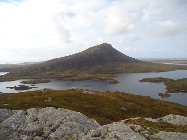
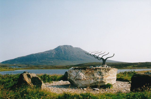
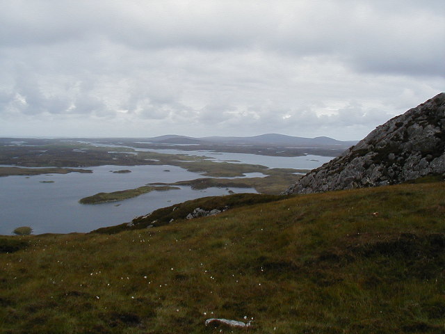
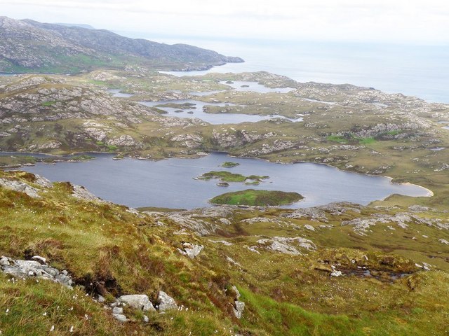
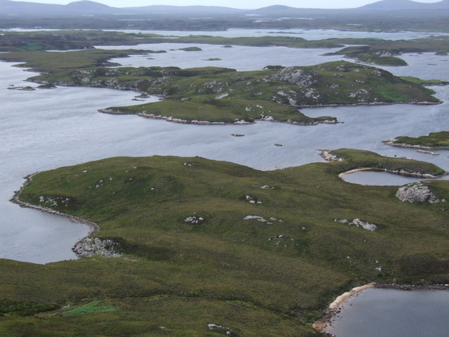
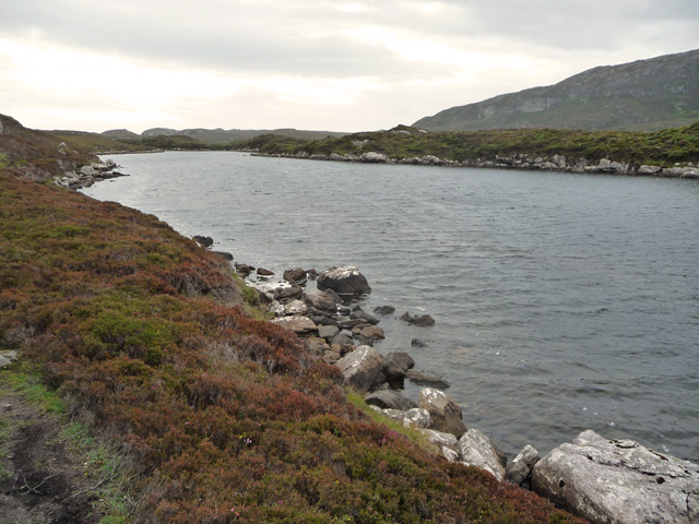
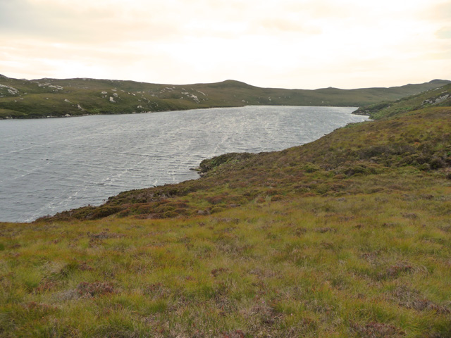
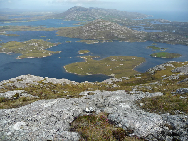
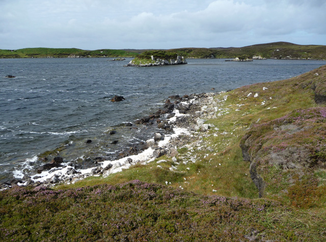
Burabhal is a prominent hill located in the county of Inverness-shire, Scotland. It is situated near the village of Leverburgh on the Isle of Harris, in the Outer Hebrides. With an elevation of approximately 586 meters (1,923 feet), Burabhal offers breathtaking panoramic views of the surrounding landscape.

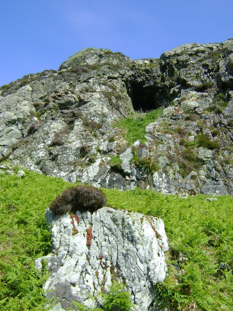
The hill is well-known for its distinctive shape, featuring a steep and rocky face that provides a challenging terrain for hikers and climbers. Its rugged slopes are covered in heather and grass, creating a picturesque scene that changes with the seasons. The summit of Burabhal is marked by a cairn, serving as a navigational point for outdoor enthusiasts.

Burabhal is a popular destination for outdoor activities such as hillwalking and birdwatching. The hill is home to a variety of bird species, including golden eagles, peregrine falcons, and red-throated divers. The surrounding area also boasts a rich diversity of flora and fauna, adding to its natural beauty.

In addition to its natural attractions, Burabhal holds historical significance. It is believed to have been used as a ceremonial site by ancient inhabitants, with evidence of prehistoric settlements in the vicinity. The hill's name, Burabhal, is derived from the Gaelic language, reflecting its cultural heritage.

Access to Burabhal is relatively straightforward, with several paths and trails leading to its summit. However, caution is advised as the weather conditions can change rapidly, and proper hiking equipment is recommended. Despite the challenges, the reward of reaching the top of Burabhal is an unforgettable experience, offering breathtaking views of the surrounding countryside and a connection to the rich history and natural wonders of Inverness-shire.

If you have any feedback on the listing, please let us know in the comments section below.
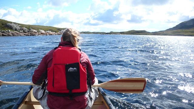
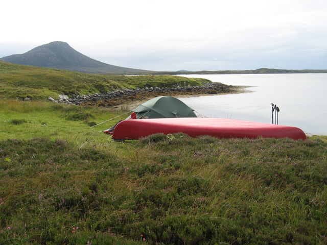
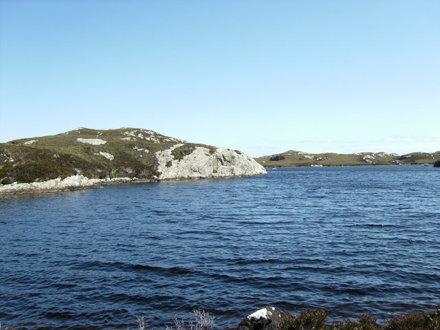
Burabhal Images

Images are sourced within 2km of 57.54399/-7.1679672 or Grid Reference NF9062. Thanks to Geograph Open Source API. All images are credited.

Eaval (Eabhal) from Burabhal, North Uist Eaval, 347m, is the highest point on North Uist. Loch Obasaraigh, seen here, is a major obstacle to the ascent of Eaval, and there are basically two routes: a very awkward one from the south-west*, and this one from the north. This starts at Saighdinis <a href="https://www.geograph.org.uk/gridref/NF8863">NF8863</a> and involves a long sweep round the east side of the loch, passing Burabhal on the way. Climbing Burabhal, 141m, is an optional extra! Once the hill is reached, at the extreme left of this photo, things become easier and the ridge can be followed to the top.

* For an indication of the problems, see my <a href="https://www.geograph.org.uk/photo/2538382">NF8960 : Eaval summit, looking to the south-west cairn</a>. Imagine trying to thread your way through all those lochans, without even the benefit of a view from above!
Eaval (Eabhal) from Burabhal, North Uist
Eaval, 347m, is the highest point on North Uist. Loch Obasaraigh, seen here, is a major obstacle to the ascent of Eaval, and there are basically two routes: a very awkward one from the south-west*, and this one from the north. This starts at Saighdinis NF8863 and involves a long sweep round the east side of the loch, passing Burabhal on the way. Climbing Burabhal, 141m, is an optional extra! Once the hill is reached, at the extreme left of this photo, things become easier and the ridge can be followed to the top. * For an indication of the problems, see my NF8960 : Eaval summit, looking to the south-west cairn. Imagine trying to thread your way through all those lochans, without even the benefit of a view from above!
Sculpture at the end of the road One of the sculptures at the end of the road. Literally at the very end of the road along Loch Euphort.
Sculpture at the end of the road
One of the sculptures at the end of the road. Literally at the very end of the road along Loch Euphort.
View NW from the slopes of Burabhal Loch Obasaraigh is to the left.
View NW from the slopes of Burabhal
Loch Obasaraigh is to the left.
Loch a Ghlinne-dorca from slopes of Burabhal
Anchorage in Loch Eyport
East end of Loch Obasaraigh, looking to Burabhal The bay at the E end of Loch Obasaraigh with the top of Burabhal clearly visible.  A quick an easy way into the hill of Eaval with the use of the canoe.  The spit of land in the background is clearly visible on the map.
East end of Loch Obasaraigh, looking to Burabhal
The bay at the E end of Loch Obasaraigh with the top of Burabhal clearly visible. A quick an easy way into the hill of Eaval with the use of the canoe. The spit of land in the background is clearly visible on the map.
South side of the island Eilean Leathann Canoeing into Eaval we passed South of the island Eilean Leathann, which you see off the persons left shoulder.  The ridge of Eaval in the distance
South side of the island Eilean Leathann
Canoeing into Eaval we passed South of the island Eilean Leathann, which you see off the persons left shoulder. The ridge of Eaval in the distance
Camp site to the South of South Lee Lovely view South to Eaval, but the midges were awful!
Camp site to the South of South Lee
Lovely view South to Eaval, but the midges were awful!
Rock feature Rock feature on Loch a'Ghlinne-dorcha
Rock feature
Rock feature on Loch a'Ghlinne-dorcha
View from Eaval Towards the western end of Loch Obasaraigh, with Burrival on the left
View from Eaval
Towards the western end of Loch Obasaraigh, with Burrival on the left
Eileann Leathan from Eabhal
East end of Loch Obasaraigh From the path below Burabhal. The land to the right is one of the smaller of the islands in the loch. The lower slopes of Eabhal are in the distance.
East end of Loch Obasaraigh
From the path below Burabhal. The land to the right is one of the smaller of the islands in the loch. The lower slopes of Eabhal are in the distance.
Loch Surtavat The loch lies right at the foot of Eabhal and discharges into the much larger Loch Obasaraigh.
Loch Surtavat
The loch lies right at the foot of Eabhal and discharges into the much larger Loch Obasaraigh.
Eastern slope of Eabhal Looking out from the exposed rocks of Eabhal across Loch Obasaraigh and its islands to Burribhal and Li a Deas.
Eastern slope of Eabhal
Looking out from the exposed rocks of Eabhal across Loch Obasaraigh and its islands to Burribhal and Li a Deas.
Loch Obasaraigh A prolonged fresh southerly wind is creating spume from the loch and blowing it onto the northern shores.
Loch Obasaraigh
A prolonged fresh southerly wind is creating spume from the loch and blowing it onto the northern shores.
Beach at the south east of Loch Obasaraigh Course sand generated by the large body of wind agitated fresh water.
Beach at the south east of Loch Obasaraigh
Course sand generated by the large body of wind agitated fresh water.
Burabhal Cave It is told that Bonnie Prince Charlie once used this cave to hide from the Red Coats.
Burabhal Cave
It is told that Bonnie Prince Charlie once used this cave to hide from the Red Coats.
Camel Rock
Camel Rock
Show me another place!

Burabhal is located at Grid Ref: NF9062 (Lat: 57.54399, Lng: -7.1679672)

Unitary Authority: Na h-Eileanan an Iar

Police Authority: Highlands and Islands

What 3 Words

///marker.voltages.honest. Near Lochmaddy, Na h-Eileanan Siar

Nearby Locations

Burabhal Bàgh a' Bhiorain

Related Wikis

Flodaigh Mòr

Flodaigh Mòr (or Floddaymore) is an uninhabited island in the Outer Hebrides of Scotland. == Geography and geology == Flodaigh Mòr lies east of North Uist...

Taigh Chearsabhagh

Taigh Chearsabhagh is an arts centre and museum in Lochmaddy on the island of North Uist, Scotland. Taigh Chearsabhagh was built in 1741 and originally...

Lochmaddy

Lochmaddy (Scottish Gaelic: Loch nam Madadh [l̪ˠɔx nə ˈmat̪əɣ], "Loch of the Hounds") is the administrative centre of North Uist in the Outer Hebrides...

Fraoch-Eilean

Fraoch-eilean is a small island with an uncertain population north of Benbecula in the Outer Hebrides of Scotland. It is about 55 hectares (140 acres...

Nearby Amenities

Located within 500m of 57.54399,-7.1679672
Burabhal
Corbett: no
Ele: 141
Graham: no
Marilyn: no
Munro: no
Name En: Burrival
Name Gd: Burabhal
Natural: peak
Lat/Long: 57.5442069/-7.1666088
Barrier: stile
Lat/Long: 57.5465465/-7.1746836
The data included in this document is from www.openstreetmap.org. The data is made available under ODbL.

Have you been to Burabhal?

Leave your review of Burabhal below (or comments, questions and feedback).