Beinn na h-Aire

Hill, Mountain in Inverness-shire

Scotland

Beinn na h-Aire

A burn drains the southeast side of Eabhal Islands litter the east coast waters off Uist
A burn drains the southeast side of Eabhal Credit: Alan Reid

Beinn na h-Aire is a prominent hill located in Inverness-shire, Scotland. It is situated in the western part of the county, approximately 7 miles northwest of the town of Fort Augustus. With an elevation of 818 meters (2,684 feet), it is classified as a Corbett, which is a Scottish mountain between 2,500 and 3,000 feet.

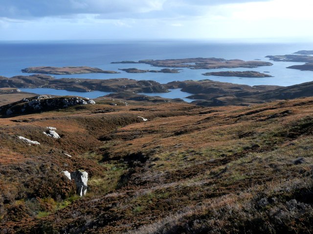
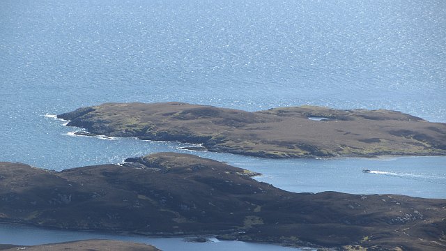
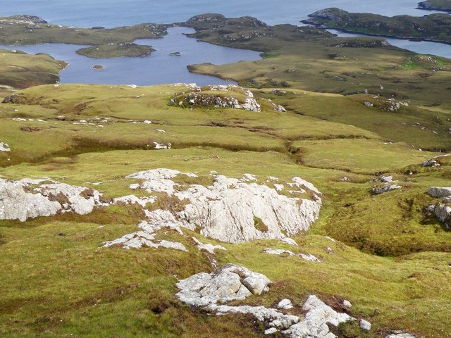
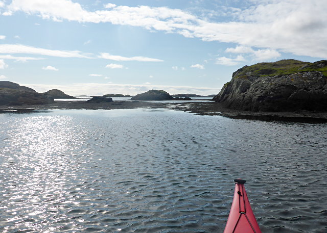
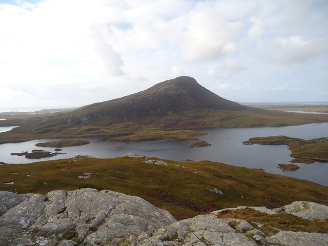
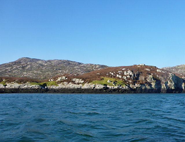
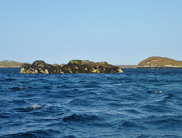
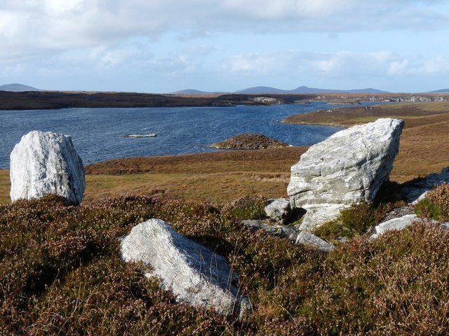
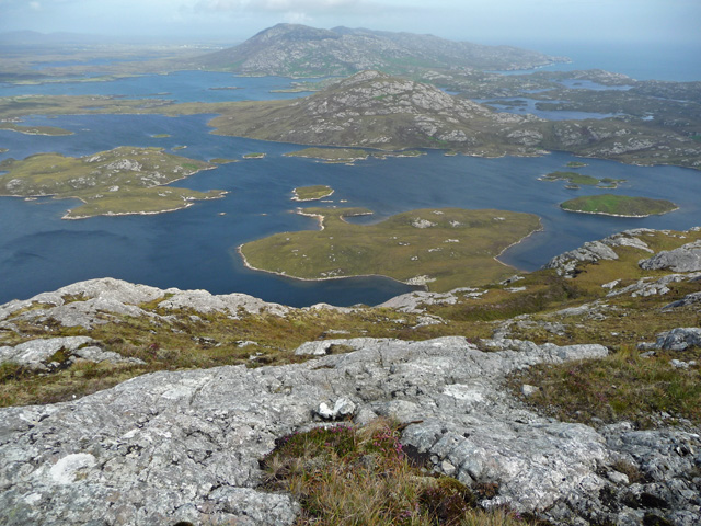
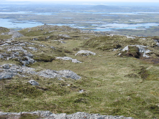
The hill offers breathtaking panoramic views of the surrounding landscape, including the Great Glen, Loch Ness, and the rugged mountains of the Scottish Highlands. Its location in the heart of the Highlands makes it a popular destination for hikers and outdoor enthusiasts.

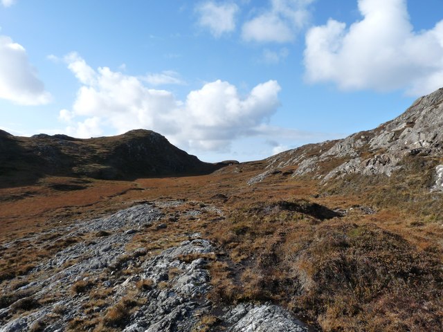
The ascent to the summit of Beinn na h-Aire is challenging but rewarding. The hill is characterized by steep slopes and rocky terrain, requiring some scrambling and navigation skills. However, the effort is well worth it, as the summit provides stunning vistas that stretch for miles.

The hill is home to a variety of flora and fauna, including heather, mosses, and lichens. Birdwatchers may spot species such as golden eagles, peregrine falcons, and red grouse in the area. Beinn na h-Aire is also part of a designated Special Area of Conservation, ensuring its preservation and protection.

Access to Beinn na h-Aire is relatively straightforward, with a designated walking route leading from Fort Augustus to the hill. It is recommended to check weather conditions before embarking on the ascent, as the Scottish Highlands are known for their changeable weather patterns.

If you have any feedback on the listing, please let us know in the comments section below.

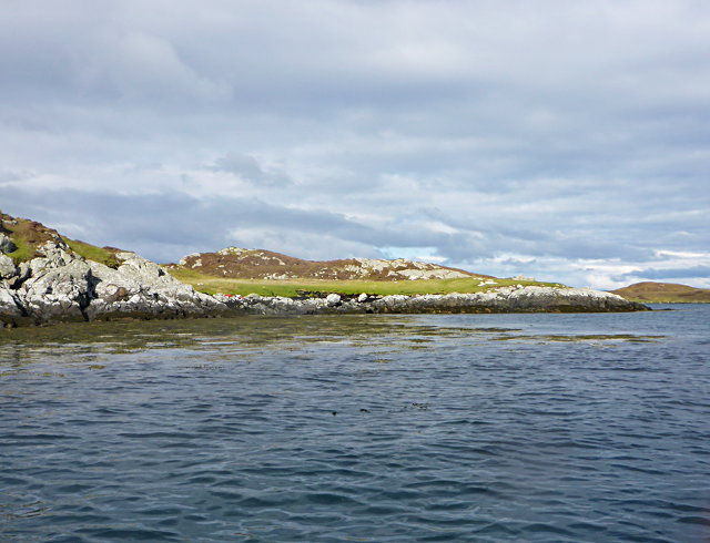
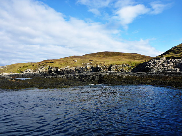
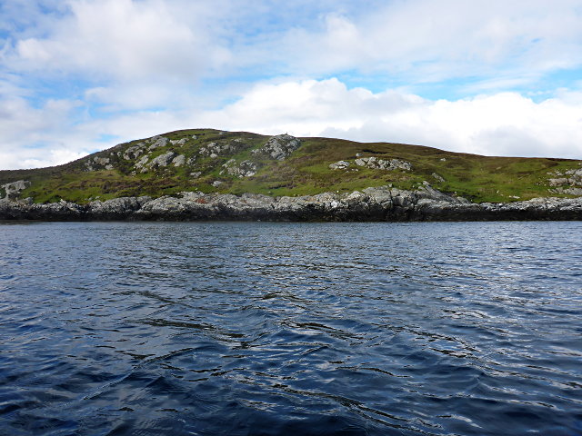
Beinn na h-Aire Images

Images are sourced within 2km of 57.51331/-7.1781803 or Grid Reference NF9058. Thanks to Geograph Open Source API. All images are credited.

A burn drains the southeast side of Eabhal Islands litter the east coast waters off Uist
A burn drains the southeast side of Eabhal
Islands litter the east coast waters off Uist
Flodaigh Beag Island off North Uist, view from Eabhal.
Flodaigh Beag
Island off North Uist, view from Eabhal.
Loch a' Gheàdais View from Eabhal.
Loch a' Gheàdais
View from Eabhal.
View from the slopes of Eaval Looking towards Loch a' Gheàdais, the small island on the right in the loch is a Dun
View from the slopes of Eaval
Looking towards Loch a' Gheàdais, the small island on the right in the loch is a Dun
Rocks south of Huanaraigh A shallow inlet of North Uist.
Rocks south of Huanaraigh
A shallow inlet of North Uist.
North Uist coastline facing Huanaraigh
Flodaigh Beag
Flodaigh Beag
Loch a' Gheàdais According to the map, there's a dun on the island in this freshwater loch, but little is evident from this vantage.
Loch a' Gheàdais
According to the map, there's a dun on the island in this freshwater loch, but little is evident from this vantage.
Duibh-eilean
Duibh-eilean
Eaval (Eabhal) from Burabhal, North Uist Eaval, 347m, is the highest point on North Uist. Loch Obasaraigh, seen here, is a major obstacle to the ascent of Eaval, and there are basically two routes: a very awkward one from the south-west*, and this one from the north. This starts at Saighdinis <a href="https://www.geograph.org.uk/gridref/NF8863">NF8863</a> and involves a long sweep round the east side of the loch, passing Burabhal on the way. Climbing Burabhal, 141m, is an optional extra! Once the hill is reached, at the extreme left of this photo, things become easier and the ridge can be followed to the top.

* For an indication of the problems, see my <a href="https://www.geograph.org.uk/photo/2538382">NF8960 : Eaval summit, looking to the south-west cairn</a>. Imagine trying to thread your way through all those lochans, without even the benefit of a view from above!
Eaval (Eabhal) from Burabhal, North Uist
Eaval, 347m, is the highest point on North Uist. Loch Obasaraigh, seen here, is a major obstacle to the ascent of Eaval, and there are basically two routes: a very awkward one from the south-west*, and this one from the north. This starts at Saighdinis NF8863 and involves a long sweep round the east side of the loch, passing Burabhal on the way. Climbing Burabhal, 141m, is an optional extra! Once the hill is reached, at the extreme left of this photo, things become easier and the ridge can be followed to the top. * For an indication of the problems, see my NF8960 : Eaval summit, looking to the south-west cairn. Imagine trying to thread your way through all those lochans, without even the benefit of a view from above!
Eilean Buidhe
Eilean Buidhe
Eilean nan Gearr The background hill is Eabhal.
Eilean nan Gearr
The background hill is Eabhal.
Islet off Eilean Dubh an Uan
A high col through the Eabhal ridge
South end of Loch Obasaraigh
Eastern slope of Eabhal Looking out from the exposed rocks of Eabhal across Loch Obasaraigh and its islands to Burribhal and Li a Deas.
Eastern slope of Eabhal
Looking out from the exposed rocks of Eabhal across Loch Obasaraigh and its islands to Burribhal and Li a Deas.
Eaval summit, looking to the south-west cairn Taken from the trig point at the summit.
Eaval summit, looking to the south-west cairn
Taken from the trig point at the summit.
Eastern slopes of Eabhal The hillside is made up of several rock ribs running along the fall line. There is some good scrambling higher up the hill.
Eastern slopes of Eabhal
The hillside is made up of several rock ribs running along the fall line. There is some good scrambling higher up the hill.
Show me another place!

Beinn na h-Aire is located at Grid Ref: NF9058 (Lat: 57.51331, Lng: -7.1781803)

Unitary Authority: Na h-Eileanan an Iar

Police Authority: Highlands and Islands

What 3 Words

///poorly.loving.hostels. Near Lochmaddy, Na h-Eileanan Siar

Related Wikis

Flodaigh Mòr

Flodaigh Mòr (or Floddaymore) is an uninhabited island in the Outer Hebrides of Scotland. == Geography and geology == Flodaigh Mòr lies east of North Uist...

Ronay

Ronay (Scottish Gaelic: Rònaigh) is an island in the Outer Hebrides of Scotland, which lies a short distance off the east coast of Grimsay. == Geography... ==

Fraoch-Eilean

Fraoch-eilean is a small island with an uncertain population north of Benbecula in the Outer Hebrides of Scotland. It is about 55 hectares (140 acres...

Grimsay

Grimsay (Scottish Gaelic: Griomasaigh) is a tidal island in the Outer Hebrides of Scotland. == Geography == Grimsay is the largest of the low-lying stepping...

Nearby Amenities

Located within 500m of 57.51331,-7.1781803
Beinn na h-Aire
Corbett: no
Ele: 145
Graham: no
Marilyn: no
Munro: no
Natural: peak
Lat/Long: 57.5137917/-7.176651
The data included in this document is from www.openstreetmap.org. The data is made available under ODbL.

Have you been to Beinn na h-Aire?

Leave your review of Beinn na h-Aire below (or comments, questions and feedback).