North Warren

Downs, Moorland in Suffolk East Suffolk

England

North Warren

Thorpeness: The Meare
Thorpeness: The Meare Credit: Andy Stephenson

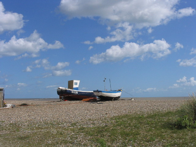
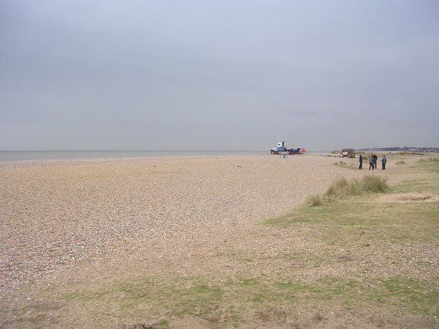
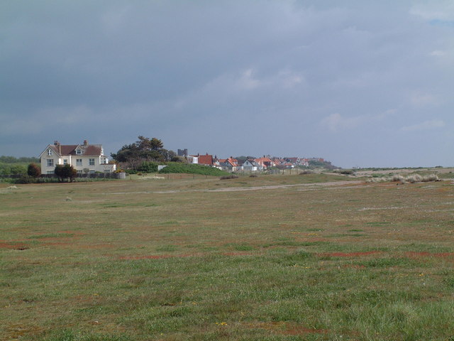
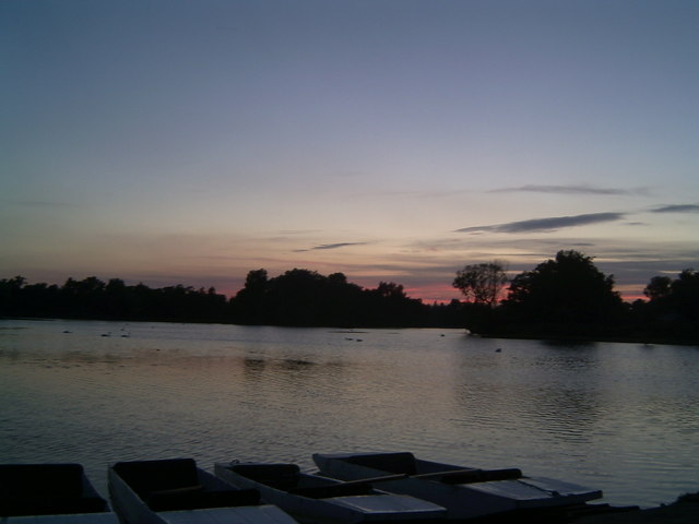
North Warren is a picturesque area located in Suffolk, England. Situated in the eastern part of the county, it encompasses both Downs and Moorland landscapes, offering visitors a diverse range of natural beauty to explore.

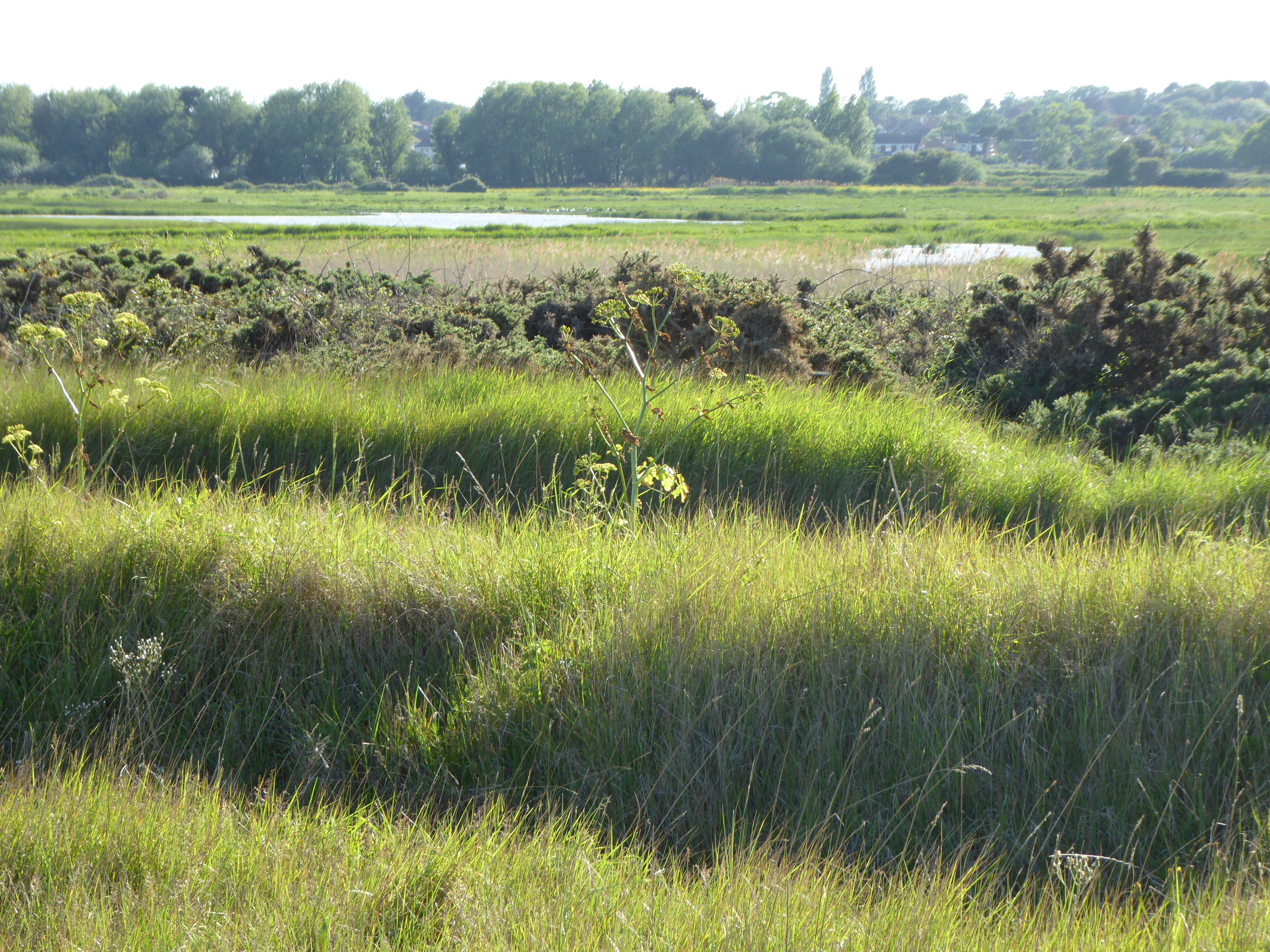
The Downs portion of North Warren features rolling hills and cliffs, providing stunning panoramic views of the surrounding countryside. The area is known for its lush green meadows, scattered with wildflowers, and is a haven for many species of birds and wildlife. Nature enthusiasts can enjoy hiking along the well-marked trails that wind through this tranquil landscape, taking in the fresh air and enjoying the peacefulness of the area.

On the other hand, the Moorland section of North Warren offers a distinctive contrast to the Downs. With its vast expanses of open heather-covered land, it presents a unique and rugged beauty. Moorland birds, such as curlews and lapwings, can be spotted here, and the area is also home to a variety of rare plants and insects.

North Warren is not only a paradise for nature lovers but also for history enthusiasts. It is renowned for its rich archaeological heritage, with numerous prehistoric sites scattered throughout the region. These include ancient burial mounds and remnants of Iron Age settlements, providing a glimpse into the area's past.

Overall, North Warren, Suffolk (Downs, Moorland) offers a captivating blend of natural landscapes, abundant wildlife, and historical significance. Whether seeking tranquility in the countryside, observing rare species of flora and fauna, or delving into the area's past, visitors will find North Warren to be a truly remarkable destination.

If you have any feedback on the listing, please let us know in the comments section below.
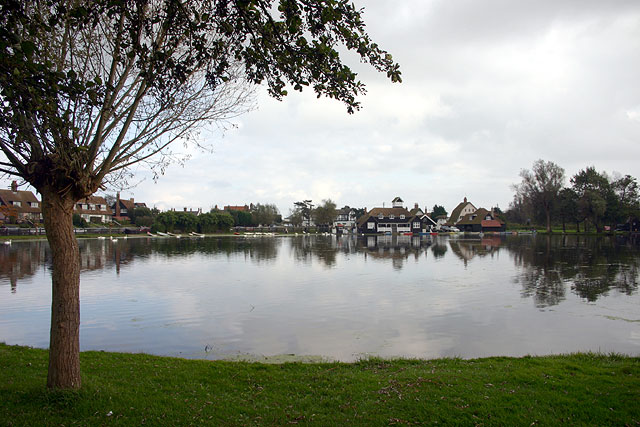
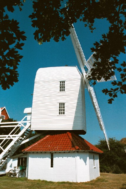
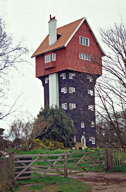
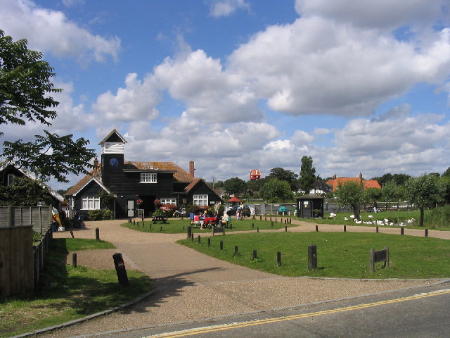
North Warren Images

Images are sourced within 2km of 52.175754/1.5897438 or Grid Reference TM4559. Thanks to Geograph Open Source API. All images are credited.

Thorpeness: The Meare
Fishing boats on the beach at Aldeburgh Early morning light over the North Sea
Fishing boats on the beach at Aldeburgh
Early morning light over the North Sea
Cows grazing in meadow Aldeburgh Suffolk Photograph taken near Aldeburgh
Cows grazing in meadow Aldeburgh Suffolk
Photograph taken near Aldeburgh
Windmill, Thorpeness, Suffolk
Tribute to Benjamin Britten : Words from Britten's Peter Grimes This sculpture, created by local artist Maggie Hamblin, resides on the beach at Aldeburgh. Although it caused some consternation when erected it now sits quietly, pondering over the sea and is now visited quite frequently. I have actually cheated in as much as the image is "flipped" in order to have the poetry reasonably legible against the setting sun (west) which is actually behind the piece. In reality, one needs to be facing seaward (east) to read the words.
Tribute to Benjamin Britten : Words from Britten's Peter Grimes
This sculpture, created by local artist Maggie Hamblin, resides on the beach at Aldeburgh. Although it caused some consternation when erected it now sits quietly, pondering over the sea and is now visited quite frequently. I have actually cheated in as much as the image is "flipped" in order to have the poetry reasonably legible against the setting sun (west) which is actually behind the piece. In reality, one needs to be facing seaward (east) to read the words.
The Haven, Thorpeness, Suffolk This is a wide embankment of shingle and dunes between North Sea and the marshes. Looking due south towards Aldeburgh.
The Haven, Thorpeness, Suffolk
This is a wide embankment of shingle and dunes between North Sea and the marshes. Looking due south towards Aldeburgh.
The House in the Clouds, near Thorpeness The House in the Clouds was built in 1923 as the Thorpeness water tower, disguised as a house to avoid it being an eyesore.  Originally it was a five storey house underneath the water tank, which itself was hidden by enclosing it in a house-like structure complete with pitched roof. Later, when Thorpeness was linked to a mains water supply, the tank inside was dismantled and the space turned into additional living accommodation making the house you see today.
The House in the Clouds, near Thorpeness
The House in the Clouds was built in 1923 as the Thorpeness water tower, disguised as a house to avoid it being an eyesore. Originally it was a five storey house underneath the water tank, which itself was hidden by enclosing it in a house-like structure complete with pitched roof. Later, when Thorpeness was linked to a mains water supply, the tank inside was dismantled and the space turned into additional living accommodation making the house you see today.
The Boathouse, Thorpeness, Suffolk Most of Thorpeness was built in 1920s as a holiday village. The boathouse serves The Meare (a boating lake) just visible in the background.
The Boathouse, Thorpeness, Suffolk
Most of Thorpeness was built in 1920s as a holiday village. The boathouse serves The Meare (a boating lake) just visible in the background.
Fishing boats, Thorpeness Beach, Suffolk
Sunset over Hazlewood Marshes, Aldeburgh, Suffolk Looking south-west from car park at Hazlewood Common towards the marshes (TM4357) with River Alde in background.
Sunset over Hazlewood Marshes, Aldeburgh, Suffolk
Looking south-west from car park at Hazlewood Common towards the marshes (TM4357) with River Alde in background.
Moth Sculpture One of a series of sculptures along the Sandlings Walk.
Moth Sculpture
One of a series of sculptures along the Sandlings Walk.
Aldeburgh Golf Club
Aldeburgh Golf Club
Do Not Disturb the Golfers There are well marked footpaths across the course, but they don't want you to stray off them!
Do Not Disturb the Golfers
There are well marked footpaths across the course, but they don't want you to stray off them!
The Meare, Thorpeness, Suffolk Looking west with the windmill and the 'house in the clouds' on the skyline.
The Meare, Thorpeness, Suffolk
Looking west with the windmill and the 'house in the clouds' on the skyline.
Beach at Thorpeness, Suffolk
The Haven What little of this grid square is not at sea lies to the east (right) of Haven House seen at the left of this photograph. Thorpeness is in the distance. Kite flying is banned on The Haven between 1 May and 1 August in order not to frighten away the ground nesting birds such as the ringed plover and skylark which frequent the short rough ground cover shown in the foreground.
The Haven
What little of this grid square is not at sea lies to the east (right) of Haven House seen at the left of this photograph. Thorpeness is in the distance. Kite flying is banned on The Haven between 1 May and 1 August in order not to frighten away the ground nesting birds such as the ringed plover and skylark which frequent the short rough ground cover shown in the foreground.
Sunset At Thorpeness Meare An unusual feature about this mere is that punts, seen in the foreground, are hired out as well as rowing boats.
Sunset At Thorpeness Meare
An unusual feature about this mere is that punts, seen in the foreground, are hired out as well as rowing boats.
Warren Hill Lane, Aldeburgh This private road leads to houses on the northern outskirts of Aldeburgh.
Warren Hill Lane, Aldeburgh
This private road leads to houses on the northern outskirts of Aldeburgh.
Show me another place!

North Warren is located at Grid Ref: TM4559 (Lat: 52.175754, Lng: 1.5897438)

Administrative County: Suffolk

District: East Suffolk

Police Authority: Suffolk

What 3 Words

///behind.change.reclusive. Near Aldeburgh, Suffolk

Nearby Locations

North Warren North Warren

Related Wikis

Aldringham cum Thorpe

Aldringham cum Thorpe is a civil parish in the East Suffolk district of Suffolk, England. Located south of the town of Leiston, the parish includes the...

Leiston - Aldeburgh

Leiston - Aldeburgh is a 534.8-hectare (1,322-acre) biological Site of Special Scientific Interest which stretches from Aldeburgh to Leiston in Suffolk...

Crag Pit, Aldeburgh

Crag Pit, Aldeburgh is a 0.2-hectare (0.49-acre) geological Site of Special Scientific Interest in Aldeburgh in Suffolk. It is a Geological Conservation...

The Red House, Aldeburgh

The Red House, in the coastal town of Aldeburgh, Suffolk, England, was the home of the composer Benjamin Britten, from 1957 until his death in 1976, and...

Nearby Amenities

Located within 500m of 52.175754,1.5897438
Bus Stop
North Warren
Bus: yes
Naptan AtcoCode: 390061120
Naptan Bearing: N
Naptan CommonName: North Warren
Naptan Indicator: adj
Naptan Landmark: North Warren
Naptan NaptanCode: sufjtajm
Naptan Street: Leiston Road
Naptan Verified: no
Public Transport: platform
Source: naptan_import
Lat/Long: 52.1740915/1.5859771
Bus Stop
North Warren
Bus: yes
Naptan AtcoCode: 390061121
Naptan Bearing: S
Naptan CommonName: North Warren
Naptan Indicator: opp
Naptan Landmark: North Warren
Naptan NaptanCode: sufjtajp
Naptan Street: Leiston Road
Naptan Verified: no
Public Transport: platform
Source: naptan_import
Lat/Long: 52.174082/1.5861609
Bench
Backrest: no
Material: wood
Seats: 3
Lat/Long: 52.1773285/1.5922538
Barrier: kissing_gate
Foot: yes
Lat/Long: 52.1774565/1.5892534
Bench
Backrest: no
Colour: brown
Material: wood
Seats: 3
Source: survey
Lat/Long: 52.1774706/1.5891958
Bench
Colour: brown
Material: wood
Seats: 3
Lat/Long: 52.1799264/1.5903544
The data included in this document is from www.openstreetmap.org. The data is made available under ODbL.

Have you been to North Warren?

Leave your review of North Warren below (or comments, questions and feedback).