Castle Green

Downs, Moorland in Suffolk East Suffolk

England

Castle Green

Orford  Castle  12th- century.  Only  the  keep  remains The curtain walls and towers were demolished in the 1590's. By the end of the 17th century the keep was a roofless shell. It passed through further private hands, the 3rd Marquess of Hertford reroofed the castle in 1831. In 1928 it was presented to Orford Town Trust and is now in the care of English Heritage
Orford Castle 12th- century. Only the keep remains Credit: Martin Dawes

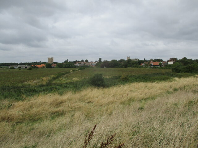
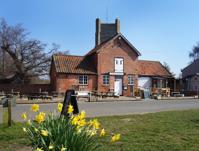
Castle Green is a picturesque area located in Suffolk, England. Situated amidst the beautiful Downs and Moorland, it offers a captivating landscape that attracts visitors from far and wide. The area is renowned for its natural beauty, with rolling hills, lush green meadows, and charming woodlands.

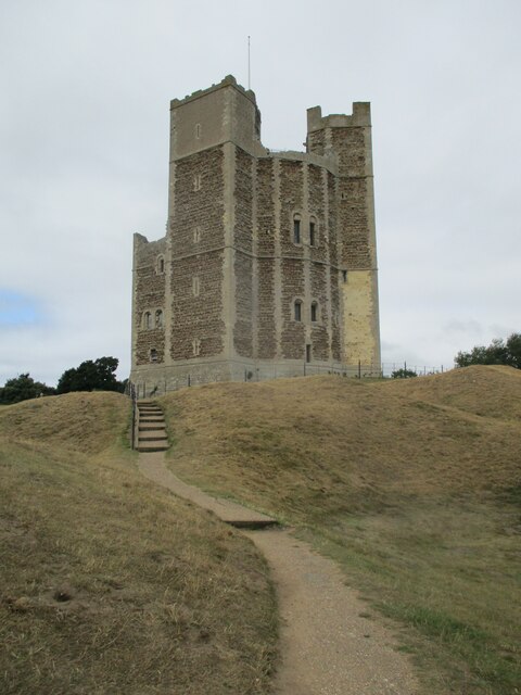
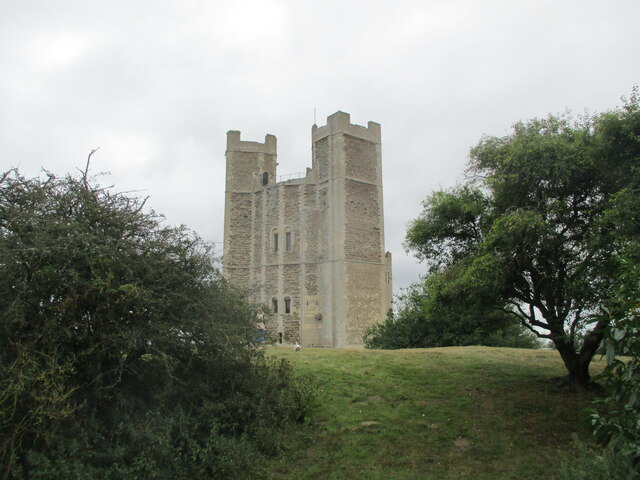
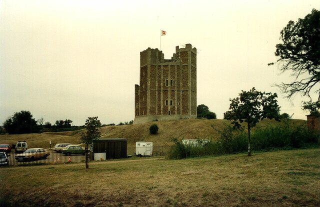
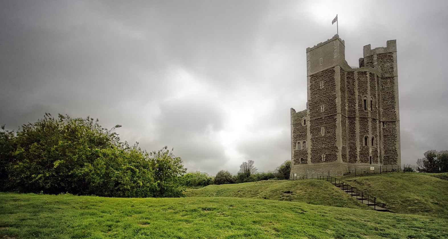
Castle Green derives its name from the historic castle ruins that once stood proudly on its grounds. These ruins are remnants of a medieval fortress that dates back to the 12th century. Today, they serve as a popular tourist attraction, allowing visitors to explore the rich history of the area.

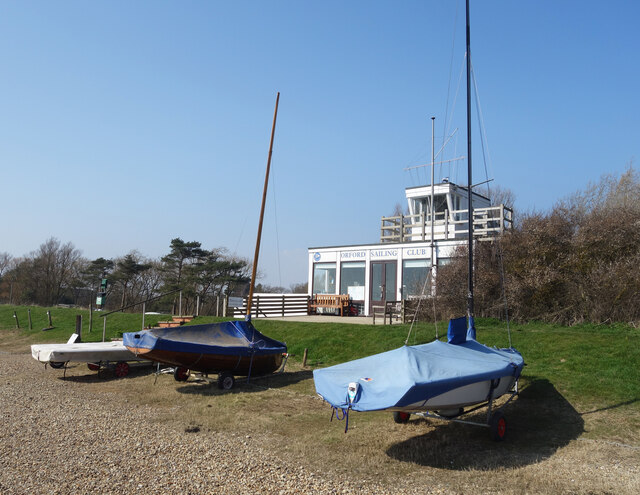
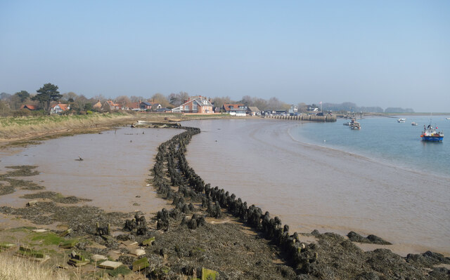
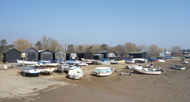
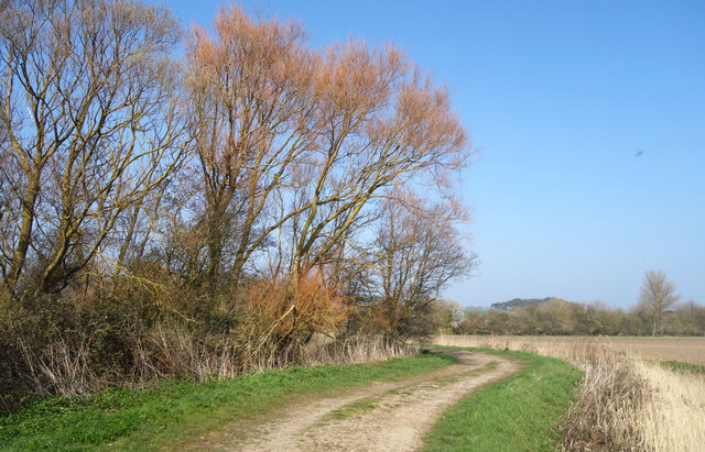
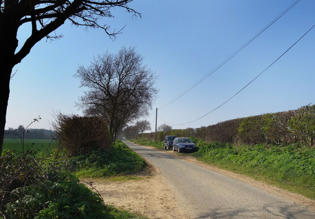
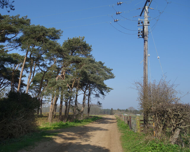
The Downs and Moorland surrounding Castle Green are a haven for nature enthusiasts. The diverse ecosystem supports a wide range of flora and fauna, making it a paradise for wildlife lovers and birdwatchers. Visitors can indulge in leisurely walks, hiking, and cycling, while immersing themselves in the tranquil surroundings.

The area is also a popular spot for picnics and family outings. The expansive meadows provide ample space for outdoor activities, while the woodlands offer shade and shelter. The peaceful atmosphere makes it an ideal destination for relaxation and rejuvenation.

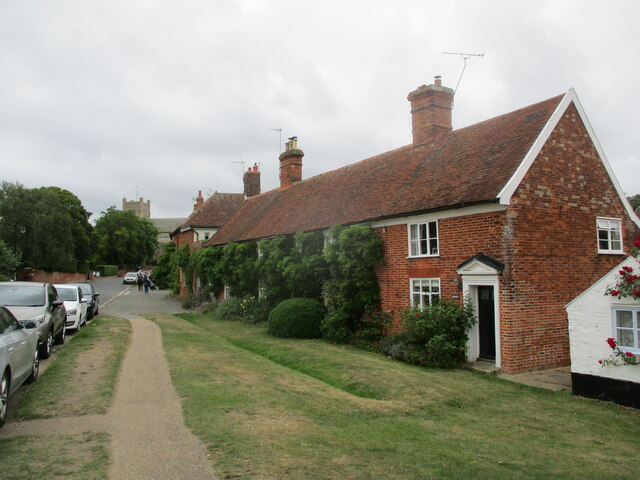
Castle Green is conveniently located near several charming villages and towns, offering visitors the opportunity to explore the local culture and heritage. The nearby market towns provide a range of amenities, including quaint shops, traditional pubs, and cozy cafes.

In conclusion, Castle Green, Suffolk, with its breathtaking natural beauty, rich history, and proximity to charming villages, is a must-visit destination for those seeking an idyllic countryside experience.

If you have any feedback on the listing, please let us know in the comments section below.

Castle Green Images

Images are sourced within 2km of 52.093945/1.5302574 or Grid Reference TM4149. Thanks to Geograph Open Source API. All images are credited.

Orford  Castle  12th- century.  Only  the  keep  remains The curtain walls and towers were demolished in the 1590's. By the end of the 17th century the keep was a roofless shell. It passed through further private hands, the 3rd Marquess of Hertford reroofed the castle in 1831. In 1928 it was presented to Orford Town Trust and is now in the care of English Heritage
Orford Castle 12th- century. Only the keep remains
The curtain walls and towers were demolished in the 1590's. By the end of the 17th century the keep was a roofless shell. It passed through further private hands, the 3rd Marquess of Hertford reroofed the castle in 1831. In 1928 it was presented to Orford Town Trust and is now in the care of English Heritage
Orford  Castle  from  the  Outer  Bank
Orford Castle from the Outer Bank
Orford  from  the  top  of  Orford  Castle The parish church of St Bartholomew stands tall
Orford from the top of Orford Castle
The parish church of St Bartholomew stands tall
River  Ore  toward  quay  and  ferry  terminal Long abandoned boats stuck in the mud.
River Ore toward quay and ferry terminal
Long abandoned boats stuck in the mud.
Over  marshes  to  Orford  from  River  Ore  floodbank Castle to left, St Bartholomew parish church to the right
Over marshes to Orford from River Ore floodbank
Castle to left, St Bartholomew parish church to the right
Row  of  cottages  on  Church  Street  Orford St Bartholomew parish church beyond
Row of cottages on Church Street Orford
St Bartholomew parish church beyond
Orford Castle <span class="nowrap"><a title="https://historicengland.org.uk/listing/the-list/list-entry/1014860?section=official-listing" rel="nofollow ugc noopener" href="https://historicengland.org.uk/listing/the-list/list-entry/1014860?section=official-listing">Link</a><img style="margin-left:2px;" alt="External link" title="External link - shift click to open in new window" src="https://s1.geograph.org.uk/img/external.png" width="10" height="10"/></span>
Orford Castle
Church Street, Orford St Bartholomew's Church at the top of the road leading up from the waterfront.
Church Street, Orford
St Bartholomew's Church at the top of the road leading up from the waterfront.
Orford Craft Centre
Orford Craft Centre
Orford Sailing Club
Orford Sailing Club
Stakes in the Mud Like some fossilised prehistoric snaky thing, the remains of a bygone wooden structure are exposed in the mud at low tide. 
An earlier attempt at coastal defence at a guess.
Stakes in the Mud
Like some fossilised prehistoric snaky thing, the remains of a bygone wooden structure are exposed in the mud at low tide. An earlier attempt at coastal defence at a guess.
Boats on the Beach Small boats up on the foreshore near Orford Sailing Club.
Boats on the Beach
Small boats up on the foreshore near Orford Sailing Club.
Abandoned Old Boats Poor old things. I always wonder what the story is behind scenes like this.
The foreshore at Orford on the non sailing club side.
Abandoned Old Boats
Poor old things. I always wonder what the story is behind scenes like this. The foreshore at Orford on the non sailing club side.
Gate onto Gedgrave Marshes The public footpath comes down off the levee and heads inland. 
Gedgrave is a small rural parish with a population of 30 at  the last count. It once had a church, St Andrew's, but that's gone and the parish is now just a few scattered houses, including Gedgrave Hall.
<span class="nowrap"><a title="https://en.wikipedia.org/wiki/Gedgrave" rel="nofollow ugc noopener" href="https://en.wikipedia.org/wiki/Gedgrave">Link</a><img style="margin-left:2px;" alt="External link" title="External link - shift click to open in new window" src="https://s1.geograph.org.uk/img/external.png" width="10" height="10"/></span>
Gate onto Gedgrave Marshes
The public footpath comes down off the levee and heads inland. Gedgrave is a small rural parish with a population of 30 at the last count. It once had a church, St Andrew's, but that's gone and the parish is now just a few scattered houses, including Gedgrave Hall. LinkExternal link
Drain on Gedgrave Marshes One of the many channels draining the marsh.
Drain on Gedgrave Marshes
One of the many channels draining the marsh.
Tree Colours on Gedgrave Marshes Willow trees coming back to life after the winter.
Tree Colours on Gedgrave Marshes
Willow trees coming back to life after the winter.
Gedgrave Road A no through road leading to Gedgrave Hall and a few other houses.
The soil is very sandy round here.
Gedgrave Road
A no through road leading to Gedgrave Hall and a few other houses. The soil is very sandy round here.
Track past Pine Trees Away from the marshes by the coast the land is dry and sandy.
Track past Pine Trees
Away from the marshes by the coast the land is dry and sandy.
Show me another place!

Castle Green is located at Grid Ref: TM4149 (Lat: 52.093945, Lng: 1.5302574)

Administrative County: Suffolk

District: East Suffolk

Police Authority: Suffolk

What 3 Words

///bookshop.sniff.mops. Near Aldeburgh, Suffolk

Related Wikis

Orford Castle

Orford Castle is a castle in Orford in the English county of Suffolk, 12 miles (19 km) northeast of Ipswich, with views over Orford Ness. It was built...
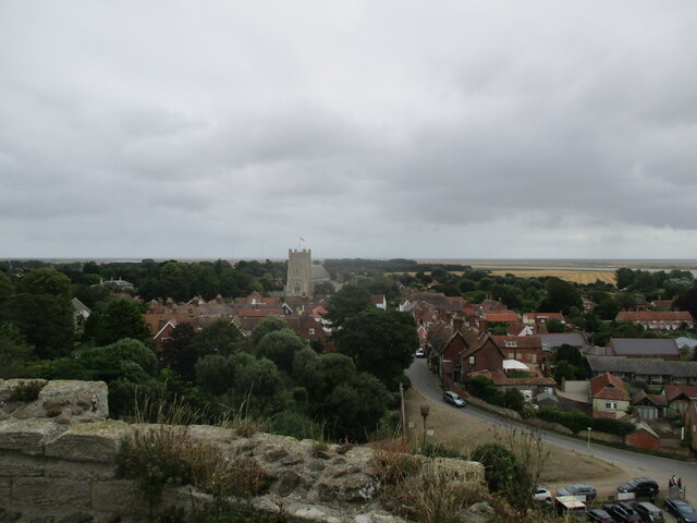
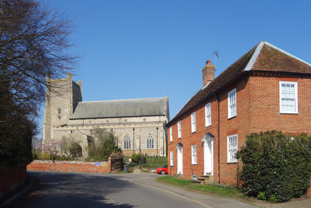
Orford, Suffolk

Orford is a village in Suffolk, England, within the Suffolk Coast and Heaths Area of Outstanding Natural Beauty. It is 9 miles (14 km) east of Woodbridge...

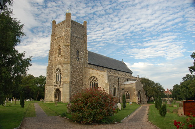
St Bartholomew's Church, Orford

The Church of St Bartholomew is the parish church of the town of Orford, England. A medieval church, dating from the fourteenth century, with reconstructions...

Richmond Farm Pit, Gedgrave

Richmond Farm Pit, Gedgrave is a 0.57-hectare (1.4-acre) geological Site of Special Scientific Interest south-west of Orford in Suffolk. It is a Geological...

Nearby Amenities

Located within 500m of 52.093945,1.5302574
Orford
Place: town
Wikidata: Q2486348
Wikipedia: en:Orford, Suffolk
Lat/Long: 52.0949765/1.5344399
Bus Stop
School
Bus: yes
Naptan AtcoCode: 390060497
Naptan Bearing: S
Naptan BusStopType: CUS
Naptan CommonName: School
Naptan Indicator: opp
Naptan Landmark: School
Naptan NaptanCode: sufgptwd
Naptan Street: Front Street
Naptan Verified: no
Public Transport: platform
Source: naptan_import
Lat/Long: 52.0971666/1.5314716
Bus Stop
Market Hill
Bus: yes
Naptan AtcoCode: 390060499
Naptan Bearing: W
Naptan CommonName: Market Hill
Naptan Indicator: adj
Naptan Landmark: Market Hill
Naptan NaptanCode: sufgptwj
Naptan Street: Market Hill
Naptan Verified: no
Public Transport: platform
Source: naptan_import
Lat/Long: 52.0946646/1.5339171
Power: pole
Lat/Long: 52.0938247/1.5256929
Power: pole
Lat/Long: 52.0962154/1.5285726
Power: pole
Lat/Long: 52.0945841/1.5265918
Power: pole
Lat/Long: 52.0953675/1.5275557
Telephone
Booth: K6
Covered: booth
Listed Status: Grade II
Phone: +44 1394 450242
Lat/Long: 52.0946391/1.5340819
Addr Housenumber: 83
Addr Postcode: IP12 2LH
Addr Street: Market Hill
Lat/Long: 52.0944608/1.5329456
Post Office
Orford Post Office
Addr City: Woodbridge
Addr Housename: Orford General Stores
Addr Village: Orford
Brand: Post Office
Brand Wikidata: Q1783168
Contact Website: https://www.postoffice.co.uk/branch-finder/1901303/orford
Opening Hours: Mo-Sa 08:30-17:30; Su 10:00-16:00
Ref Pol Id: 6075
Source Opening Hours: pol_branch_list_2018-01
Lat/Long: 52.0951815/1.5335705
Post Box
Collection Times: Mo-Fr 15:45; Sa 11:30
Operator: Royal Mail
Operator Wikidata: Q638098
Post Box Mounting: building
Post Box Type: wall
Ref: IP12 6321
Royal Cypher: GR
Royal Cypher Wikidata: Q33102273
Lat/Long: 52.0946419/1.5341177
Addr Housenumber: 84
Addr Postcode: IP12 2LH
Addr Street: Market Hill
Lat/Long: 52.0944839/1.5330582
Orford General Store
Addr Postcode: IP12 2LN
Addr Street: Front Street
Fhrs Id: 1063907
Note: formerly butcher
Shop: convenience
Website: https://www.orfordgeneralstore.co.uk/
Wheelchair: yes
Lat/Long: 52.0952005/1.5335558
Addr Housenumber: 87
Addr Postcode: IP12 2LZ
Addr Street: Pump Street
Lat/Long: 52.0949515/1.5333079
Bus Stop
School
Bus: yes
Naptan AtcoCode: 390060496
Naptan Bearing: N
Naptan CommonName: School
Naptan Indicator: o/s
Naptan Landmark: School
Naptan NaptanCode: sufgptwa
Naptan Street: Front Street
Naptan Verified: no
Public Transport: platform
Source: naptan_import
Lat/Long: 52.0971154/1.5312149
Toilets
Lat/Long: 52.0943011/1.5341134
Restaurant
The Butley Orford Oysterage
Addr Postcode: IP12 2LH
Addr Street: Market Hill
Cuisine: fish
Email: info@butleyorfordoysterage.co.uk
Fhrs Id: 659468
Name En: The Butley Orford Oysterage
Opening Hours: Mo-Su 12:00-14:30
Phone: +44 1394 450277
Source Addr: FSA Food Hygiene Ratings Database
Website: https://www.pinneysoforford.co.uk/our-restaurant/
Lat/Long: 52.0945576/1.5338718
Addr Housenumber: 103
Addr Postcode: IP12 2LN
Addr Street: Front Street
Lat/Long: 52.0956406/1.5336426
Addr Housenumber: 102
Addr Postcode: IP12 2LN
Addr Street: Front Street
Lat/Long: 52.0955879/1.5336909
Addr Housenumber: 108
Addr Postcode: IP12 2LN
Addr Street: Front Street
Lat/Long: 52.0962435/1.5329563
Addr Housenumber: 47
Addr Postcode: IP12 2NH
Addr Street: Daphne Road
Lat/Long: 52.0938773/1.5360569
Addr Housenumber: 69
Addr Street: Broad Street
Lat/Long: 52.0934836/1.5357402
Addr Housenumber: 37
Addr Postcode: IP12 2NH
Addr Street: Daphne Road
Lat/Long: 52.0940849/1.5366577
Addr Housenumber: 72
Addr Street: Broad Street
Lat/Long: 52.093304/1.5351608
Addr Housenumber: 104
Addr Postcode: IP12 2LN
Addr Street: Front Street
Lat/Long: 52.09569/1.5336051
Addr Housenumber: 105
Addr Postcode: IP12 2LN
Addr Street: Front Street
Lat/Long: 52.0961348/1.5330797
Addr Housenumber: 74
Addr Street: Broad Street
Lat/Long: 52.0933236/1.5346565
Addr Housenumber: 70
Addr Street: Broad Street
Lat/Long: 52.0934193/1.5355685
Addr Housenumber: 73
Addr Street: Broad Street
Lat/Long: 52.0933434/1.5347477
Addr Housenumber: 71
Addr Street: Broad Street
Lat/Long: 52.0933434/1.5353378
Addr Housenumber: 6
Addr Postcode: IP12 2LG
Addr Street: Bakers Lane
Lat/Long: 52.0938674/1.5344905
Addr Housenumber: 118
Addr Postcode: IP12 2NE
Addr Street: Castle Hill
Lat/Long: 52.0935775/1.5320119
Addr Housenumber: 6
Addr Postcode: IP12 2ND
Addr Street: Castle Hill
Lat/Long: 52.0938509/1.5321516
Addr Housenumber: 1
Addr Postcode: IP12 2ND
Addr Street: Castle Hill
Lat/Long: 52.0940091/1.532157
Addr Housenumber: 1
Addr Postcode: IP12 2LG
Addr Street: Bakers Lane
Lat/Long: 52.0936992/1.5345844
Addr Housenumber: 117
Addr Postcode: IP12 2NE
Addr Street: Castle Hill
Lat/Long: 52.093663/1.5319582
Addr Housenumber: 2
Addr Postcode: IP12 2NL
Addr Street: Castle View
Lat/Long: 52.0934785/1.5325376
Addr Housenumber: 4
Addr Postcode: IP12 2NL
Addr Street: Castle View
Lat/Long: 52.0936731/1.532441
Addr Housenumber: 119
Addr Postcode: IP12 2NE
Addr Street: Castle Hill
Lat/Long: 52.0935048/1.5320387
Addr Housenumber: 3
Addr Postcode: IP12 2NL
Addr Street: Castle View
Lat/Long: 52.0935709/1.5324893
Addr Housenumber: 98
Addr Postcode: IP12 2LY
Addr Street: Castle Lane
Lat/Long: 52.0949468/1.5326638
Addr Housenumber: 96
Addr Postcode: IP12 2LY
Addr Street: Castle Lane
Lat/Long: 52.095011/1.5326265
Addr Housename: Moat Cottage
Addr Housenumber: 95
Addr Postcode: IP12 2LY
Addr Street: Castle Lane
Lat/Long: 52.0950721/1.5326084
Addr Housenumber: 97
Addr Postcode: IP12 2LY
Addr Street: Castle Lane
Lat/Long: 52.0949798/1.532645
Addr Housenumber: 2
Addr Postcode: IP12 2LY
Addr Street: Castle Lane
Lat/Long: 52.0955218/1.5331494
Addr Housenumber: 14
Addr Postcode: IP12 2LY
Addr Street: Castle Lane
Lat/Long: 52.0953537/1.5326988
Addr Housenumber: 28
Addr Postcode: IP12 2LX
Addr Street: Munday's Lane
Lat/Long: 52.0965558/1.5317306
Shop: newsagent
Lat/Long: 52.094599/1.5340505
Addr Housenumber: 113
Addr Postcode: IP12 2LN
Addr Street: Front Street
Lat/Long: 52.0956816/1.5331761
Addr Housenumber: 26
Addr Postcode: IP12 2LX
Addr Street: Munday's Lane
Lat/Long: 52.096433/1.5318326
Addr Housenumber: 14
Addr Postcode: IP12 2LX
Addr Street: Munday's Lane
Lat/Long: 52.0959478/1.531957
Addr Housenumber: 18
Addr Postcode: IP12 2LX
Addr Street: Munday's Lane
Lat/Long: 52.0961306/1.5319784
Addr Housenumber: 109
Addr Postcode: IP12 2LN
Addr Street: Front Street
Lat/Long: 52.0959864/1.5329588
Addr Housenumber: 16
Addr Postcode: IP12 2LX
Addr Street: Munday's Lane
Lat/Long: 52.0960936/1.5319678
Addr Housenumber: 8
Addr Postcode: IP12 2LX
Addr Street: Munday's Lane
Lat/Long: 52.0957616/1.5320696
Addr Housenumber: 10
Addr Postcode: IP12 2LX
Addr Street: Munday's Lane
Lat/Long: 52.0958086/1.5320335
Addr Housenumber: 110
Addr Postcode: IP12 2LN
Addr Street: Front Street
Lat/Long: 52.095942/1.5330125
Addr Housenumber: 24
Addr Postcode: IP12 2LX
Addr Street: Munday's Lane
Lat/Long: 52.0963737/1.5318594
Addr Housenumber: 30
Addr Postcode: IP12 2LX
Addr Street: Munday's Lane
Lat/Long: 52.0966028/1.5317078
Addr Housenumber: 112
Addr Postcode: IP12 2LN
Addr Street: Front Street
Lat/Long: 52.0957312/1.5331385
Addr Housenumber: 22
Addr Postcode: IP12 2LX
Addr Street: Munday's Lane
Lat/Long: 52.0962633/1.5319181
Addr Housenumber: 12
Addr Postcode: IP12 2LX
Addr Street: Munday's Lane
Lat/Long: 52.0958811/1.5319919
Addr Housenumber: 20
Addr Postcode: IP12 2LX
Addr Street: Munday's Lane
Lat/Long: 52.0962122/1.5319476
Addr Housenumber: 114
Addr Postcode: IP12 2LN
Addr Street: Front Street
Lat/Long: 52.0956405/1.533227
Addr Housenumber: 7
Addr Postcode: IP12 2NX
Addr Street: Coastguard Cottages
Lat/Long: 52.0930534/1.5350189
Addr Housenumber: 32
Addr Postcode: IP12 2NH
Addr Street: Daphne Road
Lat/Long: 52.0938641/1.536754
Addr Housenumber: 1
Addr Postcode: IP12 2NX
Addr Street: Coastguard Cottages
Lat/Long: 52.0931835/1.5355607
Addr Housenumber: 34
Addr Postcode: IP12 2NH
Addr Street: Daphne Road
Lat/Long: 52.0937687/1.536754
Addr Housenumber: 33
Addr Postcode: IP12 2NH
Addr Street: Daphne Road
Lat/Long: 52.0938377/1.5366521
Addr Housenumber: 4
Addr Postcode: IP12 2NU
Addr Street: Quay Street
Lat/Long: 52.0933073/1.5363731
Addr Housename: Bell House
Addr Postcode: IP12 2NU
Addr Street: Quay Street
Lat/Long: 52.0935345/1.5361264
Addr Housenumber: 29
Addr Postcode: IP12 2NU
Addr Street: Quay Street
Lat/Long: 52.092925/1.5372368
Addr Housenumber: 62
Addr Postcode: IP12 2NU
Addr Street: Quay Street
Lat/Long: 52.0925525/1.536577
Addr Housenumber: 3
Addr Postcode: IP12 2NU
Addr Street: Quay Street
Lat/Long: 52.0933732/1.5363195
Addr Housenumber: 31
Addr Postcode: IP12 2NU
Addr Street: Quay Street
Lat/Long: 52.0928589/1.5372958
Addr Housenumber: 25
Addr Postcode: IP12 2NU
Addr Street: Quay Street
Lat/Long: 52.0930171/1.5369418
Addr Housenumber: 27
Addr Postcode: IP12 2NU
Addr Street: Quay Street
Lat/Long: 52.0929645/1.5370169
Addr Housenumber: 64
Addr Postcode: IP12 2NU
Addr Street: Quay Street
Lat/Long: 52.0932315/1.5364965
Addr Housenumber: 60
Addr Postcode: IP12 2NU
Addr Street: Quay Street
Lat/Long: 52.0924668/1.5366735
Addr Housename: The Old Brewery House
Addr Postcode: IP12 2NU
Addr Street: Quay Street
Lat/Long: 52.0923193/1.5368506
Addr Housenumber: 65a
Addr Postcode: IP12 2NU
Addr Street: Quay Street
Lat/Long: 52.0930863/1.536636
Addr Housename: Plumtree Cottage
Addr Housenumber: 61
Addr Postcode: IP12 2NU
Addr Street: Quay Street
Lat/Long: 52.0925064/1.5366306
Addr Housename: Regency House
Addr Postcode: IP12 2NU
Addr Street: Quay Street
Lat/Long: 52.0922131/1.5369579
Addr Housenumber: 65
Addr Postcode: IP12 2NU
Addr Street: Quay Street
Lat/Long: 52.0931623/1.5365502
Addr Housename: Lismore
Addr Postcode: IP12 2NU
Addr Street: Quay Street
Lat/Long: 52.0934622/1.5362068
Addr Housenumber: 59
Addr Postcode: IP12 2NU
Addr Street: Quay Street
Lat/Long: 52.0924273/1.5367057
Addr Housenumber: 8
Addr Postcode: IP12 2NW
Addr Street: High Street
Lat/Long: 52.0961381/1.5365448
Addr Housenumber: 25
Addr Postcode: IP12 2NW
Addr Street: High Street
Lat/Long: 52.0952895/1.5366039
Addr Housenumber: 26
Addr Postcode: IP12 2NW
Addr Street: High Street
Lat/Long: 52.0952104/1.5364564
Addr Housenumber: 23
Addr Postcode: IP12 2NW
Addr Street: High Street
Lat/Long: 52.0954345/1.5368078
Addr Housenumber: 10
Addr Postcode: IP12 2NW
Addr Street: High Street
Lat/Long: 52.0960687/1.5365341
Addr Housenumber: 21
Addr Postcode: IP12 2NW
Addr Street: High Street
Lat/Long: 52.0954873/1.5369043
Addr Housenumber: 24
Addr Postcode: IP12 2NW
Addr Street: High Street
Lat/Long: 52.0953835/1.5367273
Addr Housenumber: 21
Addr Postcode: IP12 2NR
Addr Street: Ferry Road
Lat/Long: 52.0973639/1.5339806
Addr Housenumber: 5
Addr Postcode: IP12 2NR
Addr Street: Ferry Road
Lat/Long: 52.0967625/1.5332928
Addr Housenumber: 25
Addr Postcode: IP12 2NR
Addr Street: Ferry Road
Lat/Long: 52.0975321/1.5341428
Addr Housenumber: 9
Addr Postcode: IP12 2NR
Addr Street: Ferry Road
Lat/Long: 52.0969651/1.5336587
Addr Housenumber: 23
Addr Postcode: IP12 2NR
Addr Street: Ferry Road
Lat/Long: 52.0974124/1.5340181
Addr Housenumber: 17
Addr Postcode: IP12 2NR
Addr Street: Ferry Road
Lat/Long: 52.0971991/1.533868
Addr Housenumber: 27
Addr Postcode: IP12 2NR
Addr Street: Ferry Road
Lat/Long: 52.0975816/1.5341777
Turning Circle
Lat/Long: 52.097626/1.5335477
Addr Housenumber: 7
Addr Postcode: IP12 2NR
Addr Street: Ferry Road
Lat/Long: 52.0967946/1.5333504
Addr Housenumber: 15
Addr Postcode: IP12 2NR
Addr Street: Ferry Road
Lat/Long: 52.0971628/1.5338358
Addr Housenumber: 29
Addr Postcode: IP12 2NR
Addr Street: Ferry Road
Lat/Long: 52.0976771/1.5342662
Addr Housenumber: 11
Addr Postcode: IP12 2NR
Addr Street: Ferry Road
Lat/Long: 52.0970112/1.5336856
Addr Housenumber: 55
Addr Postcode: IP12 2NT
Addr Street: Church Street
Lat/Long: 52.093974/1.5357971
Addr Housenumber: 54
Addr Postcode: IP12 2NT
Addr Street: Church Street
Lat/Long: 52.0941537/1.5357166
Addr Housenumber: 50
Addr Postcode: IP12 2NT
Addr Street: Church Street
Lat/Long: 52.0944041/1.5355664
Addr Housenumber: 52
Addr Postcode: IP12 2NT
Addr Street: Church Street
Lat/Long: 52.094302/1.535612
Addr Housenumber: 49
Addr Postcode: IP12 2NT
Addr Street: Church Street
Lat/Long: 52.0946283/1.5354001
Addr Housenumber: 31
Addr Postcode: IP12 2NJ
Addr Street: Burnt Lane
Lat/Long: 52.0948177/1.5371542
Addr Housenumber: 112
Addr Postcode: IP12 2LL
Addr Street: Church Street
Lat/Long: 52.0946744/1.5346841
Addr Housenumber: 30
Addr Postcode: IP12 2NJ
Addr Street: Burnt Lane
Lat/Long: 52.0947684/1.5372133
Addr Housenumber: 29
Addr Postcode: IP12 2NW
Addr Street: High Street
Lat/Long: 52.0949042/1.5360921
Addr Housenumber: 28
Addr Postcode: IP12 2NW
Addr Street: High Street
Lat/Long: 52.0949324/1.5361914
Addr Housenumber: 48
Addr Postcode: IP12 2NT
Addr Street: Church Street
Lat/Long: 52.0947008/1.5353599
Addr Housenumber: 115
Addr Postcode: IP12 2LL
Addr Street: Church Street
Lat/Long: 52.0946744/1.5349201
Addr Housenumber: 53
Addr Postcode: IP12 2NT
Addr Street: Church Street
Lat/Long: 52.0942262/1.535663
Addr Housenumber: 58
Addr Postcode: IP12 2NT
Addr Street: Church Street
Wikidata: Q26657607
Lat/Long: 52.0938308/1.5358722
Addr Housenumber: 57
Addr Postcode: IP12 2NT
Addr Street: Church Street
Lat/Long: 52.0939015/1.5358376
Addr Housenumber: 2
Addr Postcode: IP12 2TY
Addr Street: Barons Meadow
Lat/Long: 52.0982193/1.5304643
Addr Housenumber: 3
Addr Postcode: IP12 2TY
Addr Street: Barons Meadow
Lat/Long: 52.0982853/1.5302604
Addr Housenumber: 1
Addr Postcode: IP12 2TY
Addr Street: Barons Meadow
Lat/Long: 52.0982853/1.5306627
Addr Housenumber: 4
Addr Postcode: IP12 2TY
Addr Street: Barons Meadow
Lat/Long: 52.0984072/1.5301692
Addr Housenumber: 4
Addr Postcode: IP12 2LX
Addr Street: Munday's Lane
Lat/Long: 52.0954085/1.5323417
Addr Housenumber: 3
Addr Postcode: IP12 2LX
Addr Street: Munday's Lane
Lat/Long: 52.0953624/1.5323819
Addr Housenumber: 2
Addr Postcode: IP12 2LB
Addr Street: Castle Close
Lat/Long: 52.0951614/1.5318454
Addr Housenumber: 3
Addr Postcode: IP12 2LB
Addr Street: Castle Close
Lat/Long: 52.0952157/1.5317972
Addr Housename: Rose Side
Addr Postcode: IP12 2LQ
Addr Street: Market Hill
Lat/Long: 52.094779/1.5329639
Addr Housename: Pump Cottage
Addr Housenumber: 99
Addr Postcode: IP12 2LZ
Addr Street: Pump Street
Lat/Long: 52.0951828/1.533326
Addr Housenumber: 2
Addr Postcode: IP12 2LX
Addr Street: Munday's Lane
Lat/Long: 52.095326/1.5324168
Addr Housenumber: 57
Addr Postcode: IP12 2LZ
Addr Street: Pump Street
Lat/Long: 52.0951103/1.5334789
Addr Housenumber: 5
Addr Postcode: IP12 2LB
Addr Street: Castle Close
Lat/Long: 52.095364/1.5316711
Addr Housenumber: 4
Addr Postcode: IP12 2LB
Addr Street: Castle Close
Lat/Long: 52.0953014/1.5317301
Disused Man Made: water_well
Pump: manual
Lat/Long: 52.0950996/1.5333362
Addr Housenumber: 10
Addr Postcode: IP12 2LB
Addr Street: Castle Close
Lat/Long: 52.0949735/1.531309
Addr Housenumber: 1
Addr Postcode: IP12 2LX
Addr Street: Munday's Lane
Lat/Long: 52.0952848/1.5324919
Addr Housenumber: 7
Addr Postcode: IP12 2LB
Addr Street: Castle Close
Lat/Long: 52.0953014/1.5314538
Addr Housenumber: 55
Addr Postcode: IP12 2LZ
Addr Street: Pump Street
Lat/Long: 52.0950163/1.5335352
Addr Housenumber: 9
Addr Postcode: IP12 2LB
Addr Street: Castle Close
Lat/Long: 52.0950163/1.5314217
Addr Housenumber: 8
Addr Postcode: IP12 2LB
Addr Street: Castle Close
Lat/Long: 52.0951482/1.531081
Addr Housenumber: 1
Addr Postcode: IP12 2LB
Addr Street: Castle Close
Lat/Long: 52.0952008/1.5319822
Addr Housenumber: 6
Addr Postcode: IP12 2LB
Addr Street: Castle Close
Lat/Long: 52.0953277/1.5315504
Addr Housenumber: 9
Addr Postcode: IP12 2LB
Addr Street: Castle Close
Lat/Long: 52.0950608/1.5311454
Addr Housenumber: 22
Addr Postcode: IP12 2LS
Addr Street: Town Farm Estate
Lat/Long: 52.0979097/1.5329963
Addr Housenumber: 7
Addr Postcode: IP12 2LS
Addr Street: Town Farm Estate
Lat/Long: 52.0980842/1.5317785
Addr Housenumber: 12
Addr Postcode: IP12 2LS
Addr Street: Town Farm Estate
Lat/Long: 52.0977448/1.5323203
Addr Housenumber: 20
Addr Postcode: IP12 2LS
Addr Street: Town Farm Estate
Lat/Long: 52.0980416/1.5327763
Addr Housenumber: 1
Addr Postcode: IP12 2LS
Addr Street: Town Farm Estate
Lat/Long: 52.0983118/1.5311777
Addr Housenumber: 5
Addr Postcode: IP12 2LS
Addr Street: Town Farm Estate
Lat/Long: 52.0981371/1.5316659
Addr Housenumber: 30
Addr Postcode: IP12 2LS
Addr Street: Town Farm Estate
Lat/Long: 52.0978405/1.5336722
Addr Housenumber: 3
Addr Postcode: IP12 2LS
Addr Street: Town Farm Estate
Lat/Long: 52.0982459/1.5311831
Addr Housenumber: 9
Addr Postcode: IP12 2LS
Addr Street: Town Farm Estate
Lat/Long: 52.098002/1.5319556
Addr Housenumber: 8
Addr Postcode: IP12 2LS
Addr Street: Town Farm Estate
Lat/Long: 52.0977335/1.5318479
Addr Housenumber: 6
Addr Postcode: IP12 2LS
Addr Street: Town Farm Estate
Lat/Long: 52.0977764/1.5317325
Addr Housenumber: 2
Addr Postcode: IP12 2LS
Addr Street: Town Farm Estate
Lat/Long: 52.0979491/1.5313226
Addr Housenumber: 13
Addr Postcode: IP12 2LS
Addr Street: Town Farm Estate
Lat/Long: 52.098236/1.5323633
Addr Housenumber: 28
Addr Postcode: IP12 2LS
Addr Street: Town Farm Estate
Lat/Long: 52.0977646/1.5335917
Addr Housenumber: 18
Addr Postcode: IP12 2LS
Addr Street: Town Farm Estate
Lat/Long: 52.0979854/1.5327066
Addr Housenumber: 6a
Addr Postcode: IP12 2LS
Addr Street: Town Farm Estate
Lat/Long: 52.0978191/1.5316416
Addr Housenumber: 16
Addr Postcode: IP12 2LS
Addr Street: Town Farm Estate
Lat/Long: 52.0978865/1.5325778
Addr Housenumber: 24
Addr Postcode: IP12 2LS
Addr Street: Town Farm Estate
Lat/Long: 52.09787/1.5330928
Addr Housenumber: 11
Addr Postcode: IP12 2LS
Addr Street: Town Farm Estate
Lat/Long: 52.0979526/1.5320736
Addr Housenumber: 14
Addr Postcode: IP12 2LS
Addr Street: Town Farm Estate
Lat/Long: 52.0978274/1.5325242
Addr Housenumber: 10
Addr Postcode: IP12 2LS
Addr Street: Town Farm Estate
Lat/Long: 52.0976822/1.5322452
Addr Housenumber: 6
Addr Postcode: IP12 2LS
Addr Street: Town Farm Estate
Lat/Long: 52.0978834/1.5313547
Addr Housenumber: 10
Addr Postcode: IP12 2NP
Addr Street: Nightingale Piece
Lat/Long: 52.0975094/1.5331129
Addr Housenumber: 12
Addr Postcode: IP12 2NP
Addr Street: Nightingale Piece
Lat/Long: 52.0974813/1.5328165
Addr Housenumber: 8
Addr Postcode: IP12 2NP
Addr Street: Nightingale Piece
Lat/Long: 52.097488/1.5331703
Addr Housenumber: 6
Addr Postcode: IP12 2NP
Addr Street: Nightingale Piece
Lat/Long: 52.0973685/1.5332401
Addr Housenumber: 4
Addr Postcode: IP12 2NP
Addr Street: Nightingale Piece
Lat/Long: 52.0973059/1.5332294
Addr Housenumber: 7
Addr Postcode: IP12 2NP
Addr Street: Nightingale Piece
Lat/Long: 52.0974238/1.5327707
Addr Housenumber: 3
Addr Postcode: IP12 2NP
Addr Street: Nightingale Piece
Lat/Long: 52.0972326/1.5328914
Addr Housenumber: 5
Addr Postcode: IP12 2NP
Addr Street: Nightingale Piece
Lat/Long: 52.0972804/1.5328136
Bench
Lat/Long: 52.0949738/1.5339727
Bench
Lat/Long: 52.0951943/1.533819
Bench
Lat/Long: 52.0950763/1.5338667
Waste Basket
Lat/Long: 52.0951263/1.5338855
Entrance: yes
Lat/Long: 52.098085/1.530798
Defibrillator
Defibrillator Location: On exterior wall of Orford Fire Station, facing Ipswich Road
Emergency: defibrillator
Not Ref GB The Circuit: E3D6E8F1-0633-4A28-9EF5-ADBF00B078E8;97DAE8F6-3DBC-4BD5-B382-B03500ABA291
Lat/Long: 52.0980373/1.5307811
Waste Basket
Lat/Long: 52.0940784/1.5318593
Turning Circle
Lat/Long: 52.0929644/1.5270355
Power: pole
Lat/Long: 52.0970448/1.5294331
Entrance: yes
Lat/Long: 52.0950493/1.5349005
Man Made: tower
Tower Type: bell_tower
Lat/Long: 52.0951968/1.5347251
Restaurant
Lat/Long: 52.0950156/1.534123
Tourism: hotel
Lat/Long: 52.0949562/1.5341619
Pub
The Kings Head Inn
Addr Postcode: IP12 2LW
Operator: Adnams
Lat/Long: 52.0950609/1.5340921
Leisure: picnic_table
Lat/Long: 52.0953089/1.5339862
Leisure: picnic_table
Lat/Long: 52.0953163/1.5340331
Orford Craft Centre
Craft: handicraft
Lat/Long: 52.0953402/1.5339218
Orford Craft Centre
Craft: handicraft
Lat/Long: 52.0952471/1.5340519
Leisure: picnic_table
Lat/Long: 52.0951474/1.5340184
Leisure: picnic_table
Lat/Long: 52.0951672/1.5340103
Bench
Lat/Long: 52.0952751/1.5339419
Parking
Access: private
Lat/Long: 52.0952413/1.5339714
Parking
Lat/Long: 52.0975836/1.5335208
Parking
Lat/Long: 52.0981739/1.5325418
Parking
Lat/Long: 52.0979997/1.5334202
Parking
Access: private
Lat/Long: 52.0976742/1.532122
Parking
Access: private
Lat/Long: 52.0976874/1.5320402
Parking
Access: private
Lat/Long: 52.0979593/1.532625
Parking
Access: private
Lat/Long: 52.098204/1.5324385
Parking
Access: private
Lat/Long: 52.0981241/1.5323353
Parking
Access: private
Lat/Long: 52.0983968/1.5303102
Parking
Access: private
Lat/Long: 52.0963214/1.5317881
Parking
Access: private
Lat/Long: 52.0964796/1.5316513
Parking
Access: private
Lat/Long: 52.0966024/1.5315628
Parking
Access: private
Lat/Long: 52.0967836/1.5315481
Parking
Access: private
Lat/Long: 52.0924185/1.5270607
Parking
Access: private
Lat/Long: 52.092187/1.527451
Parking
Access: private
Lat/Long: 52.0930645/1.5271734
Parking
Access: private
Lat/Long: 52.0929936/1.528839
Parking
Access: private
Lat/Long: 52.0962671/1.5326411
Parking
Access: private
Lat/Long: 52.0979972/1.5314287
Parking
Access: private
Lat/Long: 52.0974716/1.5313992
Chantry Barns
Place: locality
Lat/Long: 52.0926229/1.5329052
Parking
Access: private
Lat/Long: 52.0936429/1.5326639
Leisure: picnic_table
Lat/Long: 52.0942617/1.5324808
Leisure: picnic_table
Lat/Long: 52.0942864/1.532466
Leisure: picnic_table
Lat/Long: 52.0942744/1.5325237
Leisure: picnic_table
Lat/Long: 52.0942876/1.5325934
Leisure: picnic_table
Lat/Long: 52.0943066/1.5325834
Leisure: picnic_table
Lat/Long: 52.0943004/1.5325512
Leisure: picnic_table
Lat/Long: 52.0942806/1.5325626
Leisure: picnic_table
Lat/Long: 52.0942946/1.5325177
Barrier: bollard
Lat/Long: 52.0943062/1.5326618
Barrier: bollard
Lat/Long: 52.0942641/1.5326786
Barrier: bollard
Lat/Long: 52.0942864/1.5326692
Barrier: bollard
Lat/Long: 52.0943198/1.5326571
Man Made: silo
Lat/Long: 52.0926991/1.5318485
Power: pole
Lat/Long: 52.0932631/1.5245032
Parking
Access: private
Lat/Long: 52.0922249/1.5366912
Parking
Access: private
Lat/Long: 52.0943515/1.5339527
Parking
Access: private
Lat/Long: 52.0944438/1.534422
Parking
Access: private
Lat/Long: 52.0945245/1.5345199
Parking
Access: private
Lat/Long: 52.0944874/1.5346742
Parking
Access: private
Lat/Long: 52.0931988/1.5357149
Parking
Access: private
Lat/Long: 52.0969847/1.5343536
Parking
Access: private
Lat/Long: 52.0957068/1.5319933
Parking
Access: private
Lat/Long: 52.0952603/1.5370332
Addr Housenumber: 90
Addr Postcode: IP12 2LZ
Addr Street: Pump Street
Lat/Long: 52.0950714/1.533133
Addr Housenumber: 88
Addr Postcode: IP12 2LZ
Addr Street: Pump Street
Lat/Long: 52.0950141/1.5332618
Addr Housenumber: 89
Addr Postcode: IP12 2LZ
Addr Street: Pump Street
Lat/Long: 52.0950563/1.5331919
Addr Housename: Crab Cottage
Addr Housenumber: 91
Addr Postcode: IP12 2LZ
Addr Street: Pump Street
Lat/Long: 52.0950853/1.5330633
Addr Housename: Cockle Cottage
Addr Housenumber: 94
Addr Postcode: IP12 2LZ
Addr Street: Pump Street
Lat/Long: 52.0951228/1.5328637
Addr Housename: Oyster Cottage
Addr Housenumber: 93
Addr Postcode: IP12 2LZ
Addr Street: Pump Street
Lat/Long: 52.0951103/1.5329324
Addr Housename: Lobster Pot
Addr Housenumber: 92
Addr Postcode: IP12 2LZ
Addr Street: Pump Street
Lat/Long: 52.0950965/1.5329957
Addr Housename: West Quay Cottage
Addr Street: Quay Street
Lat/Long: 52.0931288/1.5360115
Addr Housename: East Quay Cottage
Addr Street: Quay Street
Lat/Long: 52.0930463/1.5360601
Bench
Backrest: yes
Lat/Long: 52.0936005/1.5350783
Waste Basket
Lat/Long: 52.0937342/1.5356587
Waste Basket
Lat/Long: 52.0968092/1.5311903
Addr Housenumber: 1
Addr Street: Market Hill
Lat/Long: 52.0947398/1.5328388
The data included in this document is from www.openstreetmap.org. The data is made available under ODbL.

Have you been to Castle Green?

Leave your review of Castle Green below (or comments, questions and feedback).