Sheeps Walk Plantation
Downs, Moorland in Norfolk Broadland
England
Sheeps Walk Plantation

Sheeps Walk Plantation, located in Norfolk, England, is a diverse and picturesque area encompassing downs, moorland, and meadows. Spanning over a vast expanse of land, the plantation offers a unique blend of natural beauty and wildlife.
The downs of Sheeps Walk Plantation are characterized by rolling hills covered in lush green grasses and scattered with wildflowers. These open areas provide breathtaking panoramic views of the surrounding countryside and are ideal for recreational activities such as picnicking and hiking. Visitors can explore the downs on an extensive network of well-maintained trails, which offer a chance to encounter various species of birds and small mammals.
The moorland section of Sheeps Walk Plantation is a haven for nature enthusiasts and birdwatchers. This heathland ecosystem is home to a diverse range of flora and fauna, including rare species such as the Dartford warbler and the Norfolk hawker dragonfly. The moorland is crisscrossed with boardwalks and pathways, allowing visitors to traverse the area while minimizing their impact on the delicate habitat.
In addition to the downs and moorland, Sheeps Walk Plantation also boasts verdant meadows, providing a contrast to the wilder landscapes. These meadows are teeming with a vibrant array of wildflowers and grasses, attracting a multitude of butterflies and bees. The meadows are an idyllic spot for nature walks and offer a tranquil setting for visitors to relax and enjoy the peaceful ambiance.
Overall, Sheeps Walk Plantation in Norfolk is a haven of natural beauty, with its downs, moorland, and meadows offering a diverse range of landscapes and habitats. It is a place where visitors can immerse themselves in the serenity of nature and appreciate the rich biodiversity that thrives within its boundaries.
If you have any feedback on the listing, please let us know in the comments section below.
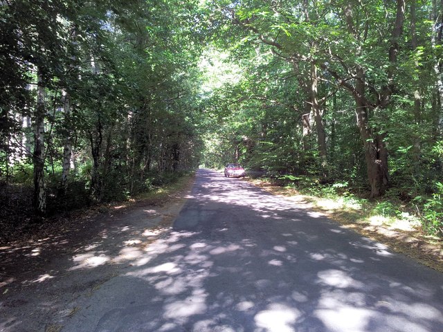
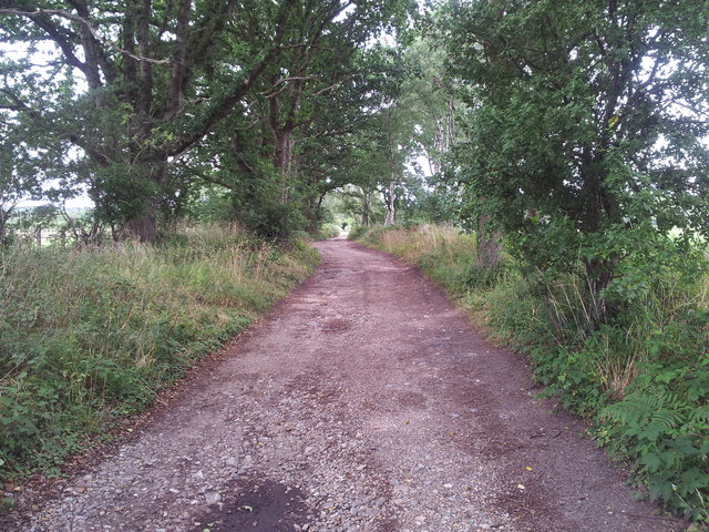
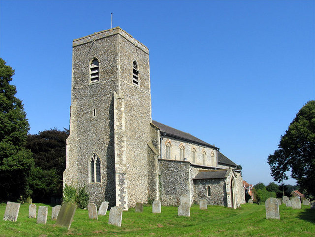
Sheeps Walk Plantation Images
Images are sourced within 2km of 52.770879/1.2265156 or Grid Reference TG1724. Thanks to Geograph Open Source API. All images are credited.


Sheeps Walk Plantation is located at Grid Ref: TG1724 (Lat: 52.770879, Lng: 1.2265156)
Administrative County: Norfolk
District: Broadland
Police Authority: Norfolk
What 3 Words
///purifier.shrubbery.lions. Near Aylsham, Norfolk
Nearby Locations
Related Wikis

Cawston and Marsham Heaths
Cawston and Marsham Heaths is a 116.7-hectare (288-acre) biological Site of Special Scientific Interest north of Norwich in Norfolk.These heaths are dominated...

The Mermaid (river)
The Mermaid (river) is a minor tributary of the River Bure in Norfolk, England, and is approximately 6 kilometres (3.7 mi) in length. == Course == The...
Marsham, Norfolk
Marsham is a village and civil parish in the English county of Norfolk, about 10 miles (16 km) north of Norwich. It covers an area of 7.40 km2 (2.86 sq...

Bolwick Hall
Bolwick Hall is located at Marsham, Norfolk, 1 mile south of Aylsham. == History == The hall is recorded in the Domesday Book of 1086 and given to King...

Cawston Road Mill, Aylsham
Cawston Road Mill is a tower mill at Aylsham, Norfolk, England which has been truncated and converted for use as a holiday home. == History == Cawston...

Aylsham South railway station
Aylsham South railway station served the town of Aylsham in Norfolk from 1880 to 1981. The period station buildings were subsequently demolished in 1989...

Aylsham railway station
Aylsham railway station is located in the town of Aylsham in Norfolk and is the northern terminus of the Bure Valley Railway, a narrow gauge operation...

Aylsham
Aylsham ( or ) is a historic market town and civil parish on the River Bure in north Norfolk, England, nearly 9 mi (14 km) north of Norwich. The river...
Nearby Amenities
Located within 500m of 52.770879,1.2265156Have you been to Sheeps Walk Plantation?
Leave your review of Sheeps Walk Plantation below (or comments, questions and feedback).