Reepham Moor

Downs, Moorland in Norfolk Broadland

England

Reepham Moor

Booton, St Michael Church Roof angels at the east end of the nave.
Booton, St Michael Church Credit: Tim Royall

Reepham Moor is a picturesque area located in the county of Norfolk, England. Situated in the east of the county, it is a combination of downs and moorland, offering a diverse and unique landscape.

The downs of Reepham Moor are characterized by their rolling hills and open grasslands. These areas provide stunning views of the surrounding countryside, with lush green fields stretching as far as the eye can see. The downs are home to a variety of plant species, including wildflowers, grasses, and shrubs, creating a vibrant and colorful environment during the spring and summer months.

The moorland in Reepham Moor is a distinct feature, characterized by its wet and marshy terrain. It is home to a range of wildlife, including birds, insects, and small mammals. The moorland provides an important habitat for several rare and endangered species, making it a significant area for conservation efforts.

Reepham Moor offers several walking trails, allowing visitors to explore the natural beauty of the area. These paths wind through the downs and moorland, offering breathtaking views and opportunities to spot wildlife. The area is also popular among birdwatchers, as it attracts a wide range of bird species throughout the year.

Overall, Reepham Moor is a stunning natural landscape that showcases the beauty of Norfolk. Its combination of downs and moorland creates a diverse and captivating environment, making it a must-visit destination for nature lovers and outdoor enthusiasts.

If you have any feedback on the listing, please let us know in the comments section below.

Reepham Moor Images

Images are sourced within 2km of 52.765606/1.1232158 or Grid Reference TG1023. Thanks to Geograph Open Source API. All images are credited.

Booton, St Michael Church Roof angels at the east end of the nave.
Booton, St Michael Church
Roof angels at the east end of the nave.
Church of St Mary & Church of St Michael There are the remains of another church (All Saints) in the churchyard. St Mary's nearest the camera is the one in use for services and St Michael is for community use.
Church of St Mary & Church of St Michael
There are the remains of another church (All Saints) in the churchyard. St Mary's nearest the camera is the one in use for services and St Michael is for community use.
Church of Saints Peter & Paul The west tower and north porch
Church of Saints Peter & Paul
The west tower and north porch
Salle: Reepham Road
Salle: Reepham Road
Salle: 'Walkgate Cottage' left
Salle: 3 and 4  'Walkgate Cottages' right
Salle: 3 and 4 'Walkgate Cottages' right
Salle, St. Peter and St. Paul's Church
Cawston: Track leading to houses at Commonside
Salle Village Sign
Salle Village Sign
Salle: Hall
Salle: Hall
Salle, St. Peter and St. Paul's Church: The nave
Salle, St. Peter and St. Paul's Church: The screen dado
Salle, St. Peter and St. Paul's Church: Chancel roof
Salle, St. Peter and St. Paul's Church: Screen dado (detail) 1
Salle, St. Peter and St. Paul's Church: Screen dado (detail) 2
Salle, St. Peter and St. Paul's Church: Screen dado (detail) 3
Salle, St. Peter and St. Paul's Church: Screen dado (detail) 4
Salle, St. Peter and St. Paul's Church: Screen dado (detail) 5
Show me another place!

Reepham Moor is located at Grid Ref: TG1023 (Lat: 52.765606, Lng: 1.1232158)

Administrative County: Norfolk

District: Broadland

Police Authority: Norfolk

What 3 Words

///mixing.partner.parent. Near Reepham, Norfolk

Nearby Locations

Reepham Moor

Related Wikis

Booton Common

Booton Common'' is an 8.2-hectare (20-acre) biological Site of Special Scientific Interest north-west of Norwich in Norfolk. It is managed by the Norfolk...

Booton, Norfolk

Booton is a village and civil parish in the Broadland district of Norfolk, England, just east of Reepham and seven miles west of Aylsham. According to...

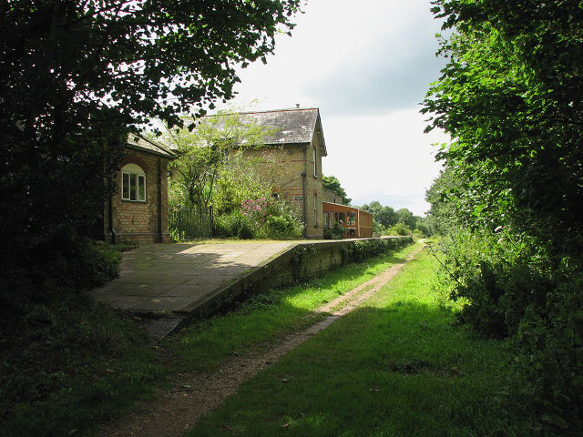
Reepham railway station (Norfolk)

Reepham (Norfolk) was a railway station in Reepham, Norfolk. It was opened in 1882 and closed to passengers in 1952; it finally shut to goods services...

Reepham, Norfolk

Reepham () is a market town and civil parish in the Broadland district of Norfolk, England. Reepham is situated on the B1145 road between the Bure and...

Nearby Amenities

Located within 500m of 52.765606,1.1232158
Barrier: cycle_barrier
Lat/Long: 52.7639643/1.1169168
Turning Circle
Lat/Long: 52.765806/1.1170035
Barrier: stile
Foot: yes
Material: wood
Stile: stepover
Lat/Long: 52.7639355/1.1235642
Barrier: cycle_barrier
Lat/Long: 52.7661224/1.1196673
Power: pole
Lat/Long: 52.7612248/1.1217749
Information: guidepost
Tourism: information
Lat/Long: 52.7688436/1.1198162
Post Box
Collection Times: Mo-Fr 16:30; Sa 11:00
Post Box Design: hovis
Post Box Type: lamp
Ref: NR10 1028
Royal Cypher: GR
Royal Cypher Wikidata: Q33102273
Lat/Long: 52.7613132/1.1248043
Barrier: stile
Foot: yes
Material: wood
Motor Vehicle: no
Stile: stepover
Lat/Long: 52.7678049/1.122847
Information: guidepost
Tourism: information
Lat/Long: 52.7677742/1.1201059
Information: guidepost
Tourism: information
Lat/Long: 52.767789/1.1195284
The data included in this document is from www.openstreetmap.org. The data is made available under ODbL.

Have you been to Reepham Moor?

Leave your review of Reepham Moor below (or comments, questions and feedback).