Kimberley Park
Downs, Moorland in Norfolk South Norfolk
England
Kimberley Park

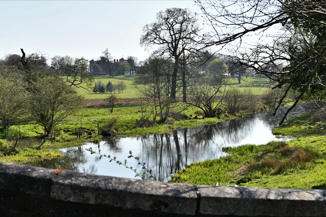
Kimberley Park, located in Norfolk, England, is a picturesque green space that offers a serene and tranquil atmosphere for locals and visitors alike. Spanning over a vast area, it is divided into two distinct sections known as the Downs and the Moorland.
The Downs section of Kimberley Park is characterized by its gently rolling hills, providing visitors with panoramic views of the surrounding countryside. This area is perfect for leisurely strolls, picnics, and recreational activities such as frisbee or kite flying. The Downs also boasts well-maintained pathways, making it accessible for those with mobility challenges.
On the other hand, the Moorland section of the park offers a more rustic and natural setting. Visitors can explore the dense woodlands, meandering through winding paths that lead to hidden clearings and small ponds. This area is a haven for wildlife enthusiasts, as it is home to a diverse range of flora and fauna.
Kimberley Park is well-equipped with amenities to enhance visitors' experiences. It features well-maintained benches, perfect for resting and enjoying the scenic beauty. There are also designated areas for children to play, including a playground with swings, slides, and climbing frames.
Moreover, the park hosts various events and activities throughout the year, including outdoor concerts, art exhibitions, and community gatherings. These events attract a diverse crowd and foster a sense of community within the area.
Overall, Kimberley Park in Norfolk offers a peaceful retreat from the hustle and bustle of city life, providing a perfect blend of natural beauty and recreational opportunities for all to enjoy.
If you have any feedback on the listing, please let us know in the comments section below.
Kimberley Park Images
Images are sourced within 2km of 52.603527/1.0866863 or Grid Reference TG0905. Thanks to Geograph Open Source API. All images are credited.


Kimberley Park is located at Grid Ref: TG0905 (Lat: 52.603527, Lng: 1.0866863)
Administrative County: Norfolk
District: South Norfolk
Police Authority: Norfolk
What 3 Words
///novels.aura.decanter. Near Hethersett, Norfolk
Nearby Locations
Related Wikis

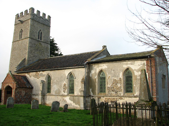
Carleton Forehoe
Carleton Forehoe is a village and former civil parish 9 miles (14 km) west of Norwich, now in the parish of Kimberley, in the South Norfolk district, in...
Kimberley, Norfolk
Kimberley is a village and civil parish in the South Norfolk district, in the county of Norfolk, England, situated about 3 miles (4.8 km) north-west of...

Wicklewood Roman Temple
Wicklewood Roman Temple is the site of a Romano-Celtic temple near Wicklewood and about 1.5 miles (2.4 km) north-west of Wymondham, in Norfolk, England...

Wramplingham
Wramplingham is a village and civil parish in the English county of Norfolk. It is situated on the River Tiffey some 4 miles (6.4 km) north of Wymondham...

Barnham Broom
Barnham Broom is a village and civil parish in the English county of Norfolk. The village is situated on the River Yare, 9 miles (15 km) West of Norwich...
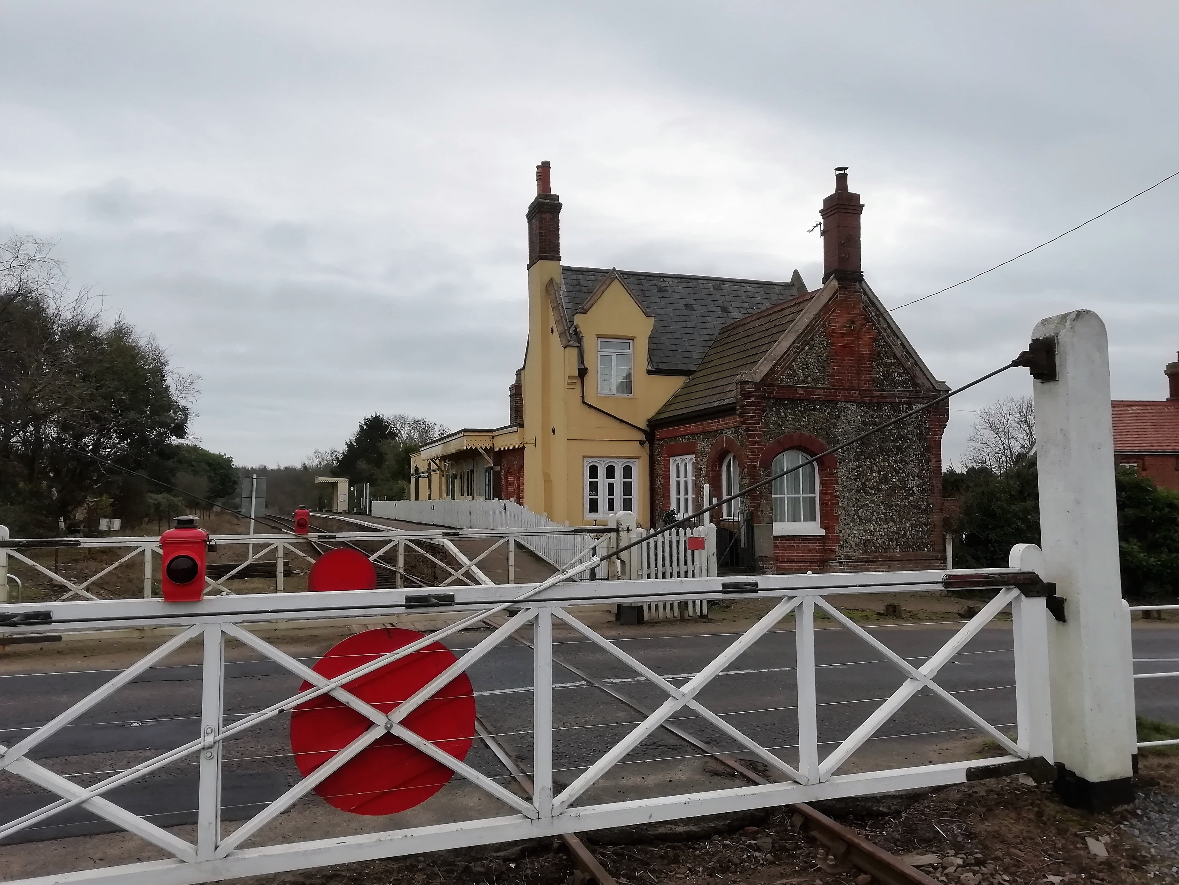
Kimberley Park railway station
Kimberley Park railway station is a railway station in the village of Kimberley in the English county of Norfolk. == History == The Wymondham-Dereham branch...
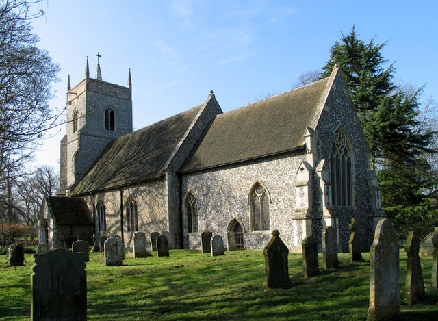
St Michael's Church, Coston
St Michael's Church is a redundant Anglican church in the hamlet of Coston, in the civil parish of Runhall, Norfolk, England. It is recorded in the National...

Wicklewood
Wicklewood is a village and civil parish in the South Norfolk district of Norfolk, England. It is located 11 miles (18 km) west of Norwich next to the...
Nearby Amenities
Located within 500m of 52.603527,1.0866863Have you been to Kimberley Park?
Leave your review of Kimberley Park below (or comments, questions and feedback).