Bressingham Fen

Downs, Moorland in Norfolk South Norfolk

England

Bressingham Fen

Welcome Centre at Lopham Fen
Welcome Centre at Lopham Fen Credit: Dave Thompson

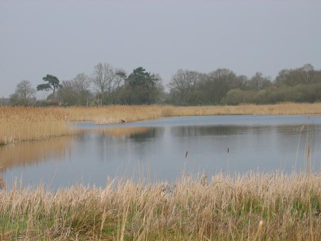
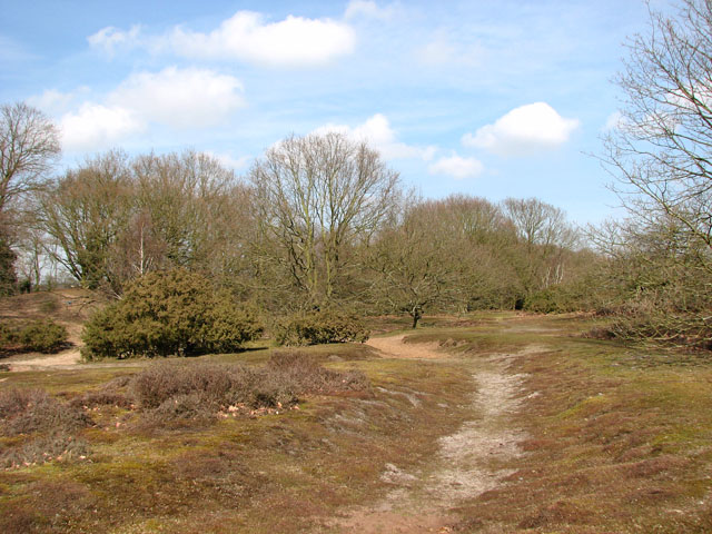
Bressingham Fen is a nature reserve located in Norfolk, England. Covering an area of approximately 70 hectares, it is known for its diverse and unique habitats, including downs, moorland, and fen. The reserve is managed by the Norfolk Wildlife Trust and is open to the public.

The fen, which is the main feature of the reserve, is a type of wetland characterized by alkaline and mineral-rich water. It supports a wide variety of plant species, including rare and endangered ones. Some of the notable plants found in Bressingham Fen include marsh fern, marsh orchid, and the carnivorous round-leaved sundew.

The reserve also encompasses areas of downs and moorland. Downs are grassy, open expanses of land that are often found on hills or elevated areas. Bressingham Downs provide habitat for a range of bird species, such as skylarks and stonechats. Moorland, on the other hand, is a type of heathland characterized by acidic and waterlogged soil. It supports plant species such as heathers, cotton grass, and bog asphodel.

Bressingham Fen is not only important for its diverse flora and fauna but also for its historical significance. It is believed that the site has been used by humans since the Bronze Age, and remnants of ancient trackways and settlements have been discovered in the area.

Overall, Bressingham Fen is a significant nature reserve in Norfolk, offering visitors a chance to explore and appreciate the unique and varied landscapes and wildlife that it supports.

If you have any feedback on the listing, please let us know in the comments section below.

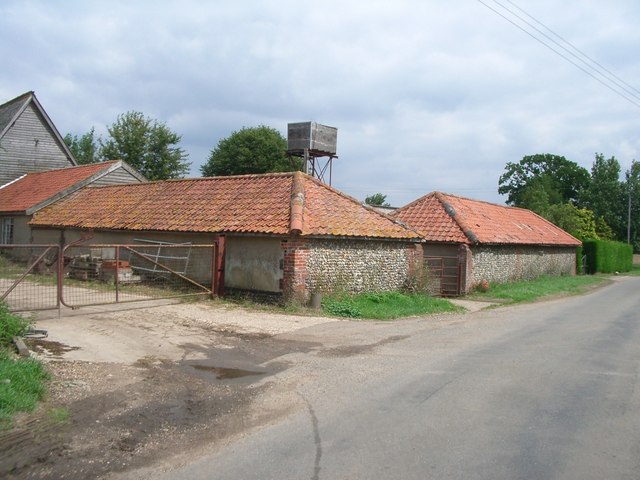
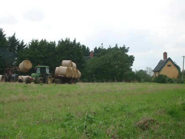
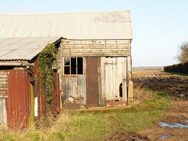
Bressingham Fen Images

Images are sourced within 2km of 52.382706/1.0349781 or Grid Reference TM0680. Thanks to Geograph Open Source API. All images are credited.

Welcome Centre at Lopham Fen
Path through Lang Fen
'The Doll' at Bressingham, 1969 Bought for the opening in 1966 of the Nursery Railway, it was over gauge for the ex-Welsh quarry track and an ex-quarry locomotive hastily procured in its stead. Some sources state that it was sold on in 1968, whether true or not it was still here in early 1969. It is now at the Leighton Buzzard Light Railway, renamed just 'Doll', for no obvious reason. An Andrew Barclay product of 1919, works number 1641.
'The Doll' at Bressingham, 1969
Bought for the opening in 1966 of the Nursery Railway, it was over gauge for the ex-Welsh quarry track and an ex-quarry locomotive hastily procured in its stead. Some sources state that it was sold on in 1968, whether true or not it was still here in early 1969. It is now at the Leighton Buzzard Light Railway, renamed just 'Doll', for no obvious reason. An Andrew Barclay product of 1919, works number 1641.
'Gwynedd' on the Nursery Railway, Bressingham, 1969 Locomotive and track from the Penrhyn quarries, a source for many of the narrow gauge locomotives to be seen on tourist and heritage lines nowadays. Hunslet works number 316 of 1883.
'Gwynedd' on the Nursery Railway, Bressingham, 1969
Locomotive and track from the Penrhyn quarries, a source for many of the narrow gauge locomotives to be seen on tourist and heritage lines nowadays. Hunslet works number 316 of 1883.
Beckton Gasworks no. 25 at Bressingham, 1969 Neilson & Co, works No 6087 of 1896. In steam on the short length of standard gauge track then built, although then it extended further north than it does now.
Beckton Gasworks no. 25 at Bressingham, 1969
Neilson & Co, works No 6087 of 1896. In steam on the short length of standard gauge track then built, although then it extended further north than it does now.
Diss Road, Pooley Street
Lych Gate at St John the Baptist Church, Bressingham
St John the Baptist Church, Bressingham
Bressingham Gardens
Bressingham Gardens
Postbox at Bressingham IP22 85. Royal Mail list this box as 'IP22 School Road Bressingham'.
Postbox at Bressingham
IP22 85. Royal Mail list this box as 'IP22 School Road Bressingham'.
Bressingham Hall <span class="nowrap"><a title="https://historicengland.org.uk/listing/the-list/list-entry/1049648?section=official-list-entry" rel="nofollow ugc noopener" href="https://historicengland.org.uk/listing/the-list/list-entry/1049648?section=official-list-entry">Link</a><img style="margin-left:2px;" alt="External link" title="External link - shift click to open in new window" src="https://s1.geograph.org.uk/img/external.png" width="10" height="10"/></span>
Bressingham Hall
Roundabout at Bressingham Gardens and Steam Museum
Low Road, by Ling Farm
Cottage at the junction of Slade Lane with Low Road
Dashes Farm
Dashes Farm
Field near Pond Farm, Fen Street The tractor on the left is unloading bales from the trailer
Field near Pond Farm, Fen Street
The tractor on the left is unloading bales from the trailer
Tin barns Old corrugated iron farm buildings and a view over the Waveney valley.
Tin barns
Old corrugated iron farm buildings and a view over the Waveney valley.
Show me another place!

Bressingham Fen is located at Grid Ref: TM0680 (Lat: 52.382706, Lng: 1.0349781)

Administrative County: Norfolk

District: South Norfolk

Police Authority: Norfolk

What 3 Words

///breached.deranged.ranged. Near Botesdale, Suffolk

Related Wikis

Bressingham

Bressingham is a village and civil parish in the English county of Norfolk. It covers an area of 15.77 km2 (6.09 sq mi) and had a population of 751 in...

Redgrave and Lopham Fens

Redgrave and Lopham Fens is a 127 hectare biological Site of Special Scientific Interest between Thelnetham in Suffolk and Diss in Norfolk. It is a national...

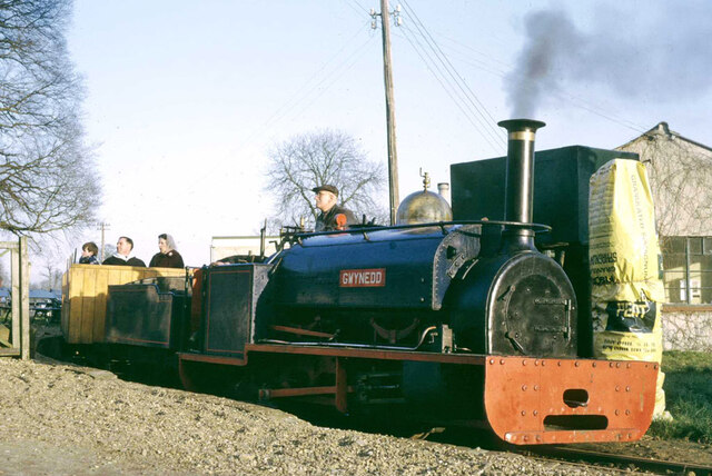
Bressingham Steam and Gardens

Bressingham Steam & Gardens is a steam museum and gardens located at Bressingham (adjacent to a garden centre), west of Diss in Norfolk, England. The site...

Fersfield

Fersfield is a village and former civil parish, now in the parish of Bressingham, in the South Norfolk district, in the county of Norfolk, England. The...

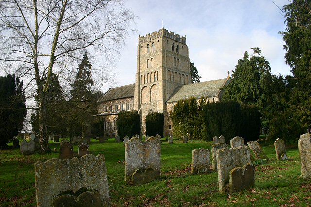
St Mary's Church, Wortham

St Mary's Church is the parish church of Wortham in Suffolk, England, and in the Diocese of St Edmundsbury and Ipswich. It is a round-tower church; the...

St Mary's Church, Redgrave

St Mary's Church is the redundant Church of England parish church of the village of Redgrave, Suffolk, England. It is a Grade I listed building. and is...

South Lopham

South Lopham is a village and civil parish in the English county of Norfolk. It covers an area of 7.91 km2 (3.05 sq mi) and had a population of 371 in...

Wortham Ling

Wortham Ling is a 53.2-hectare (131-acre) biological Site of Special Scientific Interest north of Wortham in Suffolk.This site has acid grassland and dry...

Nearby Amenities

Located within 500m of 52.382706,1.0349781
White House Bed & Breakfast
Addr Postcode: IP22 2AG
Addr Street: Low Road
Fhrs Id: 647543
Tourism: guest_house
Url: http://www.whitehousebressingham.co.uk/
Lat/Long: 52.3871517/1.0352994
Power: pole
Lat/Long: 52.3862134/1.0390526
Power: pole
Lat/Long: 52.3861076/1.0377199
Power: pole
Lat/Long: 52.3860115/1.0363577
Power: pole
Lat/Long: 52.3868563/1.0360849
Power: pole
Lat/Long: 52.385919/1.0349836
Power: pole
Lat/Long: 52.3857741/1.0306175
Power: pole
Lat/Long: 52.3858487/1.0321952
Power: pole
Lat/Long: 52.385881/1.0329023
Power: pole
Lat/Long: 52.3858921/1.0336027
Power: pole
Lat/Long: 52.3858568/1.0343296
The data included in this document is from www.openstreetmap.org. The data is made available under ODbL.

Have you been to Bressingham Fen?

Leave your review of Bressingham Fen below (or comments, questions and feedback).