Elmstead Heath

Downs, Moorland in Essex Tendring

England

Elmstead Heath

Ford Lane, Alresford
Ford Lane, Alresford Credit: Glyn Baker

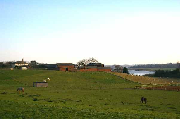
Elmstead Heath, located in Essex, England, is a picturesque area consisting of downs and moorland. Spanning approximately 200 acres, this natural beauty spot offers a diverse range of wildlife and stunning landscapes. Elmstead Heath is renowned for its tranquil atmosphere and is a popular destination for nature lovers and outdoor enthusiasts.

The heath is characterized by rolling hills, covered in vibrant purple heather and various species of grasses. The area is also abundant in wildflowers, such as orchids and primroses, adding bursts of color to the landscape. Elmstead Heath is home to a variety of wildlife, including rabbits, foxes, badgers, and numerous bird species, making it an ideal location for birdwatching.

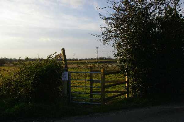
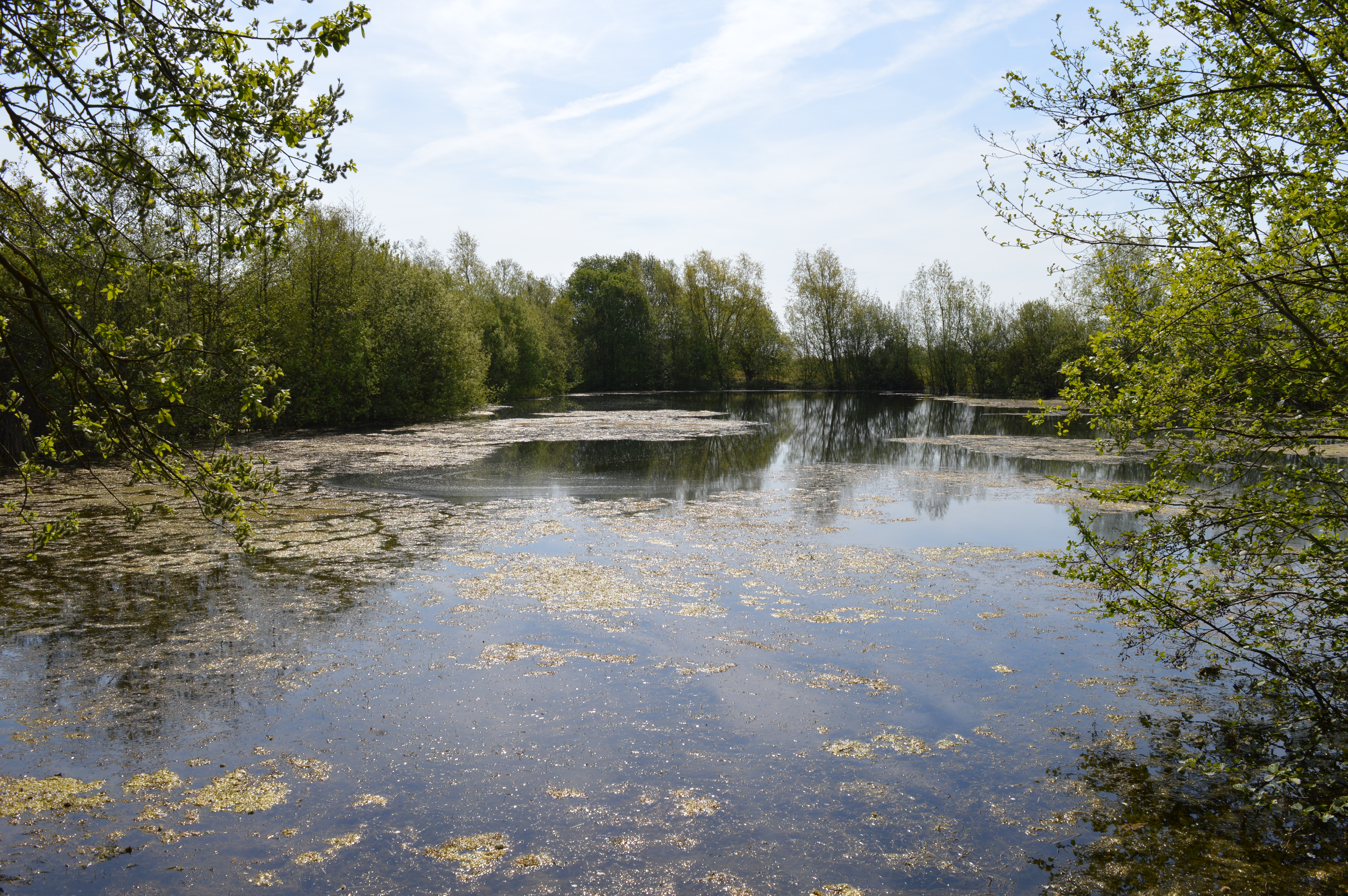
The heath is crisscrossed by a network of footpaths and trails, ensuring visitors can explore the site easily. These paths lead visitors through different habitats, allowing them to discover hidden ponds, ancient woodlands, and meadows. Elmstead Heath is also home to a small lake, which attracts a variety of water birds and provides a peaceful spot for picnics and relaxation.

The heath offers stunning views of the surrounding countryside, including nearby woodlands and the rolling hills of the Essex countryside. Visitors can enjoy panoramic vistas from various viewpoints throughout the area. Elmstead Heath is a designated Site of Special Scientific Interest, recognizing its importance in preserving and protecting the unique flora and fauna found within its boundaries.

Overall, Elmstead Heath in Essex is a haven of natural beauty, providing a serene escape for those seeking a peaceful retreat in the heart of the English countryside.

If you have any feedback on the listing, please let us know in the comments section below.

Elmstead Heath Images

Images are sourced within 2km of 51.865945/0.99525291 or Grid Reference TM0622. Thanks to Geograph Open Source API. All images are credited.

Ford Lane, Alresford
Church Road, Alresford
The Pointer A free house in Arlseford. Looking along Wivenhoe Road.
The Pointer
A free house in Arlseford. Looking along Wivenhoe Road.
Alresford Footpath 20 The path comes out on the B1027
Alresford Footpath 20
The path comes out on the B1027
Cockaynes Lane Looking towards <a href="https://www.geograph.org.uk/photo/7769176">TM0622 : Alresford Primary Substation</a>
Cockaynes Lane
Alresford Primary Mast <a href="https://www.geograph.org.uk/photo/7769176">TM0622 : Alresford Primary Substation</a> is run by U.K Power Networks
Alresford Primary Mast
TM0622 : Alresford Primary Substation is run by U.K Power Networks
Alresford Primary Substation See also <a href="https://www.geograph.org.uk/photo/7769172">TM0622 : Alresford Primary Mast</a>.
Alresford Primary Substation
The Beth Chatto Gardens
Sand and gravel pit
Sand and gravel pit
Keelars Tye
Keelars Tye
The Pointer Public house in Wivenhoe Road, Alresford
The Pointer
Public house in Wivenhoe Road, Alresford
Radio mast and pylon In Cockaynes Lane, Alresford. The mast is mainly for data communication for a nearby electricity substation.
Radio mast and pylon
In Cockaynes Lane, Alresford. The mast is mainly for data communication for a nearby electricity substation.
Elmstead Parish Memorial This looks like a modern replacement for an earlier war memorial. The inscription seems too politically correct for 1919. It reads: "Elmstead Parish Memorial. In grateful memory of those people who lost their lives in all conflicts for the cause of freedom. We will remember them."
Elmstead Parish Memorial
This looks like a modern replacement for an earlier war memorial. The inscription seems too politically correct for 1919. It reads: "Elmstead Parish Memorial. In grateful memory of those people who lost their lives in all conflicts for the cause of freedom. We will remember them."
Does it have an hackney licence? Parked outside Rolts Garden Centre, Clacton Road, Elmstead Market, this is a Bajaj RE <span class="nowrap"><a title="http://www.bajajauto.com/1024/vehicle/threewheelershow.asp?vehicle=RE%204S&vehvariation=01" rel="nofollow ugc noopener" href="http://www.bajajauto.com/1024/vehicle/threewheelershow.asp?vehicle=RE%204S&vehvariation=01">Link</a><img style="margin-left:2px;" alt="External link" title="External link - shift click to open in new window" src="https://s1.geograph.org.uk/img/external.png" width="10" height="10"/></span> three wheeled passenger carrier. Back in its native India, they are used as taxis.
Does it have an hackney licence?
Parked outside Rolts Garden Centre, Clacton Road, Elmstead Market, this is a Bajaj RE LinkExternal link three wheeled passenger carrier. Back in its native India, they are used as taxis.
Frating Hill There is about 12 metres difference in elevation between this point and the Tenpenny Brook about 150 metres away. In Tendring that counts as an hill. Junction of Church Road with Main Road, Frating. Text in the middle of the semi-circle is "E.C.C. [Essex County Council] Stick no bills" and the smudge to the right of the 5 reads "Maldon Iron Works". The spelling Thorrington is now preferred.
Frating Hill
There is about 12 metres difference in elevation between this point and the Tenpenny Brook about 150 metres away. In Tendring that counts as an hill. Junction of Church Road with Main Road, Frating. Text in the middle of the semi-circle is "E.C.C. [Essex County Council] Stick no bills" and the smudge to the right of the 5 reads "Maldon Iron Works". The spelling Thorrington is now preferred.
Frating Parish Church Snowdrops in the churchyard of Frating Parish Church. The leaning gravestones suggest that the graves are about to open as in a Stanley Spencer painting <span class="nowrap"><a title="http://www.leninimports.com/stanley_spencer_gallery_4.jpg" rel="nofollow ugc noopener" href="http://www.leninimports.com/stanley_spencer_gallery_4.jpg">Link</a><img style="margin-left:2px;" alt="External link" title="External link - shift click to open in new window" src="https://s1.geograph.org.uk/img/external.png" width="10" height="10"/></span> . The church is now a private house. No one seems to know what its dedication was.
Frating Parish Church
Snowdrops in the churchyard of Frating Parish Church. The leaning gravestones suggest that the graves are about to open as in a Stanley Spencer painting LinkExternal link . The church is now a private house. No one seems to know what its dedication was.
Marsh Farm Paddock This is a view across a paddock towards Marsh Farm near Alresford and the River Colne beyond.
Marsh Farm Paddock
This is a view across a paddock towards Marsh Farm near Alresford and the River Colne beyond.
Footpath to Wivenhoe This is the gate on Keelars Lane for a footpath that leads to the Northern edge of Wivenhoe
Footpath to Wivenhoe
This is the gate on Keelars Lane for a footpath that leads to the Northern edge of Wivenhoe
Show me another place!

Elmstead Heath is located at Grid Ref: TM0622 (Lat: 51.865945, Lng: 0.99525291)

Administrative County: Essex

District: Tendring

Police Authority: Essex

What 3 Words

///fuse.ranches.digress. Near Alresford, Essex

Related Wikis

Beth Chatto Gardens

The Beth Chatto Gardens, now known as Beth Chatto's Plants & Gardens, are an informal collection of historically significant gardens, with National Heritage...

Alresford railway station (Essex)

Alresford railway station is on the Sunshine Coast Line, a branch of the Great Eastern Main Line, in the East of England, serving the village of Alresford...

Wivenhoe Gravel Pit

Wivenhoe Gravel Pit is a 2.1-hectare (5.2-acre) geological Site of Special Scientific Interest north of Wivenhoe in Essex. It is a Geological Conservation...

Cockaynes Wood

Cockaynes Wood is a 20.2-hectare (50-acre) nature reserve between Wivenhoe and Alresford in Essex, United Kingdom. It is managed by the Essex Wildlife...

Nearby Amenities

Located within 500m of 51.865945,0.99525291
Post Box
Postal Code: CO7 8DB
Ref: CO7 126
Lat/Long: 51.8639418/0.994137
Power: tower
Source: OS_OpenData_VectorDistrict
Lat/Long: 51.8631293/0.9910205
Power: tower
Source: OS_OpenData_VectorDistrict
Lat/Long: 51.862126/0.9934628
Power: pole
Source: bing
Lat/Long: 51.8620211/0.993489
Power: pole
Source: bing
Lat/Long: 51.8618808/0.9922328
Colour: red
Marker: post
Material: concrete
Utility: gas
Lat/Long: 51.8676497/0.9906445
The data included in this document is from www.openstreetmap.org. The data is made available under ODbL.

Have you been to Elmstead Heath?

Leave your review of Elmstead Heath below (or comments, questions and feedback).