Rush Green

Downs, Moorland in Suffolk Mid Suffolk

England

Rush Green

Tot Hill Services
Tot Hill Services Credit: Dave Thompson

Rush Green is a small rural village located in Suffolk, England. Situated on the eastern side of the county, the village is known for its picturesque landscapes, characterized by rolling hills, verdant downs, and vast moorland. It is an idyllic retreat for those seeking tranquility and immersion in nature.

The Downs in Rush Green are a prominent feature of the village. These elevated areas offer breathtaking panoramic views of the surrounding countryside, making them a popular destination for hikers, nature enthusiasts, and photographers. The Downs are adorned with vibrant wildflowers during the summer months, further enhancing their beauty.

Adjacent to the Downs is the expansive moorland that stretches across Rush Green. This wild and untamed area is rich in biodiversity, supporting a variety of flora and fauna. It is a haven for birdwatchers, as numerous species can be spotted, including kestrels, lapwings, and skylarks.

Despite its rural character, Rush Green is not geographically isolated. It is conveniently located near several larger towns and cities, providing residents with easy access to amenities and services. The village itself is home to a close-knit community that prides itself on its strong sense of community spirit.

Rush Green offers a peaceful and serene lifestyle, away from the hustle and bustle of urban areas. Its natural beauty and unspoiled surroundings make it an attractive destination for those seeking a slower pace of life and a deep connection with nature.

If you have any feedback on the listing, please let us know in the comments section below.

Rush Green Images

Images are sourced within 2km of 52.210291/0.95464792 or Grid Reference TM0161. Thanks to Geograph Open Source API. All images are credited.

Tot Hill Services
Tot Hill Services
Fields and haystack next to the A14, Gallows Fields
Wind turbine by the A14, Gallows Fields
A14 westbound, Gallows Fields The A14 is a major road running 127 miles from Felixstowe to the Catthorpe Interchange, the junction of the M1 and M6 motorways near Rugby. The road connects East Anglia with the West Midlands and The North.
Wikipedia: <span class="nowrap"><a title="http://en.wikipedia.org/wiki/A14_road_(England)" rel="nofollow ugc noopener" href="http://en.wikipedia.org/wiki/A14_road_(England)">Link</a><img style="margin-left:2px;" alt="External link" title="External link - shift click to open in new window" src="https://s1.geograph.org.uk/img/external.png" width="10" height="10"/></span>
A14 westbound, Gallows Fields
The A14 is a major road running 127 miles from Felixstowe to the Catthorpe Interchange, the junction of the M1 and M6 motorways near Rugby. The road connects East Anglia with the West Midlands and The North. Wikipedia: LinkExternal link
View eastbound along the A14, from the layby at Gallows Fields
A14 eastbound at junction 49 for Stowmarket
A14 eastbound at junction 49
The church of King Charles the Martyr, Shelland A medieval church virtually rebuilt in 1767 <span class="nowrap"><a title="https://historicengland.org.uk/listing/the-list/list-entry/1352321?section=official-list-entry" rel="nofollow ugc noopener" href="https://historicengland.org.uk/listing/the-list/list-entry/1352321?section=official-list-entry">Link</a><img style="margin-left:2px;" alt="External link" title="External link - shift click to open in new window" src="https://s1.geograph.org.uk/img/external.png" width="10" height="10"/></span>
The church of King Charles the Martyr, Shelland
A medieval church virtually rebuilt in 1767 LinkExternal link
Avenue, Harleston Green
Harleston Green
Harleston Green
The church of King Charles the Martyr, Shelland Of medieval origin but largely of the eighteenth century <span class="nowrap"><a title="https://historicengland.org.uk/listing/the-list/list-entry/1352321?section=official-list-entry" rel="nofollow ugc noopener" href="https://historicengland.org.uk/listing/the-list/list-entry/1352321?section=official-list-entry">Link</a><img style="margin-left:2px;" alt="External link" title="External link - shift click to open in new window" src="https://s1.geograph.org.uk/img/external.png" width="10" height="10"/></span>
The church of King Charles the Martyr, Shelland
Of medieval origin but largely of the eighteenth century LinkExternal link
Shelland Green
Shelland Green
Footpath to Harleston
Horse chestnut at Shelland
Haughley Park House
Haughley Park House
St Augustine's, Harleston St Augustine's is a quaint Church located on a small hill some distance from the Village of Harleston. The Church clearly has been a family Church as there is still a mown path through the grass fields from the Church to Harleston Hall a couple of hundred yards away. 

The approach to the Church is along a picturesque gravelled driveway for a couple of hundred yards up a small slope. The bottom of the Drive is surrounded by a couple of pleasant ponds.
St Augustine's, Harleston
St Augustine's is a quaint Church located on a small hill some distance from the Village of Harleston. The Church clearly has been a family Church as there is still a mown path through the grass fields from the Church to Harleston Hall a couple of hundred yards away. The approach to the Church is along a picturesque gravelled driveway for a couple of hundred yards up a small slope. The bottom of the Drive is surrounded by a couple of pleasant ponds.
Village street at Haughley, Suffolk
Shelland Church Dedicated to King Charles the Martyr (King Charles I, who was beheaded in 1649), this is one of only five churches in England with this unusual dedication. The church was erected in 1767, on the site of a predecessor. See <a href="https://www.geograph.org.uk/photo/246026">TM0060 : Interior of Shelland Church</a> for the interior.
Shelland Church
Dedicated to King Charles the Martyr (King Charles I, who was beheaded in 1649), this is one of only five churches in England with this unusual dedication. The church was erected in 1767, on the site of a predecessor. See TM0060 : Interior of Shelland Church for the interior.
Show me another place!

Rush Green is located at Grid Ref: TM0161 (Lat: 52.210291, Lng: 0.95464792)

Administrative County: Suffolk

District: Mid Suffolk

Police Authority: Suffolk

What 3 Words

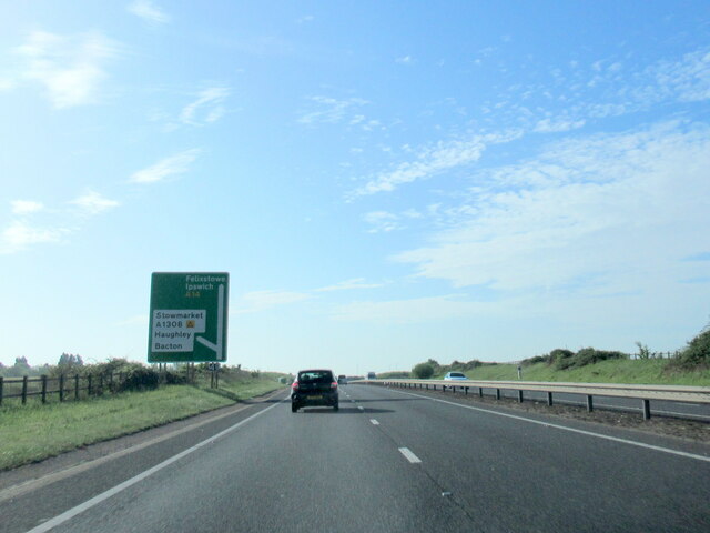
///speaker.emotional.shipyards. Near Haughley, Suffolk

Related Wikis

Harleston, Suffolk

Harleston is a village and civil parish in the Mid Suffolk district of Suffolk, England, just south of the Haughley Bends on the A14. It is located between...

Haughley Castle

Haughley Castle was a medieval castle situated in the village of Haughley, some 4 kilometres (2.5 mi) north-west of the town of Stowmarket, Suffolk. Prominent...

Haughley

Haughley is a village and civil parish in the English county of Suffolk, in the Mid Suffolk District. The village is located 2 miles (3.2 km) northwest...

Shelland

Shelland is a small village and civil parish located just off the A14, 4 miles west of Stowmarket in Suffolk, England. Shelland consists of roughly 10...
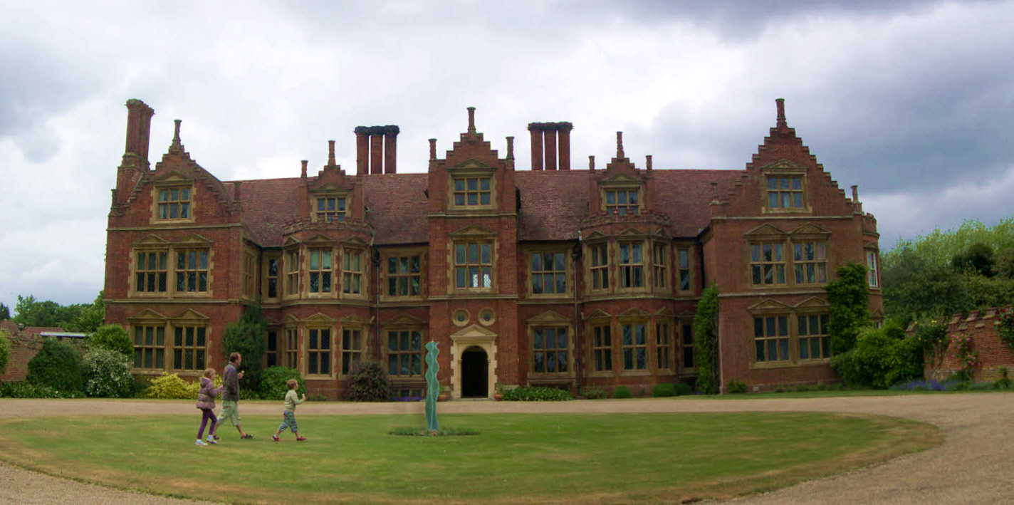
Haughley Park

Haughley Park House in Stowmarket, Suffolk is an historical house of significance listed in the English Heritage Register. It is a large red brick country...

Wetherden

Wetherden is a village and civil parish in the county of Suffolk, England, situated about 4 miles (6.4 km) northwest of Stowmarket and about 1.25 miles...

Onehouse

Onehouse is a small village in the English county of Suffolk, about 3 miles west from the centre of Stowmarket near to the Golf Club. The population of...

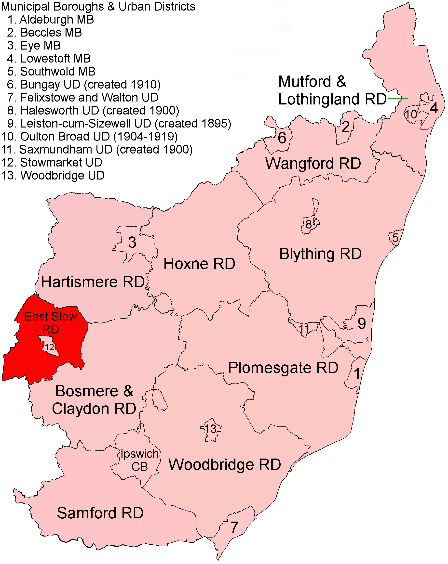
East Stow Rural District

East Stow was a rural district in East Suffolk, England from 1894 to 1934. It was created under the Local Government Act 1894, from the part of the Stow...

Nearby Amenities

Located within 500m of 52.210291,0.95464792
Generator Method: wind_turbine
Generator Source: wind
Generator Type: horizontal_axis
Power: generator
Ref GB Uprn: 10015852721
Lat/Long: 52.2106207/0.9619362
The data included in this document is from www.openstreetmap.org. The data is made available under ODbL.

Have you been to Rush Green?

Leave your review of Rush Green below (or comments, questions and feedback).