Pakenham Fen

Downs, Moorland in Suffolk West Suffolk

England

Pakenham Fen

Pakenham watermill Rebuilt 1814 on an ancient site <span class="nowrap"><a title="https://historicengland.org.uk/listing/the-list/list-entry/1285022" rel="nofollow ugc noopener" href="https://historicengland.org.uk/listing/the-list/list-entry/1285022">Link</a><img style="margin-left:2px;" alt="External link" title="External link - shift click to open in new window" src="https://s1.geograph.org.uk/img/external.png" width="10" height="10"/></span>
Pakenham watermill Credit: Jonathan Thacker

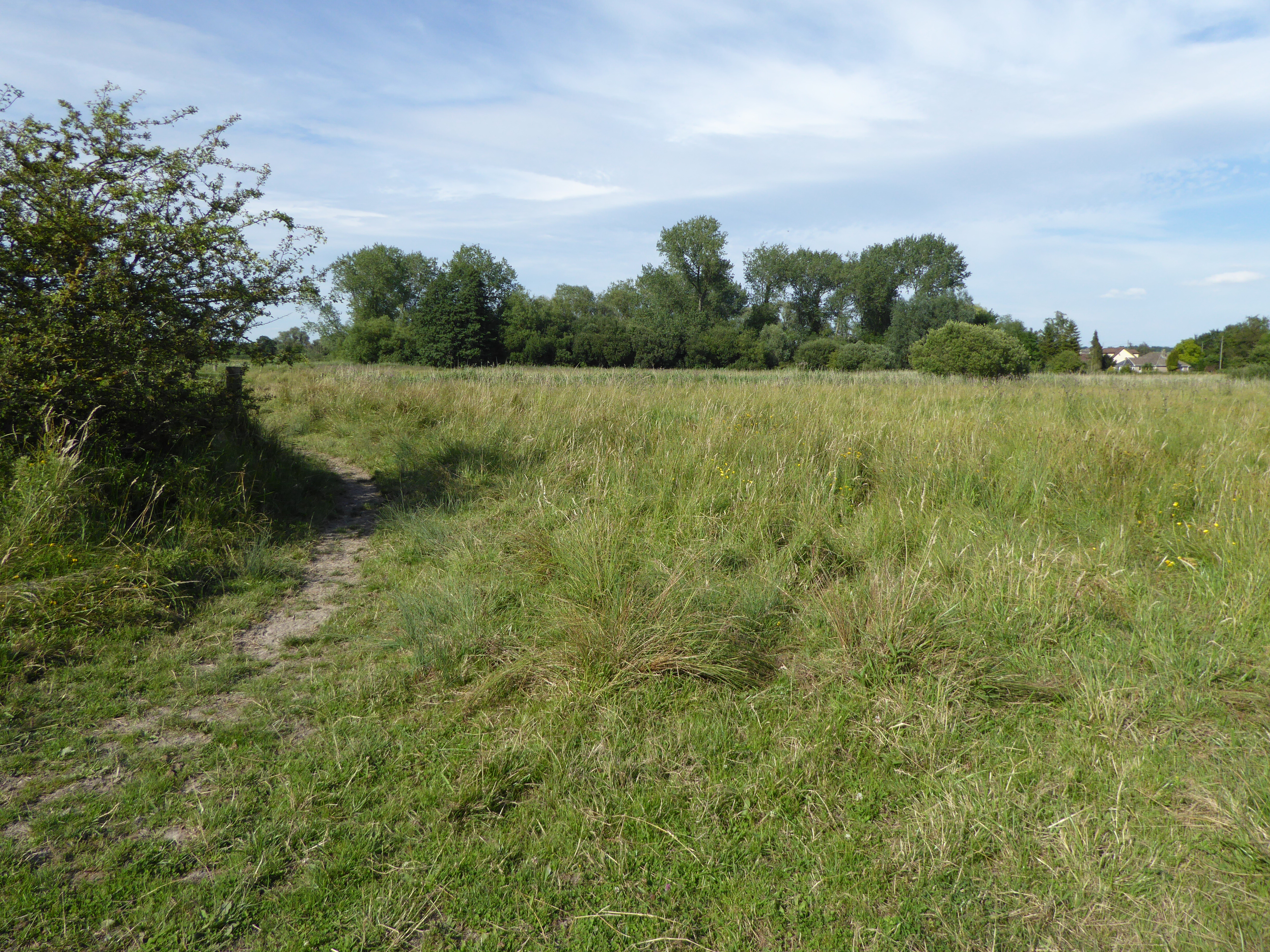
Pakenham Fen is a designated nature reserve located in Suffolk, England. It is situated in the village of Pakenham, near the town of Bury St Edmunds. Covering an area of approximately 400 acres, the fen consists of a diverse range of habitats including wetlands, meadows, woodland, and moorland.

The reserve is known for its rich biodiversity and is home to a wide variety of plant and animal species. It is particularly renowned for its birdlife, attracting birdwatchers from all over the country. Visitors can expect to spot species such as marsh harriers, bitterns, reed warblers, and kingfishers.

Pakenham Fen is managed by the Suffolk Wildlife Trust, which works to maintain and enhance the natural environment. The reserve offers several walking trails that allow visitors to explore the different habitats and observe the wildlife. There are also bird hides strategically placed around the site, providing excellent viewing opportunities.

In addition to its natural beauty, Pakenham Fen has historical significance as well. The site has evidence of human habitation dating back to the Bronze Age, and archaeological excavations have uncovered artifacts such as pottery and flint tools.

Overall, Pakenham Fen is a unique and important nature reserve in Suffolk, offering visitors the chance to experience a diverse range of habitats and observe a wide variety of wildlife. Whether you are a nature enthusiast, a birdwatcher, or someone interested in history, Pakenham Fen has something for everyone.

If you have any feedback on the listing, please let us know in the comments section below.

Pakenham Fen Images

Images are sourced within 2km of 52.276787/0.82879047 or Grid Reference TL9368. Thanks to Geograph Open Source API. All images are credited.

Pakenham watermill Rebuilt 1814 on an ancient site <span class="nowrap"><a title="https://historicengland.org.uk/listing/the-list/list-entry/1285022" rel="nofollow ugc noopener" href="https://historicengland.org.uk/listing/the-list/list-entry/1285022">Link</a><img style="margin-left:2px;" alt="External link" title="External link - shift click to open in new window" src="https://s1.geograph.org.uk/img/external.png" width="10" height="10"/></span>
Pakenham watermill
Rebuilt 1814 on an ancient site LinkExternal link
Pakenham Watermill, still grinding flour Pakenham Watermill stands on a tributary of the Black Bourn and still grinds flour. It is open to visitors at designated times. A datestone on the south gable wall reads 'C.L. 1814', for Charles Low, who rebuilt much of the mill about that time utilising earlier foundations. The mill was restored to full working order in the late 1970s. It consists of three storeys and an attic story where the lucum is located in the pantiled roof. The ground floor is tarred brick with timber-framed upper storeys, and rendered on the front of the building. Weather-boarded on the gable ends. A loading door on the first floor has a semi-circular fanlight and a loading skid below to prevent damage to sacks and wall. The waterwheel is a low breast shot waterwheel installed about 19OO. It drives three pairs of under-driven millstones.
Pakenham Watermill, still grinding flour
Pakenham Watermill stands on a tributary of the Black Bourn and still grinds flour. It is open to visitors at designated times. A datestone on the south gable wall reads 'C.L. 1814', for Charles Low, who rebuilt much of the mill about that time utilising earlier foundations. The mill was restored to full working order in the late 1970s. It consists of three storeys and an attic story where the lucum is located in the pantiled roof. The ground floor is tarred brick with timber-framed upper storeys, and rendered on the front of the building. Weather-boarded on the gable ends. A loading door on the first floor has a semi-circular fanlight and a loading skid below to prevent damage to sacks and wall. The waterwheel is a low breast shot waterwheel installed about 19OO. It drives three pairs of under-driven millstones.
Pakenham Watermill, still grinding flour Pakenham Watermill stands on a tributary of the Black Bourn and still grinds flour. It is open to visitors at designated times. A datestone on the south gable wall reads 'C.L. 1814', for Charles Low, who rebuilt much of the mill about that time utilising earlier foundations. The mill was restored to full working order in the late 1970s. It consists of three storeys and an attic story where the lucum is located in the pantiled roof. The ground floor is tarred brick with timber-framed upper storeys, and rendered on the front of the building. Weather-boarded on the gable ends. A loading door on the first floor has a semi-circular fanlight and a wooden loading skid below to prevent damage to sacks and wall. The waterwheel is a low breast shot waterwheel installed about 19OO. It drives three pairs of under-driven millstones. <a title="https://www.geograph.org.uk/photo/6980654" href="https://www.geograph.org.uk/photo/6980654">Link</a>
Pakenham Watermill, still grinding flour
Pakenham Watermill stands on a tributary of the Black Bourn and still grinds flour. It is open to visitors at designated times. A datestone on the south gable wall reads 'C.L. 1814', for Charles Low, who rebuilt much of the mill about that time utilising earlier foundations. The mill was restored to full working order in the late 1970s. It consists of three storeys and an attic story where the lucum is located in the pantiled roof. The ground floor is tarred brick with timber-framed upper storeys, and rendered on the front of the building. Weather-boarded on the gable ends. A loading door on the first floor has a semi-circular fanlight and a wooden loading skid below to prevent damage to sacks and wall. The waterwheel is a low breast shot waterwheel installed about 19OO. It drives three pairs of under-driven millstones. Link
The Black Bourn river from Baileypool Bridge Looking downstream towards Ixworth and eventually on to the Little Ouse
The Black Bourn river from Baileypool Bridge
Looking downstream towards Ixworth and eventually on to the Little Ouse
Baileypool Bridge at Grimstone End The bridge crosses the Black Bourn river
Baileypool Bridge at Grimstone End
The bridge crosses the Black Bourn river
The tailrace after passing beneath the road The mill pond and headrace are behind the mill and the water comes from Pakenham Fen and beyond. After leaving the mill through the tailrace the water travels about 300 yards before joining the Black Bourn before converging with the Little Ouse south of Thetford.
Pakenham Watermill stands on the Black Bourn and still grinds flour. It is open to visitors at designated times. A datestone on the south gable wall reads 'C.L. 1814', for Charles Low, who rebuilt much of the mill about that time utilising earlier foundations. The mill was restored to full working order in the late 1970s. It consists of three storeys and an attic story where the lucum is located in the pantiled roof. The ground floor is tarred brick with timber-framed upper storeys, and rendered on the front of the building. Weather-boarded on the gable ends. A loading door on the first floor has a semi-circular fanlight and a wooden loading skid below to prevent damage to sacks and wall. The waterwheel is a low breast shot waterwheel installed about 19OO. It drives three pairs of under-driven millstones. <a title="https://www.geograph.org.uk/photo/6980654" href="https://www.geograph.org.uk/photo/6980654">Link</a>
The tailrace after passing beneath the road
The mill pond and headrace are behind the mill and the water comes from Pakenham Fen and beyond. After leaving the mill through the tailrace the water travels about 300 yards before joining the Black Bourn before converging with the Little Ouse south of Thetford. Pakenham Watermill stands on the Black Bourn and still grinds flour. It is open to visitors at designated times. A datestone on the south gable wall reads 'C.L. 1814', for Charles Low, who rebuilt much of the mill about that time utilising earlier foundations. The mill was restored to full working order in the late 1970s. It consists of three storeys and an attic story where the lucum is located in the pantiled roof. The ground floor is tarred brick with timber-framed upper storeys, and rendered on the front of the building. Weather-boarded on the gable ends. A loading door on the first floor has a semi-circular fanlight and a wooden loading skid below to prevent damage to sacks and wall. The waterwheel is a low breast shot waterwheel installed about 19OO. It drives three pairs of under-driven millstones. Link
Pakenham Watermill, still grinding flour Pakenham Watermill stands on a tributary of the Black Bourn and still grinds flour. It is open to visitors at designated times. A datestone on the south gable wall reads 'C.L. 1814', for Charles Low, who rebuilt much of the mill about that time utilising earlier foundations. The mill was restored to full working order in the late 1970s. It consists of three storeys and an attic story where the lucum is located in the pantiled roof. The ground floor is tarred brick with timber-framed upper storeys, and rendered on the front of the building. Weather-boarded on the gable ends. A loading door on the first floor has a semi-circular fanlight and a wooden loading skid below to prevent damage to sacks and wall. The waterwheel is a low breast shot waterwheel installed about 19OO. It drives three pairs of under-driven millstones. <a title="https://www.geograph.org.uk/photo/6980654" href="https://www.geograph.org.uk/photo/6980654">Link</a>
Pakenham Watermill, still grinding flour
Pakenham Watermill stands on a tributary of the Black Bourn and still grinds flour. It is open to visitors at designated times. A datestone on the south gable wall reads 'C.L. 1814', for Charles Low, who rebuilt much of the mill about that time utilising earlier foundations. The mill was restored to full working order in the late 1970s. It consists of three storeys and an attic story where the lucum is located in the pantiled roof. The ground floor is tarred brick with timber-framed upper storeys, and rendered on the front of the building. Weather-boarded on the gable ends. A loading door on the first floor has a semi-circular fanlight and a wooden loading skid below to prevent damage to sacks and wall. The waterwheel is a low breast shot waterwheel installed about 19OO. It drives three pairs of under-driven millstones. Link
Water meadow near Pakenham Watermill
Buildings at Pakenham Watermill The one on the right houses the Blackstone oil engine.
Buildings at Pakenham Watermill
The one on the right houses the Blackstone oil engine.
The Blackstone Engine at Pakenham Watermill Ashley Dace has provided a lot of information about this engine <a title="https://www.geograph.org.uk/photo/1997244" href="https://www.geograph.org.uk/photo/1997244">Link</a> , but here are some more bits.
The engine is occasionally run as it used to do, but there is also an electric drive allowing it to be turned over at slow speed for demonstration purposes. In addition to the drive to the Midget mill, it could be connected to shafting which would have either allowed it to be turned from the main vertical shaft of the water mill when starting the engine, or technically it could have driven the shaft instead of using water power, although there is no evidence that this was ever done in practice.
The Blackstone Engine at Pakenham Watermill
Ashley Dace has provided a lot of information about this engine Link , but here are some more bits. The engine is occasionally run as it used to do, but there is also an electric drive allowing it to be turned over at slow speed for demonstration purposes. In addition to the drive to the Midget mill, it could be connected to shafting which would have either allowed it to be turned from the main vertical shaft of the water mill when starting the engine, or technically it could have driven the shaft instead of using water power, although there is no evidence that this was ever done in practice.
At Pakenham Watermill A view across the millpond.
At Pakenham Watermill
A view across the millpond.
The mill house at Pakenham Watermill The watermill gets most of the attention, but the house is also Grade II* Listed, dating from the early 17th century. This is the rear of the house facing the millpond.
The mill house at Pakenham Watermill
The watermill gets most of the attention, but the house is also Grade II* Listed, dating from the early 17th century. This is the rear of the house facing the millpond.
Pakenham Watermill A view from the south. The mill and its equipment are copiously described by other Geograph contributors. It is Grade II* Listed.
Pakenham Watermill
A view from the south. The mill and its equipment are copiously described by other Geograph contributors. It is Grade II* Listed.
Fen Road, Grimstone End Grimstone End is a distinct settlement in Pakenham parish, well separated from the main village.
Fen Road, Grimstone End
Grimstone End is a distinct settlement in Pakenham parish, well separated from the main village.
Fulmer Bridge Thieves Lane crosses the brook feeding Pakenham Watermill.
Fulmer Bridge
Thieves Lane crosses the brook feeding Pakenham Watermill.
Pakenham Windmill Restored to full working order in the 1950s, but currently unworkable due to problems with the track of the cap, which would require substantial finance to correct. Currently, the patent sails have had all the slats removed to minimise wind stresses. Tower mill with fantail and patent sails, built c.1820. Listed Grade II*.
Pakenham Windmill
Restored to full working order in the 1950s, but currently unworkable due to problems with the track of the cap, which would require substantial finance to correct. Currently, the patent sails have had all the slats removed to minimise wind stresses. Tower mill with fantail and patent sails, built c.1820. Listed Grade II*.
Cutter’s Lane, Pakenham In the parish of Pakenham although much closer to the village of Ixworth. It links Thurston Road with the A143.
Cutter’s Lane, Pakenham
In the parish of Pakenham although much closer to the village of Ixworth. It links Thurston Road with the A143.
Show me another place!

Pakenham Fen is located at Grid Ref: TL9368 (Lat: 52.276787, Lng: 0.82879047)

Administrative County: Suffolk

District: West Suffolk

Police Authority: Suffolk

What 3 Words

///origin.clock.tortoises. Near Ixworth, Suffolk

Nearby Locations

Pakenham Fen

Related Wikis

Pakenham Meadows

Pakenham Meadows is a 5.8-hectare (14-acre) biological Site of Special Scientific Interest north of Pakenham in Suffolk.This unimproved and poorly drained...
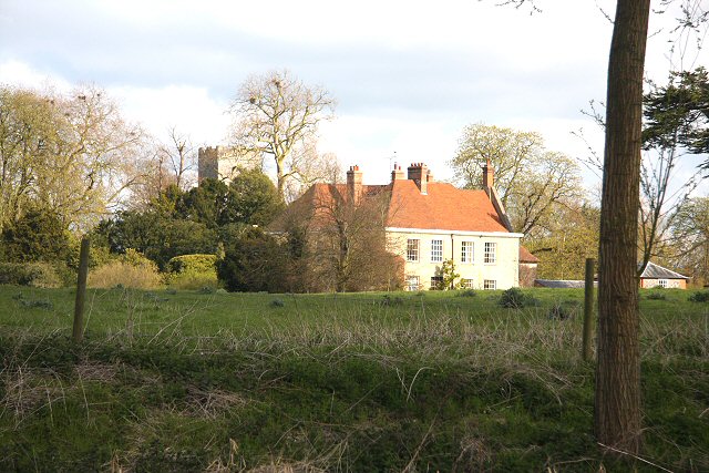
Newe House

Newe House is a Grade II* listed Jacobean dower house in the village of Pakenham, Suffolk.Newe House was built in 1622 by Sir Robert Bright and today the...

Pakenham, Suffolk

Pakenham is a village and civil parish in the West Suffolk district of Suffolk in eastern England. Its name can be linked to Anglo-Saxon roots, Pacca being...

Nether Hall, Suffolk

Nether Hall is a country house situated in the village of Pakenham, Suffolk. It was one of the ancient manors of the village and seat of the Greene baronets...

Pakenham Windmill

Pakenham Mill is a Grade II* listed tower mill at Pakenham, Suffolk, England which has been restored and is maintained in working order. == History... ==

Mickle Mere

Mickle Mere is a 17 hectare nature reserve south of Ixworth in Suffolk. It is managed by the Suffolk Wildlife Trust.This area of open water and wet meadows...

Ixworth Priory

Ixworth Priory was an Augustine priory at Ixworth in the English county of Suffolk. It was founded in the 12th century and dissolved in 1537. The priory...

Ixworth

Ixworth is a village and civil parish in the West Suffolk district of Suffolk, England, 6 miles (9.7 km) north-east of Bury St Edmunds on the A143 road...

Nearby Amenities

Located within 500m of 52.276787,0.82879047
Power: pole
Lat/Long: 52.2778537/0.8227353
Power: pole
Lat/Long: 52.2769445/0.8218984
Power: pole
Lat/Long: 52.2759599/0.8216409
Power: pole
Lat/Long: 52.2799903/0.8246235
Power: pole
Lat/Long: 52.279091/0.8238189
The data included in this document is from www.openstreetmap.org. The data is made available under ODbL.

Have you been to Pakenham Fen?

Leave your review of Pakenham Fen below (or comments, questions and feedback).