Depden Green

Downs, Moorland in Suffolk West Suffolk

England

Depden Green

Footpath to Great Knowles Green
Footpath to Great Knowles Green Credit: Jonathan Thacker

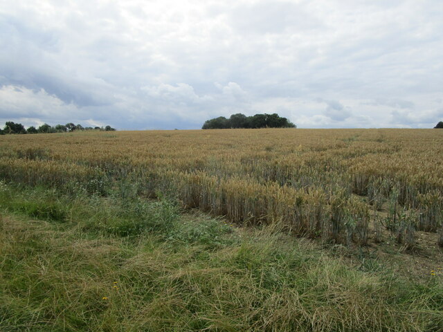
Depden Green is a small village located in the county of Suffolk, England. Situated in the picturesque landscape of the Suffolk Downs and Moorland, it is known for its natural beauty and tranquil atmosphere. The village is surrounded by rolling hills, lush green pastures, and scattered woodlands, providing residents and visitors with stunning views and ample opportunities for outdoor activities.

The village itself is characterized by its quaint charm and traditional English architecture. Its small population, consisting mostly of local families, contributes to a close-knit community feel. The village center features a few essential amenities, including a local pub and a village hall, which serves as a gathering place for various community events and activities.

Depden Green offers a quiet and peaceful lifestyle, away from the hustle and bustle of larger towns and cities. It is a popular destination for nature enthusiasts, as it boasts numerous walking trails and nature reserves nearby. The Suffolk Downs and Moorland are home to a diverse range of wildlife, including rare bird species and various types of flora and fauna.

Despite its rural setting, Depden Green is conveniently located within easy reach of larger towns and cities. The historic market town of Bury St Edmunds is just a short drive away, offering a wider range of amenities, shopping opportunities, and cultural attractions.

In summary, Depden Green is a charming village nestled in the scenic Suffolk Downs and Moorland. With its idyllic setting, close-knit community, and ample opportunities for outdoor pursuits, it offers a peaceful retreat for those seeking a slower pace of life in a beautiful natural environment.

If you have any feedback on the listing, please let us know in the comments section below.
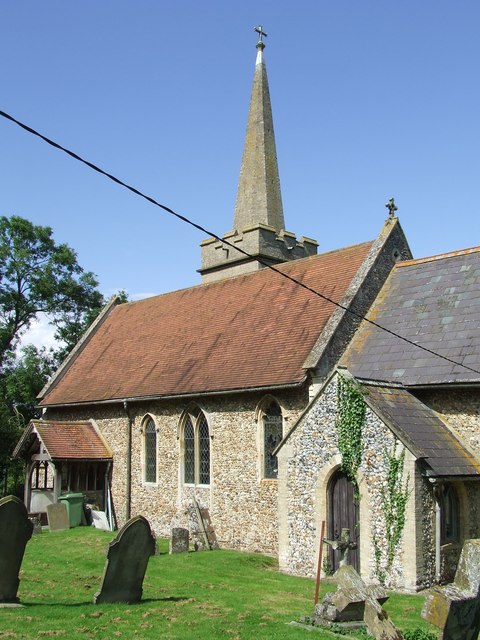
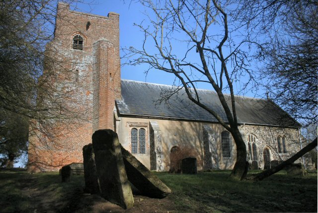
Depden Green Images

Images are sourced within 2km of 52.186081/0.59667253 or Grid Reference TL7757. Thanks to Geograph Open Source API. All images are credited.

Footpath to Great Knowles Green
Footpath to Hargrave
Farm track near The Grove, Hargrave
Footpath along the parish boundary Follows the boundary between Hargrave (left) and Chevington.
Footpath along the parish boundary
Follows the boundary between Hargrave (left) and Chevington.
Footpath to Wickhambrook Road In gently rolling Suffolk countryside.
Footpath to Wickhambrook Road
In gently rolling Suffolk countryside.
Corner of a field A footpath to Little Knowles Green cuts across this corner.
Corner of a field
A footpath to Little Knowles Green cuts across this corner.
Wheatfield and copse Near Little Knowles Green.
Wheatfield and copse
Near Little Knowles Green.
Chevington village sign The sign is close by the village hall
Chevington village sign
The sign is close by the village hall
Chevington village hall
Road leading to mast The location at the camera position is reckoned to be the Suffolk county top.
Road leading to mast
The location at the camera position is reckoned to be the Suffolk county top.
A143 towards Bury St Edmunds In the parish of Depden.
A143 towards Bury St Edmunds
In the parish of Depden.
A143 towards Bury St Edmunds In the parish of Depden.
A143 towards Bury St Edmunds
In the parish of Depden.
A143 towards Bury St Edmunds Passing through Depden, although  not much to see on the main road.
A143 towards Bury St Edmunds
Passing through Depden, although not much to see on the main road.
Bury Road, Chedburgh The older part of the village is off to the left.
Bury Road, Chedburgh
The older part of the village is off to the left.
A143 west of Chedburgh Taken from the end of The Street at its junction with the A143.
A143 west of Chedburgh
Taken from the end of The Street at its junction with the A143.
Water Tower NW of Depden: aerial 2019
RAF Chedburgh station memorial Opening in September 1942, Chedburgh was one of the earliest operational wartime airfields in Suffolk, it was a satellite bomber station for nearby RAF Stradishall.
Various Units were stationed at RAF Chedburgh in its short history.
620 Squadron was formed at RAF Chedburgh on 17 June 1943 as a heavy bomber squadron equipped with the Short Stirling. It was a part of No.3 Group of RAF Bomber Command and carried out night 61 operations, bombing and minelaying missions until November 1943 when it was transferred to No 38 Group. 
No. 23 Heavy Glider Maintenance Section
No. 214 Squadron RAF flying Handley Page Type O/100 and 400 bombers.
No. 218 Squadron RAF flying Short Sterlings as a transport Unit.
No. 301 Squadron RAF flying Handley Page Halifaxs until they were disbanded in December 1946 
No. 304 Squadron RAF  flying Halifax Mk C.8 unarmed transports and was disbanded a few months later on 18 December 1946.
No. 1653 Heavy Conversion Unit RAF
RAF Chedburgh station memorial
Opening in September 1942, Chedburgh was one of the earliest operational wartime airfields in Suffolk, it was a satellite bomber station for nearby RAF Stradishall. Various Units were stationed at RAF Chedburgh in its short history. 620 Squadron was formed at RAF Chedburgh on 17 June 1943 as a heavy bomber squadron equipped with the Short Stirling. It was a part of No.3 Group of RAF Bomber Command and carried out night 61 operations, bombing and minelaying missions until November 1943 when it was transferred to No 38 Group. No. 23 Heavy Glider Maintenance Section No. 214 Squadron RAF flying Handley Page Type O/100 and 400 bombers. No. 218 Squadron RAF flying Short Sterlings as a transport Unit. No. 301 Squadron RAF flying Handley Page Halifaxs until they were disbanded in December 1946 No. 304 Squadron RAF flying Halifax Mk C.8 unarmed transports and was disbanded a few months later on 18 December 1946. No. 1653 Heavy Conversion Unit RAF
RAF Chedburgh station memorial RAF Chedburgh station memorial
Opening in September 1942, Chedburgh was one of the earliest operational wartime airfields in Suffolk, it was a satellite bomber station for nearby RAF Stradishall.
Various Units were stationed at RAF Chedburgh in its short history.
620 Squadron was formed at RAF Chedburgh on 17 June 1943 as a heavy bomber squadron equipped with the Short Stirling. It was a part of No.3 Group of RAF Bomber Command and carried out night 61 operations, bombing and minelaying missions until November 1943 when it was transferred to No 38 Group.
No. 23 Heavy Glider Maintenance Section
No. 214 Squadron RAF flying Handley Page Type O/100 and 400 bombers.
No. 218 Squadron RAF flying Short Sterlings as a transport Unit.
No. 301 Squadron RAF flying Handley Page Halifaxs until they were disbanded in December 1946
No. 304 Squadron RAF flying Halifax Mk C.8 unarmed transports and was disbanded a few months later on 18 December 1946.
No. 1653 Heavy Conversion Unit RAF
RAF Chedburgh station memorial
RAF Chedburgh station memorial Opening in September 1942, Chedburgh was one of the earliest operational wartime airfields in Suffolk, it was a satellite bomber station for nearby RAF Stradishall. Various Units were stationed at RAF Chedburgh in its short history. 620 Squadron was formed at RAF Chedburgh on 17 June 1943 as a heavy bomber squadron equipped with the Short Stirling. It was a part of No.3 Group of RAF Bomber Command and carried out night 61 operations, bombing and minelaying missions until November 1943 when it was transferred to No 38 Group. No. 23 Heavy Glider Maintenance Section No. 214 Squadron RAF flying Handley Page Type O/100 and 400 bombers. No. 218 Squadron RAF flying Short Sterlings as a transport Unit. No. 301 Squadron RAF flying Handley Page Halifaxs until they were disbanded in December 1946 No. 304 Squadron RAF flying Halifax Mk C.8 unarmed transports and was disbanded a few months later on 18 December 1946. No. 1653 Heavy Conversion Unit RAF
Show me another place!

Depden Green is located at Grid Ref: TL7757 (Lat: 52.186081, Lng: 0.59667253)

Administrative County: Suffolk

District: West Suffolk

Police Authority: Suffolk

What 3 Words

///crouches.commenced.sticky. Near Glemsford, Suffolk

Related Wikis

Depden

Depden is a village and civil parish in the West Suffolk district of Suffolk in eastern England. Located on the A143 around five miles south-west of Bury...

Chedburgh

Chedburgh is a village and civil parish in the West Suffolk district of Suffolk in eastern England. Located on the A143 around five miles south-west of...

RAF Chedburgh

Royal Air Force Chedburgh or more simply RAF Chedburgh is a former Royal Air Force satellite station located near Bury St Edmunds, Suffolk, UK. The Bury...

Newmarket Ridge

The Newmarket Ridge or East Anglian Ridge is a ridge starting north-west of Hertford, Hertfordshire near the Chiltern Hills and ending near Sudbury, Suffolk...

Great Wood Hill

At 128 metres (420 ft), Great Wood Hill, near Chedburgh, is the highest point in the English county of Suffolk. It is the highest part of the Newmarket...

Hargrave, Suffolk

Hargrave is a village and civil parish in the West Suffolk district of Suffolk in eastern England, located about 7 miles (10 km) away from south west of...
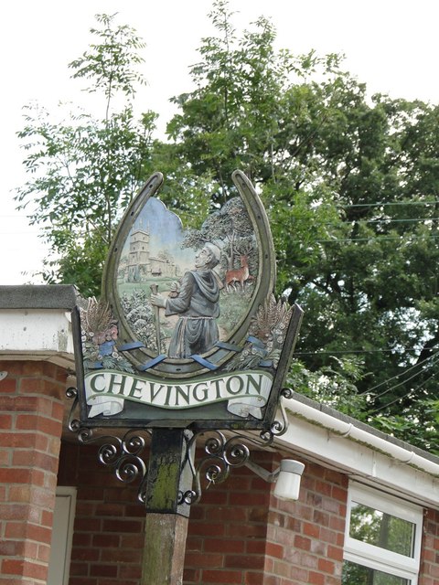
Chevington, Suffolk

Chevington is a village and civil parish in the West Suffolk district of Suffolk in East Anglia, England. Located around 10 km south-west of Bury St Edmunds...

Coltsfoot Green

Coltsfoot Green is a small hamlet within the village of Wickhambrook, Suffolk, England. It constitutes one of its eleven village greens and consists of...

Nearby Amenities

Located within 500m of 52.186081,0.59667253
Addr Housenumber: 11
Addr Postcode: IP29 4DA
Addr Street: Hall Close
Lat/Long: 52.1852499/0.5934029
Addr Housenumber: 14
Addr Postcode: IP29 4DA
Addr Street: Hall Close
Lat/Long: 52.1850721/0.5936658
Addr Housenumber: 13
Addr Postcode: IP29 4DA
Addr Street: Hall Close
Lat/Long: 52.1850557/0.5935585
Post Box
Ref: IP29 2077
Lat/Long: 52.1864637/0.597254
Addr Housenumber: 7
Addr Postcode: IP29 4DA
Addr Street: Hall Close
Lat/Long: 52.185651/0.5931347
Addr Housenumber: 9
Addr Postcode: IP29 4DA
Addr Street: Hall Close
Lat/Long: 52.1854438/0.5933171
Addr Housenumber: 12
Addr Postcode: IP29 4DA
Addr Street: Hall Close
Lat/Long: 52.185184/0.593419
Addr Housenumber: 8
Addr Postcode: IP29 4DA
Addr Street: Hall Close
Lat/Long: 52.1855655/0.5931776
Addr Housenumber: 10
Addr Postcode: IP29 4DA
Addr Street: Hall Close
Lat/Long: 52.1853879/0.5933332
The data included in this document is from www.openstreetmap.org. The data is made available under ODbL.

Have you been to Depden Green?

Leave your review of Depden Green below (or comments, questions and feedback).