Depden Green

Settlement in Suffolk West Suffolk

England

Depden Green

A143 towards Bury St Edmunds The village sign for Depden is ahead, but little sign of the actual village yet. Most of the small village is off the main road anyway.
A143 towards Bury St Edmunds Credit: Robin Webster

Depden Green is a small village located in the county of Suffolk, England. Situated in the East Anglia region, it is part of the Babergh district. With a population of just over 100 residents, Depden Green is known for its peaceful and rural atmosphere.

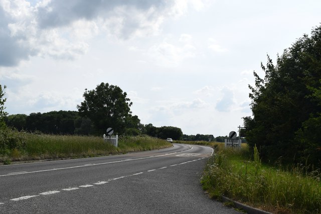
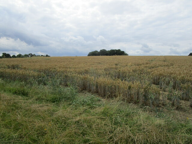
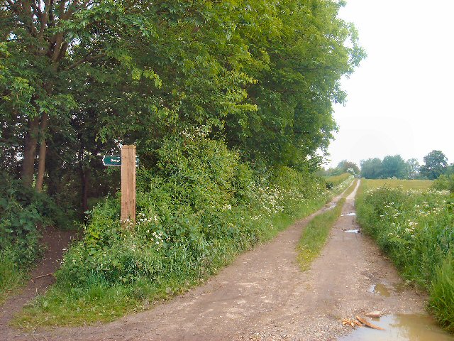
The village is surrounded by beautiful countryside, characterized by rolling hills and green fields. It is situated approximately 12 miles northeast of Bury St. Edmunds and 15 miles southwest of the larger town of Diss. The nearest railway station is located in Bury St. Edmunds, providing convenient transportation links to other parts of the country.

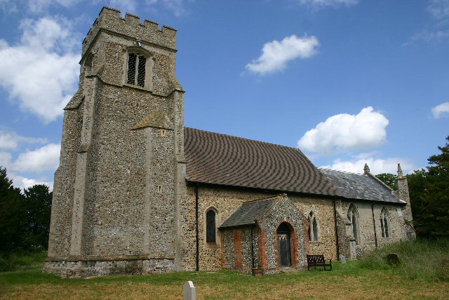
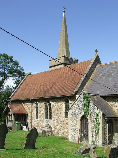
Depden Green is a close-knit community with a strong sense of community spirit. The village features a small church, St. Mary's, which serves as a focal point for religious and social gatherings. The church dates back to the 12th century and boasts impressive architectural features.

The village is predominantly residential, with a mix of historic and modern houses. Many of the properties in Depden Green are traditional cottages, adding to the charm and character of the area. The village also benefits from a small number of amenities, including a village hall and a local pub, offering a place for residents to socialize and meet.

For those who enjoy the outdoors, Depden Green offers numerous opportunities for walking, cycling, and exploring the surrounding countryside. The village is located near a number of nature reserves and country parks, allowing residents to enjoy the natural beauty of Suffolk.

In summary, Depden Green is a picturesque and tranquil village in Suffolk, offering a peaceful lifestyle and access to stunning rural landscapes.

If you have any feedback on the listing, please let us know in the comments section below.

Depden Green Images

Images are sourced within 2km of 52.182847/0.58756003 or Grid Reference TL7757. Thanks to Geograph Open Source API. All images are credited.

A143 towards Bury St Edmunds The village sign for Depden is ahead, but little sign of the actual village yet. Most of the small village is off the main road anyway.
A143 towards Bury St Edmunds
The village sign for Depden is ahead, but little sign of the actual village yet. Most of the small village is off the main road anyway.
A143 towards Bury St Edmunds In the parish of Depden.
A143 towards Bury St Edmunds
In the parish of Depden.
A143 towards Bury St Edmunds In the parish of Depden.
A143 towards Bury St Edmunds
In the parish of Depden.
A143 towards Bury St Edmunds Passing through Depden, although  not much to see on the main road.
A143 towards Bury St Edmunds
Passing through Depden, although not much to see on the main road.
Bury Road, Chedburgh The older part of the village is off to the left.
Bury Road, Chedburgh
The older part of the village is off to the left.
A143 west of Chedburgh Taken from the end of The Street at its junction with the A143.
A143 west of Chedburgh
Taken from the end of The Street at its junction with the A143.
Water Tower NW of Depden: aerial 2019
Road towards Hargrave, Fuller's Hill
Road through Ashfield Green Northwards, towards Hargrave.
Road through Ashfield Green
Northwards, towards Hargrave.
Road past Ashfield Green Farm Northwards, towards Hargrave.
Road past Ashfield Green Farm
Northwards, towards Hargrave.
Water tower west of Depden
Road northwards towards Hargrave
Depden WW1 War Memorial The memorial bears nine names of men lost in the Great War.
Depden WW1 War Memorial
The memorial bears nine names of men lost in the Great War.
Depden village sign Depden is a haven for wildlife if the sign is anything to go by. The church is tucked away in the background and never seen by a passer-by due to its remoteness. The sign features a rather oversize fox who looks about to devour a horse and cart. A cock and hen pheasant survey the scene. The brown hare in the centre is looking butterflies in the blackberry flowers. Nearby a badger peers out of its sett at a hedgehog tucked away in the corner. Flanking the name is Depden windmill which used to stand on Depden Green many years ago and a notable former resident of Depden, Anthony Sparrow (1612-1685) who was Bishop of Exeter and later Bishop of Norwich.
Since this image was taken the painting has been re-modelled and includes another badger, a wren and a robin but has lost the hedgehog. <a title="https://www.geograph.org.uk/photo/4192983" href="https://www.geograph.org.uk/photo/4192983">Link</a>
Incidentally Depden is the highest point in Suffolk, at 128m above sea level. It’s all downhill from here! <a title="https://www.geograph.org.uk/photo/4291801" href="https://www.geograph.org.uk/photo/4291801">Link</a>
Depden village sign
Depden is a haven for wildlife if the sign is anything to go by. The church is tucked away in the background and never seen by a passer-by due to its remoteness. The sign features a rather oversize fox who looks about to devour a horse and cart. A cock and hen pheasant survey the scene. The brown hare in the centre is looking butterflies in the blackberry flowers. Nearby a badger peers out of its sett at a hedgehog tucked away in the corner. Flanking the name is Depden windmill which used to stand on Depden Green many years ago and a notable former resident of Depden, Anthony Sparrow (1612-1685) who was Bishop of Exeter and later Bishop of Norwich. Since this image was taken the painting has been re-modelled and includes another badger, a wren and a robin but has lost the hedgehog. Link Incidentally Depden is the highest point in Suffolk, at 128m above sea level. It’s all downhill from here! Link
Corner of a field A footpath to Little Knowles Green cuts across this corner.
Corner of a field
A footpath to Little Knowles Green cuts across this corner.
Wheatfield and copse Near Little Knowles Green.
Wheatfield and copse
Near Little Knowles Green.
Byway junction Two byways start from this point where a metalled road ends. To the right leads to Great Knowles Green; to the left to Depden Green.
Byway junction
Two byways start from this point where a metalled road ends. To the right leads to Great Knowles Green; to the left to Depden Green.
Entrance to Chedburgh village Chedburgh is a small village five miles south-west of Bury St Edmunds. A former Bomber Command airfield to the south of the village has been turned into industrial units.
Entrance to Chedburgh village
Chedburgh is a small village five miles south-west of Bury St Edmunds. A former Bomber Command airfield to the south of the village has been turned into industrial units.
Show me another place!

Depden Green is located at Grid Ref: TL7757 (Lat: 52.182847, Lng: 0.58756003)

Administrative County: Suffolk

District: West Suffolk

Police Authority: Suffolk

What 3 Words

///instructs.jogged.heads. Near Glemsford, Suffolk

Related Wikis

Depden

Depden is a village and civil parish in the West Suffolk district of Suffolk in eastern England. Located on the A143 around five miles south-west of Bury...

Great Wood Hill

At 128 metres (420 ft), Great Wood Hill, near Chedburgh, is the highest point in the English county of Suffolk. It is the highest part of the Newmarket...

Newmarket Ridge

The Newmarket Ridge or East Anglian Ridge is a ridge starting north-west of Hertford, Hertfordshire near the Chiltern Hills and ending near Sudbury, Suffolk...

Chedburgh

Chedburgh is a village and civil parish in the West Suffolk district of Suffolk in eastern England. Located on the A143 around five miles south-west of...

Nearby Amenities

Located within 500m of 52.182847,0.58756003
Addr Housenumber: 11
Addr Postcode: IP29 4DA
Addr Street: Hall Close
Lat/Long: 52.1852499/0.5934029
Addr Housenumber: 14
Addr Postcode: IP29 4DA
Addr Street: Hall Close
Lat/Long: 52.1850721/0.5936658
Addr Housenumber: 13
Addr Postcode: IP29 4DA
Addr Street: Hall Close
Lat/Long: 52.1850557/0.5935585
Addr Housenumber: 7
Addr Postcode: IP29 4DA
Addr Street: Hall Close
Lat/Long: 52.185651/0.5931347
Addr Housenumber: 9
Addr Postcode: IP29 4DA
Addr Street: Hall Close
Lat/Long: 52.1854438/0.5933171
Addr Housenumber: 12
Addr Postcode: IP29 4DA
Addr Street: Hall Close
Lat/Long: 52.185184/0.593419
Addr Housenumber: 8
Addr Postcode: IP29 4DA
Addr Street: Hall Close
Lat/Long: 52.1855655/0.5931776
Addr Housenumber: 10
Addr Postcode: IP29 4DA
Addr Street: Hall Close
Lat/Long: 52.1853879/0.5933332
The data included in this document is from www.openstreetmap.org. The data is made available under ODbL.

Have you been to Depden Green?

Leave your review of Depden Green below (or comments, questions and feedback).