Downham Market Fen

Downs, Moorland in Norfolk King's Lynn and West Norfolk

England

Downham Market Fen

River Great Ouse Looking downstream by Downham Market
River Great Ouse Credit: Chris Morgan

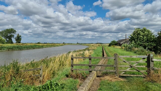
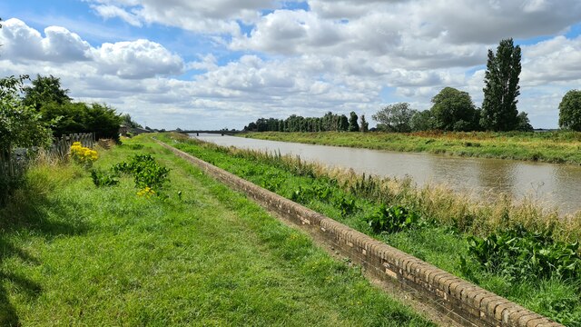
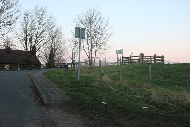
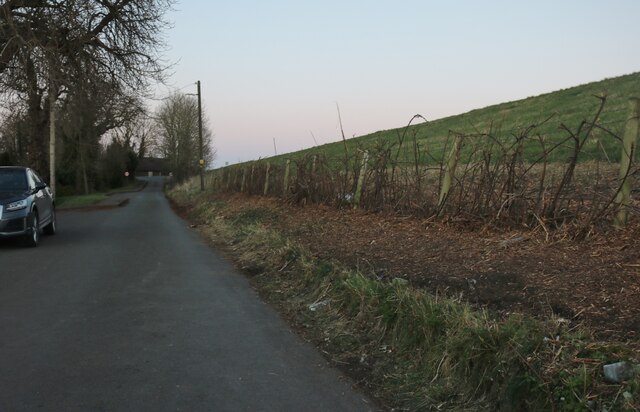
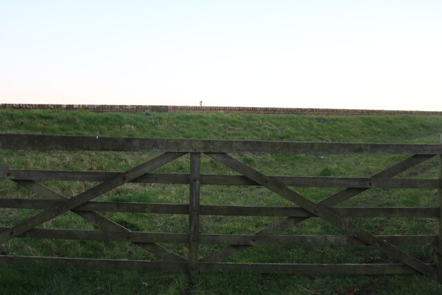
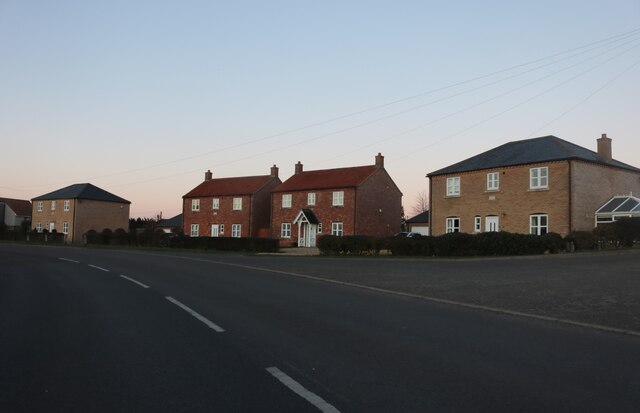
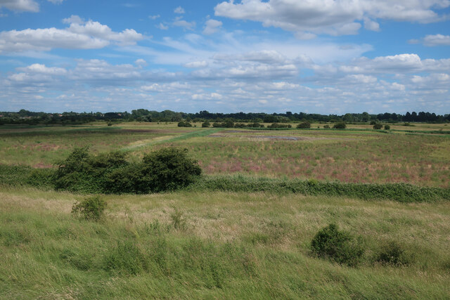
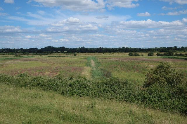
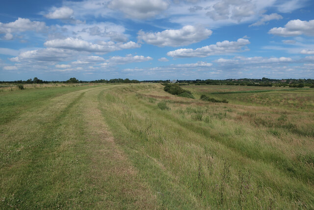
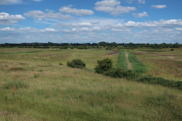
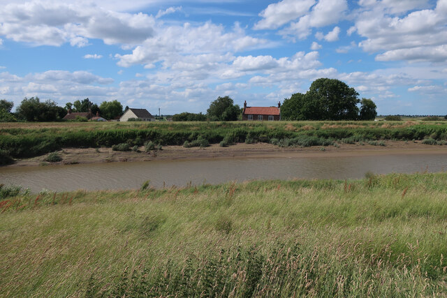
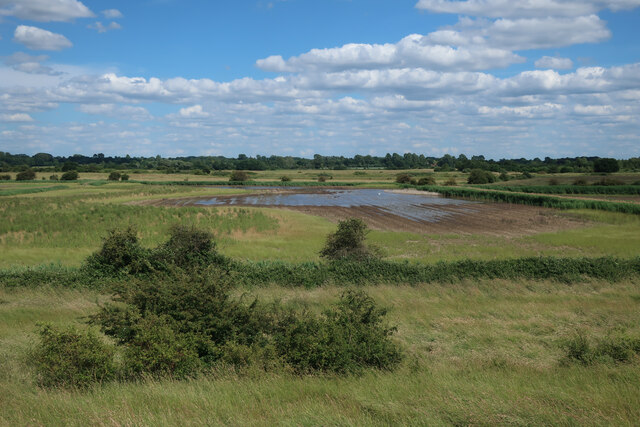
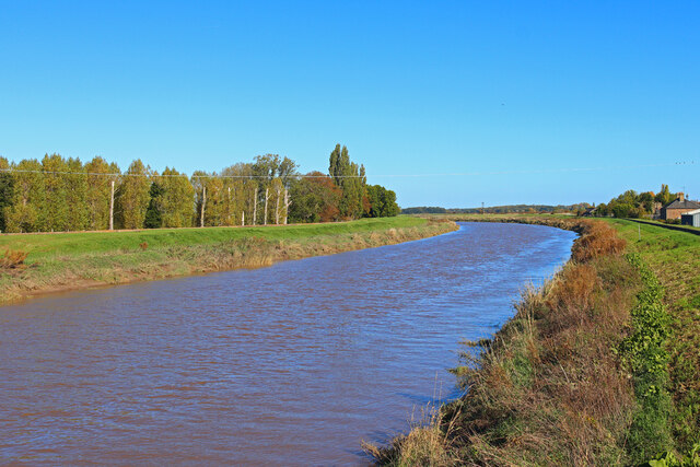
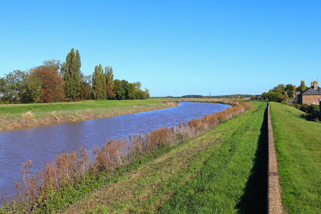
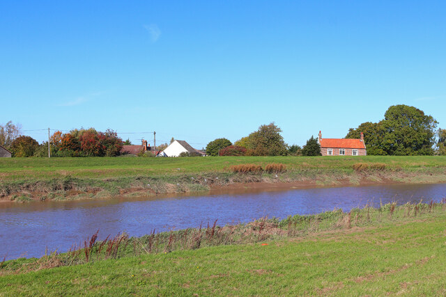
Downham Market Fen, located in Norfolk, England, is a picturesque area characterized by its unique landscape of downs and moorland. Spanning approximately 200 acres, this fen is renowned for its natural beauty and ecological significance. The fen is situated near the town of Downham Market, which lies on the edge of the Norfolk Fens, a vast region known for its marshy lowlands and rich biodiversity.

The fen is dominated by a diverse range of habitats, including wet meadows, reed beds, and open water areas. These habitats support a wide array of plant and animal species, making it an important site for nature conservation. Rare and endangered species, such as water voles, marsh harriers, and bitterns, can be found here, drawing nature enthusiasts and birdwatchers from far and wide.

Downham Market Fen also plays a crucial role in flood prevention, acting as a natural buffer zone that absorbs excess water during periods of heavy rainfall. This function is vital for protecting the surrounding areas from flooding, helping to maintain the ecological balance of the region.

In addition to its ecological significance, the fen offers recreational opportunities for visitors. Walking trails and bird hides have been established to allow people to explore and observe the diverse wildlife in the area. The tranquil atmosphere, coupled with the stunning views of the fen's landscape, make it a popular destination for nature lovers and those seeking a peaceful retreat.

Overall, Downham Market Fen is a natural gem in Norfolk, offering a unique combination of natural beauty, ecological importance, and recreational opportunities.

If you have any feedback on the listing, please let us know in the comments section below.

Downham Market Fen Images

Images are sourced within 2km of 52.605331/0.34619241 or Grid Reference TF5803. Thanks to Geograph Open Source API. All images are credited.

River Great Ouse Looking downstream by Downham Market
River Great Ouse
Looking downstream by Downham Market
River Great Ouse Looking upstream by Downham Market
River Great Ouse
Looking upstream by Downham Market
By Downham Bridge on Farthing Road
Farthing Road, Downham Market
Farthing Road, Downham Market The River Great Ouse is behind the bank.
Farthing Road, Downham Market
The River Great Ouse is behind the bank.
The bank of the Great Ouse, Downham Market This is a private strip of grassland along the river bank.
The bank of the Great Ouse, Downham Market
This is a private strip of grassland along the river bank.
New houses on Downham Road, Salters Lode These were designed to look similar to the existing houses.
New houses on Downham Road, Salters Lode
These were designed to look similar to the existing houses.
Downham Road at the junction of Farthing Road
Former arable land near Denver Sluice The area is relatively small and bounded by The Great Ouse and the Relief Channel, which makes it a good area to change water levels without affecting any neighbouring fields. See <a href="https://www.geograph.org.uk/photo/4765173">TF5801 : Farmland between Great Ouse and Relief Channel</a> for an earlier view.
Former arable land near Denver Sluice
The area is relatively small and bounded by The Great Ouse and the Relief Channel, which makes it a good area to change water levels without affecting any neighbouring fields. See TF5801 : Farmland between Great Ouse and Relief Channel for an earlier view.
Wetland creation area near Denver Sluice Former arable land. The area is relatively small and bounded by The Great Ouse and the Relief Channel, which makes it a good area to change water levels without affecting any neighbouring fields. See <a href="https://www.geograph.org.uk/photo/2734301">TF5801 : Farmland by River Great Ouse</a> for an earlier view.
Wetland creation area near Denver Sluice
Former arable land. The area is relatively small and bounded by The Great Ouse and the Relief Channel, which makes it a good area to change water levels without affecting any neighbouring fields. See TF5801 : Farmland by River Great Ouse for an earlier view.
Former arable land near Denver Sluice The area is relatively small and bounded by The Great Ouse and the Relief Channel, which makes it a good area to change water levels without affecting any neighbouring fields. See <a href="https://www.geograph.org.uk/photo/4765173">TF5801 : Farmland between Great Ouse and Relief Channel</a> for an earlier view.
Former arable land near Denver Sluice
The area is relatively small and bounded by The Great Ouse and the Relief Channel, which makes it a good area to change water levels without affecting any neighbouring fields. See TF5801 : Farmland between Great Ouse and Relief Channel for an earlier view.
Bank of the Great Ouse See <a href="https://www.geograph.org.uk/photo/4765194">TF5802 : Bridleway by River Great Ouse</a> for a view before the arable fields were converted to wetland.
Bank of the Great Ouse
See TF5802 : Bridleway by River Great Ouse for a view before the arable fields were converted to wetland.
Former arable land near Denver Sluice The area is relatively small and bounded by The Great Ouse and the Relief Channel, which makes it a good area to change water levels without affecting any neighbouring fields.
Former arable land near Denver Sluice
The area is relatively small and bounded by The Great Ouse and the Relief Channel, which makes it a good area to change water levels without affecting any neighbouring fields.
River Great Ouse at Salters Lode
Former arable land near Denver Sluice The area is relatively small and bounded by The Great Ouse and the Relief Channel, which makes it a good area to change water levels without affecting any neighbouring fields. See <a href="https://www.geograph.org.uk/photo/4765173">TF5801 : Farmland between Great Ouse and Relief Channel</a> for an earlier view.
Former arable land near Denver Sluice
The area is relatively small and bounded by The Great Ouse and the Relief Channel, which makes it a good area to change water levels without affecting any neighbouring fields. See TF5801 : Farmland between Great Ouse and Relief Channel for an earlier view.
Downham Bridge View from the main road.
Downham Bridge
View from the main road.
Great Ouse Riverbank in Downham Market.
Great Ouse
Riverbank in Downham Market.
Great Ouse Houses across the river.
Great Ouse
Houses across the river.
Show me another place!

Downham Market Fen is located at Grid Ref: TF5803 (Lat: 52.605331, Lng: 0.34619241)

Administrative County: Norfolk

District: King's Lynn and West Norfolk

Police Authority: Norfolk

What 3 Words

///trek.segregate.included. Near Downham Market, Norfolk

Nearby Locations

Downham Market Fen

Related Wikis

Downham West

Downham West is a civil parish in the English county of Norfolk The parish is 47.6 miles (76.6 km) west of Norwich, 16.3 miles (26.2 km) south-south-west...

Downham Market railway station

Downham Market railway station (formerly Downham) is on the Fen line in the east of England, serving the town of Downham Market, Norfolk. It is 86 miles...

Well Creek

Well Creek is a waterway in Norfolk, England that is a tributary to the River Great Ouse. Rising from the River Nene, the waterway in its current alignment...

Downham Market Town Hall

Downham Market Town Hall is a municipal building in Bridge Street, Downham Market, Norfolk, England. The structure, which is managed by Downham Market...

St Dominic, Downham Market

Saint Dominic's Church in Downham Market is the parish church serving the Roman Catholic population of Downham Market and the surrounding areas of Norfolk...

Downham Town F.C.

Downham Town Football Club is a football club based in Downham Market, Norfolk, England. Affiliated to the Norfolk County Football Association, they are...

Denver railway station (England)

Denver railway station (originally opened as Denver Road Gate) was a station in Denver, Norfolk on the Great Eastern Railway route between King's Lynn...

Denver Windmill

Denver Windmill is a Grade II* listed tower mill at Denver, Norfolk, England. In March 2010, there were about 374,000 list entries of which 5.5% were Grade...

Nearby Amenities

Located within 500m of 52.605331,0.34619241
Poplar Farm
Landuse: farm
Note Retag: CS #48756035
Lat/Long: 52.6018905/0.3499525
Poplar Farm Airstrip
Aeroway: airstrip
Alt Name: Barroway Drove
Lat/Long: 52.6039971/0.3463242
The data included in this document is from www.openstreetmap.org. The data is made available under ODbL.

Have you been to Downham Market Fen?

Leave your review of Downham Market Fen below (or comments, questions and feedback).