Middle Fen

Downs, Moorland in Cambridgeshire East Cambridgeshire

England

Middle Fen

Track to Nornea Farm This metalled track leads eastwards from the A142, near Stuntney.
Track to Nornea Farm Credit: Bob Jones

Middle Fen is a region located in Cambridgeshire, England. It is characterized by its diverse landscape, consisting of downs and moorland. The area is known for its natural beauty and rich biodiversity.

The downs in Middle Fen are rolling hills covered in lush green grass and scattered with various wildflowers. These gentle slopes provide breathtaking views of the surrounding countryside. The downs are also home to a variety of wildlife, including rabbits, hares, and various species of birds.

In contrast, the moorland in Middle Fen is a vast expanse of open, marshy land. The moorland is characterized by its wet and boggy terrain, making it an ideal habitat for a range of plant and animal species. Visitors to Middle Fen can expect to see heather, cotton grass, and various types of mosses thriving in this unique environment.

The region is a popular destination for nature lovers and outdoor enthusiasts. It offers numerous walking trails and cycling routes that allow visitors to explore the downs and moorland. Middle Fen is also home to several nature reserves and conservation areas, where visitors can learn more about the local flora and fauna.

Overall, Middle Fen in Cambridgeshire is a picturesque region, offering a diverse landscape of downs and moorland. With its stunning views and abundant wildlife, it provides a tranquil escape for those seeking to connect with nature.

If you have any feedback on the listing, please let us know in the comments section below.
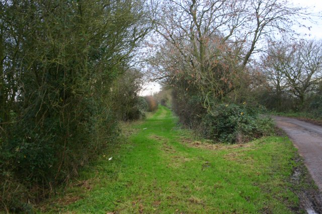
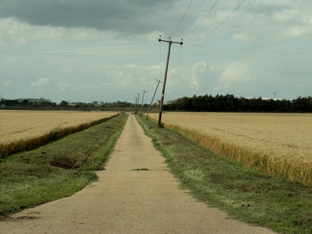
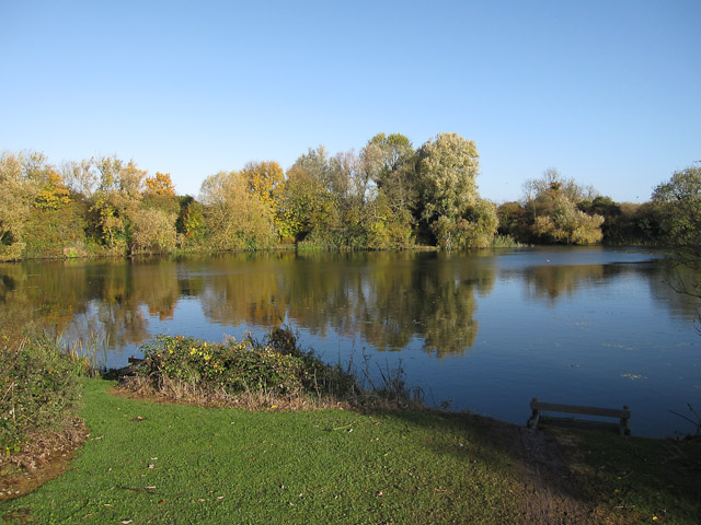
Middle Fen Images

Images are sourced within 2km of 52.389022/0.30326542 or Grid Reference TL5679. Thanks to Geograph Open Source API. All images are credited.

Track to Nornea Farm This metalled track leads eastwards from the A142, near Stuntney.
Track to Nornea Farm
This metalled track leads eastwards from the A142, near Stuntney.
The green alternative This grassy track runs parallel to the metalled track, between Nornea Farm and the  A142 Ely to Soham road.
The green alternative
This grassy track runs parallel to the metalled track, between Nornea Farm and the A142 Ely to Soham road.
Maize field at Nornea Farm Nornea Farm is situated a mile east of the A142, near Stuntney.
Maize field at Nornea Farm
Nornea Farm is situated a mile east of the A142, near Stuntney.
Holy Cross Church, Stuntney The present church at Stuntney was almost completely rebuilt in 1876 on the site of a much earlier building, going back to Norman times. For a small church Stuntney Holy Cross is well particularly endowed with five beautiful stained glass windows, three of which were erected by the Cole Ambrose family.
Holy Cross Church, Stuntney
The present church at Stuntney was almost completely rebuilt in 1876 on the site of a much earlier building, going back to Norman times. For a small church Stuntney Holy Cross is well particularly endowed with five beautiful stained glass windows, three of which were erected by the Cole Ambrose family.
Closeup of Holy Cross Church in Stuntney
Queen Adelaide Way View from dyke across Queen Adelaide Way towards Cloverleigh Farm
Queen Adelaide Way
View from dyke across Queen Adelaide Way towards Cloverleigh Farm
Hall Field Terrace
Hall Field Terrace
Cul de sac in Stuntney
The village sign at Stuntney
Farm road to Wades Farm
Road to Thorney Hill Farm
Barns at Nornea Farm This track (unmarked on the map) leads round the back of Nornea Farm  and presumably gives access to Red House Farm.
Barns at Nornea Farm
This track (unmarked on the map) leads round the back of Nornea Farm and presumably gives access to Red House Farm.
Dunstalls Drove This wide grassy track leads from an area called The Dunstalls to Middle Fen.  Whilst walking along it I disturbed three hares but I was too slow to snap them.
Dunstalls Drove
This wide grassy track leads from an area called The Dunstalls to Middle Fen. Whilst walking along it I disturbed three hares but I was too slow to snap them.
Middle Fen This fen is below sea level (by a metre).  The slight rise on the horizon (in the adjacent square) is known as Thorney Hill and is a heady ten metres above sea level.
Middle Fen
This fen is below sea level (by a metre). The slight rise on the horizon (in the adjacent square) is known as Thorney Hill and is a heady ten metres above sea level.
Hardstanding area by Swasedale Drove By a sugar beet field near Quanea Farm.
Hardstanding area by Swasedale Drove
By a sugar beet field near Quanea Farm.
Track through Quanea Farm Looking up onto this 'island' - once important features allowing settlement within the marsh.
Track through Quanea Farm
Looking up onto this 'island' - once important features allowing settlement within the marsh.
Track to Quanea Farm On Quanea Hill (everything's relative)
Track to Quanea Farm
On Quanea Hill (everything's relative)
Quanea Drove Narrow road across Middle Fen to Quanea Hill.
Quanea Drove
Narrow road across Middle Fen to Quanea Hill.
Show me another place!

Middle Fen is located at Grid Ref: TL5679 (Lat: 52.389022, Lng: 0.30326542)

Division: Isle of Ely

Administrative County: Cambridgeshire

District: East Cambridgeshire

Police Authority: Cambridgeshire

What 3 Words

///airbase.signs.salads. Near Ely, Cambridgeshire

Nearby Locations

Middle Fen

Related Wikis

East Cambridgeshire

East Cambridgeshire (locally known as East Cambs) is a local government district in Cambridgeshire, England. Its council is based in the city of Ely. The...

Isle of Ely Rowing Club

Isle of Ely Rowing Club is a rowing club on the River Great Ouse based at Kiln Lane, Prickwillow Road, Ely, Cambridgeshire.The club was founded in 2004...

Ely Pits and Meadows

Ely Pits and Meadows is an 85.8-hectare (212-acre) Site of Special Scientific Interest (SSSI) on the eastern outskirts of Ely in Cambridgeshire. It is...

Roswell Pits

Roswell Pits is an 8 hectare nature reserve on the eastern outskirts of Ely in Cambridgeshire. It is managed by the Environment Agency. It is part of the...

Nearby Amenities

Located within 500m of 52.389022,0.30326542
Middle Fen
Created By: Potlatch 0.10b
Place: locality
Source: npe
Lat/Long: 52.3916291/0.3054823
The data included in this document is from www.openstreetmap.org. The data is made available under ODbL.

Have you been to Middle Fen?

Leave your review of Middle Fen below (or comments, questions and feedback).