Turf Fen

Downs, Moorland in Cambridgeshire East Cambridgeshire

England

Turf Fen

IHP Cotes Farm, The Cotes, Soham, from the railway
IHP Cotes Farm, The Cotes, Soham, from the railway Credit: Christopher Hilton

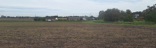
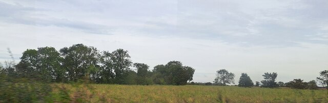
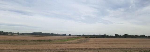
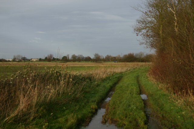
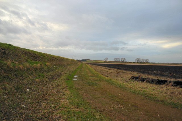
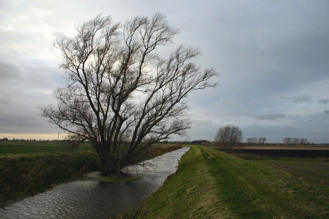
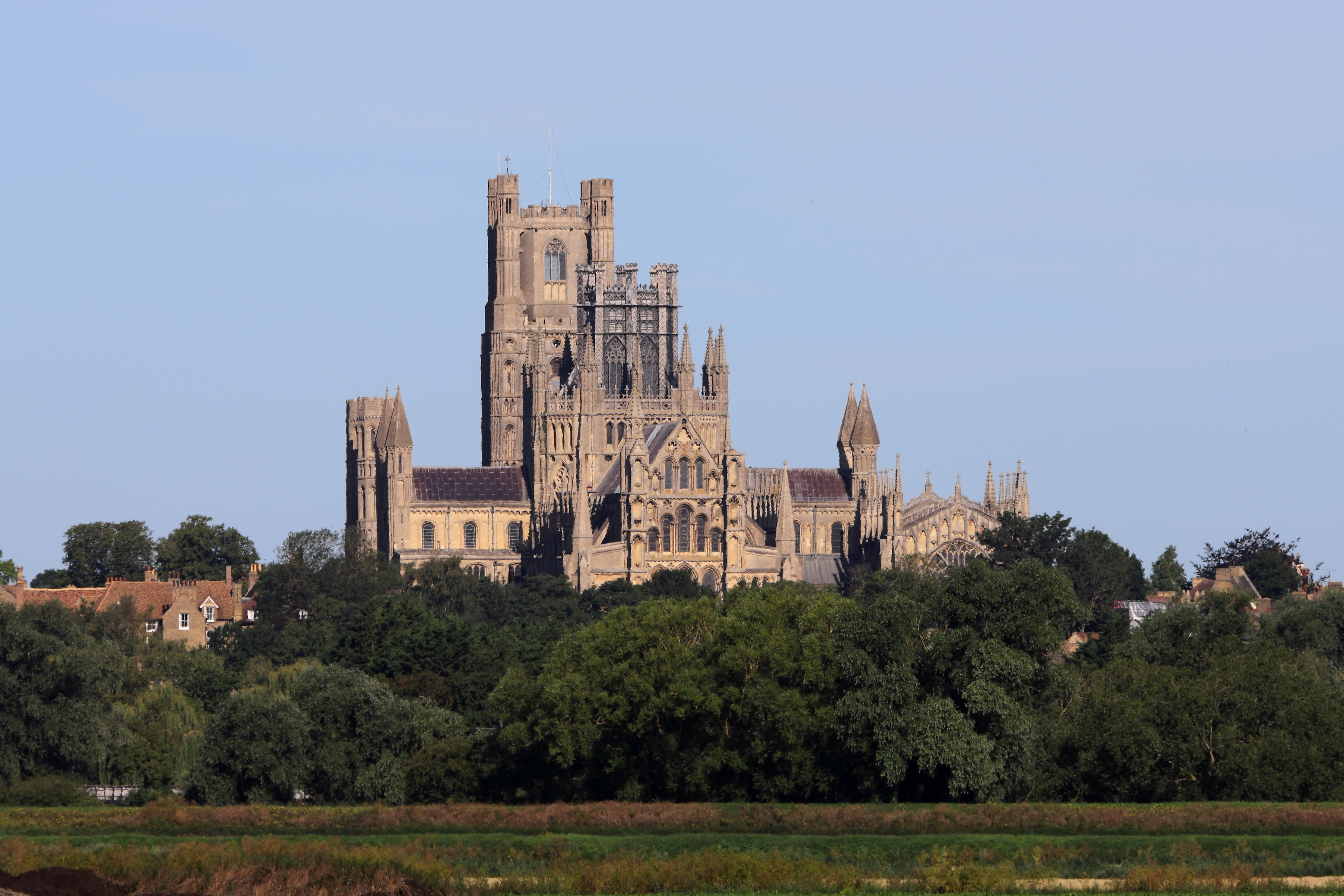
Turf Fen is a small village located in Cambridgeshire, England. It is situated in the heart of the Fens, a region known for its vast low-lying flatlands, marshes, and peat bogs. The village is surrounded by picturesque countryside, characterized by open fields, canals, and drainage channels.

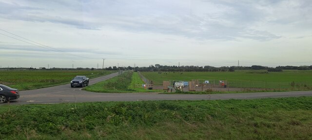
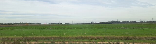
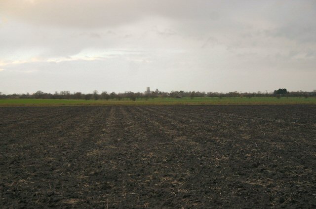
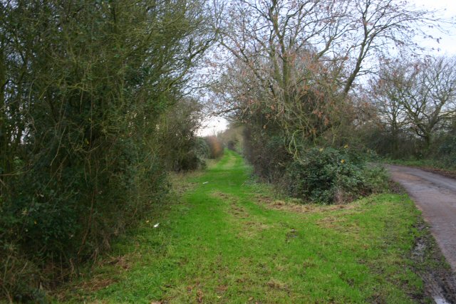
The landscape of Turf Fen is predominantly rural and agricultural, with farmland dominating the area. The fertile soil of the Fens makes it ideal for farming, particularly for growing crops such as potatoes, sugar beet, and cereals. The fields are often crisscrossed by a network of footpaths and bridleways, providing opportunities for walking and cycling enthusiasts to explore the beautiful countryside.

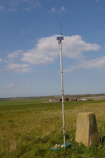
One notable feature of Turf Fen is its proximity to the Cambridgeshire Fens Moorland, a designated Site of Special Scientific Interest. The moorland is an important habitat for various wildlife species, including rare and protected birds like the bittern and marsh harrier. Visitors to Turf Fen can enjoy birdwatching and nature walks in this unique and ecologically significant area.

The village itself is small, with a close-knit community. It features a few residential properties, a local pub, and a village hall. The tranquility and peacefulness of Turf Fen make it an attractive destination for those seeking a rural retreat or a taste of traditional English countryside life.

Overall, Turf Fen offers visitors and residents alike a chance to experience the natural beauty and simplicity of life in the Fens, with its wide-open spaces, rich agricultural heritage, and thriving wildlife.

If you have any feedback on the listing, please let us know in the comments section below.

Turf Fen Images

Images are sourced within 2km of 52.365775/0.29553383 or Grid Reference TL5676. Thanks to Geograph Open Source API. All images are credited.

IHP Cotes Farm, The Cotes, Soham, from the railway
Westcote, Blockmoor Road, from the railway
Road junction at Barway Level Crossing, from the railway Tucked into the land between the roads is Soham Dog Park.
Road junction at Barway Level Crossing, from the railway
Tucked into the land between the roads is Soham Dog Park.
Fields north of Barway Road, from the railway In the foreground, Two Pole Drove runs parallel to the railway line.  In the distance, traffic marks the line of the road from Soham to Ely.
Fields north of Barway Road, from the railway
In the foreground, Two Pole Drove runs parallel to the railway line. In the distance, traffic marks the line of the road from Soham to Ely.
Woodland by the railway line, near Half Acre Lane The curving track of Half Acre Lane on the map, following a contour line, marks out this little area of higher ground, in which a small wood grows on what would once have been an island.
Woodland by the railway line, near Half Acre Lane
The curving track of Half Acre Lane on the map, following a contour line, marks out this little area of higher ground, in which a small wood grows on what would once have been an island.
Fields and drain south of Stuntney, from the railway The village of Stuntney lies on slightly higher ground that would once have been an island in the Fens (the "-ey" suffix is a giveaway, descending from the Anglo-Saxon "ea", island), and to the left the land can be seen rising out of the flatlands that were once marsh.
Fields and drain south of Stuntney, from the railway
The village of Stuntney lies on slightly higher ground that would once have been an island in the Fens (the "-ey" suffix is a giveaway, descending from the Anglo-Saxon "ea", island), and to the left the land can be seen rising out of the flatlands that were once marsh.
Rising ground south of Stuntney, from the railway The village of Stuntney lies on slightly higher ground that would once have been an island in the Fens (the "-ey" suffix is a giveaway, descending from the Anglo-Saxon "ea", island), and to the left the land can be seen rising out of the flatlands that were once marsh.
Rising ground south of Stuntney, from the railway
The village of Stuntney lies on slightly higher ground that would once have been an island in the Fens (the "-ey" suffix is a giveaway, descending from the Anglo-Saxon "ea", island), and to the left the land can be seen rising out of the flatlands that were once marsh.
Middle Fen Drain south-west of Stuntney, from the railway The village of Stuntney lies on slightly higher ground that would once have been an island in the Fens (the "-ey" suffix is a giveaway, descending from the Anglo-Saxon "ea", island), and to the right the land can be seen rising out of the flatlands that were once marsh.
Middle Fen Drain south-west of Stuntney, from the railway
The village of Stuntney lies on slightly higher ground that would once have been an island in the Fens (the "-ey" suffix is a giveaway, descending from the Anglo-Saxon "ea", island), and to the right the land can be seen rising out of the flatlands that were once marsh.
Byway at Blockmoor Fen This byway leads from Soham Cotes to the A142 Ely to Soham road.
Byway at Blockmoor Fen
This byway leads from Soham Cotes to the A142 Ely to Soham road.
Bank of Soham Lode Low-lying fenland near Soham.
Bank of Soham Lode
Low-lying fenland near Soham.
Soham Lode Soham Lode is an artificial river, effectively a drainage ditch. The water in the river is considerably higher than the surrounding land, which is at sea-level.
Soham Lode
Soham Lode is an artificial river, effectively a drainage ditch. The water in the river is considerably higher than the surrounding land, which is at sea-level.
Unrelenting Fenland Ely Cathedral can be seen in the distance across Blockmoor Fen, north of Soham.
Unrelenting Fenland
Ely Cathedral can be seen in the distance across Blockmoor Fen, north of Soham.
Track to Nornea Farm This metalled track leads eastwards from the A142, near Stuntney.
Track to Nornea Farm
This metalled track leads eastwards from the A142, near Stuntney.
The green alternative This grassy track runs parallel to the metalled track, between Nornea Farm and the  A142 Ely to Soham road.
The green alternative
This grassy track runs parallel to the metalled track, between Nornea Farm and the A142 Ely to Soham road.
Maize field at Nornea Farm Nornea Farm is situated a mile east of the A142, near Stuntney.
Maize field at Nornea Farm
Nornea Farm is situated a mile east of the A142, near Stuntney.
Holy Cross Church, Stuntney The present church at Stuntney was almost completely rebuilt in 1876 on the site of a much earlier building, going back to Norman times. For a small church Stuntney Holy Cross is well particularly endowed with five beautiful stained glass windows, three of which were erected by the Cole Ambrose family.
Holy Cross Church, Stuntney
The present church at Stuntney was almost completely rebuilt in 1876 on the site of a much earlier building, going back to Norman times. For a small church Stuntney Holy Cross is well particularly endowed with five beautiful stained glass windows, three of which were erected by the Cole Ambrose family.
Trig point and telemetrics at Hainey Hill; Ely Cathedral in distance.
Closeup of Holy Cross Church in Stuntney
Show me another place!

Turf Fen is located at Grid Ref: TL5676 (Lat: 52.365775, Lng: 0.29553383)

Division: Isle of Ely

Administrative County: Cambridgeshire

District: East Cambridgeshire

Police Authority: Cambridgeshire

What 3 Words

///coder.habits.winters. Near Soham, Cambridgeshire

Nearby Locations

Turf Fen

Related Wikis

Delph Bridge Drain

Delph Bridge Drain is a 0.15-hectare (0.37-acre) biological Site of Special Scientific Interest north-west of Soham in Cambridgeshire. This site has the...

Stuntney

Stuntney is a village in East Cambridgeshire, located between Ely and Soham. It is just off the main road going from Newmarket to Ely, the A142. ��2�...

Barway

Barway is a hamlet in Cambridgeshire, England, about three miles south of Ely. It is on Soham Lode, which flows into the River Cam. The population is included...

East Cambridgeshire

East Cambridgeshire (locally known as East Cambs) is a local government district in Cambridgeshire, England. Its council is based in the city of Ely. The...

Nearby Amenities

Located within 500m of 52.365775,0.29553383
Power: pole
Lat/Long: 52.368358/0.2954076
Power: pole
Lat/Long: 52.3668213/0.2974026
Power: pole
Lat/Long: 52.3652005/0.2995379
Power: pole
Lat/Long: 52.3699106/0.2933584
Power: pole
Lat/Long: 52.3675917/0.2963944
Power: pole
Lat/Long: 52.3636151/0.3015067
Power: pole
Lat/Long: 52.3659932/0.2984865
Power: pole
Lat/Long: 52.3691442/0.2943937
Power: pole
Lat/Long: 52.364375/0.3005894
Power: pole
Lat/Long: 52.3687147/0.2900219
Blockmore Crossing
Railway: level_crossing
Lat/Long: 52.3643522/0.2895559
The data included in this document is from www.openstreetmap.org. The data is made available under ODbL.

Have you been to Turf Fen?

Leave your review of Turf Fen below (or comments, questions and feedback).