Bramble Hills

Downs, Moorland in Lincolnshire East Lindsey

England

Bramble Hills

Higher ground Looking towards Skegness, showing the flat and dry 'creek' to the left and the 'real' beach to the right.
Higher ground Credit: Ian Paterson

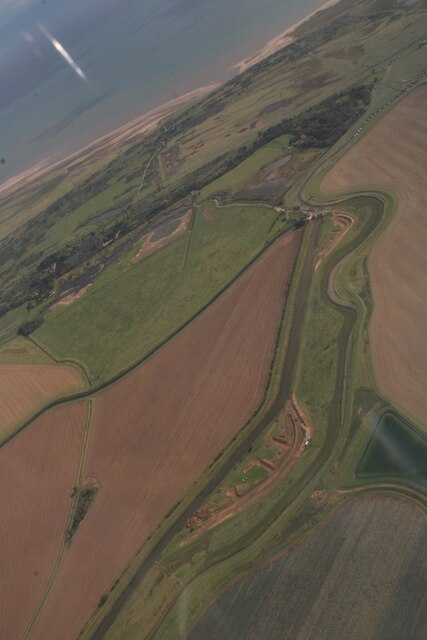
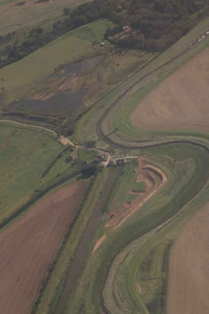
Bramble Hills is a picturesque area located in Lincolnshire, England. Situated amidst the rolling downs and sprawling moorlands, it offers a stunning landscape that captivates visitors with its natural beauty.

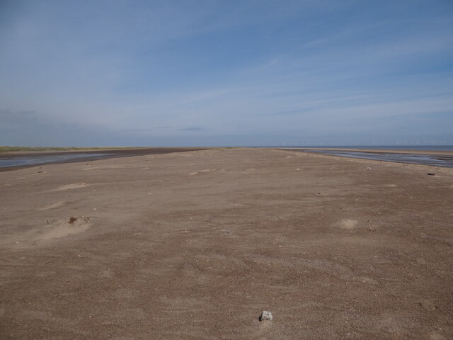
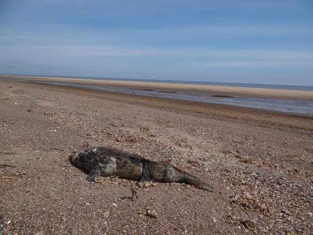
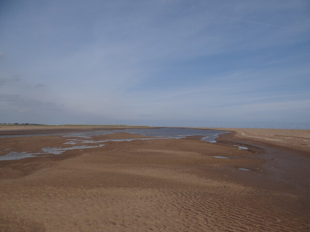
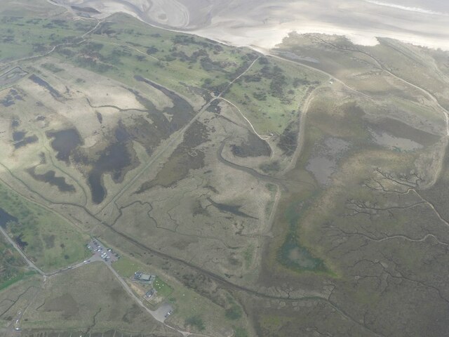
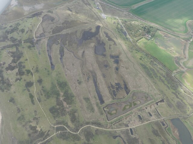
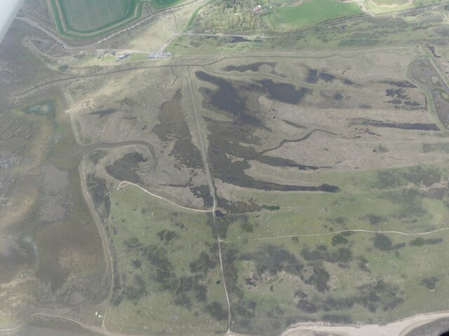
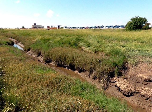
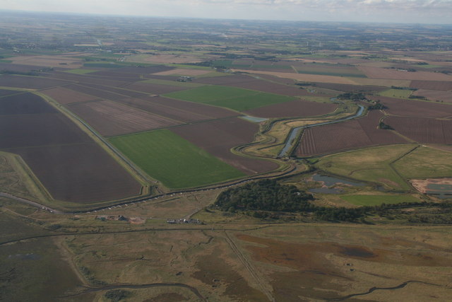
The downs of Bramble Hills are characterized by gentle slopes and lush greenery. It is a haven for hikers and nature enthusiasts, who can explore the numerous walking trails that wind through the area. The downs are home to a variety of wildlife, including rabbits, foxes, and numerous species of birds, making it a popular spot for bird-watching. The panoramic views from the top of the downs are breathtaking, offering visitors a chance to take in the vast expanse of the surrounding countryside.

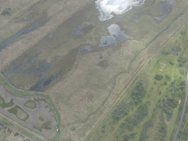
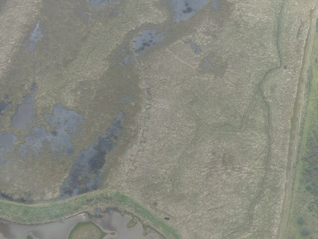
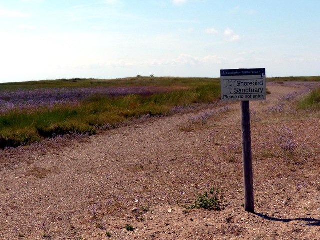
Adjacent to the downs, the moorland of Bramble Hills provides a stark contrast with its rugged and wild terrain. Covered in heather and gorse, the moorland is a unique ecosystem that supports a diverse range of plant and animal species. Keen-eyed visitors may spot rare birds, such as the elusive merlin or the majestic hen harrier, which are known to frequent the area.

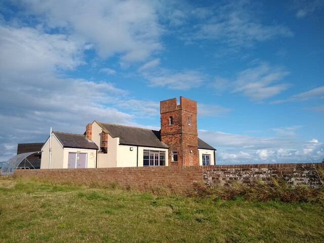
Bramble Hills is not only blessed with natural beauty but also boasts a rich history. The area is dotted with ancient burial mounds and remnants of Bronze Age settlements, offering a glimpse into the region's past. The nearby village of Bramble, with its quaint cottages and charming atmosphere, provides a delightful place to rest and enjoy the local hospitality.

Overall, Bramble Hills in Lincolnshire is a haven of natural wonders, offering visitors the chance to immerse themselves in the stunning vistas of downs and moorland, as well as experience the rich history and warm hospitality of the surrounding area.

If you have any feedback on the listing, please let us know in the comments section below.

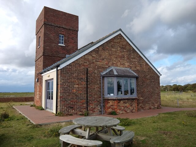
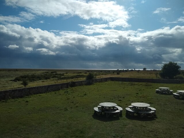
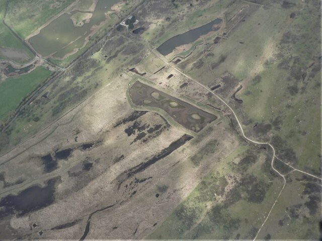
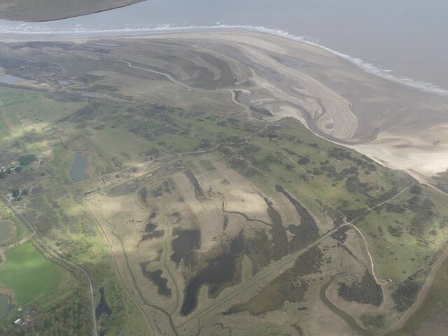
Bramble Hills Images

Images are sourced within 2km of 53.110283/0.33235543 or Grid Reference TF5659. Thanks to Geograph Open Source API. All images are credited.

Higher ground Looking towards Skegness, showing the flat and dry 'creek' to the left and the 'real' beach to the right.
Higher ground
Looking towards Skegness, showing the flat and dry 'creek' to the left and the 'real' beach to the right.
Casualty Carcass of a seal washed up on the beach near Gibraltar Point.
Casualty
Carcass of a seal washed up on the beach near Gibraltar Point.
Little lake Large pool of water remaining after the tide has gone out.
Little lake
Large pool of water remaining after the tide has gone out.
Old Coastguard Station Constructed in 1858.
Old Coastguard Station
Constructed in 1858.
Old Coastguard Station
Gibraltar Point NNR Looking south from visitor centre down onto picnic area with saltmarsh and The Wash beyond.
Gibraltar Point NNR
Looking south from visitor centre down onto picnic area with saltmarsh and The Wash beyond.
Former Anti-Tank Artillery Training Range and WW1 Practice Trench, Gibraltar Point: aerial 2023 (1) Practice trench is the "toothed belt" shaped curved line left of centre.

See: <span class="nowrap"><a title="https://www.heritagegateway.org.uk/Gateway/Results_Single.aspx?uid=MLI125932&resourceID=1006" rel="nofollow ugc noopener" href="https://www.heritagegateway.org.uk/Gateway/Results_Single.aspx?uid=MLI125932&resourceID=1006">Link</a><img style="margin-left:2px;" alt="External link" title="External link - shift click to open in new window" src="https://s1.geograph.org.uk/img/external.png" width="10" height="10"/></span> and
<span class="nowrap"><a title="https://www.heritagegateway.org.uk/Gateway/Results_Single.aspx?uid=MLI125916&resourceID=1006" rel="nofollow ugc noopener" href="https://www.heritagegateway.org.uk/Gateway/Results_Single.aspx?uid=MLI125916&resourceID=1006">Link</a><img style="margin-left:2px;" alt="External link" title="External link - shift click to open in new window" src="https://s1.geograph.org.uk/img/external.png" width="10" height="10"/></span>
Former Anti-Tank Artillery Training Range and WW1 Practice Trench, Gibraltar Point: aerial 2023 (1)
Practice trench is the "toothed belt" shaped curved line left of centre. See: LinkExternal link and LinkExternal link
Former Anti-Tank Artillery Training Range and WW1 Practice Trench, Gibraltar Point: aerial 2023 (2) Trench is more visible on <a href="https://www.geograph.org.uk/photo/7457816">TF5558 : Former Anti-Tank Artillery Training Range and WW1 Practice Trench, Gibraltar Point: aerial 2023 (4)</a>.

See: <span class="nowrap"><a title="https://www.heritagegateway.org.uk/Gateway/Results_Single.aspx?uid=MLI125932&resourceID=1006" rel="nofollow ugc noopener" href="https://www.heritagegateway.org.uk/Gateway/Results_Single.aspx?uid=MLI125932&resourceID=1006">Link</a><img style="margin-left:2px;" alt="External link" title="External link - shift click to open in new window" src="https://s1.geograph.org.uk/img/external.png" width="10" height="10"/></span> and
<span class="nowrap"><a title="https://www.heritagegateway.org.uk/Gateway/Results_Single.aspx?uid=MLI125916&resourceID=1006" rel="nofollow ugc noopener" href="https://www.heritagegateway.org.uk/Gateway/Results_Single.aspx?uid=MLI125916&resourceID=1006">Link</a><img style="margin-left:2px;" alt="External link" title="External link - shift click to open in new window" src="https://s1.geograph.org.uk/img/external.png" width="10" height="10"/></span>
Former Anti-Tank Artillery Training Range and WW1 Practice Trench, Gibraltar Point: aerial 2023 (2)
Gibraltar Point Visitor Centre and former Anti-Tank Artillery Training Range, Gibraltar Point: aerial 2023 (1) For Range see <a href="https://www.geograph.org.uk/gridref/TF5658">TF5658</a> and:
 <span class="nowrap"><a title="https://www.heritagegateway.org.uk/Gateway/Results_Single.aspx?uid=MLI125932&resourceID=1006" rel="nofollow ugc noopener" href="https://www.heritagegateway.org.uk/Gateway/Results_Single.aspx?uid=MLI125932&resourceID=1006">Link</a><img style="margin-left:2px;" alt="External link" title="External link - shift click to open in new window" src="https://s1.geograph.org.uk/img/external.png" width="10" height="10"/></span> and
<span class="nowrap"><a title="https://www.heritagegateway.org.uk/Gateway/Results_Single.aspx?uid=MLI125916&resourceID=1006" rel="nofollow ugc noopener" href="https://www.heritagegateway.org.uk/Gateway/Results_Single.aspx?uid=MLI125916&resourceID=1006">Link</a><img style="margin-left:2px;" alt="External link" title="External link - shift click to open in new window" src="https://s1.geograph.org.uk/img/external.png" width="10" height="10"/></span>
Gibraltar Point Visitor Centre and former Anti-Tank Artillery Training Range, Gibraltar Point: aerial 2023 (1)
For Range see TF5658 and: LinkExternal link and LinkExternal link
Former Anti-Tank Artillery Training Range and WW1 Practice Trench, Gibraltar Point: aerial 2023 (3) See: <span class="nowrap"><a title="https://www.heritagegateway.org.uk/Gateway/Results_Single.aspx?uid=MLI125932&resourceID=1006" rel="nofollow ugc noopener" href="https://www.heritagegateway.org.uk/Gateway/Results_Single.aspx?uid=MLI125932&resourceID=1006">Link</a><img style="margin-left:2px;" alt="External link" title="External link - shift click to open in new window" src="https://s1.geograph.org.uk/img/external.png" width="10" height="10"/></span> and
<span class="nowrap"><a title="https://www.heritagegateway.org.uk/Gateway/Results_Single.aspx?uid=MLI125916&resourceID=1006" rel="nofollow ugc noopener" href="https://www.heritagegateway.org.uk/Gateway/Results_Single.aspx?uid=MLI125916&resourceID=1006">Link</a><img style="margin-left:2px;" alt="External link" title="External link - shift click to open in new window" src="https://s1.geograph.org.uk/img/external.png" width="10" height="10"/></span>
Former Anti-Tank Artillery Training Range and WW1 Practice Trench, Gibraltar Point: aerial 2023 (3)
See: LinkExternal link and LinkExternal link
Former Anti-Tank Artillery Training Range and WW1 Practice Trench, Gibraltar Point: aerial 2023 (4) See: <span class="nowrap"><a title="https://www.heritagegateway.org.uk/Gateway/Results_Single.aspx?uid=MLI125932&resourceID=1006" rel="nofollow ugc noopener" href="https://www.heritagegateway.org.uk/Gateway/Results_Single.aspx?uid=MLI125932&resourceID=1006">Link</a><img style="margin-left:2px;" alt="External link" title="External link - shift click to open in new window" src="https://s1.geograph.org.uk/img/external.png" width="10" height="10"/></span> and
<span class="nowrap"><a title="https://www.heritagegateway.org.uk/Gateway/Results_Single.aspx?uid=MLI125916&resourceID=1006" rel="nofollow ugc noopener" href="https://www.heritagegateway.org.uk/Gateway/Results_Single.aspx?uid=MLI125916&resourceID=1006">Link</a><img style="margin-left:2px;" alt="External link" title="External link - shift click to open in new window" src="https://s1.geograph.org.uk/img/external.png" width="10" height="10"/></span>
Former Anti-Tank Artillery Training Range and WW1 Practice Trench, Gibraltar Point: aerial 2023 (4)
See: LinkExternal link and LinkExternal link
Former Anti-Tank Artillery Training Range and WW1 Practice Trench, Gibraltar Point: aerial 2023 (5) Practice trench is the "toothed belt" shaped curved line below and right of centre.

See: <span class="nowrap"><a title="https://www.heritagegateway.org.uk/Gateway/Results_Single.aspx?uid=MLI125932&resourceID=1006" rel="nofollow ugc noopener" href="https://www.heritagegateway.org.uk/Gateway/Results_Single.aspx?uid=MLI125932&resourceID=1006">Link</a><img style="margin-left:2px;" alt="External link" title="External link - shift click to open in new window" src="https://s1.geograph.org.uk/img/external.png" width="10" height="10"/></span> and
<span class="nowrap"><a title="https://www.heritagegateway.org.uk/Gateway/Results_Single.aspx?uid=MLI125916&resourceID=1006" rel="nofollow ugc noopener" href="https://www.heritagegateway.org.uk/Gateway/Results_Single.aspx?uid=MLI125916&resourceID=1006">Link</a><img style="margin-left:2px;" alt="External link" title="External link - shift click to open in new window" src="https://s1.geograph.org.uk/img/external.png" width="10" height="10"/></span>
Former Anti-Tank Artillery Training Range and WW1 Practice Trench, Gibraltar Point: aerial 2023 (5)
Practice trench is the "toothed belt" shaped curved line below and right of centre. See: LinkExternal link and LinkExternal link
Gibraltar Point Visitor Centre and former Anti-Tank Artillery Training Range, Gibraltar Point: aerial 2023 (2) For Range see <a href="https://www.geograph.org.uk/gridref/TF5658">TF5658</a> and:
 <span class="nowrap"><a title="https://www.heritagegateway.org.uk/Gateway/Results_Single.aspx?uid=MLI125932&resourceID=1006" rel="nofollow ugc noopener" href="https://www.heritagegateway.org.uk/Gateway/Results_Single.aspx?uid=MLI125932&resourceID=1006">Link</a><img style="margin-left:2px;" alt="External link" title="External link - shift click to open in new window" src="https://s1.geograph.org.uk/img/external.png" width="10" height="10"/></span> and
<span class="nowrap"><a title="https://www.heritagegateway.org.uk/Gateway/Results_Single.aspx?uid=MLI125916&resourceID=1006" rel="nofollow ugc noopener" href="https://www.heritagegateway.org.uk/Gateway/Results_Single.aspx?uid=MLI125916&resourceID=1006">Link</a><img style="margin-left:2px;" alt="External link" title="External link - shift click to open in new window" src="https://s1.geograph.org.uk/img/external.png" width="10" height="10"/></span>
Gibraltar Point Visitor Centre and former Anti-Tank Artillery Training Range, Gibraltar Point: aerial 2023 (2)
For Range see TF5658 and: LinkExternal link and LinkExternal link
New habitat creation, Steeping River near Gibraltar Point: aerial 2023 (1)
New habitat creation, Steeping River near Gibraltar Point: aerial 2023 (2)
Drainage channel, Gibraltar Point The carpark and toilets are on the skyline
Drainage channel, Gibraltar Point
The carpark and toilets are on the skyline
Please do not enter Shorebird Sanctuary
Inland across Gibraltar Point: aerial 2015 Looking up the Steeping River (left) and Burgh Sluice Relief Channel across the Gibraltar Point carpark.
Inland across Gibraltar Point: aerial 2015
Looking up the Steeping River (left) and Burgh Sluice Relief Channel across the Gibraltar Point carpark.
Show me another place!

Bramble Hills is located at Grid Ref: TF5659 (Lat: 53.110283, Lng: 0.33235543)

Administrative County: Lincolnshire

District: East Lindsey

Police Authority: Lincolnshire

What 3 Words

///gadget.roadshow.gone. Near Skegness, Lincolnshire

Nearby Locations

Bramble Hills

Related Wikis

Gibraltar Point, Lincolnshire

Gibraltar Point national nature reserve is an area of about 4.3 km2 (1.7 sq mi) on the coast of Lincolnshire, England. The reserve is owned by Lincolnshire...

Seacroft railway station

Seacroft railway station was a station in Seacroft, Lincolnshire.The station was opened on 28 July 1873 and originally called Cow Bank, but was renamed...

Richmond Drive

Richmond Drive is a cricket ground in Skegness, Lincolnshire. The first recorded match on the ground was in 1879, when a Lincolnshire team played against...

Skegness Lifeboat Station

Skegness Lifeboat Station is a lifeboat station located in the town of Skegness, Lincolnshire, England, operated by the Royal National Lifeboat Institution...

Nearby Amenities

Located within 500m of 53.110283,0.33235543
Bramble Hills
Place: locality
Source: Bing
Lat/Long: 53.1072854/0.3337069
Golf: tee
Lat/Long: 53.1086174/0.3301931
Golf: tee
Surface: grass
Lat/Long: 53.1083375/0.3284733
The data included in this document is from www.openstreetmap.org. The data is made available under ODbL.

Have you been to Bramble Hills?

Leave your review of Bramble Hills below (or comments, questions and feedback).