Joist Fen

Downs, Moorland in Cambridgeshire South Cambridgeshire

England

Joist Fen

The Five Miles Inn at Upware Although there was a public house in Upware until around 1950, this is a completely new late 20th century development. It is largely dependent on motorised visitors, although it does also cater for passing pedestrian and boating traffic. The old pub, the Lord Nelson, was popularly known as 'Five Miles from Anywhere: No Hurry' and this phrase is still used to advertise the modern establishment.
The Five Miles Inn at Upware Credit: Alan Murray-Rust

Joist Fen is a natural reserve located in Cambridgeshire, England. It is a unique area characterized by its diverse landscape consisting of downs and moorland. Covering an extensive area, Joist Fen provides a haven for various species of flora and fauna.

The downs in Joist Fen are rolling hills covered in grasses and low-lying shrubs. These open spaces offer breathtaking panoramic views of the surrounding countryside. The downs are known for their rich biodiversity, supporting a wide range of plant species such as orchids, heathers, and wildflowers.

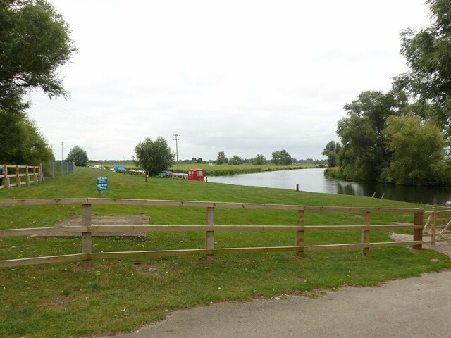
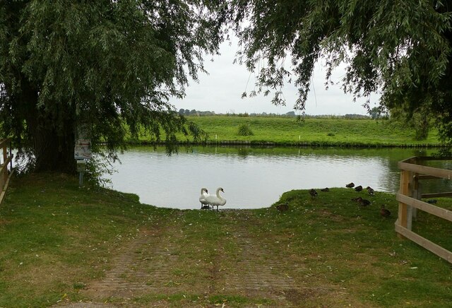
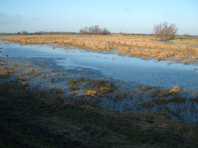
Adjacent to the downs, the moorland in Joist Fen adds another dimension to the landscape. The moorland is characterized by wet, peat-rich soil and is home to a variety of wetland plants, including sphagnum mosses and cotton grass. This habitat provides an ideal breeding ground for a number of bird species, such as curlews, lapwings, and snipes.

The reserve is also home to several rare and endangered species. The fen raft spider, one of the UK's largest spiders, can be found here, as well as the fen violet, a delicate purple flower that is unique to this area.

Joist Fen is a popular destination for nature enthusiasts and birdwatchers, who can explore the reserve on designated paths and trails. The reserve is managed by conservation organizations to maintain its natural beauty and protect its diverse wildlife.

In conclusion, Joist Fen in Cambridgeshire offers a picturesque blend of downs and moorland, providing a habitat for a wide range of plants and animals. Its unique landscape and rich biodiversity make it an important natural reserve in the region.

If you have any feedback on the listing, please let us know in the comments section below.
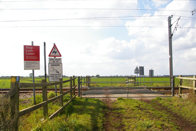
Joist Fen Images

Images are sourced within 2km of 52.304735/0.22758253 or Grid Reference TL5169. Thanks to Geograph Open Source API. All images are credited.

The Five Miles Inn at Upware Although there was a public house in Upware until around 1950, this is a completely new late 20th century development. It is largely dependent on motorised visitors, although it does also cater for passing pedestrian and boating traffic. The old pub, the Lord Nelson, was popularly known as 'Five Miles from Anywhere: No Hurry' and this phrase is still used to advertise the modern establishment.
The Five Miles Inn at Upware
Although there was a public house in Upware until around 1950, this is a completely new late 20th century development. It is largely dependent on motorised visitors, although it does also cater for passing pedestrian and boating traffic. The old pub, the Lord Nelson, was popularly known as 'Five Miles from Anywhere: No Hurry' and this phrase is still used to advertise the modern establishment.
The River Cam at Upware Reach Lode branches to the left.
The River Cam at Upware
Reach Lode branches to the left.
Slipway at Upware There was a ferry here until around 1960.
Slipway at Upware
There was a ferry here until around 1960.
Palatial Potton house in Upware A very comprehensive blog covering the construction of this impressive house can be found here >> <span class="nowrap"><a title="http://upware.house/" rel="nofollow ugc noopener" href="http://upware.house/">Link</a><img style="margin-left:2px;" alt="External link" title="External link - shift click to open in new window" src="https://s1.geograph.org.uk/img/external.png" width="10" height="10"/></span>
Palatial Potton house in Upware
A very comprehensive blog covering the construction of this impressive house can be found here >> LinkExternal link
Houses on Upware Road
Reeds at Chittering These reeds are growing by the side of a no through road east of Chittering.
Reeds at Chittering
These reeds are growing by the side of a no through road east of Chittering.
Upper Mill Drain Viewed from Chittering Drove.
Upper Mill Drain
Viewed from Chittering Drove.
Tin Roof Cottages Unusual Tin Roof cottages in Upware.
Tin Roof Cottages
Unusual Tin Roof cottages in Upware.
River Cam at Upware
River Cam at Upware
River Cam, Upware The decking provides a mooring for pleasure craft outside the Five Miles Inn (as in five miles from anywhere) at this remote fenland village.
River Cam, Upware
The decking provides a mooring for pleasure craft outside the Five Miles Inn (as in five miles from anywhere) at this remote fenland village.
River Cam, Upware A boat arrives at the mooring outside the Five Miles Inn at Upware in light rain on a day not conducive to pleasure boating.
River Cam, Upware
A boat arrives at the mooring outside the Five Miles Inn at Upware in light rain on a day not conducive to pleasure boating.
Towards the end of Long Drove, Waterbeach Long Drove runs northwards for three miles from Bottisham Lock.  At the end, it degenerates into this farm track.
Towards the end of Long Drove, Waterbeach
Long Drove runs northwards for three miles from Bottisham Lock. At the end, it degenerates into this farm track.
Adams's level crossing This is a user-worked crossing on a farm road (and public footpath) across the Cambridge-to-Ely railway line.
Adams's level crossing
This is a user-worked crossing on a farm road (and public footpath) across the Cambridge-to-Ely railway line.
Northfen Farm? According to my map, there should be some buildings called "Northfen Farm" here, but all that seem to be left are these weedy depressions in a wheat field.
Northfen Farm?
According to my map, there should be some buildings called "Northfen Farm" here, but all that seem to be left are these weedy depressions in a wheat field.
The Cam at Upware Looking along the River Cam towards Ely - visible in the distance.  Upware is just in front of the wing.  In the foreground is Ducketts Farm and a small flooded area - popular with wildfowl in the winter.  The Cambridge-Ely railway line is visible on the upper left of the photo.  The dark nature of the fenland soil is apparent where last year's crops have been ploughed in.
The Cam at Upware
Looking along the River Cam towards Ely - visible in the distance. Upware is just in front of the wing. In the foreground is Ducketts Farm and a small flooded area - popular with wildfowl in the winter. The Cambridge-Ely railway line is visible on the upper left of the photo. The dark nature of the fenland soil is apparent where last year's crops have been ploughed in.
Instant Irrigation Kit Just add water!
Instant Irrigation Kit
Just add water!
Maize crop on North Fen With the railway line in the background
Maize crop on North Fen
With the railway line in the background
Round bales on North Fen
Show me another place!

Joist Fen is located at Grid Ref: TL5169 (Lat: 52.304735, Lng: 0.22758253)

Administrative County: Cambridgeshire

District: South Cambridgeshire

Police Authority: Cambridgeshire

What 3 Words

///loser.diagram.aliens. Near Stretham, Cambridgeshire

Related Wikis

Upware

Upware is a village in Wicken civil parish, part of East Cambridgeshire, England, lying on the east bank of the River Cam. == History == Situated in the...

Cam Washes

Cam Washes is a 166.5-hectare (411-acre) biological Site of Special Scientific Interest west of Wicken in Cambridgeshire.This site on the banks of the...

Chittering, Cambridgeshire

Chittering is a hamlet about 8 miles (13 km) north of Cambridge in Cambridgeshire, England. For administrative purposes it is part of the parish of Waterbeach...

Upware South Pit

Upware South Pit is a 1.1-hectare (2.7-acre) geological Site of Special Scientific Interest (SSSI) north of Upware in Cambridgeshire. It is a Geological...

Nearby Amenities

Located within 500m of 52.304735,0.22758253
North Fen
Created By: Potlatch 0.10b
Place: locality
Source: npe
Lat/Long: 52.3065883/0.2247157
Joist Fen
Created By: Potlatch 0.10b
Place: locality
Source: npe
Lat/Long: 52.3020224/0.2263464
Joist Farm
Landuse: farmyard
Lat/Long: 52.304695/0.2337174
Power: pole
Source: bing
Lat/Long: 52.3031246/0.2336808
Power: pole
Source: bing
Lat/Long: 52.3025744/0.2331256
Power: pole
Source: bing
Lat/Long: 52.3018502/0.2322002
Power: pole
Source: bing
Lat/Long: 52.3010524/0.2311729
The data included in this document is from www.openstreetmap.org. The data is made available under ODbL.

Have you been to Joist Fen?

Leave your review of Joist Fen below (or comments, questions and feedback).