Great West New Field

Downs, Moorland in Norfolk King's Lynn and West Norfolk

England

Great West New Field

Across the snowy fields The car is driving along a farm track connecting Trinity Road to Walton Road.
Across the snowy fields Credit: Ben Harris

Great West New Field is a vast area of land located in Norfolk, England. Situated in the region known as the Norfolk Downs, it is also referred to as the Moorland due to its characteristic landscape. This area encompasses a diverse range of features, making it a significant natural and historical site.

The Norfolk Downs, of which Great West New Field is a part, is known for its rolling hills, expansive meadows, and heathland. The Moorland, in particular, is characterized by its open, treeless landscape, covered in a mix of grasses, shrubs, and heather. This unique environment provides a habitat for various species of plants, birds, and animals, making it a popular destination for nature enthusiasts and birdwatchers.

Great West New Field also has historical significance, with evidence of human settlement dating back centuries. Archaeological discoveries, including ancient burial mounds and artifacts, provide insights into the area's past. Additionally, the remains of medieval settlements and structures can be found within the field, adding to its historical allure.

The field is accessible to the public, offering numerous walking paths and trails for visitors to explore and enjoy the beauty of the landscape. The wide-open spaces, tranquil atmosphere, and breathtaking views make Great West New Field a perfect destination for outdoor activities such as hiking, picnicking, and photography.

Overall, Great West New Field in Norfolk offers a combination of natural beauty, ecological diversity, and historical significance, making it a must-visit destination for those seeking a connection with nature and a glimpse into the region's rich past.

If you have any feedback on the listing, please let us know in the comments section below.

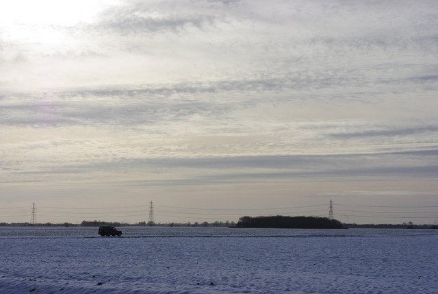
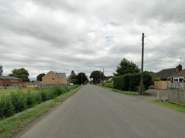
Great West New Field Images

Images are sourced within 2km of 52.679209/0.23968279 or Grid Reference TF5111. Thanks to Geograph Open Source API. All images are credited.

Across the snowy fields The car is driving along a farm track connecting Trinity Road to Walton Road.
Across the snowy fields
The car is driving along a farm track connecting Trinity Road to Walton Road.
Bonnett's Lane junction on Smeeth Road, Marshland
New house at Fenberry Fruit Farm, Marshland
Dismantled railway, Marshland St. James: aerial 2022
Village sign in Smeeth Road, Marshland St James Village signs are typically placed along the principal road or in a prominent location such as a village green or close by the church. The design often depicts a particularly feature of the village or a scene from its history, heritage, or culture. They are typically made of wood or metal or a combination of both, the designs are often made by the local community.
Although they do appear in villages and towns all over the country they are more prominent in East Anglia than elsewhere in the country.
Village sign in Smeeth Road, Marshland St James
Village signs are typically placed along the principal road or in a prominent location such as a village green or close by the church. The design often depicts a particularly feature of the village or a scene from its history, heritage, or culture. They are typically made of wood or metal or a combination of both, the designs are often made by the local community. Although they do appear in villages and towns all over the country they are more prominent in East Anglia than elsewhere in the country.
Fruit Farm Packhouse off Smeeth Road
Bowling Green at The Smeeth
Farm buildings at Small Drove
Maintaining the power lines near Harps Hall Cottages In the distance can be glimpsed the cradle used by the workers to access the cables.
Maintaining the power lines near Harps Hall Cottages
In the distance can be glimpsed the cradle used by the workers to access the cables.
The Walton High Bank near Harp's Hall
Fine willows by the Smeeth Lode near Trafford House
Trinity Hall Farm
Trinity Hall Farm
Green Lane Farm peeking through the trees.
Willow Farm, Walpole Highway
Children's Playground
Cottages and barn on Mill Field
West Drove Farm
West Drove Farm
Drove onto Wheatley Field With an aptly named crop.
Drove onto Wheatley Field
With an aptly named crop.
Show me another place!

Great West New Field is located at Grid Ref: TF5111 (Lat: 52.679209, Lng: 0.23968279)

Administrative County: Norfolk

District: King's Lynn and West Norfolk

Police Authority: Norfolk

What 3 Words

///poker.vandalism.snitch. Near Terrington St John, Norfolk

Nearby Locations

Great West New Field

Related Wikis

Smeeth Road railway station

Smeeth Road was a railway station serving the villages of Emneth Hungate, Marshland St James and St John Fen's End, all east of Wisbech in Norfolk, England...

Walpole Highway

Walpole Highway is a village and civil parish in the English county of Norfolk. It covers an area of 10.48 km2 (4.05 sq mi) and had a population of 685...

Marshland St James

Marshland St James is a village and civil parish in the English county of Norfolk. It covers an area of 25.69 km2 (9.92 sq mi) and had a population of...

Emneth railway station

Emneth was a railway station, near Wisbech, which served the village of Emneth, Norfolk. The station was opened in 1848 as an extension of the East Anglian...

Nearby Amenities

Located within 500m of 52.679209,0.23968279
Power: pole
Lat/Long: 52.6824135/0.2424797
Power: pole
Lat/Long: 52.6820444/0.2412325
Power: pole
Lat/Long: 52.6816801/0.2399048
Power: pole
Lat/Long: 52.6811956/0.2385825
Power: pole
Lat/Long: 52.6806411/0.2371609
Power: pole
Lat/Long: 52.6800947/0.2357018
Power: pole
Lat/Long: 52.679602/0.2343821
Power: pole
Lat/Long: 52.6790198/0.2329203
The data included in this document is from www.openstreetmap.org. The data is made available under ODbL.

Have you been to Great West New Field?

Leave your review of Great West New Field below (or comments, questions and feedback).