Black Patch

Downs, Moorland in Sussex Wealden

England

Black Patch

Comp Lane Comp Lane at the turning for the footpath across the fields to Berwick village.  Comp Lane formerly was the main road between Lewes and Alfriston, later eclipsed by the turnpike (now the A27). In the distance can be seen Comp Barn.
Comp Lane Credit: Hugh Craddock

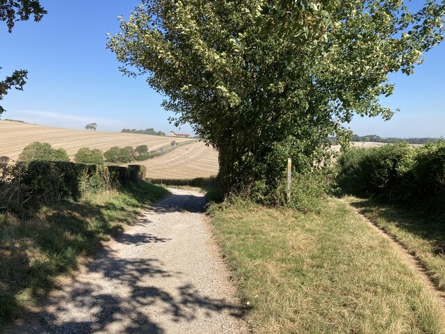
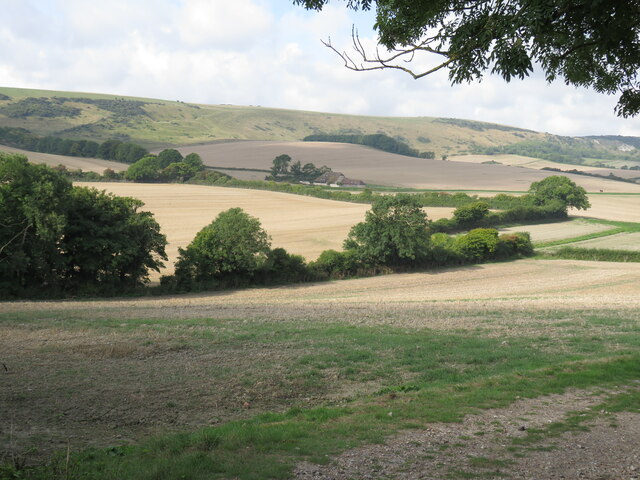
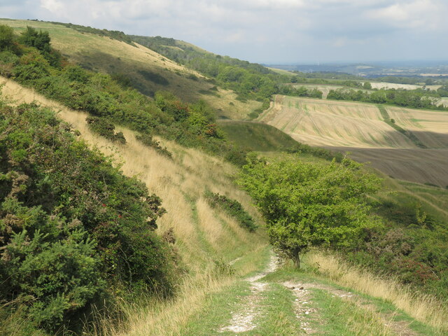
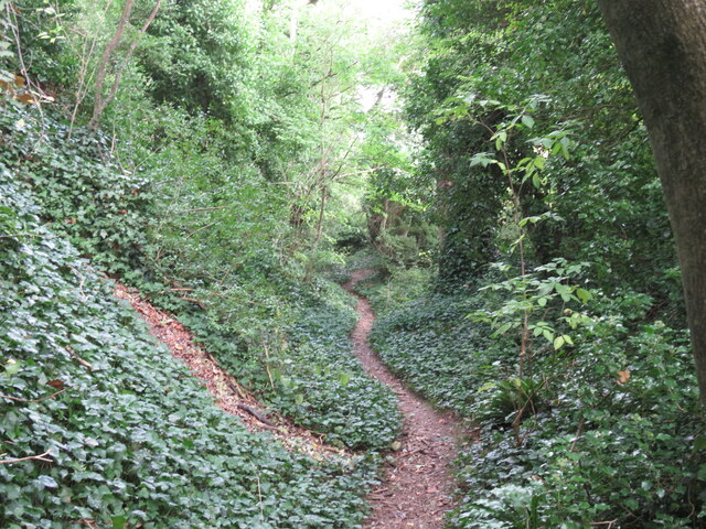
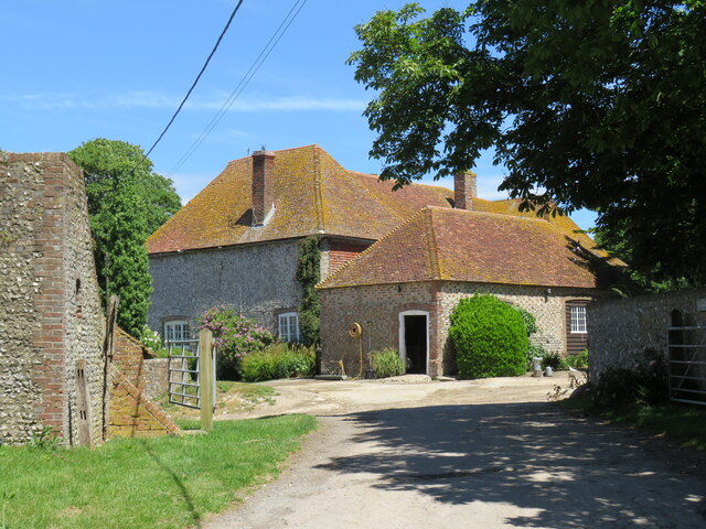
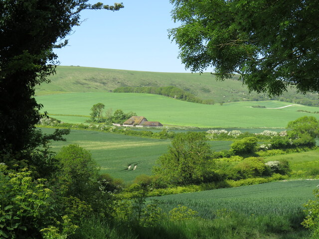
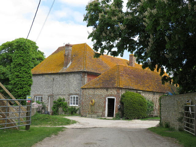
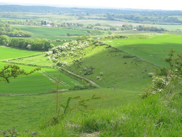
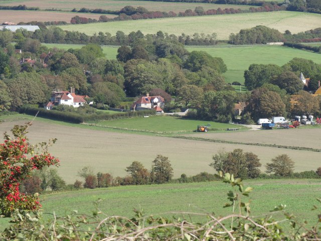
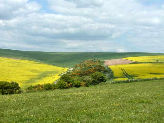
Black Patch is a picturesque area located in the heart of the Sussex Downs, a region renowned for its natural beauty and diverse landscapes. Situated on the outskirts of the village of Ditchling, Black Patch is characterized by its rolling hills, open moorland, and enchanting woodlands.

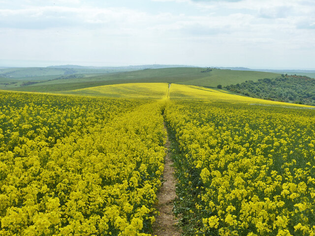
The area is beloved by walkers, hikers, and nature enthusiasts who are drawn to the tranquil ambiance and breathtaking vistas that Black Patch offers. The undulating hills provide sweeping views of the surrounding countryside, with patches of vibrant wildflowers adding a splash of color to the landscape during the summer months.

Black Patch is also home to a variety of wildlife, making it a haven for bird watchers and animal lovers. Visitors can spot a range of species, including skylarks, kestrels, and even the occasional deer or fox. The area's diverse ecosystem is carefully preserved, with conservation efforts ensuring the protection of the local flora and fauna.

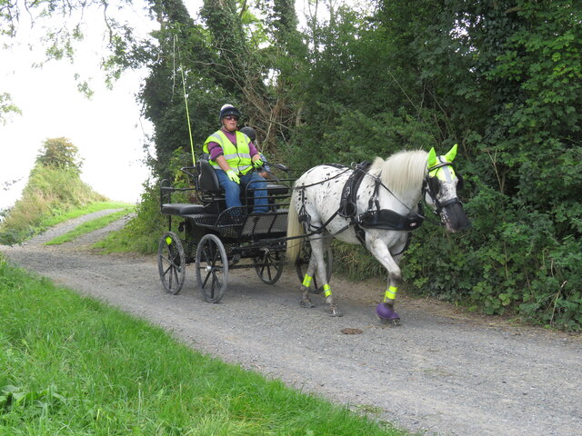
For those seeking outdoor activities, Black Patch offers ample opportunities for exploration. The network of well-maintained footpaths and bridleways crisscrossing the area allows visitors to discover hidden treasures, from ancient burial mounds to secluded streams. Additionally, the nearby South Downs Way, a long-distance trail, passes through Black Patch, providing access to even more stunning landscapes and attractions.

Black Patch, Sussex, offers a true escape from the hustle and bustle of everyday life. Its striking natural beauty, abundant wildlife, and network of trails make it a must-visit destination for anyone looking to reconnect with nature and experience the charm of the Sussex Downs.

If you have any feedback on the listing, please let us know in the comments section below.

Black Patch Images

Images are sourced within 2km of 50.815882/0.12472167 or Grid Reference TQ4903. Thanks to Geograph Open Source API. All images are credited.

Comp Lane Comp Lane at the turning for the footpath across the fields to Berwick village.  Comp Lane formerly was the main road between Lewes and Alfriston, later eclipsed by the turnpike (now the A27). In the distance can be seen Comp Barn.
Comp Lane
Comp Lane at the turning for the footpath across the fields to Berwick village. Comp Lane formerly was the main road between Lewes and Alfriston, later eclipsed by the turnpike (now the A27). In the distance can be seen Comp Barn.
Alfriston Camp Site Catch up time after the height of the COVID restrictions.
Alfriston Camp Site
Catch up time after the height of the COVID restrictions.
View south from Berwick Church New Barn on the coach road in centre, Bopeep chalk pits top right.
View south from Berwick Church
New Barn on the coach road in centre, Bopeep chalk pits top right.
Bridleway above New Barn Bridleway from Berwick Church crosses the Old Coach Road and climbs fairly gently past old chalk workings here, before joining the South Downs Way.
Bridleway above New Barn
Bridleway from Berwick Church crosses the Old Coach Road and climbs fairly gently past old chalk workings here, before joining the South Downs Way.
Sunken lane above Alciston This is only recorded on the Explorer map as a public footpath crossing what appears to be a large field. In fact it is an old cartway which, with the erosive power of rainwater, has become a deep sunken lane, and is clearly still used by horse-riders.
Sunken lane above Alciston
This is only recorded on the Explorer map as a public footpath crossing what appears to be a large field. In fact it is an old cartway which, with the erosive power of rainwater, has become a deep sunken lane, and is clearly still used by horse-riders.
Horse and carriage on the old coach road The old coach road from Firle to Alfriston provides an all-weather route for horse-riders, cyclists and walkers. It is classed as a byway - and is enjoying an upgrade.
Horse and carriage on the old coach road
The old coach road from Firle to Alfriston provides an all-weather route for horse-riders, cyclists and walkers. It is classed as a byway - and is enjoying an upgrade.
Alciston's tithe barn The 16th-century barn is more than 50 metres long, and is part of the Alciston Court House farm complex.
Alciston's tithe barn
The 16th-century barn is more than 50 metres long, and is part of the Alciston Court House farm complex.
Alciston from Bostal path Village in the trees - seen here from one of two paths that drop down to the village from the South Downs Way.
Alciston from Bostal path
Village in the trees - seen here from one of two paths that drop down to the village from the South Downs Way.
Dovecots at Alciston Court Farm The map claims them as ruins, but they look pretty convincing.
Dovecots at Alciston Court Farm
The map claims them as ruins, but they look pretty convincing.
Alciston Court Farm Farming much of Alciston as tenants of the Gage family of Firle.
Alciston Court Farm
Farming much of Alciston as tenants of the Gage family of Firle.
Black Bryony - Dioscorea communis
New Barn from Berwick Church New Barn, now converted into a home, sits alongside the Old Coach Road that runs from Firle to Alfriston.
New Barn from Berwick Church
New Barn, now converted into a home, sits alongside the Old Coach Road that runs from Firle to Alfriston.
Alciston Court Farm Much of the land in Alciston  forms part of the Court Farm.
Alciston Court Farm
Much of the land in Alciston forms part of the Court Farm.
View from Berwick Bostal path The path climbs steadily from New Barn, past old chalk workings,  to reach the South Downs Way, offering fine views back, with Drusillas in the far distance.
View from Berwick Bostal path
The path climbs steadily from New Barn, past old chalk workings, to reach the South Downs Way, offering fine views back, with Drusillas in the far distance.
Alciston from Bopeep Bostal Alciston village, part of the Firle estate, seen from the car park on Bopeep Bostal.
Alciston from Bopeep Bostal
Alciston village, part of the Firle estate, seen from the car park on Bopeep Bostal.
Bridleway descending Heighton Hill Bridleway South Heighton 6c towards Bopeep Bostal.
Bridleway descending Heighton Hill
Bridleway South Heighton 6c towards Bopeep Bostal.
Tilton Bottom
Tilton Bottom
A raped bridleway Public bridleway Alciston 15c, which becomes South Heighton 6c at the parish boundary at the end of the rape.
A raped bridleway
Public bridleway Alciston 15c, which becomes South Heighton 6c at the parish boundary at the end of the rape.
Show me another place!

Black Patch is located at Grid Ref: TQ4903 (Lat: 50.815882, Lng: 0.12472167)

Administrative County: East Sussex

District: Wealden

Police Authority: Sussex

What 3 Words

///polishing.tram.heckler. Near Seaford, East Sussex

Related Wikis

Firle Hill Climb

Firle Hill Climb is a disused hillclimbing course near Lewes, East Sussex, England, sometimes referred to as Bo Peep Hill Climb. The event was celebrated...

Long Burgh Long Barrow

Long Burgh Long Barrow, is an unchambered long barrow located near to the village of Alfriston in the south-eastern English county of East Sussex. Probably...

Alciston

Alciston is a village and civil parish in the Wealden district of East Sussex, England. It is inland, just off the A27 road, about ten miles (16 km) north...

Alfriston

Alfriston is a village and civil parish in the East Sussex district of Wealden, England. The village lies in the valley of the River Cuckmere, about four...

Berwick, East Sussex

Berwick (pronounced BUR-wik or, more recently, BERR-ik) is a village and civil parish in the Wealden district of East Sussex in England. The village...

Alfriston Windmill

Alfriston Windmill is a tower mill at Alfriston, Sussex, England which has been converted to residential accommodation. == History == Alfriston Windmill...

Alfriston Market Cross

Alfriston Market Cross is the only remaining market cross in Sussex, other than the elaborate market cross in Chichester. It is formed of a stone base...

Dean's Place Hotel

Dean's Place in Alfriston, East Sussex is a building of historical significance and is listed on the English Heritage Register. It was built in the 17th...

Nearby Amenities

Located within 500m of 50.815882,0.12472167
The data included in this document is from www.openstreetmap.org. The data is made available under ODbL.

Have you been to Black Patch?

Leave your review of Black Patch below (or comments, questions and feedback).