High Weald

Downs, Moorland in Sussex Wealden

England

High Weald

Postbox at Duddleswell, Sussex Located outside the Duddleswell Tea Rooms.
Postbox at Duddleswell, Sussex Credit: Peter Trimming

High Weald, Sussex, located in the southeastern part of England, is an area known for its breathtaking natural beauty and diverse landscapes. The region encompasses the High Weald Area of Outstanding Natural Beauty, which includes parts of East and West Sussex, as well as parts of Kent and Surrey.

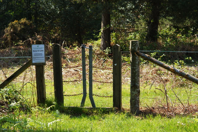
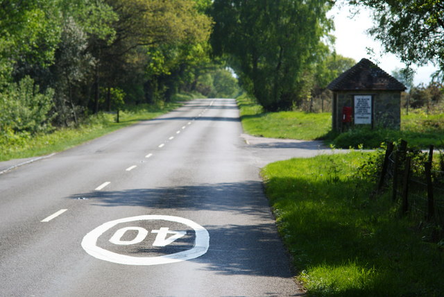
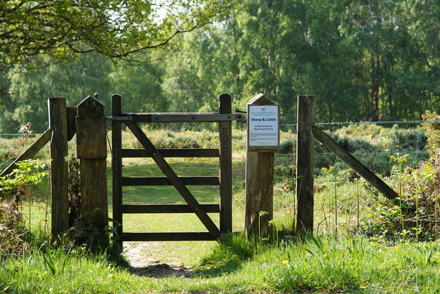
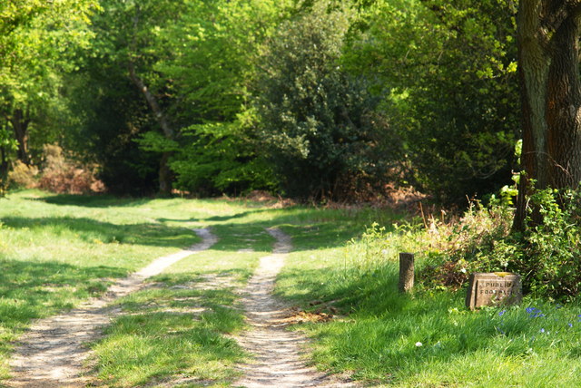
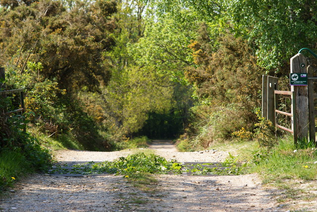
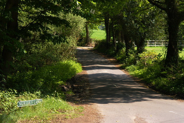
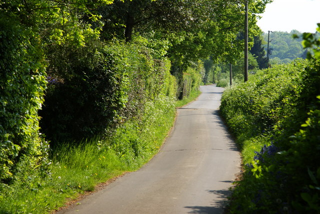
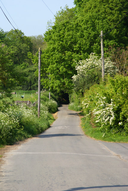
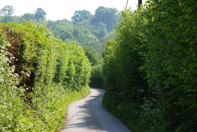
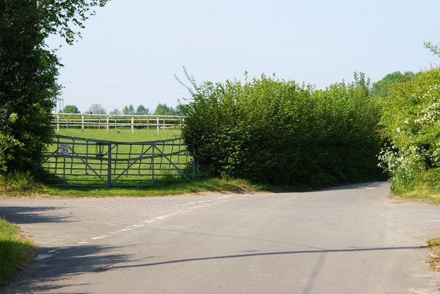
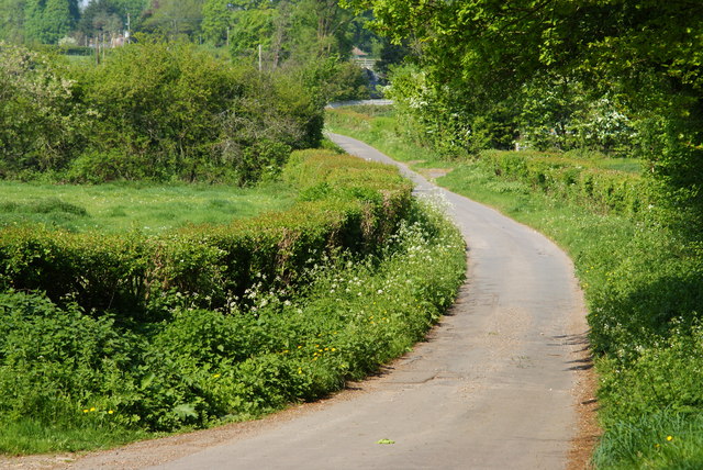
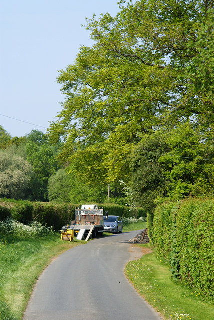
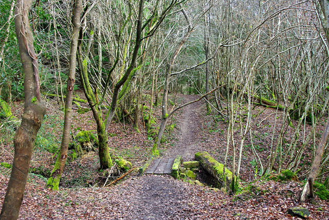
The High Weald is characterized by its rolling hills, ancient woodlands, and picturesque villages. The landscape is predominantly rural, with an abundance of farmland, meadows, and hedgerows. The area is also home to a network of small, winding lanes and footpaths, making it a popular destination for outdoor enthusiasts and walkers.

One of the notable features of the High Weald is the presence of the Sussex Downs, a range of chalk hills that extend across the region. These downs offer stunning panoramic views of the surrounding countryside and are a haven for wildlife, including rare butterflies, orchids, and birds.

In addition to the downs, the High Weald also boasts areas of heathland and moorland, which provide habitat for a variety of plant and animal species. These areas are often covered in vibrant purple heather and are a photographer's delight.

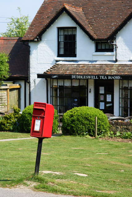
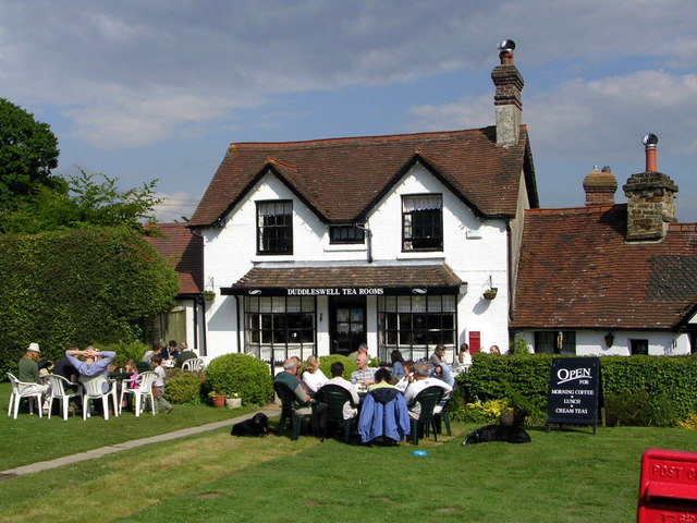
The High Weald is dotted with charming, historic villages and market towns, such as Royal Tunbridge Wells, Cranbrook, and Rye. These settlements showcase traditional architecture, including timber-framed buildings and medieval churches, and offer a glimpse into the area's rich heritage.

Overall, High Weald, Sussex offers a unique blend of natural beauty, rural charm, and cultural heritage, making it a must-visit destination for nature lovers and history enthusiasts alike.

If you have any feedback on the listing, please let us know in the comments section below.

High Weald Images

Images are sourced within 2km of 51.016567/0.1052529 or Grid Reference TQ4726. Thanks to Geograph Open Source API. All images are credited.

Postbox at Duddleswell, Sussex Located outside the Duddleswell Tea Rooms.
Postbox at Duddleswell, Sussex
Located outside the Duddleswell Tea Rooms.
Stile Onto the Ashdown Forest, Sussex A useful stile design; especially for those with mobility problems, or with animals.
Stile Onto the Ashdown Forest, Sussex
A useful stile design; especially for those with mobility problems, or with animals.
B2026 at Fairwarp, Sussex In the foreground, the 40 MPH Ashdown Forest speed limit is marked on the road. To the right of picture, a bus shelter can be seen.
B2026 at Fairwarp, Sussex
In the foreground, the 40 MPH Ashdown Forest speed limit is marked on the road. To the right of picture, a bus shelter can be seen.
Gate Onto the Ashdown Forest, Sussex Photographed from the B2026
Gate Onto the Ashdown Forest, Sussex
Photographed from the B2026
Public Footpath at Fairwarp, Sussex Photographed from the B2026.
Public Footpath at Fairwarp, Sussex
Photographed from the B2026.
Public Footpath at Fairwarp, Sussex Looking in the direction of the Ashdown Forest, from the B2026. A sign, to the right of picture, states that riding beyond this point is by permit only.
Public Footpath at Fairwarp, Sussex
Looking in the direction of the Ashdown Forest, from the B2026. A sign, to the right of picture, states that riding beyond this point is by permit only.
B2026 at Fairwarp, Sussex Looking in the direction of the Ashdown Forest. Note the 40 MPH speed limit, marked on the road. Fairwarp Church, hidden behind trees, is located near the centre of picture. The gateway, to the church, can just be seen.
B2026 at Fairwarp, Sussex
Looking in the direction of the Ashdown Forest. Note the 40 MPH speed limit, marked on the road. Fairwarp Church, hidden behind trees, is located near the centre of picture. The gateway, to the church, can just be seen.
Nursery Lane, Fairwarp, Sussex An inviting country lane, seen from the B2026.
Nursery Lane, Fairwarp, Sussex
An inviting country lane, seen from the B2026.
Fairwarp Village Hall, Sussex Photographed from Nursery Lane.
Fairwarp Village Hall, Sussex
Photographed from Nursery Lane.
Nursery Lane, Fairwarp, Sussex A quiet country lane. Out of picture, to the left, a row of houses is hidden by the high hedge.
Nursery Lane, Fairwarp, Sussex
A quiet country lane. Out of picture, to the left, a row of houses is hidden by the high hedge.
Nursery Lane, Fairwarp, Sussex Looking in the direction of Fairwarp village. A row of houses is out of picture, to the right.
Nursery Lane, Fairwarp, Sussex
Looking in the direction of Fairwarp village. A row of houses is out of picture, to the right.
Nursery Lane, Fairwarp, Sussex Looking in the direction of Maresfield. Note the high hedges, either side of this narrow lane.
Nursery Lane, Fairwarp, Sussex
Looking in the direction of Maresfield. Note the high hedges, either side of this narrow lane.
Junction of Nursery Lane and Burrells Lane, Sussex The location is just north of the Maresfield Park estate.
Junction of Nursery Lane and Burrells Lane, Sussex
The location is just north of the Maresfield Park estate.
Nursery Lane, Maresfield, Sussex Photograph taken from beside Nightingale Wood, looking north.
Nursery Lane, Maresfield, Sussex
Photograph taken from beside Nightingale Wood, looking north.
Nursery Lane, Maresfield, Sussex The large tree, to the right of picture, marks the position of Oak Tree Cottage.
Nursery Lane, Maresfield, Sussex
The large tree, to the right of picture, marks the position of Oak Tree Cottage.
View from the A22 north of Maresfield
Roundabout on the A22 near Maresfield
Duddleswell Tea Rooms
Show me another place!

High Weald is located at Grid Ref: TQ4726 (Lat: 51.016567, Lng: 0.1052529)

Administrative County: East Sussex

District: Wealden

Police Authority: Sussex

What 3 Words

///imprinted.trip.duke. Near Buxted, East Sussex

Related Wikis

Brickfield Meadow

Brickfield Meadow is a 1.4-hectare (3.5-acre) nature reserve north of Maresfield in East Sussex. It is managed by the Sussex Wildlife Trust.This wildflower...

Heron's Ghyll

Heron's Ghyll is a hamlet in the Wealden district of East Sussex. St John the Evangelist Church is a Catholic church in the village. There is a late 19th...
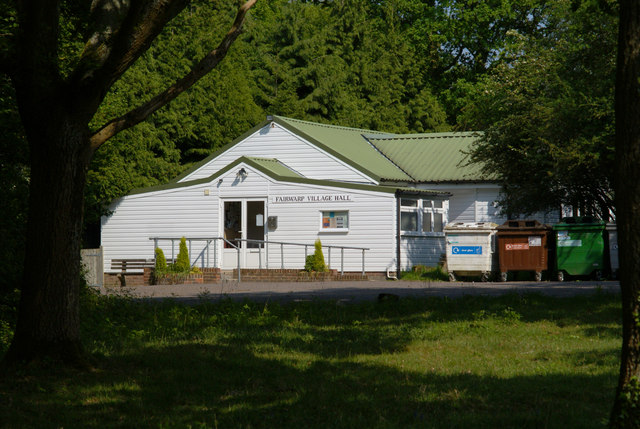
Fairwarp

Fairwarp is a small village within the civil parish of Maresfield in the Wealden district of East Sussex, England. Its nearest town is Uckfield, which...

Rock Wood

Rock Wood is a 10.4-hectare (26-acre) biological Site of Special Scientific Interest north of Uckfield in East Sussex.This ancient wood has several different...

St John the Evangelist Church, Heron's Ghyll

St John's Church or St John the Evangelist Church is a Roman Catholic Parish Church in the Heron's Ghyll settlement of Buxted, East Sussex, England. It...

Temple Grove School

Temple Grove School was a preparatory school for boys, and after 1984 also for girls, originally at Parsons Green, London, later at East Sheen, London...

Buxted Park

Buxted Park is an 84.7 hectare (206.16 acre) biological Site of Special Scientific Interest, located near the village of Buxted, East Sussex, England....

Five Ash Down

Five Ash Down is a small village within the civil parish of Buxted, in the Wealden district of East Sussex, England. Its nearest town is Uckfield, which...

Nearby Amenities

Located within 500m of 51.016567,0.1052529
Claygate Farm
Place: farm
Lat/Long: 51.0164639/0.1067838
Barrier: stile
Lat/Long: 51.0134423/0.1027601
Barrier: stile
Lat/Long: 51.0132653/0.1017614
Barrier: stile
Lat/Long: 51.0131015/0.1007798
Bus Stop
Perrymans Lane
Naptan AtcoCode: 1400WE10089
Naptan NaptanCode: esudgwpw
Public Transport: platform
Lat/Long: 51.0200524/0.1087011
Bus Stop
Perrymans Lane
Public Transport: platform
Lat/Long: 51.0202221/0.1087182
The data included in this document is from www.openstreetmap.org. The data is made available under ODbL.

Have you been to High Weald?

Leave your review of High Weald below (or comments, questions and feedback).