Green End Cow Pastures
Downs, Moorland in Cambridgeshire South Cambridgeshire
England
Green End Cow Pastures
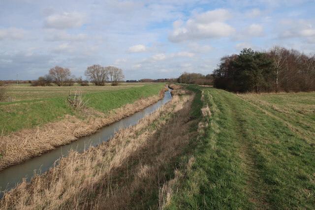
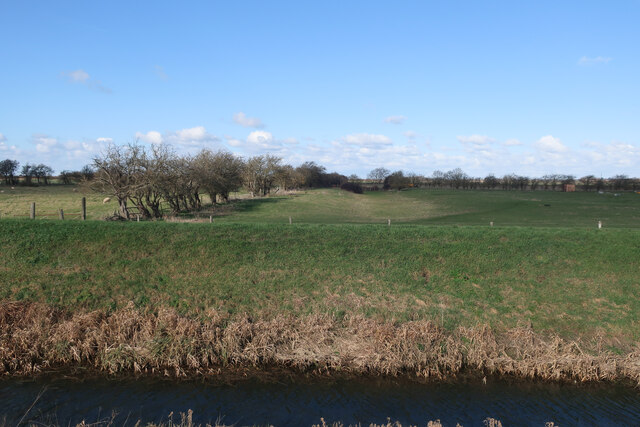
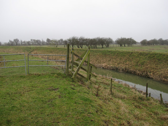
Green End Cow Pastures is a picturesque area located in Cambridgeshire, England. Spread across rolling downs and moorland, this vast expanse of land covers several acres, offering a serene and idyllic setting for both visitors and local farmers.
The cow pastures are home to a diverse range of flora and fauna, providing an important habitat for numerous species. The lush green meadows are dotted with wildflowers during the summer months, attracting a variety of pollinators such as butterflies and bees. Additionally, the area supports a healthy population of small mammals, including rabbits and voles, which are prey for the local bird species like kestrels and buzzards.
The pastoral landscape of Green End Cow Pastures is primarily used for grazing cattle, with numerous herds of cows dotting the fields. The cows are primarily of the traditional British breeds, such as Hereford and Aberdeen Angus, known for their hardiness and ability to thrive in these open spaces. The cows are carefully managed by local farmers, who ensure their welfare and maintain the ecological balance of the area.
Visitors to Green End Cow Pastures can enjoy leisurely walks along the well-maintained footpaths that crisscross the area. The stunning vistas of the surrounding countryside, with its undulating hills and expansive skies, provide a perfect backdrop for nature enthusiasts, photographers, and those seeking tranquility amidst nature.
In conclusion, Green End Cow Pastures in Cambridgeshire offers a beautiful and ecologically significant landscape, where cows roam freely, and visitors can immerse themselves in the beauty of the English countryside.
If you have any feedback on the listing, please let us know in the comments section below.
Green End Cow Pastures Images
Images are sourced within 2km of 52.294111/0.15912065 or Grid Reference TL4768. Thanks to Geograph Open Source API. All images are credited.


Green End Cow Pastures is located at Grid Ref: TL4768 (Lat: 52.294111, Lng: 0.15912065)
Administrative County: Cambridgeshire
District: South Cambridgeshire
Police Authority: Cambridgeshire
What 3 Words
///choppy.remotest.wash. Near Cottenham, Cambridgeshire
Nearby Locations
Related Wikis

Fen Edge
Fen Edge is an area and collection of villages in the South Cambridgeshire district of Cambridgeshire, England. The five villages in Fen Edge are Cottenham...
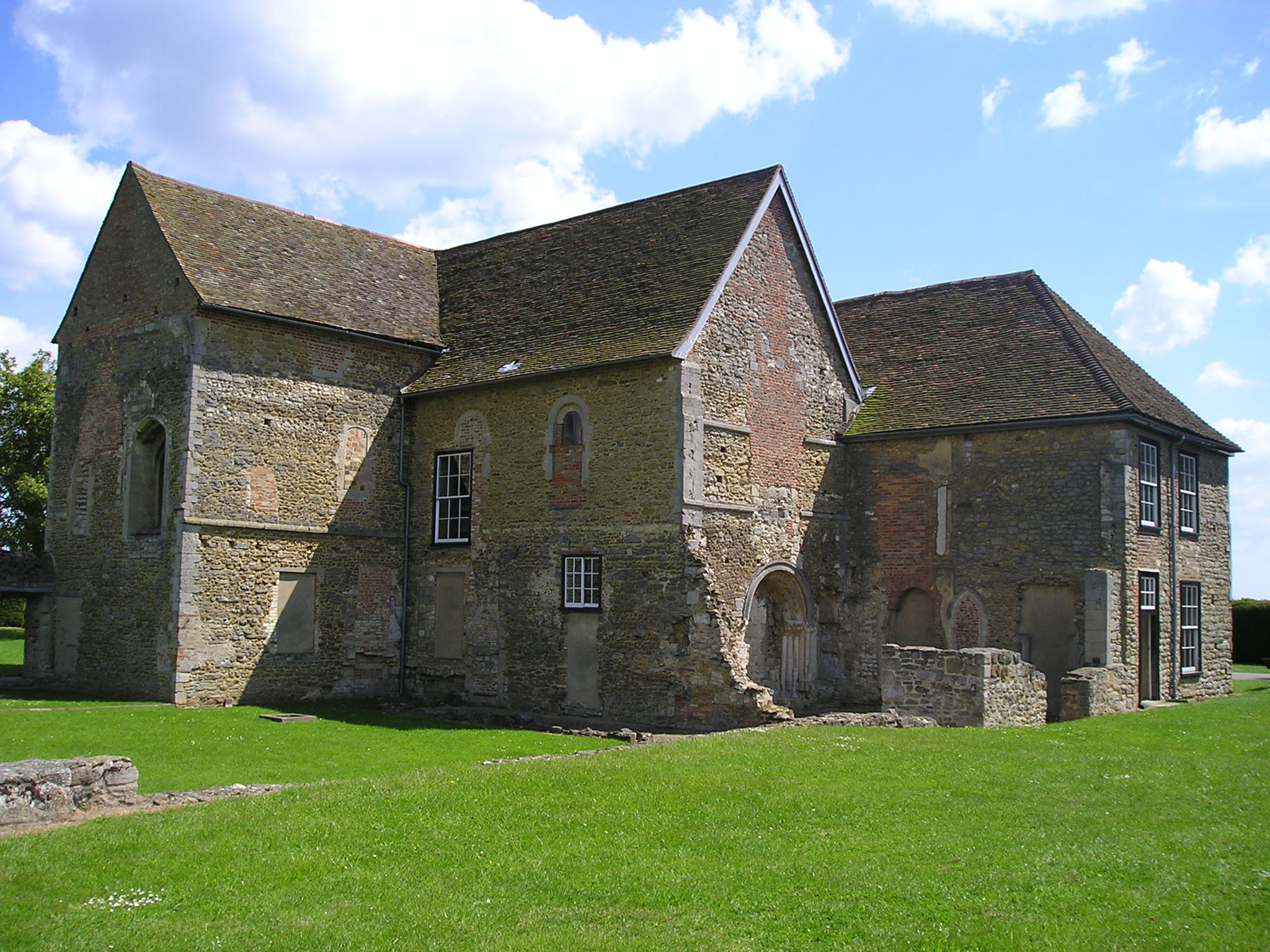
Denny Abbey
Denny Abbey is a former abbey near Waterbeach, about 6 miles (10 km) north of Cambridge in Cambridgeshire, England. It is now the Farmland Museum and Denny...

Cottenham
Cottenham is a village in Cambridgeshire, England. Cottenham is one of the larger villages surrounding the city of Cambridge, located around five miles...
Cottenham Village College
Cottenham Village College is an academy school located in Cottenham, Cambridgeshire, England. The school offers secondary education to pupils from the...

Chittering, Cambridgeshire
Chittering is a hamlet about 8 miles (13 km) north of Cambridge in Cambridgeshire, England. For administrative purposes it is part of the parish of Waterbeach...
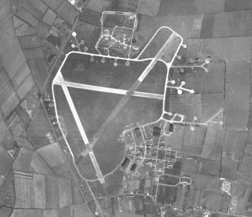
RAF Waterbeach
Royal Air Force Waterbeach or more simply RAF Waterbeach is a former Royal Air Force station located in Waterbeach, Cambridgeshire which is about 5.5 miles...

Waterbeach Barracks
Waterbeach Barracks is a former military installation in Waterbeach, Cambridgeshire. The site was an RAF Station, RAF Waterbeach and then used by the Royal...
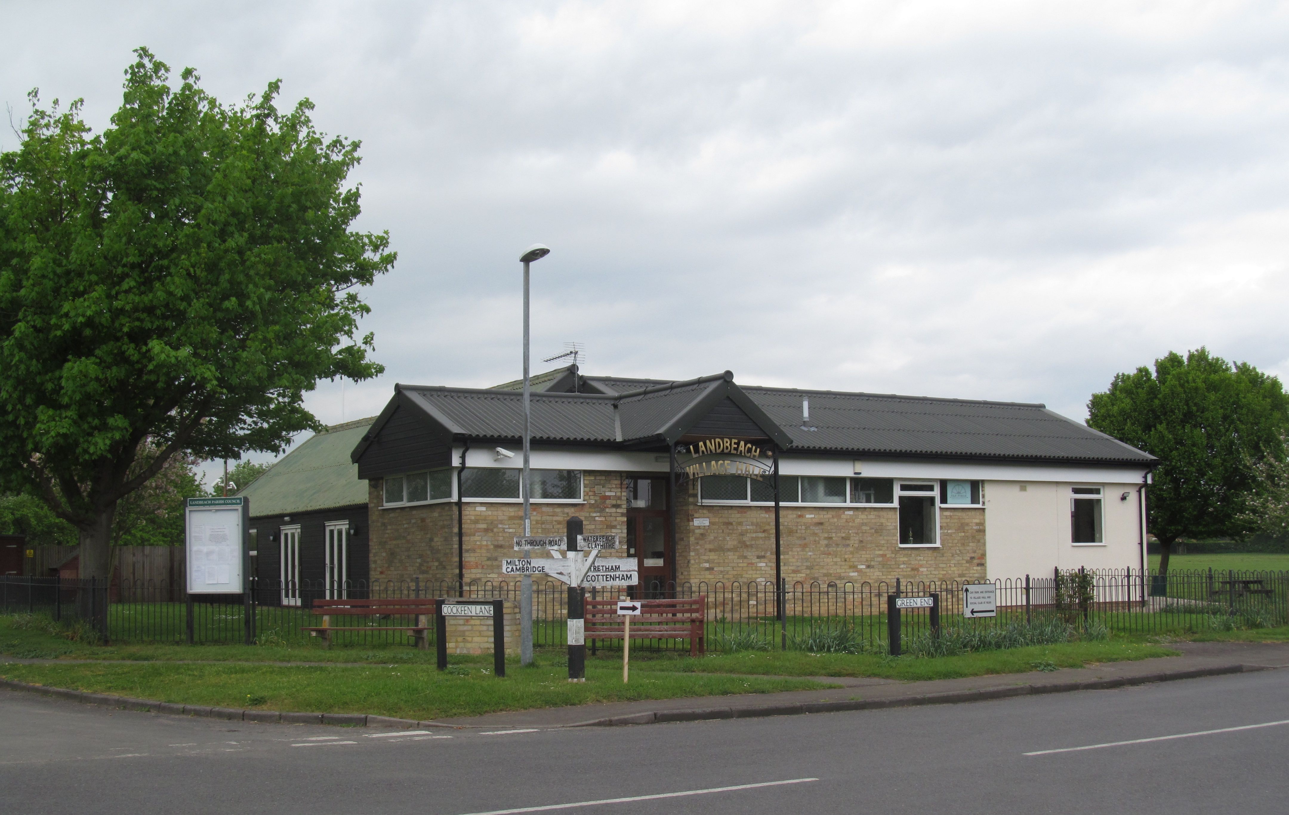
Landbeach
Landbeach is a small fen-edge English village about three miles (5 km) north of Cambridge. The parish covers an area of 9 km2 (3.5 sq mi). == History... ==
Nearby Amenities
Located within 500m of 52.294111,0.15912065Have you been to Green End Cow Pastures?
Leave your review of Green End Cow Pastures below (or comments, questions and feedback).