Block Fen
Downs, Moorland in Cambridgeshire Fenland
England
Block Fen

Block Fen is a nature reserve located in the county of Cambridgeshire, England. It is characterized by its diverse landscape, featuring both downs and moorland. The reserve covers an area of approximately 200 acres, making it a significant natural habitat within the region.
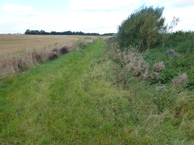
The downs at Block Fen are comprised of rolling hills covered in grasses and heather, offering stunning panoramic views of the surrounding countryside. This terrain is home to a variety of bird species, including skylarks and meadow pipits, which can often be seen darting through the air.
The moorland section of Block Fen is characterized by its wet and boggy nature, with areas of open water and reed beds providing a habitat for a range of plants and animals. This diverse ecosystem supports a wealth of wildlife, including dragonflies, frogs, and waterfowl. The reserve is also known for its population of rare and endangered species, such as the water vole and the bittern.
Visitors to Block Fen can explore a network of footpaths and trails that wind through the reserve, offering the opportunity to observe and appreciate the natural beauty of the area. Interpretive signs and information boards provide educational insights into the flora and fauna found in the reserve.
Overall, Block Fen in Cambridgeshire is a unique and important natural site, offering a rich and diverse environment for both wildlife and visitors to enjoy.
If you have any feedback on the listing, please let us know in the comments section below.
Block Fen Images
Images are sourced within 2km of 52.486946/0.10685368 or Grid Reference TL4389. Thanks to Geograph Open Source API. All images are credited.


Block Fen is located at Grid Ref: TL4389 (Lat: 52.486946, Lng: 0.10685368)
Division: Isle of Ely
Administrative County: Cambridgeshire
District: Fenland
Police Authority: Cambridgeshire
What 3 Words
///rejoined.troubled.radiated. Near Wimblington, Cambridgeshire
Nearby Locations
Related Wikis

Stonea
Stonea is a hamlet in Cambridgeshire, England, south east of March and part of the parish of Wimblington. Stonea today consists of a scattered collection...

Wimblington
Wimblington is a village in the Isle of Ely, Cambridgeshire, England, with a population of 1700 as of the 2001 census, including Stonea and increasing...

Wimblington railway station
Wimblington railway station was a station in the village of Wimblington, Cambridgeshire. It was closed in 1967 as part of the Beeching Axe.The station...

Doddington, Cambridgeshire
Doddington is a village and civil parish lying just off the A141 in the Isle of Ely, Cambridgeshire, approximately half way (4 miles (6 km)) between Chatteris...
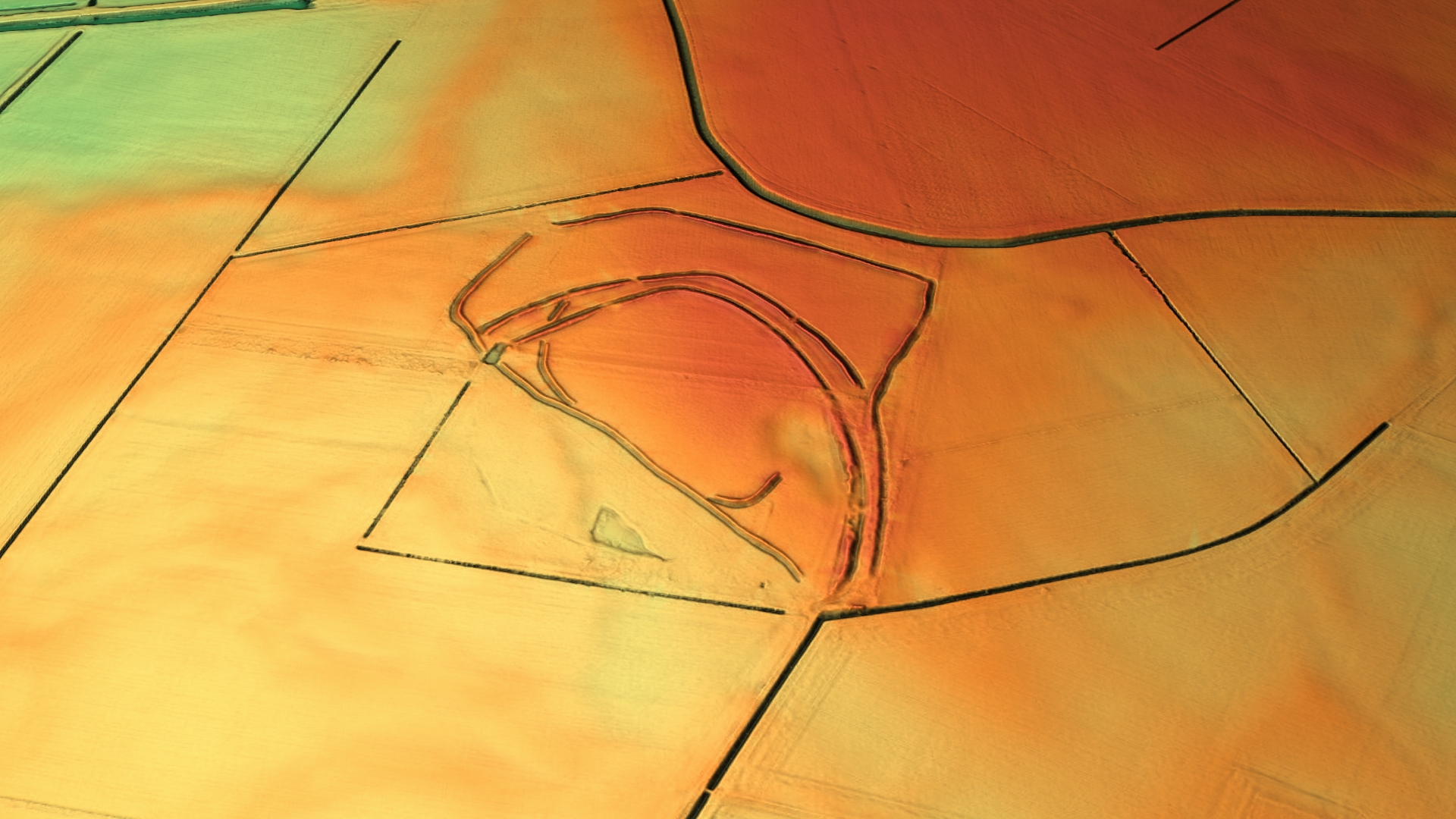
Stonea Camp
Stonea Camp is an Iron Age multivallate hill fort located at Stonea near March in the Cambridgeshire Fens. Situated on a gravel bank just 2 metres (6 ft...
Manea, Cambridgeshire
Manea is a village and civil parish in the District of Fenland, Isle of Ely, Cambridgeshire, England. The population (including Welches Dam) of the civil...
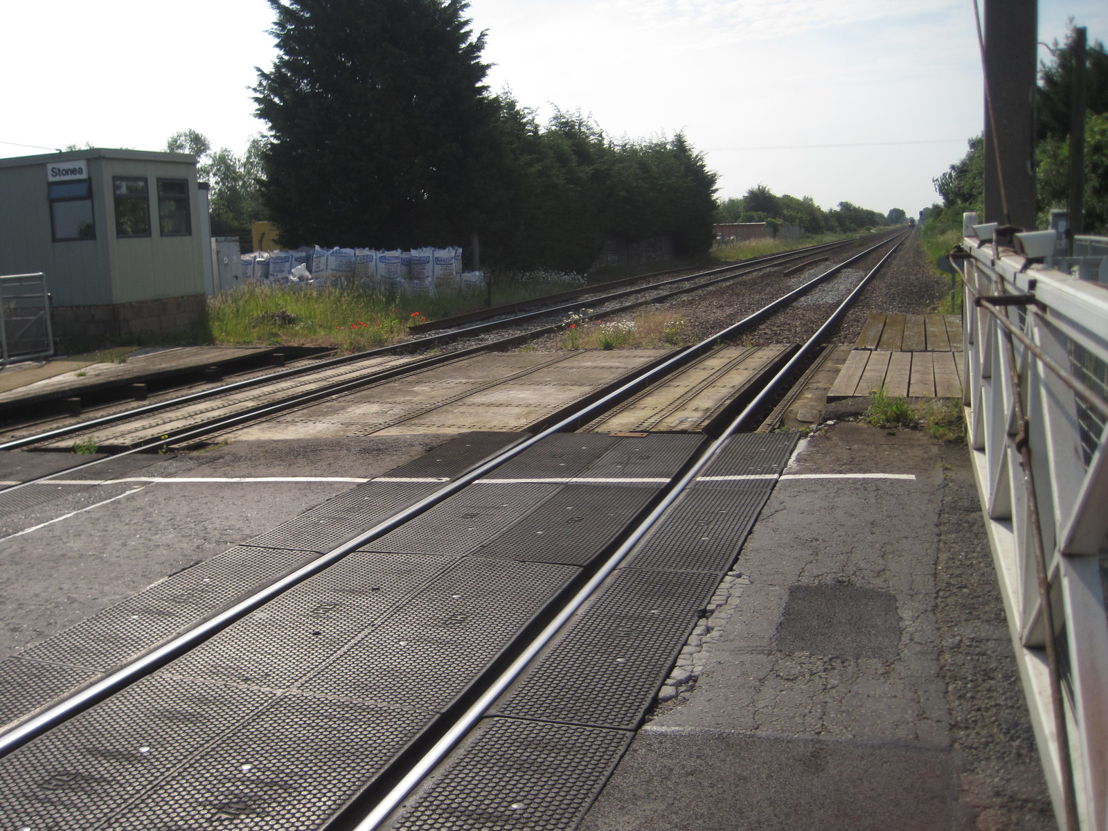
Stonea railway station
Stonea railway station is a former railway station serving the small village of Stonea, Cambridgeshire. Although the station closed in 1966, the line is...

Chatteris
Chatteris () is a market town and civil parish in the Fenland district of Cambridgeshire, England, situated in The Fens between Huntingdon, March and Ely...
Nearby Amenities
Located within 500m of 52.486946,0.10685368Have you been to Block Fen?
Leave your review of Block Fen below (or comments, questions and feedback).