Authorpe Field

Downs, Moorland in Lincolnshire East Lindsey

England

Authorpe Field

St.Edith's churchyard, South Reston, Lincs. The parishioners of South Reston built a new church here by James Fowler in 1864 ..... it was shamelessly pulled down in 1983. The splendid Perpendicular font with eight heads marks the site, surrounded by the graves of parishioners who most probably worshipped in the church. One of many demolished churches in this part of Lincolnshire.
St.Edith's churchyard, South Reston, Lincs. Credit: Richard Croft

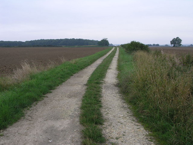
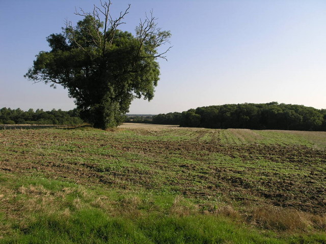
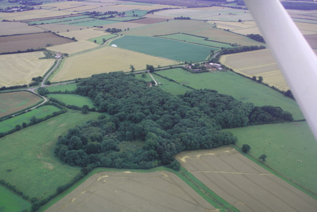
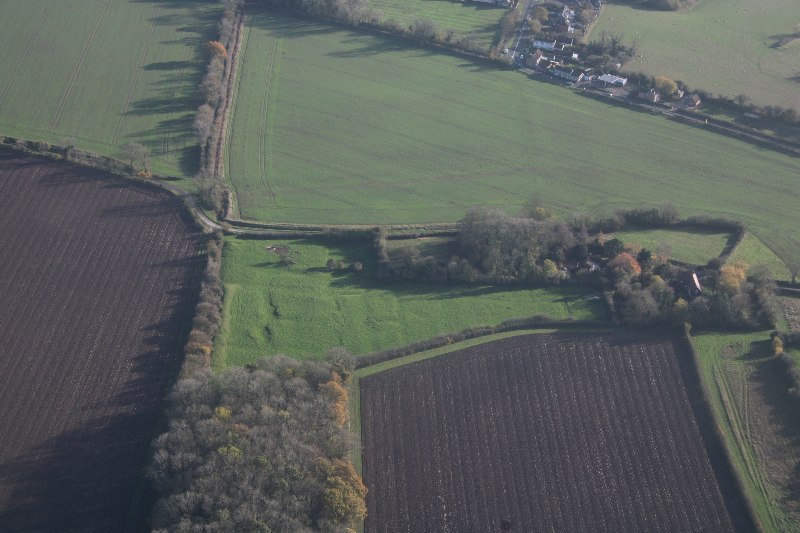
Authorpe Field is a picturesque and diverse landscape located in the county of Lincolnshire in England. Spanning over a vast area, it encompasses both downs and moorland, offering a unique combination of natural beauty and ecological importance.

The downs of Authorpe Field are characterized by their gently rolling hills and expansive grasslands. These open spaces are adorned with vibrant wildflowers during the spring and summer months, creating a stunning and colorful display. The downs are also home to a variety of bird species, including skylarks and meadow pipits, which can be seen and heard throughout the year.

Moving towards the moorland section of Authorpe Field, visitors are greeted with a different but equally captivating landscape. Here, the terrain becomes more rugged, with heather-covered hills and scattered woodland areas. This habitat provides a haven for a range of wildlife, such as red grouse, curlews, and various species of butterflies.

Authorpe Field is not only a visual delight but also of great ecological significance. It acts as an important habitat for many rare and protected species, including the marsh fritillary butterfly and the grayling butterfly. The field also supports a diverse range of plant life, with several species of orchids and other wildflowers thriving in its varied habitats.

In addition to its natural wonders, Authorpe Field offers visitors a tranquil and peaceful setting for outdoor activities such as walking, birdwatching, and photography. Its unspoiled and untouched beauty makes it a popular destination for nature enthusiasts and those seeking solace in the midst of nature's bounty.

If you have any feedback on the listing, please let us know in the comments section below.

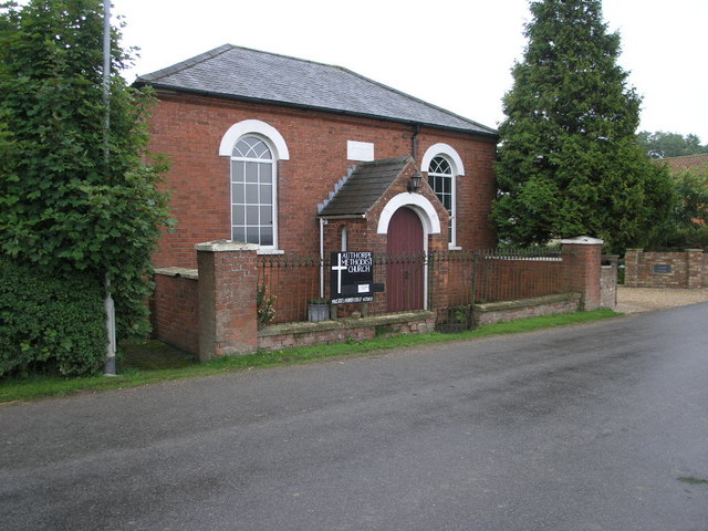
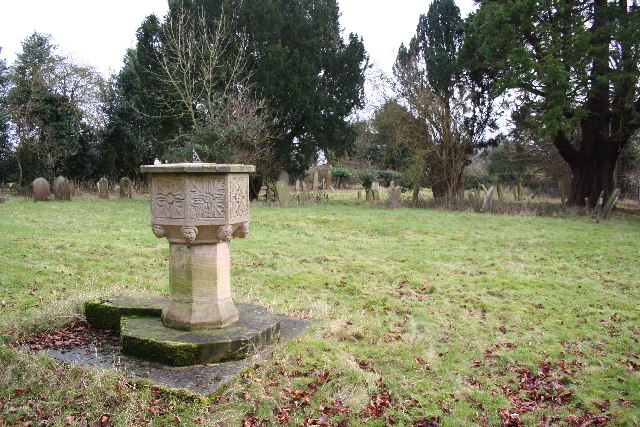
Authorpe Field Images

Images are sourced within 2km of 53.311894/0.093550232 or Grid Reference TF3981. Thanks to Geograph Open Source API. All images are credited.

St.Edith's churchyard, South Reston, Lincs. The parishioners of South Reston built a new church here by James Fowler in 1864 ..... it was shamelessly pulled down in 1983. The splendid Perpendicular font with eight heads marks the site, surrounded by the graves of parishioners who most probably worshipped in the church. One of many demolished churches in this part of Lincolnshire.
St.Edith's churchyard, South Reston, Lincs.
The parishioners of South Reston built a new church here by James Fowler in 1864 ..... it was shamelessly pulled down in 1983. The splendid Perpendicular font with eight heads marks the site, surrounded by the graves of parishioners who most probably worshipped in the church. One of many demolished churches in this part of Lincolnshire.
Methodist Church, South Reston A handsome Victorian methodist church that, unlike its Church of England neighbour has survived into the 21st century.
Methodist Church, South Reston
A handsome Victorian methodist church that, unlike its Church of England neighbour has survived into the 21st century.
The Wagon & Horses Popular hostelry in South Reston
The Wagon & Horses
Popular hostelry in South Reston
Railway Embankment The green embankment visible between the trees used to carry the Railway between Alford and Louth.
Railway Embankment
The green embankment visible between the trees used to carry the Railway between Alford and Louth.
Authorpe Methodist Church This compact and pleasingly symmetrical building is the Methodist Church in Authorpe.
Authorpe Methodist Church
This compact and pleasingly symmetrical building is the Methodist Church in Authorpe.
Path to Authorpe This track is also a footpath to Authorpe.  The trees on the horizon are part of Tothill Wood.
Path to Authorpe
This track is also a footpath to Authorpe. The trees on the horizon are part of Tothill Wood.
St.Margaret's churchyard The little church of St.Margaret stood here until recently. It was largely rebuilt in 1848 using some of the medieval church stone, declared redundant in 1980 and demolished in 1982
St.Margaret's churchyard
The little church of St.Margaret stood here until recently. It was largely rebuilt in 1848 using some of the medieval church stone, declared redundant in 1980 and demolished in 1982
Methodist Church South Reston
Public footpaths over the stile at South Reston One of two footpaths to choose from. Close to the Methodist Church. <a href="https://www.geograph.org.uk/photo/1848971">TF4083 : Methodist Church South Reston</a>
Public footpaths over the stile at South Reston
One of two footpaths to choose from. Close to the Methodist Church. TF4083 : Methodist Church South Reston
Direction Sign – Signpost at Station Farm in Austhorpe parish Located on the southwest side of the T junction at Station Farm southwest of the village in Authorpe parish. 3 arms and no finial.

Milestone Society National ID: LI_TF3980
Direction Sign – Signpost at Station Farm in Austhorpe parish
Located on the southwest side of the T junction at Station Farm southwest of the village in Authorpe parish. 3 arms and no finial. Milestone Society National ID: LI_TF3980
Historic Park, South Reston: aerial 2022 Recorded on the 1907 Ordnance Survey map, surrounding South Reston Hall Lodge.

See <span class="nowrap"><a title="https://www.heritagegateway.org.uk/Gateway/Results_Single.aspx?uid=MLI92241&resourceID=1006" rel="nofollow ugc noopener" href="https://www.heritagegateway.org.uk/Gateway/Results_Single.aspx?uid=MLI92241&resourceID=1006">Link</a><img style="margin-left:2px;" alt="External link" title="External link - shift click to open in new window" src="https://s1.geograph.org.uk/img/external.png" width="10" height="10"/></span>
Historic Park, South Reston: aerial 2022
Recorded on the 1907 Ordnance Survey map, surrounding South Reston Hall Lodge. See LinkExternal link
Direction Sign – Signpost on Burwell Road, Muckton Located on the south side of the junction on Burwell Road at the south end of the village in Muckton parish. 3 arms but no finial. 

Milestone Society National ID: LI_TF3781
Direction Sign – Signpost on Burwell Road, Muckton
Located on the south side of the junction on Burwell Road at the south end of the village in Muckton parish. 3 arms but no finial. Milestone Society National ID: LI_TF3781
South Reston: aerial 2023 (1)
South Reston: aerial 2023 (2)
Bridleway to Little Cawthorpe
A sea of oilseed rape near Muckton
Track to Muckton Wood Not a public right of way.
Track to Muckton Wood
Not a public right of way.
Show me another place!

Authorpe Field is located at Grid Ref: TF3981 (Lat: 53.311894, Lng: 0.093550232)

Administrative County: Lincolnshire

District: East Lindsey

Police Authority: Lincolnshire

What 3 Words

///motivator.screaming.propose. Near Burwell, Lincolnshire

Nearby Locations

Authorpe Field

Related Wikis

Authorpe

Authorpe is a village and civil parish in the East Lindsey district of Lincolnshire, England. It is situated between the A16 and the A157 roads, 6 miles...

Authorpe railway station

Authorpe was a railway station on the East Lincolnshire Railway, which served the village of Authorpe in Lincolnshire between 1848 and 1964. The station...

South Reston

South Reston is a village in the civil parish of Reston, in the East Lindsey district of Lincolnshire, England. It is situated on the A157 road 5 miles...

Muckton

Muckton is a village and former civil parish in the East Lindsey district of Lincolnshire, England. It lies between the A16 and A157 roads, 5 miles (8...

Carlton Castle

Castle Hill is the name given to the once substantial motte and bailey, perhaps double bailey, apparently associated with the then new town of Castle Carlton...

Tothill

Tothill is a hamlet in the civil parish of Withern with Stain, in the East Lindsey district of Lincolnshire, England. It is situated about 6 miles (10...

Castle Carlton

Castle Carlton is a hamlet and former civil parish, now in the parish of Reston, in the East Lindsey district of Lincolnshire, England. It is approximately...

North Reston

North Reston is a village and former civil parish, now in the parish of Reston, in the East Lindsey district of Lincolnshire, England, and on the A157...

Nearby Amenities

Located within 500m of 53.311894,0.093550232
Authorpe Fields
Place: locality
Source: Bing
Lat/Long: 53.3127991/0.0934436
The Grove
Place: isolated_dwelling
Source: Bing
Lat/Long: 53.3162243/0.0955593
The data included in this document is from www.openstreetmap.org. The data is made available under ODbL.

Have you been to Authorpe Field?

Leave your review of Authorpe Field below (or comments, questions and feedback).