Burrow Moor

Downs, Moorland in Cambridgeshire Fenland

England

Burrow Moor

Field east of the Whitemoor Road level crossing
Field east of the Whitemoor Road level crossing Credit: Christopher Hilton

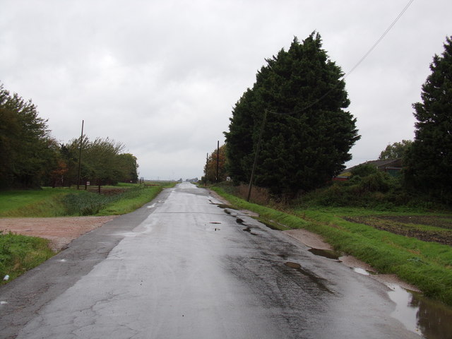
Burrow Moor is a picturesque area located in Cambridgeshire, England. Situated on the edge of the Fens, it is known for its expansive downs and moorland landscapes. Covering an area of approximately 500 acres, Burrow Moor offers a unique blend of natural beauty and historical significance.

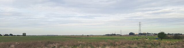
The moorland of Burrow Moor is characterized by its open, windswept terrain, dotted with patches of heather and grasses. This creates a stunning tapestry of colors, especially during the summer months when the heather blooms in vibrant shades of purple. In addition to its stunning flora, the moorland is also home to a variety of wildlife, including numerous bird species, small mammals, and reptiles.

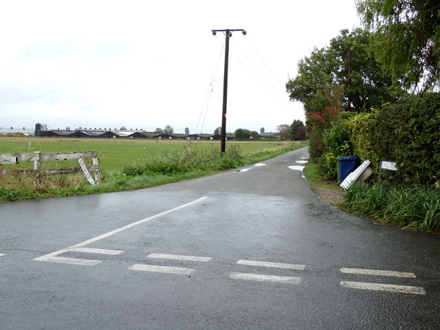
The downs of Burrow Moor, on the other hand, offer a stark contrast to the moorland. These rolling hills are covered in lush grasses and offer breathtaking views of the surrounding countryside. The downs are crisscrossed by a network of footpaths, making it a popular destination for walkers and nature enthusiasts.

One of the notable features of Burrow Moor is its rich archaeological history. The area has been inhabited for thousands of years, and evidence of early human settlement can be found in the form of burial mounds and ancient trackways. In fact, the famous Flag Fen archaeological site is located just a short distance from Burrow Moor, adding to its historical significance.

Overall, Burrow Moor is a captivating destination for those seeking to immerse themselves in the natural beauty and rich history of Cambridgeshire. Whether it's exploring the moorland, admiring the views from the downs, or delving into the area's archaeological past, Burrow Moor offers something for everyone.

If you have any feedback on the listing, please let us know in the comments section below.
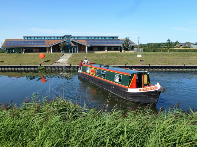
Burrow Moor Images

Images are sourced within 2km of 52.543511/0.05260549 or Grid Reference TL3995. Thanks to Geograph Open Source API. All images are credited.

Field east of the Whitemoor Road level crossing
Farmland west of the Whitemoor Road level crossing, from the railway
Railway to March across West Fen; Middle Road LC: aerial 2016
Nene (Old Course) west of March, Botany Bay: aerial 2016 One of the earliest mapped courses of the River Nene, from Peterborough to The Wash, was around Whittlesey Mere, through Benwick, March and Upwell, eventually joining The Well Stream at Outwell which flowed to the then coastal town of Wisbech. Over the centuries a straight channel was dug through the marshes north of Wisbech to the current outfall north of Sutton Bridge and the land on either side reclaimed. There are numerous visible sections of the old coastal banks on both sides of the River Nene north of Wisbech, see <a title="https://www.geograph.org.uk/photo/2207164" href="https://www.geograph.org.uk/photo/2207164">Link</a>.
One of the earliest attempts to improve the flow of water from Peterborough to the coast and reduce flooding in the Fens was made by Bishop Morton who had a straight channel dug in the late 15th century from Peterborough to Wisbech known as Morton’s Leam, see <a title="https://www.geograph.org.uk/photo/1737089" href="https://www.geograph.org.uk/photo/1737089">Link</a>  In the early 1700s a new and much larger straight channel was dug from Peterborough to Wisbech called Smith's Leam, parallel to and just north of Morton’s Leam, to improve the flow of water from Peterborough to the sea. Morton’s Leam from Guyhirn to Wisbech was incorporated into Smith’s Leam and the remainder of Morton’s Leam from Peterborough to Guyhirn became the main artery into and out of the Nene Washes which were created between Guyhirn and Peterborough.
Smith’s Leam is now known as the River Nene and the original meandering river from Peterborough to Marmont Priory Lock in Upwell is now known as The River Nene (Old course), see <a title="https://www.geograph.org.uk/photo/2888565" href="https://www.geograph.org.uk/photo/2888565">Link</a>.
Nene (Old Course) west of March, Botany Bay: aerial 2016
One of the earliest mapped courses of the River Nene, from Peterborough to The Wash, was around Whittlesey Mere, through Benwick, March and Upwell, eventually joining The Well Stream at Outwell which flowed to the then coastal town of Wisbech. Over the centuries a straight channel was dug through the marshes north of Wisbech to the current outfall north of Sutton Bridge and the land on either side reclaimed. There are numerous visible sections of the old coastal banks on both sides of the River Nene north of Wisbech, see Link. One of the earliest attempts to improve the flow of water from Peterborough to the coast and reduce flooding in the Fens was made by Bishop Morton who had a straight channel dug in the late 15th century from Peterborough to Wisbech known as Morton’s Leam, see Link In the early 1700s a new and much larger straight channel was dug from Peterborough to Wisbech called Smith's Leam, parallel to and just north of Morton’s Leam, to improve the flow of water from Peterborough to the sea. Morton’s Leam from Guyhirn to Wisbech was incorporated into Smith’s Leam and the remainder of Morton’s Leam from Peterborough to Guyhirn became the main artery into and out of the Nene Washes which were created between Guyhirn and Peterborough. Smith’s Leam is now known as the River Nene and the original meandering river from Peterborough to Marmont Priory Lock in Upwell is now known as The River Nene (Old course), see Link.
Knight's End Road, to March: aerial 2016
Urban Fox turning on the River Nene (old course) near March ...
Urban Fox turning on the River Nene (old course) near March
...
Middle Level Commissioners office near March On the bank of The River nene (old course) 
<span class="nowrap"><a title="https://middlelevel.gov.uk/" rel="nofollow ugc noopener" href="https://middlelevel.gov.uk/">Link</a><img style="margin-left:2px;" alt="External link" title="External link - shift click to open in new window" src="https://s1.geograph.org.uk/img/external.png" width="10" height="10"/></span>
Middle Level Commissioners office near March
On the bank of The River nene (old course) LinkExternal link
Entrance of The Auction Field Off Knights End Road
Entrance of The Auction Field
Off Knights End Road
The Auction Field, March Off Knights End Road
(At the end of the weekend at Anglia Acorns Obedience Dog Show)
The Auction Field, March
Off Knights End Road (At the end of the weekend at Anglia Acorns Obedience Dog Show)
Office at The Auction Field Off Knights End Road
Office at The Auction Field
Off Knights End Road
Tufts No1 occupational level crossing
Knight's End Road, March Looking towards Knight's End Farm
Knight's End Road, March
Looking towards Knight's End Farm
March Patio Centre Off Knight's End Road
<span class="nowrap"><a title="https://marchpatiocentre.co.uk/" rel="nofollow ugc noopener" href="https://marchpatiocentre.co.uk/">Link</a><img style="margin-left:2px;" alt="External link" title="External link - shift click to open in new window" src="https://s1.geograph.org.uk/img/external.png" width="10" height="10"/></span>
March Patio Centre
Off Knight's End Road LinkExternal link
Knight's End Road, March At the entrance to the Auction Grounds
Knight's End Road, March
At the entrance to the Auction Grounds
Freight train approaching March 66710 “Phil Packer BRIT” passing with the 06:58 Doncaster Decoy to Whitemoor train, taken near Middle Road Crossing (West of March)
Freight train approaching March
66710 “Phil Packer BRIT” passing with the 06:58 Doncaster Decoy to Whitemoor train, taken near Middle Road Crossing (West of March)
Knights End Road, March At the junction with Cross Road
Knights End Road, March
At the junction with Cross Road
Cross Road sign On Cross Road at the junction with Knights End Road
Cross Road sign
On Cross Road at the junction with Knights End Road
Cross Road, March At the junction with Knights End Road near Corner Lodge
Cross Road, March
At the junction with Knights End Road near Corner Lodge
Show me another place!

Burrow Moor is located at Grid Ref: TL3995 (Lat: 52.543511, Lng: 0.05260549)

Division: Isle of Ely

Administrative County: Cambridgeshire

District: Fenland

Police Authority: Cambridgeshire

What 3 Words

///unframed.crumb.described. Near March, Cambridgeshire

Nearby Locations

Burrow Moor

Related Wikis

Gault Wood

Gault Wood is a woodland in Cambridgeshire, England, near the town of March. It covers a total area of 6.51 hectares (16.09 acres). It is owned and managed...

The Avenue Sports Club Ground

The Avenue Sports Club Ground is a cricket ground in March, Cambridgeshire. The ground was established in 1939, when Cambridgeshire played Suffolk in...

March Town Hall

March Town Hall is a municipal building in the Market Square in March, Cambridgeshire, England. The building, which was the headquarters of March Urban...

Neale-Wade Academy

Neale-Wade Academy (formerly Neale-Wade Community College) is a secondary school and sixth form with academy status in the market town of March, Cambridgeshire...

March, Cambridgeshire

March is a Fenland market town and civil parish in the Isle of Ely area of Cambridgeshire, England. It was the county town of the Isle of Ely which was...

March Town United F.C.

March Town United Football Club is a football club based in March, Cambridgeshire, England. They are currently members of the United Counties League Premier...

Fen Causeway

Fen Causeway or the Fen Road is the modern name for a Roman road of England that runs between Denver, Norfolk in the east and Peterborough in the west...

Westry

Westry is a village in Cambridgeshire, England. It lies to the northwest of March on the A141 to Wisbech. The Church of St Mary was erected in 1873 to...

Nearby Amenities

Located within 500m of 52.543511,0.05260549
Power: pole
Lat/Long: 52.5431833/0.0549797
Power: pole
Lat/Long: 52.5418914/0.0504414
Power: pole
Lat/Long: 52.5440832/0.058019
Power: pole
Lat/Long: 52.5427623/0.0533811
Power: pole
Lat/Long: 52.5410168/0.047212
Power: pole
Lat/Long: 52.5414638/0.048773
Power: pole
Lat/Long: 52.5436268/0.0564922
Power: pole
Lat/Long: 52.5423188/0.0518039
Power: pole
Lat/Long: 52.5445111/0.0595931
Power: pole
Lat/Long: 52.5455047/0.0552187
Power: pole
Lat/Long: 52.5432814/0.0551275
Power: pole
Lat/Long: 52.5452405/0.0557553
Power: pole
Lat/Long: 52.5428393/0.0549344
Power: pole
Lat/Long: 52.5450479/0.0556936
Power: pole
Lat/Long: 52.5440415/0.0499884
Power: pole
Lat/Long: 52.5464752/0.0550712
Power: pole
Lat/Long: 52.5435065/0.0536469
Power: pole
Lat/Long: 52.5438475/0.0512866
Power: pole
Lat/Long: 52.5436794/0.0524293
Power: pole
Lat/Long: 52.5441737/0.0553984
Power: pole
Lat/Long: 52.5473511/0.0549344
Power: pole
Lat/Long: 52.5413695/0.054792
Operator: po
Power: pole
Lat/Long: 52.540531/0.0547491
Power: pole
Lat/Long: 52.5397142/0.0546628
Power: pole
Lat/Long: 52.5421574/0.054894
The data included in this document is from www.openstreetmap.org. The data is made available under ODbL.

Have you been to Burrow Moor?

Leave your review of Burrow Moor below (or comments, questions and feedback).