Fleet Hurn Fields

Downs, Moorland in Lincolnshire South Holland

England

Fleet Hurn Fields

View over the fields to Gedney St Mary Magdalene Church on the horizon
View over the fields to Gedney Credit: Eirian Evans

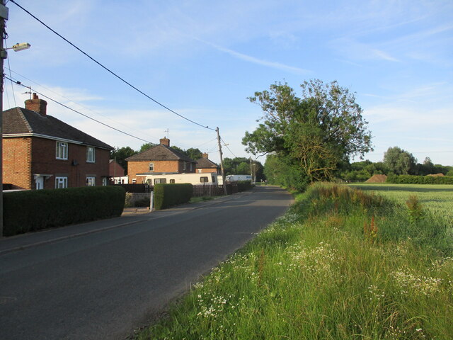
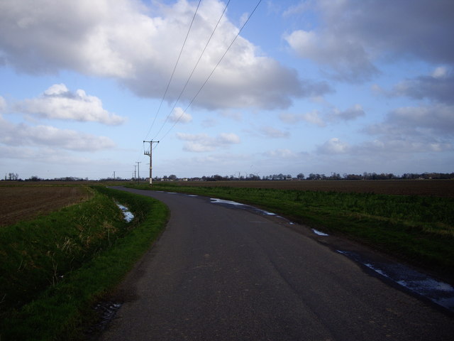
Fleet Hurn Fields is a picturesque area located in Lincolnshire, England. Nestled between the downs and moorland, it is renowned for its stunning natural beauty and diverse wildlife. This rural landscape spans approximately several square miles, offering visitors a tranquil and idyllic escape from the hustle and bustle of city life.

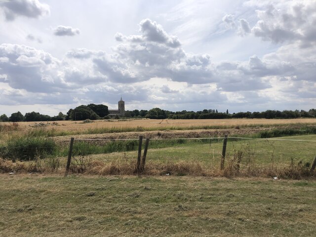
The downs of Fleet Hurn Fields are characterized by rolling hills and expansive grasslands. These open spaces provide a perfect habitat for various species of wildflowers, creating a vibrant and colorful landscape during the spring and summer months. The downs also offer breathtaking panoramic views of the surrounding countryside, making it a popular spot for hikers and nature enthusiasts.

In contrast, the moorland of Fleet Hurn Fields offers a distinct and unique ecosystem. This area is characterized by its heather-clad hills and marshy terrain, providing a habitat for a range of bird species such as curlews and lapwings. The moorland is also home to rare and endangered plants, adding to its ecological significance.

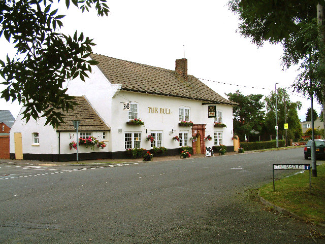
Beyond its natural beauty, Fleet Hurn Fields holds historical and cultural importance. The area is dotted with ancient burial mounds and archaeological sites, providing a glimpse into the region's rich heritage. Additionally, the local community takes great pride in preserving and celebrating their cultural traditions, organizing events and festivals throughout the year.

Overall, Fleet Hurn Fields is a captivating destination that offers a harmonious blend of natural splendor, wildlife diversity, and cultural heritage. Whether it's exploring the downs, walking through the moorland, or immersing oneself in the local traditions, this area promises a memorable and enriching experience for all who visit.

If you have any feedback on the listing, please let us know in the comments section below.

Fleet Hurn Fields Images

Images are sourced within 2km of 52.810259/0.057953805 or Grid Reference TF3825. Thanks to Geograph Open Source API. All images are credited.

View over the fields to Gedney St Mary Magdalene Church on the horizon
View over the fields to Gedney
St Mary Magdalene Church on the horizon
Potato ridges near Holbeach
Battlefield Lane South, Holbeach
Old Milestone by B1515, Fleet Road The Milestone is located on the verge on the South of the road.  Parish of Fleet (South Holland District). Carved stone post,  erected by the Holbeach turnpike trust in the 19th Century. An earlier photograph can be found here: <a title="https://www.geograph.org.uk/photo/6728737" href="https://www.geograph.org.uk/photo/6728737">Link</a> 

Inscription reads:-   
HOLBEACH / 1 / MILE / FLEET / 2 : : SUTTON / 4 / MILES / FLEET / 2

Grade II listed. List Entry Number: 1064519 <span class="nowrap"><a title="https://historicengland.org.uk/listing/the-list/list-entry/1064519" rel="nofollow ugc noopener" href="https://historicengland.org.uk/listing/the-list/list-entry/1064519">Link</a><img style="margin-left:2px;" alt="External link" title="External link - shift click to open in new window" src="https://s1.geograph.org.uk/img/external.png" width="10" height="10"/></span> 

Milestone Society National ID: LI_HBSU01
Old Milestone by B1515, Fleet Road
The Milestone is located on the verge on the South of the road.  Parish of Fleet (South Holland District). Carved stone post, erected by the Holbeach turnpike trust in the 19th Century. An earlier photograph can be found here: Link  Inscription reads:- HOLBEACH / 1 / MILE / FLEET / 2 : : SUTTON / 4 / MILES / FLEET / 2 Grade II listed. List Entry Number: 1064519 LinkExternal link Milestone Society National ID: LI_HBSU01
Old Milestone by B1515, Fleet Road The Milestone is located on the verge on the South of the road.  Parish of Fleet (South Holland District). Carved stone post,  erected by the Holbeach turnpike trust in the 19th Century. An earlier photograph can be found here: <a title="https://www.geograph.org.uk/photo/6728737" href="https://www.geograph.org.uk/photo/6728737">Link</a> 

Inscription reads:-   HOLBEACH / 1 / MILE / FLEET / 2 : : SUTTON / 4 / MILES / FLEET / 2 

Grade II listed. List Entry Number: 1064519 <span class="nowrap"><a title="https://historicengland.org.uk/listing/the-list/list-entry/1064519" rel="nofollow ugc noopener" href="https://historicengland.org.uk/listing/the-list/list-entry/1064519">Link</a><img style="margin-left:2px;" alt="External link" title="External link - shift click to open in new window" src="https://s1.geograph.org.uk/img/external.png" width="10" height="10"/></span> 

Milestone Society National ID: LI_HBSU01
Old Milestone by B1515, Fleet Road
The Milestone is located on the verge on the South of the road.  Parish of Fleet (South Holland District). Carved stone post, erected by the Holbeach turnpike trust in the 19th Century. An earlier photograph can be found here: Link  Inscription reads:- HOLBEACH / 1 / MILE / FLEET / 2 : : SUTTON / 4 / MILES / FLEET / 2 Grade II listed. List Entry Number: 1064519 LinkExternal link Milestone Society National ID: LI_HBSU01
The Bull at Fleet Hargate The village of Fleet Hargate formerly Fleet Harbourgate a small port
The Bull at Fleet Hargate
The village of Fleet Hargate formerly Fleet Harbourgate a small port
Fleet View of Fleet Rd Garage looking along Fleet Rd towards Holbeach from the Industrial Estate
Fleet
View of Fleet Rd Garage looking along Fleet Rd towards Holbeach from the Industrial Estate
Fleet parish church The steeple is detached from the body of the church, a feature of several other churches in the area.
Fleet parish church
The steeple is detached from the body of the church, a feature of several other churches in the area.
Hamlet of Holbeach Hurn From the south
Hamlet of Holbeach Hurn
From the south
Hurn Road Looking west
Hurn Road
Looking west
Fleet Road Industry As the sign clearly states this is Fleet Road Industrial Estate to the east of Holbeach.
Fleet Road Industry
As the sign clearly states this is Fleet Road Industrial Estate to the east of Holbeach.
Two Pubs The Bull and The Rose and Crown cluster together on the main street through Fleet Hargate.  The road repair doesn't quite match colour.
Two Pubs
The Bull and The Rose and Crown cluster together on the main street through Fleet Hargate. The road repair doesn't quite match colour.
Windbreaks and Potatoes The black windbreaks are clearly in place to protect the greenhouses next to them.  The field in the foreground was growing potatoes.
Windbreaks and Potatoes
The black windbreaks are clearly in place to protect the greenhouses next to them. The field in the foreground was growing potatoes.
Field and Cafe The cafe is beyond the busy A17.  The field is protected by this unusual one bar gate.
Field and Cafe
The cafe is beyond the busy A17. The field is protected by this unusual one bar gate.
The Road to Holbeach Hurn On my journey, this seemed to be the point of no return. Once leaving Holbeach towards the 'Wash area' The roads get no wider than this and the landscape littered with wind farms. If you look carefully, you can see some turbines in the distance to the mid right of this picture.
The Road to Holbeach Hurn
On my journey, this seemed to be the point of no return. Once leaving Holbeach towards the 'Wash area' The roads get no wider than this and the landscape littered with wind farms. If you look carefully, you can see some turbines in the distance to the mid right of this picture.
Church of St Luke, Holbeach Hurn Consecrated in 1869
Church of St Luke, Holbeach Hurn
Consecrated in 1869
View from Roman Bank The road into Holbeach Hurn is called Roman Bank and follows the old sea defence bank. You can see that the farmland is considerably lower than the bank immediately in front of the view point. A tall hedge follows the drain here, which acts as a windbreak. The farm machinery on the right looks as if it is lifting potatoes and there is a large JCB on the left carrying out drain maintenance. The wind farm in <a href="https://www.geograph.org.uk/gridref/TF4229">TF4229</a> is clearly visible on the horizon. The electricity pylon is in fact several kilometres in front of the turbines which just emphasizes how big they are: each one has an overall height of 100 metres and the rotors are 82 metres long, generating 2 megawatts of power.
View from Roman Bank
The road into Holbeach Hurn is called Roman Bank and follows the old sea defence bank. You can see that the farmland is considerably lower than the bank immediately in front of the view point. A tall hedge follows the drain here, which acts as a windbreak. The farm machinery on the right looks as if it is lifting potatoes and there is a large JCB on the left carrying out drain maintenance. The wind farm in TF4229 is clearly visible on the horizon. The electricity pylon is in fact several kilometres in front of the turbines which just emphasizes how big they are: each one has an overall height of 100 metres and the rotors are 82 metres long, generating 2 megawatts of power.
Roman Bank, Holbeach Hurn The houses on each side of Roman Bank, which follows the old sea bank, are considerably lower than the road.
Roman Bank, Holbeach Hurn
The houses on each side of Roman Bank, which follows the old sea bank, are considerably lower than the road.
Show me another place!

Fleet Hurn Fields is located at Grid Ref: TF3825 (Lat: 52.810259, Lng: 0.057953805)

Administrative County: Lincolnshire

District: South Holland

Police Authority: Lincolnshire

What 3 Words

///listen.pose.recliner. Near Fleet, Lincolnshire

Nearby Locations

Fleet Hurn Fields

Related Wikis

Fleet Hargate

Fleet Hargate is a village in the South Holland district of Lincolnshire, England. It is situated 2 miles (3.2 km) east from Holbeach, and just south from...

Fleet railway station (Lincolnshire)

Fleet railway station was a station in Fleet, Lincolnshire. It opened in 1862 and closed to passengers in 1959, with the goods yard closing on 3 February...

Holbeach Hurn

Holbeach Hurn is a small fenland village in the civil parish of Holbeach in the South Holland district of southern Lincolnshire, England. It is 2.5 miles...

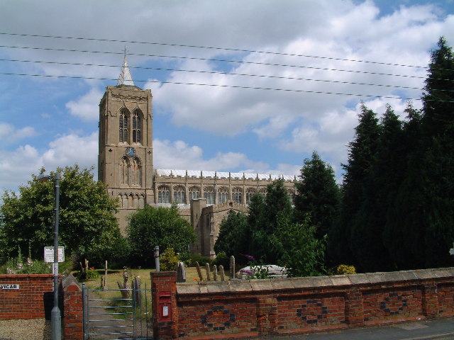
St Mary Magdalene Church, Gedney

St Mary Magdalene Church is an Anglican parish church of medieval origin in Gedney, Lincolnshire. Renowned for its large size in the surrounding low-lying...

Fleet, Lincolnshire

Fleet is a village, civil parish and electoral ward in the South Holland district of Lincolnshire, England. It lies on Delph Bank, 3 miles (4.8 km) south...

Gedney, Lincolnshire

Gedney is a village, civil parish and electoral ward in the South Holland district of Lincolnshire, England. It is just to the south of the A17 Boston...

Gedney Dyke

Gedney Dyke is a village in the civil parish of Gedney and the South Holland district of Lincolnshire, England. It is 40 miles (64 km) south-east from...

East Elloe Rural District

East Elloe was a rural district in Holland in Lincolnshire from 1894 to 1974. == History == The district had its origins in the Holbeach Poor Law Union...

Nearby Amenities

Located within 500m of 52.810259,0.057953805
Cafe
Farm Cafe
Addr City: Fleet
Addr Country: GB
Addr Postcode: PE12 8LT
Addr Street: Washway Road
Fhrs Authority: South Holland
Fhrs Id: 242892
Fhrs Local Authority Id: 639
Lat/Long: 52.8075539/0.0583248
Shop: farm
Lat/Long: 52.8076276/0.0579752
Parking
Parking: layby
Lat/Long: 52.8078965/0.0560688
Fleet Hurn Fields
Place: locality
Source: Bing
Lat/Long: 52.8097157/0.0567666
Cafe
Lat/Long: 52.8067113/0.0586404
Anglia Motel & Clubroom
Addr City: Holbeach
Addr Country: GB
Addr Postcode: PE12 7PE
Addr Street: Washway Road
Fhrs Authority: South Holland
Fhrs Id: 243226
Fhrs Local Authority Id: 638
Tourism: motel
Lat/Long: 52.8065038/0.0604355
The data included in this document is from www.openstreetmap.org. The data is made available under ODbL.

Have you been to Fleet Hurn Fields?

Leave your review of Fleet Hurn Fields below (or comments, questions and feedback).